United States Bureau of NavigationBiblio.com

3,430 results
ref. 1333218966.Gpaperback. Good. Access codes and supplements are not guaranteed with used items. May be an ex-library book. paperback
1938ref. SPN-385Londres : Edward Arnold & Co, 1938. 1e édition. Cartonnage spiralé, 72 pages illustrées de vues aériennes héliogravées. 19x25. Ouvrage toilé, sans sa jaquette, nombreuses rousseurs.
1953[ca. 90] pp., geïllustreerd, 30cm., goede staat, B101502
First edition, [ii], 3-14pp., recent quarter calf, marbled boards, red morocco title label. Benjamin Lacam's proposal to establish a new shipping channel and harbour East of Saugor Sound, which avoided the dangers of the old approach to Calcutta via the Hoogly River. ESTC locates just three copies (C; MRu; Luk) all in the UK.
ref. 0265826128.Ghardcover. Good. Access codes and supplements are not guaranteed with used items. May be an ex-library book. hardcover
ref. 0265796873.Ghardcover. Good. Access codes and supplements are not guaranteed with used items. May be an ex-library book. hardcover
in-8°, 199 pages, Bl./Wh. illustr., maps, index, bind. in boards, plast. dustjacket. Very good copy with a Good DJ. [EN-1]
1987ref. 1270111987 Editions Dupuis - Mai 1987 - In-4, cartonnage illustré - 44 planches en couleurs
1992ref. 1270121992 Editions Dupuis - Avril 1992 - In-4, cartonnage illustré, dans un coffret avec un carnet de croquis de 32 pages ''Lettres d'orient'' - 46 planches en couleurs
1753ref. G115322Paris, chez la Veuve Estienne & fils 1753 2 parties en 1 volume physique, [2bl.] + [2] xii + 280 + 206 + [2] + [2bl.] pp., Première édition en français (traduction 'libre' de la seconde édition espagnole de 1742, la 1ère date de 1724), reliure d'époque à 5 nerfs en plein-cuir (dos orné, coins légèrement abimés, petite manque de cuir en haut du dos), tranches rouges, feuilles de garde décorées, quelques rousseurs, 26cm., bon exemplaire, [Cet ouvrage traite des divers aspects de l'économie appliquée et du commerce international comme des problèmes d'impots, de monopole, de population, etc., ainsi que de la marine espagnole et les colonies espagnoles en Amérique], poids: 1.1kg., G115322
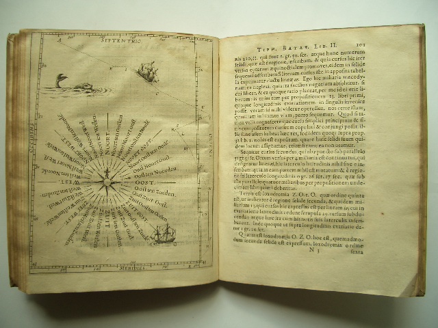
1624ref. 1935Mit 2 Kupfertafeln, 1 ganzseit. Textkupfer sowie einigen schematischen Textholzschnitten. Leiden, Elzevier, 1624. 4to. (20,2 x 15,9 cm). 28 nn. Bll., 109 S., 1 Bl., 62 S., 1 Bl. Errata. Pergamentband d. Zt. mit Goldprägung auf beiden Deckeln.
1882ref. 17482New York: Leve & Alden's Publication Department 1882. Very good condition. Folding brochure with map of the St. Lawrence and Saguenay River and timetable with cover illustration of the river and with advertisement for Leve & Alden General Agents for the United States and list of ticket office locations. Yellow stock with black text. Descriptive text on points of interest along the route including Ha! Ha! Bay; with a Time Table commencing June 27 1882 "Until about September 10 1882" and listing departure times for the steamer "Saguenay" and "Union". With full page b&w map on the verso with the map of the Saguenay River at the top and below the map of the St. Lawrence "traversed by the Saguenay boats". The St. Lawrence route originates in Quebec and shows stops in Murray Bay Riviere du Loup and Tadousac. Lists Hon. Thomas McGreevy President Julien Chabot Manager and A. Gaboury Secretary of the Company. Folded 3 1/2 x 7 1/2". Unfolded 17 1/2 x 15". Very small area of loss at fold on lower map of St. Lawrence; short split at horizontal fold left edge o/w very good. Leve & Alden's Publication Department unknown
ref. 6350Editions l'Ancre de Marine, 1989 - In -8, br. couverture contre pliée ill. bib. notes, carte in fine, 292 pages, 30 pages de planches en noir. Très agréable.
ref. 37858Paris, Flammarion 1952, 215x150mm, 254pages, broché. Bon état.
ref. 88837Paris, Flammarion 1952, 215x150mm, 254pages, reliure demi-toile. Pièce de titre en cuir au dos. Bel exemplaire.
ref. 1932broché - 13x20 - 251 pp - 1942 - éditions HACHETTE, Paris.
1999ref. 23538Grenoble Glénat / Madison Press Book 1999 In-8 96 pp
1965pp. ix, 309 + Plus photographs. Map endpapers. 8vo. Original full cloth binding. Original dust jacket. Nice copy. Fascinating history of the ship the "Bear" which spent most of her time in the service of the Coast Guard and set an unequalled record of achievements, including Arctic and Antarctic service. **PRICE JUST REDUCED! POLAR 3
1896ref. 77014Washington DC: U.S. Department of the Navy Bureau of Navigation Hydrographic Office 1896. Presumed First Edition First printing thus. Map. Good. This was published at the Hydrographic Office in Washington D.C. in February 1896. No. 1530. Charles D. Sigabee Commander U.S. N. Hydrographer. Format is approximately 26 inches by 17 inches folded. This map is disbound from Volume I of the Commercial Directory of the American Republics compiled by the Bureau of American Republics International Union of American Republics Joseph P. Smith Director 1897 Title page from Directory is present. Taped to top right of map in margin is the statement "This chart is intended solely to show tracks of steam vessels on the ocean and no authority is assumed for the boundary lines as drawn between the countries." Map has some color differentiation and several inserts presenting distance information between major ports of call. Map has been folded with approximately the top third folded down. It is also folded into four sections of different lengths to fit as the frontis to the Directory. Map has some wear and soiling/staining. This is similar to the large-scale and detailed World chart on Mercator's projection produced by the British Admiralty under the "Superintendence of Captain Wharton R.N. F.R.S Hydrographer" engraved by Edward Weller and sold by J. D. Potter chart agent. The map has no internal landmass detail unless relevant to steam ship routes thus the Suez and Panama canals are marked as is the Canadian Pacific Railway. Panels along the lower edge list major ports and give distances dependent on routes taken and average knots-per-hour speeds with daily distances covered in miles. The world's major ports are linked by ship-routes each track with its relevant distance and so on. An interesting chart at the time steam took over from sail. Charles Dwight Sigsbee 1845 - 1923 was a Rear Admiral in the United States Navy. In his earlier career he was a pioneering oceanographer and hydrographer. He is best remembered as the captain of the USS Maine which exploded in Havana harbor Cuba in 1898. U.S. Department of the Navy, Bureau of Navigation, Hydrographic Office unknown
ref. 0260786365.Ghardcover. Good. Access codes and supplements are not guaranteed with used items. May be an ex-library book. hardcover
ref. 0266627919.Gpaperback. Good. Access codes and supplements are not guaranteed with used items. May be an ex-library book. paperback
1986xiii + 246pp., 23cm., softcover, very good condition, G94430
1986ref. G94430Köln-Wien, Böhlau Verlag 1986 xiii + 246pp., 23cm., softcover, very good condition, G94430
1969ref. 2082702114611746Shiroyama Do 1969. Soft Cover. Fine. Number of books: 1 Shiroyama Do paperback
193625x17. 582p. Sello anterior poseedor. Ilstr.