3427 risultati
1815rif. 55781New York: Printed for Edmund M. Blunt Oct. 1815. 8vo. xvi 297 86 pp. plus 2 pp. publisher’s ads. Woodcut-engraved front of the Blunt New York Shop 9 of 15 maps & charts 1 w/ partial loss several w/ additional sailing instructions and printed notices pasted-in manuscript sailing instructions and notes on versos of some. Original calf spine & calf on rear cover perished shaken dampstaining & toning still fair reference copy from the library of Captain Thomas Hall II 1804-1829 son of Captain Thomas Hall 1778-1816 who was lost at sea while sailing from Charleston to Boston in Feb. 1829 which his brother Charles Hall 1810-1829 ownership markings on endpapers of both w/ manuscript note on verso of ffep. that this is “good for a pint of ale” facing clippings about new lighthouses ca. 1821 listing the Ten Pound Island stone tower light house first built on the site in 1821. Preserved in brick-coloured linen cloth clamshell slipcase w/ printed label on spine. Eighth edition of this early vital tool for American sea captains and navigators first published in a much shorter version of only 122 pp. in 1796 and the first edition to bear only Edmund Blunt’s name as author. The original commissioned from Captain Lawrence Furlong proved so crude and unusable that Blunt arranged for it to be edited and rewritten. Blunt’s Coast Pilots were the earliest works of their type published in North America to cover the Atlantic Coast of the U.S. with sailing directions tide tables tables of latitudes and longitudes and as this copy shows were often working evolving documents with additional manuscript annotations and printed additions including in this case the Charleston Harbour map which is not included in the binding instructions and supposedly left out of the 8th edition. Printed for Edmund M. Blunt, hardcover
2026rif. LRB4007686Paris: Editions Recreasoft 2026 Language: English. Approximately 647 pages. English : Print-on-demand reprint. Original edition : 1888. Guide de navigation maritime de référence réunissant les principes essentiels de navigation et d'astronomie nautique. Cet ouvrage associé au nom de Nathaniel Bowditch a longtemps servi de manuel pratique pour les officiers et navigateurs avec une présentation méthodique des calculs des tables et des procédés utiles à la conduite d'un navire. Reference work on maritime navigation bringing together the essential principles of navigation and nautical astronomy. Associated with the name of Nathaniel Bowditch this manual was long used by officers and navigators for its practical treatment of calculations tables and procedures useful in the handling of a vessel. Book images are non-contractual. Editions Recreasoft. Softcover. New. Editions Recreasoft paperback
1995rif. biblio617Bethesda Md: Defense Mapping Agency Hydrographic / Topographic Center pub no 9 1995. Fine. 4to 873p ill maps full red cloth Defense Mapping Agency Hydrographic / Topographic Center, pub no 9 hardcover
194180 pages. A concise and diminutive work seemingly intended to aid in the mass-production of young aviators during WWII. Clear tape along spine and inside front joint. Above-average wear and soiling. It is sobering to consider the fate of the young person(s) who studied from this well-handled copy. Book
1875pp. xviii, 556 + 8 Chromoxylographic plates, a folding map and numerous woodcuts. XLib bookplate. Gift of Aaron Rabinowitz. Large 8vo. Original full orange cloth binding. Front board decorated in black with a drawing of mountains, bridge, river and town with a rainbow in gold. Spine decorated and lettered in gold. Beveled edges. Head of spine torn with some loss. Extremities slightly bumped and worn. Binding slightly soiled. Hardbound. Very good. Includes interesting material on: flying machines; balloons; pleasures and perils of aerial navigation; the Great Nassau Balloon; Scientific aerial voyages; the Balloon in War; weather; etc. JUN5 BOX 4. DC/14
rif. 607350Oxford, BAR International Series 1181, 2003. In-4 carré collé, XI-199 pp., très nb. fig., cartes, tableaux, graphiques etc en n/b. in-t., texte en anglais sur 2 colonnes, bibliographie.
rif. 0243300921.Gpaperback. Good. Access codes and supplements are not guaranteed with used items. May be an ex-library book. paperback
1975Book is in excellent condition, in green cloth covers, large graphic in black on front cover, gilt lettering at spine. Many b&w illustrations on heavy cream colored paper, top page ends colored. Binding is solid and square, covers have sharp corners, exterior shows no blemishes, text/interior is clean and free of marking of any kind. Dust jacket shows the slightest signs of shelf wear only, is price clipped, no tears. Previous owner's name or sticker in front section of the book. From the flyleaf "Irked by the derogatory reaction of British critics who doubted that such books as Typee and Omoo could have been written by a common American sailor, Melville created Mardi -- on the surface, the record of an odyssey through imagined South Sea world. For the first time, Moore unravels the puzzle Melville created in Mardi, designed to dupe his elitist British readers, by exploring Melville's knowledge of astronomy, nautical navigation, astrology, and game theories. Hennig Cohen's foreword defends the traditional approach to reading Mardi and argues that Moore's heretical interpretation is interesting but narrow in scope. Moore then invites the reader to 'play Mardi'--to engage in games of wit, elaborate metaphor, and arcane learning-- to reveal the full meaning of the novel. The game may be plated most successfully by using the astronomy and astrology of Melville's time, but a knowledge of the Tarot and Ganjifa cards and of the usual Western decks of playing cards will add depth to your understanding. Mardi fulfills Melville's calim to originality and stands unique as a masterpiece of synthesis. Moore demonstrates a circular pattern in which metaphors intertwine and shows how Melville's use of The American Alamanac and his metaphor of time provides unity. She theorizes that Melville was a highly concious artist, capable of manipulating intricate strands of imagery, metaphor, and symbol through a detailed and precise method. Moreover, an elaborate system of puns gives his work an unsuspected economy even where it seems excessively and unnecessarily wordy. Though Mardi fails, perhaps from tediousness and overmanipulation, Melville followed through with the artistic implications in his later and greater books. Moore feels he had a highly developed concept of the errant or deceitful narrator and hoped to force his readers into an intense riddle-solving approach to Mardi."
1952rif. 28093Paris René Julliard 1952 In-12 carré 249 p
1915418 pages including fold-out maps. "Furnishes a complete and reliable text book for those who are studying for the Trade examinations, as well as providing a complete text book for general students. The process of solving problems has been fully explained and illustrated by means of diagrams and numerous worked-out examples." - from Preface. Unmarked. Hinges open. Edges and endpapers yellowed. Above-average but not excessive wear to boards. Bright gilt lettering clearly legible upon spine and front board. Useful reference copy. Book
1981rif. V17558Bielefeld (Delius + Klasing) 1981 (= 5., überarbeitete Auflage). 8°, Originalbroschur (Paperback), 98 S., Kartenskizzen, ISBN 3-7688-0379-1 5
1973rif. 05431Hamburg, Selbstverlag, 1973. kt, 221S, Besitzvermerk, gutes Exemplar
Madrid, Calpe, 1924. 8vo.; 387 pp., 2 hs., con 75 ilustraciones entre el texto y en láminas plegadas. Encuadernación original en tela.
Madrid, Imprenta y Litografía del Ministerio de Marina, 1902. 4to.mayor; 252 pp., 2 hs., con 31 figuras entre el texto. Cubiertas originales. García de los Reyes, nacido en Montevideo, fue uno de los marinos españoles de más alto nivel técnico del pasado siglo. Ingresó en la Escuela Naval en 1876 y tomó parte en las Campañas de Filipinas y Marruecos. Organizador y primer jefe del Arma Submarina, fue posteriormente Ministro de Marina en 1928, introduciendo sustanciales cambios en la organización de la Armada.
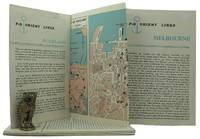
1962rif. 161834London: P&O Orient Lines 1962. Ten long single sheets folded into four five or six panels with text on one side and coloured maps on reverse the headings printed in blue & black; small cr. 8vo folded size; all numbered by hand near the top fore-corner of the upper panel with the number whited-out on number 2 Melbourne occasional slight soiling heavier on the Miami folder edges a trifle rubbed; P&O Orient Lines London 1962-1963. The folders were 'produced to assist passengers' and contain a brief history and description of each city including places of interest hotels shopping theatres currency information etc. P&O Orient Lines unknown
Madrid, en la Imprenta Nacional, 1852. 4to. menor; 366 pp., 1 h. + XVI-44 pp., 2 hs. Cubiertas mudas en papel de le época. El autor, experto de la Real Armada, rehace por entero el método de señales ideado por Bonifacio Tosta en 1810, quien a su vez había adaptado el del Almirante Sir Home Riggs Popham (1762-1820) nacido en Gibraltar, que había sido presentado al Almirantazgo en 1803 y utilizado por Nelson en la Batalla de Trafalgar. La primera edición de la obra, muy rara, es de 1819.
Madrid, Tipografía de Gregorio Estrada, 1871. 4to.; 238 pp. Encuadernación en media piel, de la época.
rif. 26649Paris, Beauchesne, 1967. 15 x 19, 291 pp., 1 carte dépliante, broché, bon état.
1975rif. W115388Berlin, 1975 209pp., 21cm., Doctoral Dissertation ("vom Fachbereich Wirtschaftswissenschaften der Technischen Universität Berlin zur Verleihung des akademischen Grades Doktor-Ingenieur genehmigte Dissertation"), softcover, stamp at verso of title page, text is clean and bright, W115388
1975rif. 7103Presses Universitaires de France 1975 collection que sais je n°498. poche. 1975. broché. Ouvrage technique de Pierre Célérier contre-amiral publié dans la collection encyclopédique 'Que sais-je ?' des Presses universitaires de France traitant des techniques de navigation maritime. Il s'agit d'un manuel de référence au format compact (128 pages 18 cm) destiné à présenter les connaissances actuelles sur le sujet
1969rif. 1282Düsseldorf. Eigenverlag. 1967 bis 1969. Je Jahrgang in vier Heften. (Zusammen 12 Hefte). 372, (12); 353, (10) und 352, (18) Seiten. Mit zahlr. faks. Abbildungen u. Dokumenten. Einfacher Bibl.-Einband der Zeit. (Einband unsauber. Mehrfach gestempeltes Exemplar). 23x16 cm
rif. 5924P., Lahure 1892. in8 broché, 40pp.
rif. 5923P., Lahure 1892. in8 broché, 20pp.
2018New Turkish Original bdg. HC. In publisher special box. Atlas folio. In Turkish. 336 p., fully color ills. Tarihte Türkiye haritalari: 2000 yillik harita koleksiyonu. This work begins from the first ages, continues with maps from Islamic geographers, maps with religious motifs, maps from the age of explorations and from the Ottoman Empire, goes until the Arabic letter maps from the early years of the Turkish Republic and ends with the map of Hatay joining the Turkish Republic in 1939. It is an indispensible work that traces the evolution of cartography in these lands. The collection, enriched with maps compiled from the major museums and libraries of England, France, the Netherlands, Russia and the USA, is the largest exhibition of maps of the Turkish lands. THis book is a product of nearly 20 years of work with 265 select maps in large 50 x 70 cm pages. A very heavy volume.
1941rif. Alibris.0024602Washington: U S DEPARTMENT OF COMMERCE 1941. Trade paperback. Good. No dust jacket. Signed by previous owner. CONTENTS; TANK VESSELS-GENERAL PROVISIONS-INSPECTION AND CERTIFICATION-REQUIREMENTS FOR HULLS MACHINERY AND EQUIPMENT-LIFE SAVING APPLIANCES-FIRE FIGHTING EQUIPMENT-OPERATION-LICENSED OFFICERS AND CERTIFICATED MEN-SPECIFICATIONS FOR LIFE SAVING APPLIANCES-TRANSPORTATION OF LIQUEFIED INFLAMMABLE GASES. INDEX U S DEPARTMENT OF COMMERCE paperback