3427 risultati
rif. 12433J. Susse, 1943. In-8, broché, illustrations.
1887rif. 21061887 Editions "Librairie Nouvelle", Paris, 1887. 2 volumes in-8 brochés. 551, 768 pages
rif. 20746Paris, Gaume, 1835. Broché, couverture muette amateur, ex-libris manuscrit: "Contagnet chanoine" (religieux de Viviers). in-8, faux-titre, titre, (2)-IV-286 pages,
1908[62] planches sous serpentes, avec texte et illustrations (photographies), frontispice de m. Flori Van Acker, in oblong (25x38cm.), reliure cart. d'éditeur avec traces d'usage, texte et intérieur en bon état, B105898
1908rif. B105898Bruges, Impr. Herreboudt 1908 [62] planches sous serpentes, avec texte et illustrations (photographies), frontispice de m. Flori Van Acker, in oblong (25x38cm.), reliure cart. d'éditeur avec traces d'usage, texte et intérieur en bon état, B105898
rif. 226885Paris, A. Cadart, s.d. (vers 1875) in-4, titre et 40 planches gravées à l'eau-forte, signées, en partie numérotées et généralement légendées, demi-chagrin olive, dos lisse orné de filets dorés, tranches mouchetées de rouge (reliure moderne).
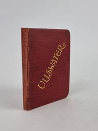
1903rif. 4159Derby United Kingdom: Bemrose and Sons Ltd. 1903. hardcover. Very Good. Various. Publication: Derby London and Watford Bemrose and Sons Ltd. 1903 Formatting: 24mo pp. 136. Condition Report: Very Good. The original publisher's maroon cloth binding remains remarkably tight square and structurally sound exhibiting minimal shelf-wear across the boards and exceptionally bright unoxidised gilt lettering to both the upper cover and spine. Internally the hinges are secure and the text block is firm with pages remaining clean crisp and largely free of foxing. Institutional provenance stamps present to the rear leaf and a notable closed tear along the fold of the rear supplementary map though the volume presents as an exceptionally attractive well-preserved surviving example overall. Catalogue Note: This second edition designated on the title page as the "Twenty-Fourth Thousand" represents a substantially revised and enlarged printing issued directly for the Ullswater Steam Navigation Company. Produced during the height of Edwardian Lake District tourism this pocket-sized guide was crafted to accompany travelers aboard the company's iconic steam yachts navigating England's second-largest lake. The volume is profusely illustrated with half-tone monochrome photographic plates highlighted by a dramatic frontispiece view capturing Ullswater from Gowbarrow Fell alongside three detailed folding maps and two folding panoramic vistas of the surrounding mountain ranges. Noteworthy institutional provenance is established by a neat circular blue ink stamp from the Lancaster Public Libraries and associated accession numbers on the rear leaf. Early twentieth-century ephemeral travel guides of this nature were routinely subjected to rigorous field use; consequently surviving examples that retain their fragile folding cartographic inserts in complete unrendered condition have become increasingly scarce on the open market. An evocative and indispensable companion to the dramatic landscapes of the Lake District this official guide invites readers to explore the majestic waters of Ullswater. Combining romantic topography celebrated through prefatory verse by Cumberland with practical navigation local history and sweeping panoramic vistas this charming pocket volume captures the timeless allure of England’s most celebrated fells. Bemrose and Sons, Ltd. hardcover
1971rif. 144630Couverture rigide. Cartonné. 388 pages.
1927rif. 59236Washington D.C.: Government Printing Office Hydrographic Office U.S. Navy 1927-1930. Three vols. 8vo. x 4 550; viii 4 560 pp.; 1 17 2 leaves. With 4 large folding colour maps 1 w/ toning at fore-edge from being improperly folded some edgewear numerous plates showing lighthouses. Two volumes uniformly bound in red publisher’s cloth gilt lettering front cover & spine darkening to spine fore-edges minor shelfwear dustsoiling minor paint drip at fore-edge 1 vol. Supplement in self-printed softcovers edgewear toning to fore-edges minor predation still VG- set. Third editions revised & updated of vols. I & II first edition of scarce Supplement of these coast pilot guides to South America and Antarctica in the 1920’s. Prior to modern GPS systems and satellite navigation these regularly updated and revised navigation handbooks provided key sailing instructions often drawing not only from Brazilian Argentine and British coast pilots as well as sailing reports from U.S. Navy vessels and those from merchant ships. The first large map delineates the requisite coast pilots for sailing in American waters and charts to be ordered from the Hydrographic Office while the second maps depict the sailing routes. The expanded 3rd edition is quite scarce with 1 copy located of both vols. in Worldcat NYPL. Government Printing Office, Hydrographic Office, U.S. Navy, paperback
PARIS, Fernand Lanore - 1946 - In-12 - Broché - Couverture illustrée en couleurs - Illustrations NB HT - 246 pages - Bon exemplaire
rif. 16657PARIS, Fernand Lanore - 1946 - In-12 - Broché - Couverture illustrée en couleurs - Illustrations NB HT - 246 pages - Bon exemplaire
rif. M18484P, Dépôt général de la Marine 1831, grande carte gravée de 93 x 65 cm . Edition d ' Avril 1888 . Court de marge . Marge supérieure légèrement froissée . Quelques annotations de navigations .
1954rif. na599Ouest France Broché 1954 In-8, (22.5x14 cm), broché, couverture à rabats illustrée, 292 pages, non coupé, quelques illustrations en noir et blanc, lexique ; plats légèrement défraîchis, bon état général. Livraison a domicile (La Poste) ou en Mondial Relay sur simple demande.
1999rif. 209325Couverture souple. Broché. 269 pages.
1980rif. MAR54M10Broché, 256 pages, paru en 1980 chez Arthaud, livre en très bon état général.
rif. 102863Dunkerque, Michel, 1881 in-12, 16 pp., broché.
rif. 20341Privas, imprimerie Constant Laurent, 1903. Broché, couverture illustrée. in-8 de 24 pages, photos,
196122x15. 285p. Fotogr. Ilstr. Trad. y apéndice R. Candel Vila, R. Candel Comas. Enc. Tela ed. Sobrecubierta.
rif. 0266801900.Ghardcover. Good. Access codes and supplements are not guaranteed with used items. May be an ex-library book. hardcover
1905rif. 100722Montreal: Desbarats & Co. 1905. Book. Good. Original Wraps. 8vo - over 7¾" - 9¾" tall. Title continued: With many illustrations of interesting places and scenes also a short description of the Ottawa River and points of interest to the tourist who may make the trip via the Grand River and Rideau Lakes through the most charming scenery in America between Montreal Ottawa and Kingston. 56 p. Folding map - Route of the Ottawa River Navigation Co. 35 illustrations. Covers worn with chips in spine. Top corner stained. A scarce guide book. Desbarats & Co. Paperback
1986No marks or inscriptions. No creasing to covers or to spine. A lovely clean very tight copy with bright unmarked covers and no bumping to corners. 256pp.
1964rif. gm3662Editions Chiron Cartonné avec jaquette 1964 In-8 (18,5 x 23,5 cm), cartonné avec jaquette, 235 pages, illustrations en noir de Roger Chapelet ; petite déchirure sans manque en tête du quatrième plat de la jaquette, traces au quatrième plat de la jaquette, par ailleurs bon état général. Livraison a domicile (La Poste) ou en Mondial Relay sur simple demande.
1931pp. xiv, 359 + Plus frontis + photographs. Uncut. 8vo. Original full cloth binding. Original dust jacket, worn at edges. Eleventh impression. Very scarce with the original dust jacket. **PRICE JUST REDUCED! POLAR 1