Multiple ContributorsMareMagnum

1 873 résultats
193495 pages. Black and white photographic plates. Fold-out map entitled "Doubly Equidistant Projection of the Sphere". Features: The Somali Coasts; Plotting the Vertical Photographs of the Second Mount Everest Flight; Archaeological Reconnaissances in Southern Persia; The John Murray Expedition to the Indian Ocean; The Sixth and Seventh Thule Expeditions of Knud; An Oblique Cylindrical Equal-Area Map. University library bar code upon first page of advertisements. Ink stamp to front cover and several pages. Average wear. One inch opening to fore-edge of front cover. Binding intact. A sound copy. Book
1963Features: In Defense of Gambling, by Jimmy Breslin; Quack Marriage Counselors - a growing nationwide scandal - long article; "King" of the U.S. Senate - Robert S. Kerr; Basketball's Bullies - reckless coaches, rowdy players and riotous fans disgrace our colleges, says Referee Al Lightner; Making the "Best-Dressed" List - some women have resorted to bribery; New Science that Copies Life - by mimicking the sensory organs of animals, scientists are inventing startling new machines; The Fateful Dive of the Atlantis - a bold experiment which took two divers to the ocean floor ends in mysterious death. Somewhat above-average external wear. Unmarked. A sound copy. Book
1952Features: The Chief's Daughter - dark deeds in Africa; The Mystery Man - an unusual man who served in the Merchant Navy on the Western Ocean; Three Christmas Days - reprint of a 1905 story dealing with a series of coincidences in Australia; Big Game Farming on the border of Kenya and Tanganyika; Dead Man's Trouble - a man gets in trouble because of his (dead) double; Australia's 'Prison Trees'; My Crocodile; Matcheli Makes 'Medicine'; Crack of Doom - a former Mountie's graphic account of a touch-and-go experience in the Canadian Arctic; Desert El Dorado - Tennant's Creek, Australia and its early history; Our Trip to Robber's Roost - a roadless wilderness in Nebraska which provided haven for many outlaws in earlier years; The Wailing Waterhole - a tale from Australia's Outback; and more. Above-average wear. Chips from backstrip. Binding intact. Covers attached. Book
1956Features: Two against the ocean, including a polio victim; White Man Fire-Walker - Methodist Missionary The Rev. Eric. L. Robinson; Pilot's 300 Crashes into Balloon Cables - continuing 'The Sky's No Limit," the first authentic story of the test pilots; The Mongoose - killer of Cobras; I Joined the Rush for Uranium - The Colorado Plateau; Rendezvous with Maneaters - Adventurer's Paradise Continued; Captured by Chinese Pirates - the steamer Ningpo; Below Zero Road - The Alaska Highway; The Trail of Crab Oonaka; Search for the Whooping Crane - trailing two wild birds for over 2,000 miles; We found unknown mountains - Nepalese adventures; The Beads of Assa - Somali adventure; Up-Helly-A - Norse Festival; and more. Backstrip missing; Covers partially loose. Still a worthy copy. Book
1955Features: Destination Unknown - one of the most remarkable narratives of one-man pilgrimage ever - the adventures of Peter Pinney; Ocean Feud - the dramatic story of a bitter feud between two Norsemen, and of a "Yank" - great photos; The Terror at 16 Fathoms - Divers rate the groper, 800lb, as the deadliest fish in the seas; Horned Heroine of the Himilayas - the black goat; Nitchie's Grizzly - a Canadian Parks Officer describes an experience with a Grizzly Bear; The Ju-Ju Tree - an African story; A Ship with a Secret - an unsolved sea mystery - the Carrol A. Deering; The Kidnapped Crook - Part II - the concluding instalment of the amazing adventure of Clement Passal - alias the Marquis de Champaubert; The Wettest Place on Earth - Cherrapunji, a village in Assam; and more. Chips from back strip. Back cover loose but present. Average wear. Book
196018 pages. Features: Mailbag; How Wide is Steelhead Ocean Range?; Quail Hunt - article with photos of Pete Worobey and his song Bob; Bouncing the Bars - photo-illustrated article by Jim Railton about fishing in the Cowichan River includes photos of The Hancocks, Bob Hazeldine, Art Hancock, Dick Mahoney, Murray West, and Terry Thomas; Six-Pound Dynamute - Ed Meade writes about the six pound Breda magnum rifle, with photo of Jack Hutton; Boats; Photo of Wally Gentles holding 23-lb Spring salmon caught at Brentwood on Vancouver Island; Photo of near record Caribou trophy shot by Harold Daye with Don and Wes Bickerton and Innis Short near Burns Lake; Photo of Mrs. Montgomery of New Westminster holding 18-lb Steelhead caught in the Kispiox River; Back cover Lucky Lager beer ad shows men watching football on TV; Many additional nostalgic ads. Unmarked with moderate wear. A quality vintage copy. Book
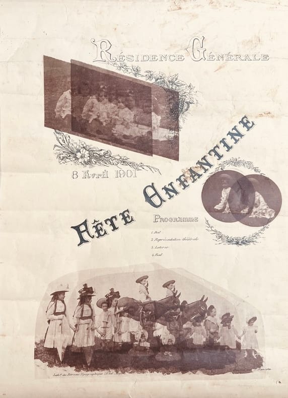
1901réf. 44538(Tananarive), Lithographie du Bureau Topographique (État-Major), 1901. Affiche imprimée recto verso, illustrée de 3 reproductions photographiques (43 x 31,5 cm).
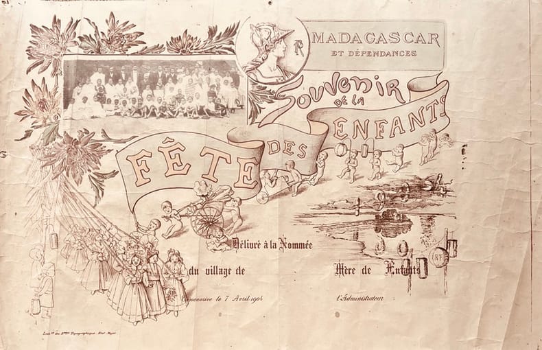
1904réf. 44539Tananarive, Lithographie du Bureau Topographique (État-Major), 1904. Affiche imprimée en couleurs illustrée d'une reproduction photographique (50 x 32 cm).
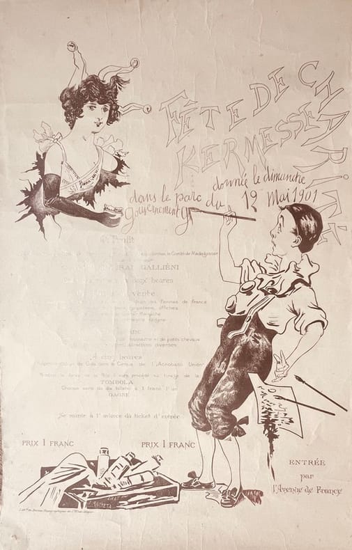
1901réf. 44540Tananarive, Lithographie du Bureau Topographique (État-Major), 1901. Affiche imprimée (55 x 36 cm).
900Anchorages in the Solomon Islands. In the left part of the chart insert of Utuha H.r or Port Purvis Enlarged from a Survey by Comm. R.W. Glennie, H.M. Surveying Ship "Sealark" 1911, With Additions from a sketch Survey by Lieut. J.P. Rolleston H.M.S "Royalist", 1889, Alite H.r Langa Langa H.r Sketch Survey by Lieut. C.G.S. Eeles, H.M.S. Curacoa, 1893, Anonyma Cove Sketch Survey by Lieut. C.G.S. Eeles, H.M.S. Curacoa, 1893. In the middle part of the chart insert of Sio Harbour Sketch Survey by Lieut. J.P. Rolleston H.M.S "Royalist", 1889, Uru I. Anchorage Sketch by T.H.Switzer, Mate S.S. Rhoderick Dhu, 1894, Korombusu P.t to Susu P.t Surveyed by Commander R.W. Glennie H.M. Surveying Ship "Sealark" 1912. In the right part of the chart insert of Waisissi or Royalist Harbour Sketch Survey by Lieut. J.P. Rolleston, H.M.S. Royalist, 1889, Palaina Anchorage Sketch Survey by Lieut C.G.S. Eeles, H.M.S. Curacoa, 1893, Coleridge Bay Sketch Survey by Lieut. E. Reeves, H.M.S Royalist, 1894, Sualaha Cove Sketch Survey by Lieut. C.G.S. Eeles, H.M.S Curacoa, 1893, Mappo Harbour Sketch by T.H. Switzer, Mate of S.S. Rhoderick Dhu, 1894, S.W. Coast of Malaita By W.T. Wawn, Master of the Brigantine "Borough Belle" 1891. London Published at the Admiralty 30th May 1890, under the Superintendence of Captain W.J.L. Wharton, Hydrographer. Small corrections. Folded editorially. Autore: Admiralty Charts. Luogo: Salomon Islands - Pacific Ocean. Anno: '900. Tecnica: incisione. Dimensioni: 649x998 mm
900Bauro or San Cristoval Island Surveyed by Lieutenant C.F. Oldham, assisted by Lieutenants Alex Leeper, C.F. de M. Malan, and T.H. Heming, H.M. Surveying ship "Lark" 1883-4. The Southern and Western coasts from sketch surveys made in 1793, 1855, & 1867. In the upper right corner of the chart insert of Wango Bay Sketch survey by Lieut. C.A. Buckland, H.M.S. "Royalist" 1892, Marunga Harbour Sketch survey by M.r T.H. Switzer, Master S.S. "Roderick Dhu" 1900, Star Harbour Sketch survey by M.r T.H. Switzer, Master S.S. "Roderick Dhu" 1900, London Published at the Admiralty, 19th April 1892, under the Superintendence of Captain W.J.L. Wharton, Hydrographer. Small corrections: 1921. Folded editorially. Autore: Admiralty Charts. Luogo: Bauro or San Cristoval Island - Salomon Islands - Pacific Ocean. Anno: '900. Tecnica: incisione. Dimensioni: 649x985 mm
900Bouganville Strait Surveyed by Lieutenant C.F. Oldham, assisted by Lieutenants A. Leeper and T.H. Heming and Sub Lieutenant A.G. Causton, H.M. Surveying Ship "Lark" 1883-4. Bouganville I. and the adjacent waters amended from the German Government Charts of 1910-13. In the upper right corner of the chart insert of Shortland Harbour Surveyed by Lieut. C.F. Oldham and the Officers of H.M.S. "Lark", 1883-4. London Published at the Admiralty, 9th June, 1886, under the Superintendence of Captain W.J.L. Wharton, Hydrographer. Small corrections: 1930. Folded editorially. Autore: Admiralty Charts. Luogo: Bouganville Strait - Salomon islands - Pacific Ocean. Anno: '900. Tecnica: incisione. Dimensioni: 828x653 mm
900Ancient and original map of Malekula (Mallicolo) Island Northern part with portion of Malo Island Surveyed by Lieut. & Comm. G.C. Frederick, assisted by Lieut.ts H.J. Gedge, E.A. Day & H.B.T. Somerville, and Lieut. & Comm. H.E. Purey-Cust, assisted by Lieut.ts W. Pudsey-Dawson, F.C.C. Pasco & A.E.H. Marescaux, H.M. Surveying Ship "Dart" 1891-92. The West Coast: South of Malua Bay from a Sketch Survey by Lieut. K. Dixon, assisted by M.r G.J. Pacey, Gunner, H.M.S. "Archer" 1903. London Published at the Admiralty, 11th Dec. 1893, under the Superintendence of Captain W.J.L. Wharton, Hydrographer. Small corrections: 1928. Folded editorially. Autore: Admiralty Charts. Luogo: Pacific Ocean South - Malekula Island. Anno: '900. Tecnica: incisione. Dimensioni: 986x640 mm
900Plans of Islands in the South Pacific. In the left side of the chart insert of Niutao From a sketch by Captain Peters of the German Mercantile Marine, 1876, Nanomea From a sketch by Capt. Peters of the German Mercantile Marine, 1876, Hoorn I.s From the French Government Chart of 1893, Sigave Bay From a French Gov. Survey 1883, Oeno Island From a Running Survey. In the middle of the chart insert of Ducie IslandFrom a Running Survey by Capt. F.W. Beechey, 1826. In the right side of the chart Niue or Savage I. From a Survey by H.D.M. Haszard Esq. 1903, Uea or Wallis I.s From a French Government Chart of 1901, Henderson I. From a Running Survey by Capt. F.W. Beechey, 1826, Niuafou Island From an Eye Sketch by Lieut. B.T. Somerville, H.M. Surveying Ship "Penguin" 1895. London Published at the Admiralty 20th Sept. 1873, under the Superintendence of Rear Admiral G.H. Richards, Hydrographer. Small corrections: 1930. Autore: Admiralty Charts. Luogo: Pacific Ocean Islands. Anno: '900. Tecnica: incisione. Dimensioni: 631x489 mm
900South Pacific Ocean - New Hebrides & Islands adjacent Surveyed by Capt. H.M. Denham, 1853-6. In the left side of the chart insert of Port Aneityum. In the right side of the chart insert of Aneityum Island or Annatam, Conway Reef. In the lower part of the chart insert of Walpole Island, Matthew Island, Hunter Island, Erronan or Futuna. London Published at the Admiralty, 4th June 1862, under the Superintendence of R.Adm. Washington, Hydrographer. Small corrections: 1920. Autore: Admiralty Charts. Luogo: New Hebrides Islands - Pacific Ocean. Anno: '900. Tecnica: incisione. Dimensioni: 481x654 mm
900Tonga or Friendly Islands. In the upper part of the chart insert of Tongatabu Nukualofa Anchorage Surveyed by Captain Pelham Aldrich, assisted by Lieuts. C.J. Baker, T.H. Heming, G.C.A. Marescaux, W. Richardson, C.E. Monro and Sub Lieut. E.B. Kiddle, H.M. Surveying Ship "Egeria", 1888. In the lower part of the chart insert of Nomuka Harbour Surveyed by Lieut.ts W. Richardson and E.B. Kiddle, under the direction of Commander C.F. Oldham, H.M. Surveying Ship "Egeria", 1889, Eua Island Surveyed by Captain Pelham Aldrich, and the Officers of H.M. Surveying Ship "Egeria" 1888, Falcon Island Surveyed by Commander C.F. Oldham, and the Officers of H.M. Surveying Ship "Egeria" 1889. London Published at the Admiralty, 15th Feb. 1890, under the Superintendence of Captain W.J.L. Wharton, Hydrographer. Small corrections: 1931. Folded editorially. Autore: Admiralty Charts. Luogo: Pacific Ocean - Island Tonga. Anno: '900. Tecnica: incisione. Dimensioni: 965x652.
900Vanikoro Islands Surveyed by Capt. Durmont D'Urville, French Royal Navy 1828 - Tevai and Manevai Bays From the Survey by Capt Durmont D'Urville, French Royal Navy 1828. In the right side of the chart insert of Basilisk Harbour By Lieut. Hayter & Nav. Lieut. T.L. Mourilyan, 1872. Sub.Lieut. C.F.M. Malan, 1874, & Lieut. W. Munro Kerr, 1900. London Published at the Admiralty 1st Sept. 1873, under the Superintendence of Rear Admiral G.H. Richards, Hydrographer. Small corrections: 1930. Folded editorially. Autore: Admiralty Charts. Luogo: Vanikoro Islands - Pacific Ocean. Anno: '900. Tecnica: incisione. Dimensioni: 993x662 mm
réf. 10036In 8 pleine toile rouge, titre, doré, caissons à froid, armes du collège de Commercy sur le premier plat. faux-titre, titre, XXVII-367 pages, Paris Librairie classique et d’éducation A. PIGOREAU successeur, sans date. (1859) 190€ étude politique, historique, sociale, description des provinces, mœurs, coutumes, conquête, colonisation
196924 pages. Features: WSP (U.S.) Conference of 1969; The Kennedy Family Passion Play; That Reformer Fellow, President Nixon; That High Cost of Living; "Reparations" Vs. World Socialism; N.D.P. Shell Game - Ed Schreyer assumes leadership of the Manitoba N.D.P.; Historic Words Live Long After Tragedy - "Bill" Pritchard, one of eight men tried in connection with the famous Winnipeg general strike of 1919, speaks again; Those Halls of Montezuma - looking back on Aztec history, and myths which surround it; Marx and the American Civil War; Do Loose Lips Sink Ships? - fascinating article claims German U-boats were had fore-knowledge of targets by gleaning information from European reinsurance companies who underwrote the risk of ocean shipments; Passing of Jeni "Chubbi" Kligman; and more. Average wear. Unmarked. A sound vintage copy. Book
réf. OCE210MGARNIER FRERES non daté, XIXe siecle. 2 forts volumes in-8, reliés, tome 1 demi-cuir rouge à coins, tome 2 sans coins, dos long orné, 960-952pp. Riche iconographie comprenant différentes cartes et plans couleurs et n&b in et hors textes dont certaines sous serpente. Coin substantiellement déchiré sur pages de titre et faux-titre du tome 1. Quelques feuillets désolidarisés. Volumes usés mais convenables. Intérieur satisfaisant. Pièces de témoignage
réf. OCE123MCalmann Lévy - Paris, Paris, 1881. Édition originale. In-8, reliure amateur, demi-basane brune à coins, dos à nerfs, couvertures non conservées, 293 pp. Très beau travail d'illustration par J. Férat avec 45 vignettes dont 17 hors texte. Infimes épidermures. Coins émoussés. Reliure charmante dans le goût de l'époque. Aimable exemplaire du témoignage essentiel de celui qui fut chargé par la division navale de Nouvelle-Calédonie de réprimer l'insurrection canaque.
réf. ORD-19668Paris. Armand Colin. 1920. 2 volumes in-8 (162 x 245 mm) pleine basane rouge, dos à 4 nerfs, titre et filets dorés, gardes marbrées roses, 3ff., IX, 340 et 2ff., 3014 pages. Complet des illustrations. Mors du tome I affaiblis, nerfs du même tome épidermés sinon bon état.
1894réf. 106301894suivi de L’Île Inconnu et du Prince Papillon - 298 pages -Illustrations de F.A.Besnier hors texte et in texte - volume in 4 pleine toile éditeur à décors polychrome -reliure de P.Souze - Intérieur fortement roussi - E.Le Dentu Éditeur - 1894 - Paris .
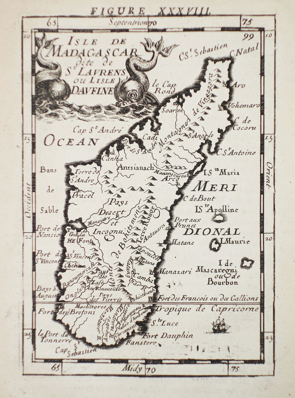
1683réf. LBW-2312[1683]. 140 x 98 mm.
réf. 490Ed.Central News Agency Ltd, South Africa, 1953. In-4. Cartonnage éditeur. (XVI), 564 pages. Avant-propos de B. F. J. Schonland; illustrations de Margaret M. Smith et al. 107 planches en couleurs. Plus de 1320 illustrations in-texte et hors texte.