1 863 résultats
1892Very Good English, Middle (1100-1500) Original imitation vellum. An OCLC register says "decorated with small shells and seaweed pasted on". Chipped on extremities and spine, slight pouring on paper; several tapes used at the link of the pages to binding. Otherwise a good copy. Small 4to. (27 x 18 cm). In Middle English (15th century). The first leaf attached to front cover. At end, 6 blank leaves. [46] p. with [7] blank pages, many illustrations, 1 letter with its broken seal. Separately, a facsimile of a letter from Isabella (Dona Isabel por Gracia de Dios Reina de Castilla y Leon etc. etc. A Don Cristobal Colon de Genova) to Columbus, dated 'Granada a? trece de Abril de MCCCCXCII,' with a broken seal attached. Script on vellum as well. Two registers in OCLC (1029665801 and 60764823 -This one is New York Edition-). 'Düsseldorf Edition' says "A spurious work purporting to be the logbook of Christopher Columbus, which, according to legend, he threw into the sea during a storm, and which was found on the coast of Pembrokeshire 400 years later. Written in antiquated English, with paper and binding made to imitate in color and appearance a volume damaged by exposure to seawater. "S.A.S.X. MY XPO FERENS" from cover, variously interpreted, eg. Supples servus altissimi Salvatoris Xristi Mariae Josephi Xpoferens. Forgery attributed to Karl Maria Seyppel. Printed by lithographic process on imitation parchment paper. Text and illustrations printed to appear handwritten, with many decorated initials. Accompanied by: reproduction of a letter purported to be by the finder of the logbook dated "September forth 1890"; "Don~a Isabel por gracia de Dios Reina do Castilla y Leon, etc., etc. a? Don Cristo?bal Colon de Ge?nova," supposed letter on imitation parchment, authorizing his voyage, dated "Granada, a? trece de abril de mccccxcij," with an attached seal, laid in.". This is a fine hoax on Colombus' first travel into America. It includes a map containing Cuba, San Salvador, and unknown areas with a hand drawing of Columbus as well as other illustrations and decorative borders, etc. This Edition may be printed in memory of the 400th year of '1492'. "Columbus's log of the first voyage has not survived, although we do have an abstract of it, written in the 1530s by Bartolome de las Casas. However, that actually used the "Barcelona Copy" of Columbus's original log. The chart above shows the sources that exist today in green, and sources that have disappeared in red. The chart also shows where secondary souses got their original information. When he returned to Spain in 1493, Columbus gave his original log to the Sovereigns at the royal court in Barcelona. Queen Isabela ordered the log to be copied, resulting in the so-called Barcelona Copy. The original has not been seen since, however, the Barcelona Copy was returned to Columbus just before his second voyage later that year, and remained in his possession until his death in 1506. It then passed into the hands of son Fernando, who used it when he wrote a biography of Columbus in 1538. The Barcelona Copy too was lost sometime after 1554. Sometime around 1530, the Barcelona Copy was abstracted by Las Casas into the Diario. This abstract as part of his research that led to his massive work, the Historia de las Indias. So The Diario remains our best historical record of the first voyage of Columbus. On the westward passage, Columbus kept two sets of distance figures in the log. According to Las Casas, this was done to allay the fears of the crew that they had sailed too far from Spain. The abstract is mostly written in the third person, but there are a number of large direct quotes from the log written in Columbus's own first-person.". (Source: Christopher-Columbus Europe website).
1966Very Good English Original wrappers. 4to. (29 x 22 cm). In English. 41 p., 31 original gelatin silver photographs in various sizes mounted on pages within the text, many architectural plans of the bridges, with a folded page, and a folded map. The title, author, and contents are on the front cover with a handwritten date "1966". The first two pages are folded inside. Exceedingly modern rare printed material with original gelatin silvers including a detailed historical, scientific, and visual account of the highway bridges in all of Japan, by Dr. Eiichi Murakami, the Director Public Works Research Institute Ministry of Construction of Japan. The book starts with a General title containing two tables: "Present condition of Highway Bridges in Japan 1965", and "Longest Span Bridge by Types in Japan". The second part is the History of Highway Bridges. This part deals with some selected examples from the oldest bridge on record, Ikuinotsu built in 326 AD to present, and this part has three original silver gelatins of Enkyo (Monkey) Bridge, Kintai (Shining Arch) Bridge, and Aimoto Bridge. The third and fourth part is "Specifications" and "Influence of Earthquake upon Bridge Structure" discussing its history from 1921 to the present day and the effects of an earthquake upon a bridge, these parts have one photo mounted on the sixth page as well as two tables. The fifth part is "Steel Bridges" and also is the longest part of the work, with examples from the first metallic bridge in Japan "the Kanenohashi" [i.e. Iron Bridge] constructed in Yokohama in 1869 to the present day, including 18 original silver gelatins of Eitai Bridge, Tied Arch over the Sumida River in Tokyo (its a panoramic view), Sagami Grand Bridge, Nagara Bridge, Azuma Bridge, Jogashima Bridge (this consists of two separate photos), New Tsukuda Bridge, Biwako Grand Bridge, Choshi Grand Bridge, New Mikuni Grand Bridge, Ondo Grand Bridge, Asahi Bridge, Uwagawa Bridge, Takumo Bridge, Saikai Bridge /two different views of this bridge), Konaruto Bridge, Kachidoki Bridge, and the Side-view of Wakato Bridge under construction. The sixth part deals with the subject of Reinforced Concrete Bridges including three gelatin silvers of the Nihon Bridge, Tokachi Grand Bridge, and Sasatsu Bridge. The seventh part is "Prestressed Concrete Bridges". It was in 1952 that prestressed concrete was first industrialized in Japan. This part tells that the studies for industrialization had been made earlier, but implementation had been delayed partly due to World War II and it follows the technique to the present day with five gelatin silvers of Sataunai Bridge, Ranzan Bridge, Komekami Bridge, Koshinoo Bridge, and Nada Bridge, pp. 25-28. The eighth part is "Substructures", including a gelatin silver Steel caisson for the main tower foundation of the Wakato Bridge, towed 20 km across the ocean. The ninth part is "The Amakusa Highway" which is a link between Misumi-cho, Uto-peninsular, and Aizu, Kamishima-Island. This part deals with the project which has a total length of 16,5 km including five bridges on the route made by the Japan Highway, this part has five plans. The last part is "Proposed Highway Bridges across the Bay and the Sea", including 16 plans (one folded). The book has an extra folded large map (58x45,5 cm) in Japanese and a folded page. This item is from the library of Turkish certificated engineer Alkut Aytun (1937-) (dated on the front cover "6/IV/1966"). During the time he worked at the Earthquake Branch of the Ministry of Development and Settlement, he specialized in earthquake engineering as a UNESCO scholar at the International Institute of Seismology and Earthquake Engineering (I.I.S.E.E.), which was established in Tokyo (Japan) with the cooperation of the United Nations and the Japanese Government, between August 1965 and August 1966. This was followed by an extension study at the University of Tokyo under the supervision of Atsushi Hirai with a scholarship from Waseda University unti
2011réf. SBBIH-Q7PCDORG3P6DJuicySpirituality.com 2011. paperback. Good. Our good condition books are generally good for reading but not for gifting or collecting. They could have imperfections such as creasing fanning inscriptions margin notes yellowing staining on edge or cover or pages bumps scuffs etc etc sometimes multiple of these. It's a wide category that encompasses anything that isn't almost-new down to anything that is slightly better than poor. We would NOT recommend gifting Good books - these should be considered reading copies. Our books are dispatched from a Yorkshire former cotton mill. We list via barcode/ISBN so please note that the images are stock images and may not be the exact copy you receive furthermore the details about edition and year might not be accurate as many publishers reuse the same ISBN for multiple editions and as we simply scan a barcode or enter an ISBN we do not check the validity of the edition data when listing. If you're looking for an exact edition please don't order at least not without checking with us first although we don't always have time to check. We aim to dispatch prompty the service used will depend on order value and book size. We can ship to most countries see our shipping policies. Payment is via Abe only. JuicySpirituality.com paperback
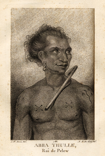
1788réf. 14520Paris, Le Jay et Maradan, 1788 ; 2 tomes in-8 ; demi-chagrin noisette (reliure moderne) ; (4), 282 pp., portrait du capitaine Henri Wilson en frontispice, gravé par Mme Massard d'après I. Russell, grande carte géographique dépliante, 7 planches gravées dont 6 dépliantes ; (4), 274 pp., (3) ff. Errata et Approbation, 8 planches gravées dont 6 dépliantes, soit 17 planches au total ; vocabulaire de la langue Pelew pp. 251-267 du tome II.
1833réf. 14286J. Morlent Le Havre 1833 1 vol. In-8 de XVI 280 pp., demi-basane fauve de l'époque, dos lisse fileté, pièce de titre, couverture conservée.
1802réf. P2-7C-1Paris, Prault, An X (1802). 3 volumes in-8 (205x125mm), demi-chagrin à coins, dos lisse orné, reliure de l’époque.
1851réf. PACIFICO015869Longman Brown Green and Longmans London. 1851. First edition. Octavo. Two volumes in one: pp xii 352; xii 371. Four chromolithograph plates. Original blue cloth decorated in blind lettered in gilt.On the front free endpaper are two 19th century inscriptions one of which has been crossed through. Some foxing here and there. Head and tail of spine a bit scuffed. Some wear to edges. Very good. Very scarce in the intact publishers' binding. Longman, Brown, Green, and Longmans, London. hardcover
réf. 8186dans le quel la côte Nord-ouest de l’Amérique a été soigneusement reconnue et relevée ordonnée par le Roi d’Angleterre, principalement dans la vue de constater s’il existe,à travers le continent de l’Amérique,un passage pour les vaisseaux,de l’Océan pacifique du nord à l’Océan atlantique septentrional et exécuté en 1790,1791,1792,1793 par le capitaine George VANCOUVER traduit de l’anglais. Ouvrage enrichi de figures.Trois tomes en trois volumes petit in folio,reliure cartonnée, postérieure,avec étiquette de titre imprimée.Tome premier:faux-titre,titre, XII,491 pages 7 gravures hors-texte sous serpente.I) village indien désert II)4 mâts singuliers fichés en terre III) Mont Rainier IV) village d’une tribu d’indiens V) village de Cheslakées VI) la découverte VII) Anse des amis. Tome second : faux-titre titre 516 pages 5 planches hors-texte sous serpente petites déchirures réparées en marge inférieure de la table des matières. Planche I) La mission Carlos près de Monterey II) cartes des iles d’Hergest, III) Anse des Saumons, dans l’entrée de l’observatoire. IV) New-Eddystone, dans le canal de Behm. V) le Présidio de Monterey Tome troisième : faux-titre, titre 562 pages, une déchirure réparée à la dernière page de la table des matières ainsi qu’à la page de garde. 5 planches hors-texte sous serpente planche I) cratère d’un volcan au sommet du Mont Worroway dans l’ile d’Owhyhée. II) Port Dick pris à l’entrée de Cook avec une flotille de pirogues indiennes III) Le mont saint Elie IV) Montagne remarquable près de la rivière de Monterey VI) le village d’Almandrel dans la baie de Valparaiso.La vue de Valparaiso,annoncée,n’était pas jointe à ce volume.Grandes marges.Sans l'atlas.Edition originale de la traduction française. A Paris de l’Imprimerie de la République An VIII
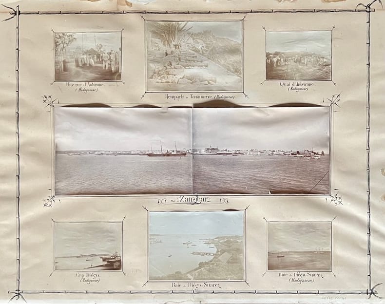
1901réf. 44542, , 1901. 50 photographies en tirage original d'époque de formats divers (de 6 x 5 à 17 x 11 cm environ), disposées et contrecollées sur 4 planches ornées et légendées à la plume (63,5 x 49,5 cm).
1773réf. 0034671773 Amsterdam, et se trouve à Paris, Chez Merlin, 1773. Deux volumes in-8 (134 X 205 mm) veau fauve marbré, encadrement de filet à froid sur les plats, dos cinq nerfs, caissons dorés avec fleuron central, large dentelle en queue et tête, coupes et coiffes ornées, pièces de titre et de tomaison maroquin rouge, tranches rouges (reliure de l'époque). Tome I : (1) f. blanc, faux-titre, frontispice, titre, 328 pages, 3 planches et 4 tableaux dépliants, (1) f. blanc ; Tome II : faux-titre, titre, 278 pages, 2 planches, (1) f. blanc. Notice ancienne collée sur le premier contreplat du tome I. Les planches de Moreau sont brunies.
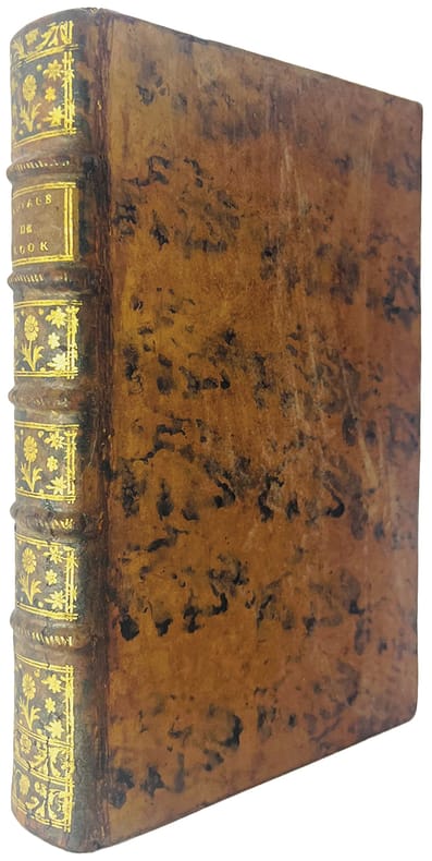
réf. 4671" undertaken by the command of his majesty, for making discoveries in the Northern Hemisphere. Performed under the direction of captains Cook, Clerke and Gore, in his majesty's ships the Resolution and Discovery; in the years 1776, 1777, 1779, and 1780. IN THREE VOLUMES : Volume 1- 3; Vol. I and II written by Captain James Cook; Published by Order of the Lords Commissioners of the Admiralty, Vol. III by Captain James King . Second edition."
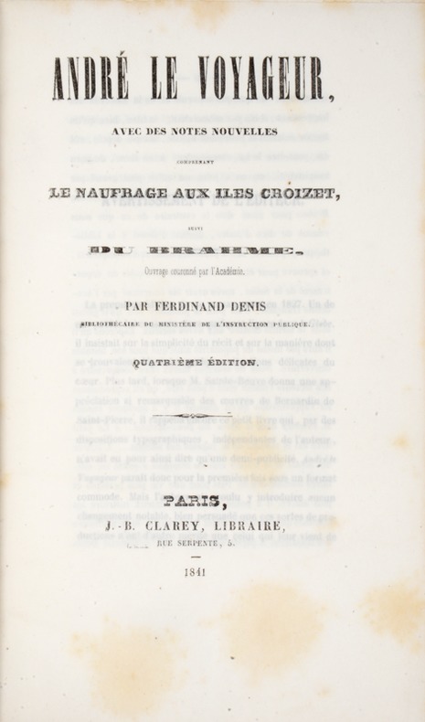
1841réf. 39808Paris, Clarey, 1841. In-8 de (4)-III-259 pp. maroquin vert, dos orné à nerfs, triple filet doré d’encadrement sur les plats, dentelle intérieure dorée, tranches dorées sur marbrure, non rogné (Brany).
réf. 104239De l'Imprimerie Didot Jeune, An X (1801-1802), 5 volumes +1atlas in-8 de 220x140 mm environ, viij-341 pages - 384 pp., - 381 pp., - 368 pp.,- 438 pp., dernier volume-atlas contenant 17 vues sous serpentes et 9 cartes dont 8 dépliantes, cartonnage de l'éditeur portant titres et tomaisons dorés sur le dos. Feuillets non rognés. Dos insolés, frottements sur les coins et coiffes, petits défauts de marge sur quelques pages sans atteinte au texte, sinon bon état.
1909réf. 55870n.p.: Mr. & Mrs. Rutherford 1909-1910. Oblong 4to. 11.5 x 7.5 in. 46 pp unpaginated. on thick gray card stock mounted on green linen hinges at gutter margin. With 56 silver gelatin & albumen photographs 3 hand-coloured 1 RPPC sized from 2.5 x 4.25 in. up to 6.75 x 9.75 in. several of the photos have descriptive text w/in the negative at lower margin some w/ lettering in manuscript below the images; seating chart for dinner with the Viceroy two ALS invitations on letterhead dance card menu and clipping touting the attendees. Recent leather post-binder lettering stamped on front cover occasional fading to a few images some albumen photos w/ wrinkling from being applied to boards occasional edgewear couple minor tears still a VG exemplar; Nine albumen photos sized from 7 x 9.25 in. up to 8.5 x 11 in. uniformly mounted on 11 x 14 in. gray studio board and 8 of the 9 w/ manuscript notes in bold hand on versos minor edgewear a few corners w/ minor wear still a VG set of images. This intriguing souvenir album for a voyage on the SS Prinzess Irene through the Mediterranean and onto India and Singapore opens with photos on shipboard of the Rutherfords and Miss Weir with their small dog companion. They have incorporated three albumen photos of Naples including a panoramic view of Naples St. Martin’s Charterhouse the Neapolitan Monastery and Santa Lucia street. Additional views on shipboard as they sail to India including a view of camels and desert dunes along the Suez Canal. Upon their arrival in Calcutta India they are invited and attend a state diner with Sir Syed Hussain Ali Bahadur b. 1875 the Nawab of Murshidabad two Maharaja’s British officers and Baron Charles Hardinge Viceroy of India with menus and invitation included and a mounted hand-coloured view of the Nawab. The menu featured Filets de Canetons au Foie Gras Mousses de Volaille Petits Rolls Mayonnaise Plum Cake Bavarois Chocolat Pistache and Macedonian Champaign while the musical accompaniment featured old favorites of Teddy Bear’s Picnic Die Meistersinger by Wagner ballet music from Faust and compositions by Rosse. Street scenes of markets native dress elephants owning the road as well as several different wagons pulled by horses camels and oxen. Also included are albumen views of pilgrims washing in the Ganges at Benares Varanasi Hawa Mahal or Palace of the Winds at Jeypore street scene in Jeypore depicts oxen market buildings by Bourne & Shepard whose images were marketed throughout India by agents and wholesale distributors. From there the trio voyage onto Singapore shown in images of Kampong Bugis along the Kallang River with a native in their boat with thatched homes built on stilts; a bustling port views along palm tree lined streets a bustling market scene elephants washing as well as a particularly striking scene of oxen pulling a large loaded woven cart. The nine separate views include albumen photos of the entrance gate to the Taj Mahal a detail shot the inner courtyard and screen around the the tombs of Shah Jehan and Mumtaz Mahal three striking and large albumen photos of the Thanjavur temple site including the Brihadishavara Temple and the monumental Gopuras gateways and finally the Pearl Mosque. The SS Prinzess Irene was an 18000 ton lier launched in 1900 for North German Lloyd was seized in 1917 in the United States renamed the USS Pocahontas and eventually sold back to North German Lloyd in 1922 first renamed the Bremen and then the Karlsruhe and sailing until 1932. Mr. & Mrs. Rutherford, hardcover
1777réf. 44433Amsterdam, et se trouve à Paris, chez Pissot, Nyon, 1777. In-8 de (4)-XIX-(1)-546 pp., veau havane marbré, dos orné à nerfs, pièce de titre en maroquin rouge, tranches rouges (reliure de l'époque).
1851In-8 gr. (mm. 255 x 165), 5 volumi, tela editoriale, ricca decoraz. a secco ai piatti e al dorso (2 volumi restaur. per piccole manc. ai bordi), pp. LX,434; XVI,476; XVI,438; XVI,540; XVI,558; molto ben illustrati da numerose figg. inc. su legno nel testo e da 63 (su 64) belle tavole inc. su acciaio fuori testo: sono vedute, ritratti di indigeni, loro abitazioni e cerimonie; unite 13 cartine geografiche piu' volte ripieg. Resoconto di una importante missione scientifica di esplorazione, diretta dall'ufficiale di marina americano Charles Wilkes (1798-1877). Durante il lungo viaggio vennero visitati vari arcipelaghi del Sud Pacifico, toccata l'Australia, scoperte le coste dell'Antartico oggi chiamate "Wilkes Land" e percorse le isole Fidji, Hawaii e la costa nord-ovest degli Stati Uniti; ritornata fino al Borneo via Filippine, la spedizione fece definitivo rientro attraverso la Polinesia e il Capo di Buona Speranza. Esemplare uniformemente arrossato e con fioriture ma complessivamente in buono stato.
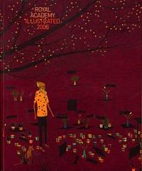
2008réf. 77505Harry N. Abrams Distribution . New. Paperback. FREE UPGRADE to Courier/Priority Shipping Upon Request - IN STOCK AND IMMEDIATELY AVAILABLE FOR SHIPMENT - Flawless copy brand new pristine never opened -- Text in English. 192 pp. With 218 ills. 211 col. . 24 x 20 cm. -- with a bonus offer--; The Royal Academy of Art’s Summer Exhibition in London has been an annual event since 1768. Today about a thousand works are selected to be shown each year from over 10000 entries. The exhibition which includes paintings drawings prints sculpture and architectural designs and models continues to be the largest open exhibition in the UK. First published in the 1870s Royal Academy Illustrated is an excellent way to stay current with trends in contemporary British art by surveying the highlights of each year’s show. This colorful collection features a cross-section of the works on display at the Summer Exhibition accompanied by installation shots of the galleries and an insightful introduction to the theme of the show. . 2008. 1905711123 . Harry N. Abrams (Distribution) paperback
1837réf. PHO-2280Paris, Arthus Bertrand, 1837, 2 volumes (3) grand in-4° (30x24,5cm), VIII pp., 742 pp., demi chagrin et coins époque, dos lisse avec auteur, titre et tomaison, frottements au dos, quelques rousseurs, défaut à la coiffe supérieure. Édition originale du texte du voyage du Bougainville autour du monde, manque l’atlas.
1923Very Good Turkish, Ottoman (1500-1928) Full morocco in Ottoman style. Large roy. 8vo. (25 x 18 cm). In Ottoman script (Old Turkish with Arabic letters). 62 p., 18 unnumbered b/w photos, and four b/w maps. Slight foxing on extremities. Otherwise a very good copy. First and only edition of this exceedingly rare first book on Muslims and Islam in the Comoro Islands of Africa, located in the Mozambique Channel to the north-west of Madagascar and facing Mozambique, including Ngazidja (Grande Comore), Ndzuwani (Anjouan), Mwali (Moheli) and Mayotte (Maore) Islands. The book gives detailed information about the races, customs, and traditions of the natives of the archipelago, the introduction of Islam to the islands, and how influential it was on the people as well as on their education, social structure and the population of the archipelago. The work carried out in the context of missionary activities is also discussed in detail, and such information is supported by photographs, statistical tables and chronology of the islands. According to the information given in the work, Muslims first came to Yuhana Island in 750 AD and began to settle on the island. Since 854, there are claims that the Ismailis, a Shiite community, and then the Fatimid prince came to the islands and ruled for a period. Especially Arabs, Iranians, and Indians, who came and settled on the islands mostly for trade or travel, introduced Islam to the islands' natives, strengthened their ties with marriages and thus increased the population and influence on the islands and became instrumental in the establishment of Islam. Okday also describes the process of French exploitation that started when Comoros fell into the hands of the French, each of whom was under the control of the Malagasy despite England and Germany, and got the support of their pirates. This book has rich and attractive photos of natives of the archipelago, and other peoples who lived on the islands like Arabs, traditional homes and streets, Sultan Ahmad of the Comodo, statesmen and clergies, Prince Said Mohammad, women, and a French ship named 'La Bourdonnaise' as well as four maps showing the African continent and each of the islands. Ismail Hakki Tevfik Okday was an Ottoman intellectual and military commander, who participated in the First Balkan War, the Great War, and the Turkish War of Independence. He was born in Athens as the son of Ahmet Tevfik Pasha, who was then the Ottoman Ambassador to Greece, and later became the last Grand Vizier of the Ottoman Empire. Only two printed copies in OCLC: 949523840 (Bogaziçi University and Stanford University Libraries).; Özege 131.
1812réf. PHO-1644Paris, A. Nepveu, 1812. Atlas in-folio oblong (420x280), pleine toile moderne, auteur et titre au dos, rousseurs, cachet de librairie, petite mouillure en début d’ouvrage, déchirures sur 2 planches en marge sans manque. Première édition, l'atlas comprend 45 planches et cartes, dessinées et gravées la plupart par l'auteur, certaines terminées par Coube, Hulk, Gossard ou Perdoux, (vue de la ville du Port Napoléon, vue du Cap de Bonne-Espérance, etc.). L'ouvrage traite de l'histoire de l'île Maurice, de sa population et de son administration, de géologie et de sciences naturelles.
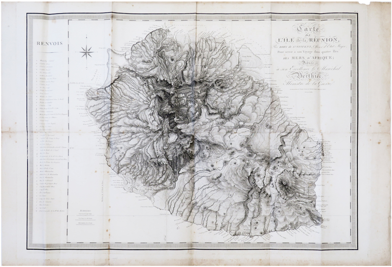
1804réf. LBW-7306[Paris, F. Buisson, an XIII-1804]. 598 x 840 mm.
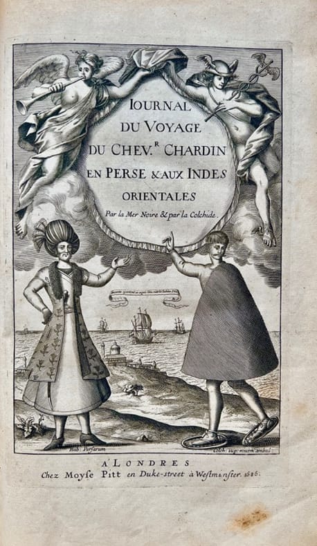
1686réf. 42700Londres, Moses Pitt, 1686. In-folio de (10)-349-(5) pp., veau havane marbré, dos orné à nerfs, pièce de titre en maroquin rouge, tranches rouges (reliure de l'époque).
1831réf. 12073Ile Maurice, Imprimerie de G. Deroullede & Cie, Imprimeurs du Gouvernement, 1831. In-8 broché de 79 pp., couverture muette, chemise étui.
1895Very Good Turkish, Ottoman (1500-1928) Original handsome brown quarter leather binding with Ottoman lettered gilt to spine. Five raised bands to spine, separated from each other with lined gilt. Slight stains on the title page. Else a fine copy. Roy. 8vo. (23 x 16 cm). In Ottoman script (Old Turkish with Arabic letters). 99 p. Hegira: 1313 = Gregorian: 1895. Extremely rare first printed edition of this one of the earliest travel accounts, of an Ottoman admiral's early expeditions to the Indian Ocean, Arabian Sea, Red Sea, and Persian Gulf to counter Portuguese piracy and attacks on Muslim pilgrim ships, which describes the lands he has seen during his voyage from India to Constantinople by Sidi (Seydi) Ali Reis (1498-1563) sent by Sultan Suleiman the Magnificent covering the years 1553-1556. During these naval wars, after two marine battles against the Portuguese fleet and a great storm named The Elephant Typhoon (Tufan-i Fil) by the locals, Reis' remaining six galleys drifted to India. The fleet was unserviceable, resulting in his return home overland with 50 men. Reis then arrived at the royal court of the Mughal Emperor Humayun in Delhi, where he met the future Mughal emperor Akbar, who was twelve years old at the time. He returned to the Ottoman Land over Muslim states in South Asia; Afghanistan, Central Asia, and Iran. But he delayed his return because of the war between the Ottoman and the Safavid Empires in Iran. Finally, following the treaty of Amasya in 1555, he was able to return home and present his book of this narrative journey to the Sultan in 1557. This work offers an extensive insight into the Muslim situation in 16th century South and Central Asia and the Middle East, Islamic navigation, and Turkish - Portuguese relations as well as Persian, Afghan, and Indian geography, naval routes, flora, and fauna. Seydi Ali Reis, formerly also written Sidi Ali Reis and Sidi Ali Ben Hossein, was an Ottoman admiral and navigator. Known also as Katib-i Rumi, Galatali, or Sidi Ali Çelebi, he commanded the left wing of the Ottoman fleet at the naval Battle of Preveza in 1538. He was later promoted to the rank of fleet admiral of the Ottoman fleet in the Indian Ocean, and as such, encountered the Portuguese forces based in the Indian city of Goa on several occasions in 1554. Seydi was able to unite several Muslim countries on the coast of the Arabian Sea (such as the Makran Kingdom, Gujarat Sultanate, and Adal Sultanate) against the Portuguese. He is famous today for his books of travel such as the Mir'ât ül Memâlik [i.e. The Mirror of Countries], and his books of navigation and astronomy, such as the Mir'ât-i Kâinât (Mirror of the Universe) and the Kitâb ül Muhit: El Muhit fî Ilmi'l Eflâk ve'l Buhûr [i.e. Book of the Regional Seas and the Science of Astronomy and Navigation] which contain information on navigation techniques, methods of determining direction, calculating time, using the compass, information on stars, sun and moon calendars, wind and sea currents, as well as portolan information regarding the ports, harbours, coastal settlements and islands in the various regions of the Ottoman Empire. His books are translated into numerous languages including English, French, Italian, German, Greek, Arabic, Persian, Urdu, Russian, and Bengali, and are considered among the finest literary works dating from the Ottoman period. "When Sultan Suleiman had taken up his winter residence in Aleppo, I, the author of these pages, was appointed to the Admiralship of the Egyptian fleet and received instructions to fetch back to Egypt the ships (15 galleys), which some time ago had been sent to Basrah on the Persian Gulf. But, 'Man proposes, God disposes.' I was unable to carry out my mission, and as I realized the impossibility of returning by water, I resolved to go back to Turkey by the overland route, accompanied by a few tried and faithful Egyptian soldiers. I traveled through Gujarat, Hind, Sind, Balkh, Zabulistan, Bedakhshan, Khotlan, Turan, and Iran
1897réf. 2210164Comprising two coloured map board 66 x 99 cm folding down to 32.5 x 49.5 cm one cloth hinge broken; 14 route cards; a barometer dial 19 x 19 cm with gilt metal spinning arrow some abrading from use; eight painted white metal playing pieces in the form of ships contained in the original small box one piece not original; 16pp booklet of instructions bound in original light green printed wrappers; all contained in the original box 35 x 52 x 5 cm; the hinged lid with a large coloured lithograph title label showing the 'Normandie' leaving port at full steam some minor abrasions but overall in good condition. Jue des Paquebots was something new to games when it was published in 1897 as each player moves their boats on large maps exactly replicating the routes taken by two major French shipping lines. The game includes two large folding boards designated 'Carte A' which illustrates the Atlantic shipping lines the other 'Carte B' with the shipping lines leaving Marseilles in the direction of the Black Sea the Indian Ocean and the Pacific. Rather pointedly the instructions state that the two maps include only the French shipping lines of the Messageries Maritimes and the Cie Générale Transatlantique the United Kingdom then the leading maritime nation is neither shown on the maps nor mentioned. The players first decide which map they are going use and then select or bid one of the Itinerary cards 8 for map A and 6 for map B. The aim of each player is to complete the journey indicated by their itinerary and then make the return voyage; the first player to complete this double crossing wins. However the number of stopovers is not equal for each different itinerary in play. In order to equalise the chances of winning the players with the fewer ports of call have to repeat their journey a second or even a third time if necessary until the number of ports visited or passed by them in these different routes equates to the number of ports of the busiest route. The routes all follow those which the two major French shipping companies plied. These include final destinations at Yokohama Australia New Zealand Zanzibar Odessa Buenos Ayres New York and the Antilles. Each player places a ship playing piece at port at the beginning of their route. The first player now spins the Barometer Dial which has outer and inner instructions that allows them to advance out of port when their turn come around again the arrow is again spun and the player can read the inner line of instructions and so advance 1 2 or 3 ports along their route. However there are also stops on the Barometer Dial that include Damage - where you go back to the previous port and pay a token to the bank; Heavy Fog - where you are left stranded until the next round; Collision - this allows another turn of the dial but it the result is 50/50 chance of being sunk and thrown out of the game - you can pay for another ships so all is not lost; Call for Distress - also misses a turn; Shipwreck - something like collision although you can start out again with a new ship and no fine; Rescue - also causes the player to miss a turn; lastly and somewhat topical there is Quarantine - here the player misses a turn and also has a second spin of the arrow to determine if you can go into port or not. The lid of the box illustrates the Cie Général Transatlantique liner La Normandie that plied the North Atlantic to New York in the summer and the south Atlantic in the winter - the ship sports a US flag on the foremast and the makers initials on the aft mast. Built in 1886 it was the largest and fastest liner of the company and was originally named 'Ville de New York.' It was also lit by electricity and could carry 1000 passengers and became the model for several sister ships built to the same plan. The maker Charles Watilliaux succeeded the games manufacturer Coqueret in 1874 and for the next 35 years became a major publisher and manufacturer of board games and toys until their acquisition by Revenaz & Tabernat. His registered initials were 'W.X.' which is slightly modified for the flag on the box lid as C.W.X. Watilliaux, éditeur.