[OCEAN LINERS -- DECK PLANS].Biblio.com
2 090 résultats
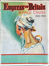
1932réf. 60328Montreal Canada & Liverpool UK: Canadian Pacific 1932. 4to. which opens into Double Atlas Folio. 42 x 50 in. colour-illustrated on recto and verso with large colour deck plans delineating decks amenities cabins for 1st class and Tourist Class folding map at lower portion indicating the route large colour plate of Empress of Britain on verso numerous photo illustrations. Self-printed colour-illustrated softcovers striking cover art of Southeast Asian woman with neck elongated by gold rings front & back by Frederick J. Hoertz minor edgewear light creasing to folds very slight closed tears at a couple folds still VG bright copy. First edition of this very uncommon and large deck plan for the famed Empress of Empress of Britain a 42000 ton ocean liner specifically built and constructed with double-hull construction for the Northern Trans-Atlantic Route between Quebec and the UK who entered service in 1931. She was the first cruise ship designed for Winter routes when the St. Lawrence River was frozen and when converted for her Round the World cruises she was converted with more luxury cabins. At the height of the Great Depression and following a price increase only 283 passengers sailed in the 1932-1933 Round the World Cruise with 100 leaving the ship in India. Notables included Baron F. De Marwicz 1907-1990 hockey player who led England’s National Team in the 1930 & 1934 World Championships Sir Walter Preston 1875-1946 inventor & engineer Cornelius Vanderbilt IV and famed British author George Bernard Shaw with his wife Charlotte who spent most of the cruise writing rather than taking the port excursions. No copies located in Worldcat of this giant version 2 copies located of smaller piece at Wolfsonian measuring 10 x 11.5 in. Canadian Pacific, paperback
1955réf. 57750Paris France: Imprimerie Transatlantique 170 bis rue de charonne 1955. 4to. 9.5 x 12.75 in. 20 pp unpaginated. colour-printed throughout which folds out into 46.5 x 25 in. colour poster w/ photo illustrations text and double-page pictorial map on recto. Colour-illustrated softcovers w/ porthole image of the SS Antilles minor creasing to one corner still NF copy. First edition of this marvelously illustrated cutaway deck plan for the SS Antilles which had been completed in 1953 and eventually was placed on the West Indies Cruise service. The SS Antilles or her sister ship the SS Flandre appeared in the stock footge in the 1964 Perry Mason television episode “Nautical Knot” set near Acapulco Mexico. The double-page pictorial map showing her stops in the West Indies was executed by R. Bonnard. The ship hit rocks and caught fire in Lansecoy Bay in 1971 and all were evacuated to the island of Mustique and later rescued by the Queen Elizabeth 2. Imprimerie Transatlantique, 170 bis rue de charonne, paperback
réf. AManPro4FE3-0003696Captain Trip. Audio CD. Used - Very Good. 0x0x0. Very good condition. Comes from non smoking home Captain Trip unknown
réf. Hagman, Tore and PhotograIn Pristine Condition. unknown
réf. DADAX3319865307New unknown
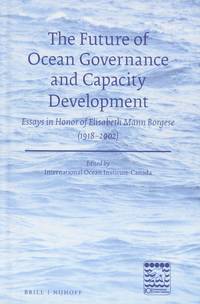
2018réf. L3 box714 a1The Future of Ocean Governance and Capacity Development: Essays in Honor of Elisabeth Mann Borgese 1918 - 2002. Edited by International Ocean Institute - Canada. 2018 by Koninklijke Brill NV; Brill Nijhoff. Hardcover 592 pages. Koninklijke Brill NV; Brill Nijhoff. hardcover
réf. DADAX0794418694New unknown
réf. DADAX0412729601New unknown
réf. DADAX0306462931New unknown
réf. DADAX1409450511New unknown
18203 volumi, cm. 18, brossura editoriale, pag. XIV, 246 (su 248: manca ultima carta di indice) più ritratto in b/n; 267 più carta geografica rip. e 4 tavole f.t.; 274 (manca l'ultima c. con elenco delle tavole) più 6 tavole f.t. (manca la n° 4). La carta geografica riguarda le Isole Washington. Collana "Raccolta de' viaggi più interessanti eseguiti nelle varie parti del mondo, tanto per terra quanto per mare, dopo quelli del celebre Cook...". Ottimo esemplare.
1881réf. PHO-887Hachette, Paris, 1881, 2 volume in-8 (230x170), vol. I: La carabine du roi; vol. II: La famille Coillard, 456 p. et 468 p. , relié demi basane verte , dos à nerfs avec auteur , titre et tomaison , dos frottés . Édition originale française de ce récit exploratoire de la première traversée de l’Afrique centrale d'ouest en est par un Européen. Elle est illustrée de 30 cartes et fac-similés et 244 gravures.
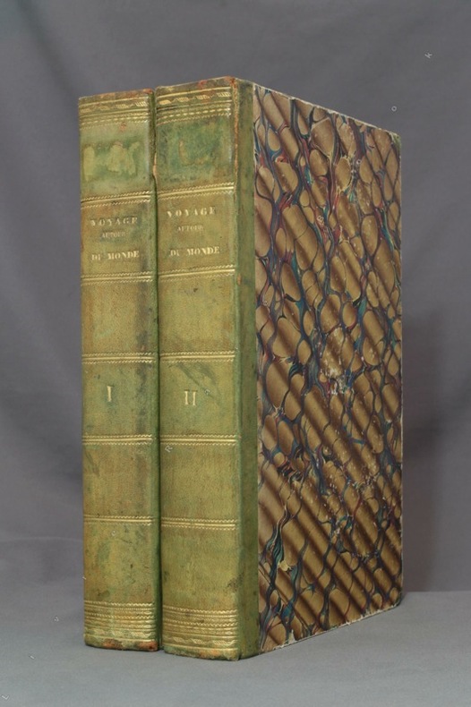
1834réf. 8783Paris, L. Tenré et Henri Dupuy, 1834. 2 volumes in-4 de [4]-VIII-576 et [4]-584 pages, demi-basane verte, dos lisses ornés de filets dorés, traces d'étiquette dans la partie supérieure des dos, petite fente à un mors, coiffes, coupes et coins frottés, premier cahier du tome second légèrement déboîté, avec une petite mouillure.
2012réf. x-019991589XOxford Univ Pr 2012. Hardcover. New. 602 pages. 9.13x6.57x1.10 inches. Oxford Univ Pr hardcover
réf. DADAX0231128487New unknown
réf. DADAX3030209725New unknown
réf. DADAX0195087682New unknown
réf. DADAX041580390XNew unknown
réf. DADAX036734453XNew unknown
réf. DADAX0415497825New unknown
réf. DADAX0415297664New unknown
réf. DADAX0415312779New unknown
réf. DADAX0367276828New unknown
réf. DADAX0195175700New unknown
réf. DADAX0367316838New unknown