Admiralty ChartsMareMagnum

1 745 résultats
900Pacific Ocean Western part latitude 28"N. to 20"S. and longitude 94"E. to 160"E. including Eastern Archipelago - Magnetic variation curves are for 1930. Washington D.C., published Oct. 1931, at the Hydrographic Office, under the authority of the Secretary of the Navy. Small corrections. Folded editorially. Autore: Admiralty Charts. Luogo: Pacific Ocean Western. Anno: '900. Tecnica: incisione. Dimensioni: 777x1031 mm
1820In-16 p. (mm. 163x92), 3 volumi in 2 tomi, mz. pelle coeva con ang., fregi e tit. oro su tassello al dorso, decoraz. a secco con fregi e tit. oro, tagli blu, pp. XIII,247;266; 275; ben illustrato f.t., come da Indice, da un ritratto dell’Autore e da 10 (su 11) tavole che raffigurano usi e costumi degli indigeni + una carta geografica relativa alle “Isole Washington” (gruppo di isole al N.U. delle Marquesas nell’Oceano Pacifico del Sud, scoperte dal Cap. Ingraham del brigantino ‘la Speranza’ di Boston, 1701). Questo giornale contiene “la descrizione delle isole del Capo-Verde, delle coste del Brasile, della Patagonia, del Perù, del Chili e delle isole Gallapagos; nonchè una relazione del gruppo delle isole Washington, delle maniere, costumi e foggie di quegli abitanti, ecc.”. Tomi XXXII-XXXIV della “Raccolta de’ viaggi.. nelle varie parti del mondo.. dopo quelli di Cook, e non pubblicati fin ora in lingua italiana”. Lieviss. aloni sul vol. 1°; manca l’Indice delle tavole nel vol. 2°; altrimenti esemplare ben conservato. .
1836456 pages. Fold-out map present at title page. Foxing throughout. Binding open at title page. Bit of pencil writing to front endpaper. Back hinge open. Above-average wear and soiling. Book
1898The second issue of this popular and long-lived publication. Pages 114-224. Features: Canadian Curiosities - article with great illustrations; The Marvelous Feats of Juggler Ram Pershad; Earth Pyramids in the Rosengarten Mountains; "For the Company's Credit" - story of an ocean-liner race; The Queerest Monarch in the World - Mwanga, King of Uganda (illustrated article); The Wreck of the "Rising Sun" - fire at sea; Picnics in Perak - article with photo of many Malay sultans aboard elephants crossing a river; The Telegraphist of Neufchateau - true WWI story; The Romance of the Mission Field - part 1; Across the Atlantic in an Open Boat - article with photo of Harvo and Samuelson in their rowboat "Fox"; The Mysterious Tramp; Tree-Blazing - how explorers in Australia's interior mark trees to guide those who may come after them; Bagging a Man-Eater - Major A. St. H. Gibbons kills a lion to protect villagers - article with photo; "The Miracle of Moses" - the Platte High Line Canal in Colorado - article with photos; In Search of an Orchid; The Fiery Ordeal of Fiji - walking on coals (illustrated article; In the Ocean Depths - illustrated recollections of ocean diver John Pearce. Front cover loose but present. Back cover missing. Last page is 224. It is uncertain if any pages were included after that. Few pencil markings. A worthy vintage copy. Book
1922Abundant black and white illustrations and reproductions of photos. Features: The Sorcerer of Nerac - The disappearance of a young farmer leads to the discovery of an amazing tragedy of superstition, leading to Frenchman Pierre Faget, the stoop-shouldered old wizard of Nerac, being sent to prison for trial; Our Crocodile Hunt - a Lake Nyassa tale involving a brush fire, a crocodile hunt, and the Kaiser's elephant gun - a lifetime of excitement in a few hours; The Man Who Turned Thief - Part II - the most mysterious one-man robberies to ever take place in America; At the Back of Beyond - photo-illustrated account of some experiences in remote Chitral; The Mutiny of the Athol - a very exciting story of the old whaling days in the Pacific, obtained from the ship's original log; Trailing the Gun-Runners - Part IV - conclusion of this thrilling story of adventure in the turbulent negro Republic of Dominica; P.M. Clarke - Correspondent - the story of an odd character whose pretty exterior concealed plenty of pluck and inexhaustible energy; "Honeymoon Island" - Photo-illustrated feature on idyllic Norfolk Island, originally a convict settlement, in the lonely Pacific; Through the East by Air - Part II - The memorable adventures of Richard and Sydney Carline, who were commissioned to make paintings of scenes in Egypt, Palestine, Syria, Mesopotamia, Kurdistan, and Persia for the National War Museum; The Banker's Bet - the tale of a cautious banker, an unwary Scandinavian, and two clever rogues; Photo of "The Peanut Office" and its Nantucket, MA proprietor; and more. 86 pages plus 8 pages of nostalgic ads. Clean and unmarked with light wear. Binding tight. A high-quality copy of this excellent vintage issue. Book
1788réf. 22927Londres J.-P. Lyton 1788 -in-12 plein-veau 4 Tomes reliés en 2 volumes, reliure plein veau havane marbré in-douze (binding full calfskin in-12)(17,3 x 10 cm), RELIURE D'EPOQUE, dos long (spine without raised bands), décoré "or"et à froid (gilt and blind stamping decoration), titre frappé "or" avec un filet "or" en encadrement, tomaison frappée "or", pièce de tomaison sur fond maroquin vert olive avec un filet "or" en encadrement, entre nerfs à fleuron "or" dans un encadrement d'un filet "or" avec rinceaux "or" aux angles, roulette "or" en place des nerfs avec un filet "or" de part et d'autre et en tête et en pied, plats marbrés décorés à froid d'un filet à froid en encadrement, roulette "or" sur les coupes avec manques de dorure, toutes tranches lisses rouges, marque page en tissus, sans illustrations (no illustration) excepté une vignette au titre (différente à chaque fois) gravée sur bois en noir, en noir, (319) + (324) + (319) + (308) pages, 1788 Londres : J.-P. Lyton Editeur,
réf. 53104583-nnew. unknown
900Anchorages in the Galapagos Islands.In the left part of the chart insert of Wreck Bay and approaches From a British survey in 1849 with additions and corrections. In the middle of the chart insert of Iguana Cove From a British survey in 1836, Webb Cove From a British survey in 1886, James Bay From a British survey in 1836, Sulivan Bay From a British survey in 1836, Terrapin Road From a British survey in 1836, Freshwater Bay From a British survey in 1836, Conway Bay From a British survey in 1846, Wreck Bay to Stephens Bay From Italian surveys in 1882 and 1885. In the right part of the chart insert of Tagus Cove From a British survey in 1835, Gardner Bay From a British survey in 1835, Post Office Bay From British surveys in 1836 and 1846, Sappho Cove From a British survey in 1883, Black Beach Anchorage From a French survey in 1887. Washington D.C., published July, 1899, at the Hydrographic Office, under the authority of the Secretary of the Navy. Small corrections: Printed: Oct. 1926. Folded editorially. Autore: Admiralty Charts. Luogo: Galapagos Islands - Pacific Ocean. Anno: '900. Tecnica: incisione. Dimensioni: 639x1105 mm
réf. 19700Paris, Imprimerie Nationale, 1895, 1 cartonnage, dos et plats frottés. in-12 de 178 pages, 23 planches (dessins dont 1 dépliant, vues dont 1 en double page, panoramas dont 1 en double page et 1 dépliant de 60 cm (Tananarive), plans dont 1 dépliant, cartes ) ;
réf. ORD-2779Avec la collaboration de MM. De Froberville, Frédéric Lacroix, Fd Hoefer, Mac Carthy, Victor Charlier. Paris. Firmin Didot. 1848. In-8 (140 x 215mm) dos lisse basane fauve, gardes marbrées, Iles de l'Afrique: 126 pages et 8 gravures, MALTE et LE GOZE: 192 pages et 40 gravures, MADAGASCAR: 163 pages et 8 gravures, Iles de l'Afrique (seconde partie): 300 pages et 12 gravures. (Les gravures sont en hors texte). Papier un peu piqué, mors un peu faible mais bon exemplaire.
1854réf. 2457Paris ; Niort, Allouard et Kaeppelin ; Robin, [1854]. In-8 de (6)-368-(2) pp., toile verte, décor à froid sur les plats, tranches dorées (reliure de l'époque).
1834réf. 2587Paris, Imp. de Cosson, 1834. In-8 de VIII-318 pp., demi-veau brun, dos orné à nerfs, pièce de titre en veau noir (reliure de l'époque).
2008In-4 p., 5 voll., cartonato editoriale figurato a colori, pp. 758; 848; 665; 676; 628; con complessive 1600 tavv. a colori. Uno degli studi più completi ed esaustivi sui molluschi marini indo-pacifici. Complessivamente la fauna filippina conta, ad oggi, 5835 specie identificate e documentate, appartenenti a 297 famiglie diverse. L’opera, così suddivisa: “Gastropoda. Part 1 - Gastropoda. Part 2 - Gastropoda. Part 3 & Bivalvia, Part 1 - Bivalvia. Part 2 / Scaphopoda, Polyplacophora, Cephalopoda & Addenda - New records, completing the volumes I to IV”. Allo stato di nuovo.
1925512 pages. The third of seven reports which cover the survey and demarcation of the international boundary between Alaska and Canada and between the United States and Canada from the Atlantic Ocean to the Pacific Ocean, excepting that part of the boundary through the Great Lakes and the St. Lawrence River, which was surveyed and reported upon by the International Waterways Commission. Compiled in accordance with the provisions of Article III of the treaty between the United States and Great Britain, signed at Washington, April 11, 1908. Printed on high quality coated paper. Includes four colour fold-out maps, all of which are in excellent condition. Dozens of fascinating black and white photographs. Detailed Table of Contents, List of Illustrations, and Indeces. Clean, bright and unmarked. Very light wear. Binding tight. Bright gilt lettering upon green spine. Lettering upon front board significantly faded. Top and bottom corners of the last 60 pages bear minor moisture-induced undulations. Very nice copy. Please note: Sketches of the triangulation and precise traverse were printed under separate cover which is not included. Book
2026réf. x-0443298599Elsevier - Health Sciences Division 2026. Paperback. New. 514 pages. 5.98x1.21x9.02 inches. Elsevier - Health Sciences Division paperback
réf. DADAX1701890399Embryant 2019-10-22. paperback. New. 1.00x11.00x8.00. Buy with confidence. Excellent Customer Service & Return policy. Embryant paperback
1902xxiv, 328 p. incl. front. plates., fold. map. 24 cm. Hardcover Very good condition
2025réf. x-1032745037Routledge 2025. Hardcover. New. 272 pages. 9.00x6.00x9.24 inches. Routledge hardcover
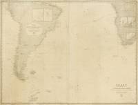
1882réf. 143690Washington: United States Hydrographic Office 1882. Fair. Washington United States Hydrographic Office 1882/ 1868 and 1869. A very large engraved chart in two sheets combined size approximately 940 × 1230 mm overall total size 954 × 1252 mm with minimal hand-colouring mounted together on linen. Some foxing and light soiling with a few light stains and creases and trifling surface loss from insect damage; light wear to the edges; verso of the linen backing a little waterstained; overall a working map in decent condition. A large United States Navy Hydrographic Office chart with five inset charts showing the anchorages of Walwich Bay Walvis Bay Angra Pequena Lüderitz Bay and St Helena and channels through the Abrolhos and Manoel Luiz Banks. The two sheets incorporate corrections to December 1881 and January 1882 respectively. Pencil annotations show the tracks of three voyages two south-east towards the Cape of Good Hope in March-April and November-December 1883 and one in the opposite direction in April-May 1886 this is identified in the right-hand margin as part of a voyage from Hong Kong to London made by one J.B. Newcomb. A further partial track is given in purple ink dated only 'Route in October November and December'. Lighthouses are highlighted with spots of red and yellow colouring. United States Hydrographic Office unknown
900Two maps, Haapai Group Northem & Southern portion Surveyed by Captain A. Mostyn Field, Assisted by Lieutenants F.C. Pasco, A. Waugh, G.E. Nares, A.W. Lowis, C.R. Brewis, and M.r F. Payne, Boats. H.M. Surveying Ship Penguin, 1898. London Published at the Admiralty, 9th Mar. 1900, under the Superintendence of Rear Admiral Sir W.J.L. Wharton, Hydrographer. Small corrections: 1929. Folded editorially. Autore: Admiralty Charts. Luogo: Pacific Ocean - Haspai Group. Anno: '900. Tecnica: incisione. Dimensioni: 655x991 + 653x990 mm
900Islands and Anchorages in Cook Islands In the upper left side of the chart insert of Arutunga Anchorage From a British Survey in 1892 and Rarotonga Island From a New Zealand Government plan of 1913 (with additions from a British survey in 1922). In the middle of the chart insert of Aitutaki Island From a British survey in 1892 (with additions from a New Zealand Gov.plan of 1906) and Atu Island From a New Zealand Gov. survey in 1919. In the right part of the chart insert of Hervey Islands From a New Zealand Gov. plan of 1906 and Mauke Island From a New Zealand Gov. plan of 1906. In the lower part of the chart insert of Avarua and Avatiu Harbors From a British survey in 1922. Washington D.C., published Apr. 1902, at the Hydrographic Office, under the authority of the Secretary of the Navy. Small corrections: Printed Mar. 1928. Folded editorialyy. Autore: Admiralty Charts. Luogo: Cook Islands - Pacific Ocean. Anno: '900. Tecnica: incisione. Dimensioni: 960x661 mm
1863Raoul or Sunday I. Surveyed by Capt. H.M. Denham, assisted by Lieut: J. Hutchison, J.W. Smith, Mast. E. Wilds, F. Hixson, & F. Howard Sec. Masters 1854. In the left side of the chart insert of CMacauley I. From a Sketch Survey by the Ass. Surveyor General of New Zealand in 1887, Curtis I. From a Sketch Survey by the Ass. Surveyor General of New Zealand in 1887. London Published at the Admiralty, May 4th 1863, under the Superintendence of R. Adm. Washington, Hydrographer. Small corrections: 1930. Autore: Admiralty Charts. Luogo: New Zealand - Kermadec Group - Polynesia - Pacific Ocean. Anno: 1863 [1930]. Tecnica: incisione. Dimensioni: 471x670 mm
900Samoa Islands Island of Tutuila From United States Naval surveys between 1901 and 1922. In the upper left corner of the chart insert of Manua Islands - Tau, Ofu and Olosega Islands From a United States Naval survey in 1915 - and insert of Rose Island From latest information. Washington D.C., published June 1923, at the Hydrographic Office, under the authority of the Secretary of the Navy. Small corrections: Printed: April 1932. Folded editorially. Autore: Admiralty Charts. Luogo: Samoa Islands - Pacific Ocean. Anno: '900. Tecnica: incisione. Dimensioni: 789x1215 mm
900South Pacific Ocean. Sheet III. The curves of Variation are for 1915. Washington D.C., published Oct. 1883, at the Hydrographic Office, under the authority of the Secretary of the Navy. Small corrections Printed: July 1932. Folded editorially. Autore: Admiralty Charts. Luogo: Pacific Ocean South. Anno: '900. Tecnica: incisione. Dimensioni: 594x774 mm
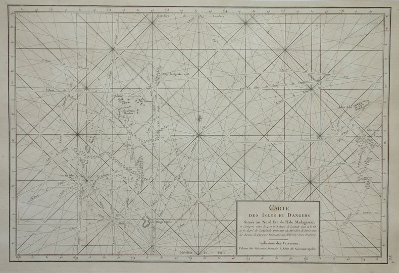
1775réf. LBW-1963[1775-1781]. 334 x 495 mm.