2201 risultati
rif. DADAX0521039681New unknown
rif. DADAX052101767XNew unknown
rif. DADAX0415645603New unknown
1959rif. xs904Centre national de la recherche scientifique Cartonné 1959 In-4 (22 x 27,5 cm), cartonné, 313 pages, avec carte dépliante et planches en noir et blanc hors texte ; mors inférieur abîmé en queue, coins et coiffes frottés, par ailleurs bon état général. Livraison a domicile (La Poste) ou en Mondial Relay sur simple demande.
rif. SONG0739812416Used: Good unknown
rif. DADAX0520266870New unknown
rif. DADAX0125586914New unknown
1994rif. 440790PN. New. 1994. Soft Cover. Date is original print. This is a reprint edition. . PN paperback
1974rif. 748213PN. New. 1974. Soft Cover. Date is original print. This is a reprint edition. . PN paperback
rif. DADAX0253011825New unknown
rif. 200-07738Harry Abrams. Hardcover. New. In shrink wrap. Looks like an interesting title! Harry Abrams hardcover
rif. 40-12347Buzy Beez. Spirlabound. New. . Buzy Beez unknown
rif. DADAX1637999771New unknown
1939xv, 17-234 p. : incl. front., illus. ; 27 cm. Hardcover Very good condition
2025rif. 013359UK: Jonathan Cape. A fine UK first edition first printing hardback - in a fine dustjacket - All my books are always securely packed with plenty of bubblewrap in professional boxes and promptly dispatched within 2-3 days - SIGNED & DATED BY THE AUTHOR - Pictures available upon request. . Fine. Hardcover. 1st Edition. 1st Printing. 2025. Jonathan Cape hardcover
rif. SONG1568985029Used: Good unknown
2009rif. 2111902158500561Shinsei shuppan 2009. Soft Cover. Fine. Number of pages: 399p. Size: 21cm Shinsei shuppan paperback
rif. 1925952355.Gpaperback. Good. Access codes and supplements are not guaranteed with used items. May be an ex-library book. paperback
2003rif. G8449424429I3N10Oceano 2003. Hardcover. Good. Former library book; Pages can have notes/highlighting. Spine may show signs of wear. ~ ThriftBooks: Read More Spend Less.Dust jacket quality is not guaranteed. Oceano hardcover
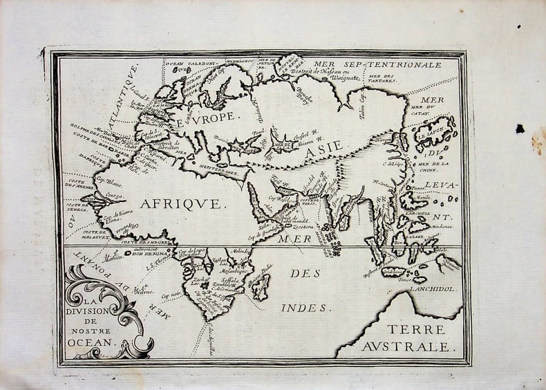
rif. 018813[Philippe Briet, Parallela geographiae veteris et novae] La division de nostre océan - Afrique, Europe, Asie, Australie. Gravure originale, 1649, environ 240*170mm. Gravure tirée de l'ouvrage du savant jésuite Philippe Briet (1601-1668) publié en 1648-1649. Texte au dos. [437]
900Anchorages in the Solomon Islands. In the upper part of the chart insert of Hat horn Sound Sketch Survey to Lieut. Marx & Torlesse, H.M.S. "Swinger" and Lieut. Elton, H.M.S. "Diamond" 1884. North of Marx P.t by Lieut. Bower, H.M.S. "Danae", 1879. With additions from a Survey by Lieut. Comm. W.U Moore, H.M.S. "Dart" 1884, Hathorn Sound Sketch Survey by Lieut C. W. Beresford and S.V. Messum under the direction of Lieut. Comm. W.U. Moore, H.M.S. "Dart" 1884, Port Diamond or Sinarango Sketch survey by the Officers of H.M.S. "Diamond", 1886. under the direction of Captain F.S. Clayton, Choiseul Bay Surveyed By Lieut. C.F. Oldham and the Officers of H.M.S. Lark, 1883. In the lower part of the chart insert of Blanche Harbour Surveyed By Lieut. C.F. Oldham and the Officers of H.M.S. Lark, 188, Plan of the Anchorage, Bambatani From a rough Sketch by Lieut. G. Stapleton, H.M.S. "Torch"1900. London Published at the Admiralty, 30th Dec. 1884, under the Superintendence of Captain W.J.L. Wharton, Hydrographer. Small corrections: 1929. Autore: Admiralty Charts. Luogo: Salomon islands - Pacific Ocean. Anno: '900. Tecnica: incisione. Dimensioni: 450x623 mm

900Anchorages in the Solomon Islands. In the upper part of the chart insert of Pavuvu Islands (Russell Islands) Sketch Survey by Lieut. G.E. Richards and the Officers of H.M.S. Renard 1880. Pepesala (Paddy) Bay from a sketch by M.r F.J. Bayldon, "Maresby" 1908. In the lower part of the chart insert of Viru Harbour Preliminary Survey By Commander A.F. Balfour, Assisted by the Officers of H.M. Surveying ship "Penguin" 1893, Rendova Harbour Preliminary Survey By Commander A.F. Balfour, Assisted by the Officers of H.M. Surveying ship "Penguin" 1893. London Published at the Admiralty, 28th Jan. 1895, under the Superintendence of Rear Admiral W.J.L. Wharton, Hydrographer. Small corrections: 1921. Autore: Admiralty Charts. Luogo: Salomon Islands - Pacific Ocean. Anno: '900. Tecnica: incisione. Dimensioni: 649x484 mm
900Anchorages in the Solomon Islands. In the upper part of the chart insert of Sketch of the Islands in Manning Strait between Choiseul and Ysabel Islands By M.r W. Hamilton 1908. Ysabel I from a sketch survey by Lieutenant F.C.C. Pasco, H.M. Surveying Ship "Dart" 1902. Taura Bay from an Austrian Government Plan, 1897. In the lower part of the chart insert of Sketch of the Southern portion of Lord Howe Islands (Ongtong Java or Leueneuwa) By Lieutenant G. Stapleton H.M.S. "Torch", 1900. London Published at the Admiralty, 9th May 1901, under the Superintendence of Rear Admiral Sir W.J.L. Wharton, Hydrographer. Small corrections: 1921. Autore: Admiralty Charts. Luogo: Salomon Islands - Pacific Ocean. Anno: '900. Tecnica: incisione. Dimensioni: 457x659 mm
900Anchorages in the Solomon Islands Surveyed by Commander A.F. Balfour, assisted by the Officers of H.M. Surveying ship "Penguin" 1894. In the upper part of the chart insert of Marovo Lagoon. In the lower part of the chart insert of Mongo Entrance, Charapoana Entrance, Tongoro Entrance. London Published at the Admiralty, 24th Feb. 1896, under the Superintendence of Rear Admiral W.J.L. Wharton, Hydrographer. Small corrections: 1919. Autore: Admiralty Charts. Luogo: Salomon Islands - Pacific Ocean. Anno: '900. Tecnica: incisione. Dimensioni: 626x481 mm
900Anchorages in the Solomon Islands. In the upper left corner of the chart insert of Beaufort Bay From a Sketch by M.r T.H. Switzer Master Schooner Roderick Dhu, 1896, Sutulahia Anch.e Sketch Survey by Lieut. W.R. Willis H.M.S. "Ringdove" 1895. In the middle part of the chart insert of Vura Anchorage From a Sketch by M.r T.H. Switzer, Master, Schooner, "Roderick Dhu"1896, Narovo Island Surveyed by Lieut. C.F. Odham and the Officers of H.M. Surveying Ship "Lark" 1882. In the right part of the chart insert of Auki Harbour Surveyed by Lieut. Com. R.L. Hancock and the Officers of H.M. Surveying Vessel "Sealark" 1913, Albatros Bay From an Austrian Government Sketch Survey, 1897, Ngora Fu Harbour From a Sketch Survey by Lieut. G.P. Bigg-Wither and the Officers of H.M.S. "Pylades", 1905. London Published at the Admiralty 20th Feb. 1907, under the Superintendence of Rear Admiral A. Mostyn Field, Hydrographer.Small corrections: 1927. Autore: Admiralty Charts. Luogo: Salomon Islands - Pacific Ocean. Anno: '900. Tecnica: incisione. Dimensioni: 617x470 mm