GRANDIDIER Alfred.-Livre Rare Book
1 858 résultats
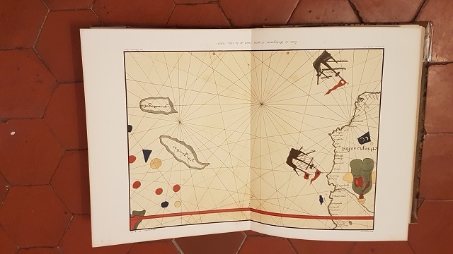
réf. ORD-19801Paris. (Imprimerie Nationale, ca 1885-1892). 1 volume in-4 (250 x 308 mm) cartonnage dos et coins toile ocre jaune, plats marbrés, gardes satinées. Exemplaire sans page de titre contenant 61 planches, fac-similés de cartes et plans anciens, montés sur onglets soit 6 à double page dont 4 en couleurs, 15 simples en couleurs et 40 en noir et blanc. (Chadenat 4890, seule référence que j'ai pu trouver en donne 67). Dos et coins épidermés, mors intérieur faible, rares rousseurs, planches en excellent état. Ouvrage de toute rareté.
1904réf. 33776Paris Delagrave 1904 In-8 carré bon exemplaire ( non coupé) intérieur très frais, une carte dépliante en noir et blanc . L'auteur est par ailleurs celui qui a rédigé un ouvrage sur la Cartographie de Madagascar.
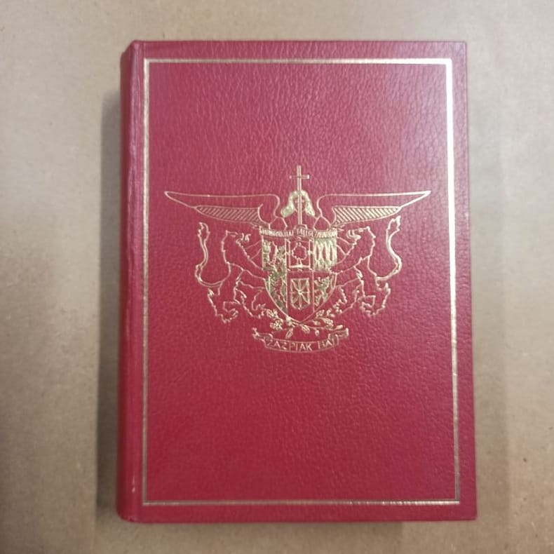
1979réf. 5871979 - reliure - Société Nouvelle d'Editions Régionales et de Diffusion, Pau - 1979 - Fort in-4 (30 x 22 cm) reliure éditeur plein cuir rouge, avec cadre et décor doré au premier plat. Titre doré au dos - 671 pages - Très nombreuses photographies en noir et blanc hors texte + Cartes in fine - Louis COZZOLINO (Directeur de la rédaction) - Marguerite DEMANGEON (Reliure) - Monique MORALES (Cartographie) - Robert BRU (Photographie) - Ouvrage sous titré : "Le Pays Basque. Soule, Labourd, Basse-Navarre" - Tirage limité. Exemplaire nominatif, ouvrage numéroté N° 715, imprimé pour M et Mme Bernard ARDOHAIN
1912"Contains information published for the first time, of navigable distances of lakes and rivers in north-western Ontario, Manitoba, Saskatchewan, Alberta and Mackenzie Territory; the draught and number of steamers plying on thoses waters. Similar information is given of the inland waters of British Columbia for the first time. In the description of the Transcontinental and Intercolonial railways much new information appears... Original photographs of various localities were procured from the headquarters of the railways and steamboat lines. The book is copiously illustrated." - A. Johnston, Deputy Minister of Marine and Fisheries. "Intended as a sketch of Canada, for the use of representatives, delegates and members of the XIIth Congress of the Permanent International Association of Navigation Congresses, to be held at Philadelphia. Contains information relating to Canada, important lines of communication on this continent, and ocean going steamers, that will be valuable to travellers engaged in business, tourists, sportsmen, yachtsmen, canoeists, surf bathers, and others who may find the means of satisfying any reasonable desire connected with travel, pastime or recreation." - from Introduction. Prior owner's name upon first blank leaf else unmarked. Average wear with the following exception: Affixed to the last leaf is a 35" x 21.5" fold-out map of the Dominion of Canada which shows national rail lines, resource locations, fog signals, lighthouses, wireless stations, and more. Through use, this leaf and the two which preceed it are loose but present. Two-inch opening at base of back cover and backstrip. Also included is a 21" x 17.5" fold-out map entitled "Chart of Radio-Telegraph Stations on the East Coast". Profusely illustrated with often enthralling black and white photography. Attractive gilt lettering upon embossed chocolate brown cover. A magnificent survey of Canada's natural resources and transportation infrastructure in the Pre- World War One era. Book
19583 volumes broch?s. 231 + 275 + 285 pages.
1995190p., illus. Hardcover Very good condition very good d.j. good
1962A clean, unmarked book with a tight binding, covers show very light edge wear only. Staple-bound. 10 1/4"w x 13 3/4"h. 30 pages. No date shown; circa 1962.
1960Two books in a series of two fish guides. Color illustrations by Gordon Ertz. Oblong 24mo. Original glossy printed wraps. NH 1
in-8, 364 pp., abdt illustré en noir, cartes, cartonnage de l'éditeur. Bel exemplaire. [TX-19] La découverte, la conquete et la domination…
réf. 8772broché - 14x22 - 365 pp - 1947 - éditions BORDAS, Paris - Nombreuses illustrations et cartes.
1947réf. 1056901947 Editions Bordas - 1947 - In-8, broché sous papier cristal - 364 p. - Pages partiellement coupés, tranches non massicotées - Reproductions photographiques en N&B hors texte + quelques schémas en N&B
réf. ORD-4515France-Empire. (1976). In-8 br. couverture illustrée, 431pp. 8 planches h.-t. recto verso, ff. lgt jaunis.
2019br. Dall'attacco a Pearl Harbor il 7 dicembre 1941, "un giorno segnato dall'infamia", alla spaventosa resa imposta dalla bomba atomica, l'opera in due volumi di Giuglaris spiega chiaramente quale fosse l'obiettivo del Giappone durante il secondo conflitto mondiale: imporre la propria egemonia su tutta l'Asia. L'autore costruisce una narrazione affascinante e accurata dei combattimenti tra marines e soldati imperiali, lasciando emergere un quadro preciso della politica giapponese e delle sue relazioni con i vari paesi dell'Estremo Oriente. Basato quasi interamente su fonti nipponiche, questo libro permette di comprendere sia le motivazioni che spinsero il Giappone ad attaccare gli USA, sia le modalità strategiche di conduzione della guerra.
1980Includes the songs from the albums Take It Easy & Written On The Wind with piano music, guitar chords and lyrics. Songs include: Take a Hand; Love is Alive; Little People; Full Immersion Ocean Water Baptism by the Sea; Without Your Love; Our Lives are in your Hands; His Word is Still His Promise; Song for a Christian Wedding; Wings of Mercy; All I want; Spirit Wind; Mary's Song; Thank-you Lord; Plain Ol' Joe; Harvest Time; Fool for Jesus; Hear the Angels Sing; Peace in the Valley; The Warrior. Nice colour centerfold with photos of Chuck. Prior owner's name atop table of contents else unmarked. Above-average wear. Coffee stain to lower corner at spine affecting all pages - all text remains legible. Book
réf. 12450In 8 reliure éditeur pleine toile bleue à décor passe-partout et titre au premier plat, dorés. Titre et caissons dorés. (dorure oxydée) . Côtes de la Manche et de l’océan, autrefois et aujourd’hui. Mention de deuxième édition. Faux-titre, titre, 296 pages, 1 page de table, cartes, gravures hors-texte. Tranches dorées. Librairie Charles DELAGRAVE 1886. Rousseurs, fortes à certaines pages.
réf. 6265Paris, Librairie Ch. Delagrave, 1891, Reliure dos chagrin marron à 5 nerfs, titre et fleurons dorés, plats toilés avec décor à froid et blason doré au centre "Lycée Charlemagne, Université de France", 15x24 cm, 296 pages, Illustrations et cartes en noir et blanc.
1965Rilegatura con copertina rigida,ci sono lievi segni di sfregamento nella parte anteriore c'è una macchia,in quella posteriore in alcuni punti è leggermente scolorita,le pagine sono ingiallite ma in buono stato,la pagina 81 ha la punta piegata al interno per non farla rovinare in quanto ha un eccesso di carta,i contropiatti e le sguardie anteriore e posteriore sono bruniti,il volume ha 190 figure nel testo,è il numero 12 della collana La conquista della terra.Numero pagine 449. USATO
2000réf. LFA-126741443Un ouvrage de 168 pages, format 220 x 300 mm, illustré, relié cartonnage sous jaquette couleurs, publié en 2000, Editions Glénat, bon état
réf. 13978882s. l.: Editions Jean-Claude Nourault, [1972] 3 volumes in-4 d'env. 180 pages chacun, nombreuses illustrations en couleurs. Reliure d'éd., bon état. Texte français et traduction angiaise. Manque le tome 2 sur Madagascar.
2010réf. 2111902158904763Gifushinbunsha 2010. Soft Cover. Fine. Volume: 1 Gifushinbunsha paperback
In 16. Dim. 16x11,5 cm. Pp. 124+(2). Edizione senza data ma degli anni '20 di questo volume della raccolta "I grandi viaggi di scoperta" n. 3. L'opera descrive l'esplorazione del Pacifico e la scoperta dell'Australia a cura del Prof. Giacinto Carbonera. All'interno alcune mappe e illustrazioni Tra gli argomenti trattati: Magellano, La Nuova Olanda, Inglesi nel Pacifico (corsari, Drake, Cavendish ecc..), Avventurieri e pirati (Walter Raleigh, Alla ricerca di El Dorado, Dampier, Isola di Robinson ecc..), Esplorazione scientifica (Cosacchi, stretto di Bering, Bougainville, Cook), Oceania (Nuova Zelanda), La Perouse ecc... In ottime condizioni. Copertina cartonata editoriale in ottime condizioni generali con lievi usure ai margini e dorso. Legatura in buone condizioni. All'interno le pagine si presentano in buone condizioni con rare fioriture. Not dated edition of 1920's of this volume of the collection "I grandi viaggi di scoperta" n. 3. The work describes the exploration of Pacific Sea and discovery of Australia by Prof. Giacinto Carbonera. Some maps and illustrations inside Between the issues treated: Magellano, New Holland, English i Pacific Sea (pirates, Drake, Cavendish ecc..), Advernturers and pirates (Walter Raleigh, Looking for El Dorado, Dampier, Robinson Island ecc..), Scientiphic exploration (Cosacchi, stretto di Bering, Bougainville, Cook), Oceania (New Zealand), La Perouse etc... In very good conditions. Editorial carton cover in very good general conditions slightly worn in the edges and spine. Binding in good conditions. Inside pages are in good conditions with occasional foxings.
2000Mm 140x210 Brossura editoriale di pp. 185, sovraccoperta editoriale. Opera in buone condizioni.
1935Pages 947-994. Features: The Diesel Automobile; Plating river beds with stainless steel; Ocean gloder the "Genial"; Auto Safety device warns of railway crossings; Photo of little Jean Darlington whose father communicates with her from afar by shortwave radio; Telephoning a Picture; Sleep Meter; Mechanical novelties; Vacuum lifts Planeless Aircraft - invented by John H. Davis; "House of Glass" Shell gas station; European Novelties; Finding the Source of "Cosmic Rays"; New Mechanical Ideas; Power from Ocean Waves; Exploring the Upper Air by Spectroscope; Metal Melts Like Wax; Newest Devices for the General Use; New Patents of Interest; Robot directs street traffic; Dry ice test of jewels; Where did the Moon Come From?; Mechanics of Magic; Making White Iodine; Practical Hints and Home Kinks; and more. Above-average wear. Binding intact. PLEASE NOTE: Most ads clipped and removed from pages 985-994. We believe no text was lost but please inquire if you are interested in any specific content so we can check. A worthy reading copy Magazine
1991réf. H-493-382John Wiley & Sons Inc 1991. Hardcover. Good. Former library book. Different cover. Edition 1991. Ammareal gives back up to 15% of this item's net price to charity organizations. John Wiley & Sons Inc hardcover
1960[11], 12-274 pages. Glossary, bibliography, index. Fourteen monotone maps and illustrations. "This study is confined to piratical and other foreign incursions on the Pacific coast from Panama north, beginning in 1575 or 1576 and continuing for the next 167 years." - Preface. Above-average external wear. Usual library markings. Binding intact. Contents clean. A worthy reading copy. Book