ALBERTO I DI MONACO - JOURDAN, ETIENNE.MareMagnum

1 873 résultats
Imprimerie de Monaco, 1895. In 4to grande, pp. 36 + 2 (Lègende de la Planche 1 e Lègende de la Planche 2 ) + le 2 tavole con veline sciolte, rispettivamente con 14 e 12 figure in litografia in colore, testo in francese, bross. edit. in carta muta protetta da velina recante i titoli e con alette di protezione. Importante raccolta di studi scientifici di biologia marina, realizzati sotto la direzione del Principe Alberto I di Monaco (Parigi, 1848 – Parigi, 1922). Alberto I, ancora molto giovane, ad appena ventidue anni, iniziò a coltivare la passione per le scienze naturali e in particolare per l'oceanografia. Si interessò ai nuovi strumenti che la tecnica metteva a disposizione per lo studio dei fondali marini, e con il sostegno di importanti scienziati compì studi oceanografici, realizzò mappe e carte nautiche. A lui si deve la fondazione di quello che sarebbe divenuto l'”Istituto Oceanografico” di Monaco, che include oggi un acquario, un museo e una biblioteca. Disponiamo di questo fascicolo VIII relativo a Epizoanthus, Caryophillia, Deltocyathus, Flabellum, Stephanotrochus, Balanophyllia. Piccole fioriture e alcune gualciture alla brossura, alcune fioriture marginali alla prima tavola, buono tutto l'interno, ancora intonso.
1886In 8. Dim. 19x12 cm. Pp. 281+(3). Interessante opera di viaggi del 1886 di Albert David che descrive il suo viaggio lungo l'Oceano Pacifico. All'interno sono presenti dieci incisioni fuori testo che mostrano vedute: Baie Borja, Lima, Indiani peruviani, Tahiti ecc... Tra i luoghi descritti: Distretto di Magellano e Canali laterali della Patagonia, Lima durante vl'occupazione cilena, Valparaiso e i Cileni dopo la Guerra del Pacifico, Peru e Cile, Callao, Pisco, Pisagua, Arica e Tacna, Iquique, Lota, Una necropoli degli Incas, Honolulu, Un mese a Noukahiva, Tahiti ecc... In buone condizioni e completo Copertina editoriale in buone condizioni generali con lievi usure ai margini e dorso. Legatura in buone condizioni. All'interno le pagine si presentano in buone condizioni con fioriture. Interesting work of travel of 1886 written by Albert David describing his travel in the Pacific Ocean. Inside there are ten out of text planches showing different views: Baie Borja, Lima, Peruvian Indians, Tahiti ecc... Between the places described: District of Magellano and channels of Patagonia, Lima during Chile occupation, Valparaiso and Cileni after Pacific war, Peru and Cile, Callao, Pisco, Pisagua, Arica e Tacna, Iquique, Lota, a city of Incas, Honolulu, a month in Noukahiva, Tahiti ecc... In good conditions and complete. Editorial cover in good general conditions slightly worn in the edges and spine. Binding in good conditions. Inside pages are in good conditions with foxings.
1978réf. LFA-126732671Un ouvrage de 97 pages, format 235 x 235 mm, illustré, relié cartonnage couleurs, publié en 1978, Editions B.L.T. / COOP, bon état
2004réf. MER11MEdité par Atlantica, 2004. In-4 broché, couverture illustrée, légèrement usée sur les bords. Coin inférieur abîmé, voir photo. Nombreuses illustrations n&b et en couleurs. 190 pages. Quatrième de couverture et dernières pages abîmées, voir photo.
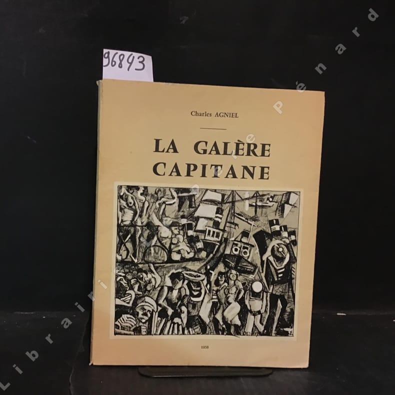
1958réf. 968431958 Imprimeur Joseph Reschly, Montpellier - 1958 - grand In-8 broché avec jaquette rempliée - 118 pages - nombreuses reproductions photographiques contrecollées - N° 270/500 sur velin bouffant "fleur d'alfa" des papeteries de France
1994v, 109 pages. Glossary. Index. Black and white illustrations. "In this manual, the techniques used to create the 32 different species in the Open Ocean exhibit have been presented in 10 groups, ranging from the simplest to the most complex. These techniques can be adapted for many uses such as reproducing archaeological artifacts as well as biological specimens." - Preface. Clean, bright and unmarked with very light wear. A nice copy. Book
900Anchorages in the Galapagos Islands.In the left part of the chart insert of Wreck Bay and approaches From a British survey in 1849 with additions and corrections. In the middle of the chart insert of Iguana Cove From a British survey in 1836, Webb Cove From a British survey in 1886, James Bay From a British survey in 1836, Sulivan Bay From a British survey in 1836, Terrapin Road From a British survey in 1836, Freshwater Bay From a British survey in 1836, Conway Bay From a British survey in 1846, Wreck Bay to Stephens Bay From Italian surveys in 1882 and 1885. In the right part of the chart insert of Tagus Cove From a British survey in 1835, Gardner Bay From a British survey in 1835, Post Office Bay From British surveys in 1836 and 1846, Sappho Cove From a British survey in 1883, Black Beach Anchorage From a French survey in 1887. Washington D.C., published July, 1899, at the Hydrographic Office, under the authority of the Secretary of the Navy. Small corrections: Printed: Oct. 1926. Folded editorially. Autore: Admiralty Charts. Luogo: Galapagos Islands - Pacific Ocean. Anno: '900. Tecnica: incisione. Dimensioni: 639x1105 mm
900Anchorages in the Solomon Islands. In the upper part of the chart insert of Hat horn Sound Sketch Survey to Lieut. Marx & Torlesse, H.M.S. "Swinger" and Lieut. Elton, H.M.S. "Diamond" 1884. North of Marx P.t by Lieut. Bower, H.M.S. "Danae", 1879. With additions from a Survey by Lieut. Comm. W.U Moore, H.M.S. "Dart" 1884, Hathorn Sound Sketch Survey by Lieut C. W. Beresford and S.V. Messum under the direction of Lieut. Comm. W.U. Moore, H.M.S. "Dart" 1884, Port Diamond or Sinarango Sketch survey by the Officers of H.M.S. "Diamond", 1886. under the direction of Captain F.S. Clayton, Choiseul Bay Surveyed By Lieut. C.F. Oldham and the Officers of H.M.S. Lark, 1883. In the lower part of the chart insert of Blanche Harbour Surveyed By Lieut. C.F. Oldham and the Officers of H.M.S. Lark, 188, Plan of the Anchorage, Bambatani From a rough Sketch by Lieut. G. Stapleton, H.M.S. "Torch"1900. London Published at the Admiralty, 30th Dec. 1884, under the Superintendence of Captain W.J.L. Wharton, Hydrographer. Small corrections: 1929. Autore: Admiralty Charts. Luogo: Salomon islands - Pacific Ocean. Anno: '900. Tecnica: incisione. Dimensioni: 450x623 mm
900Anchorages in the Solomon Islands. In the upper part of the chart insert of Pavuvu Islands (Russell Islands) Sketch Survey by Lieut. G.E. Richards and the Officers of H.M.S. Renard 1880. Pepesala (Paddy) Bay from a sketch by M.r F.J. Bayldon, "Maresby" 1908. In the lower part of the chart insert of Viru Harbour Preliminary Survey By Commander A.F. Balfour, Assisted by the Officers of H.M. Surveying ship "Penguin" 1893, Rendova Harbour Preliminary Survey By Commander A.F. Balfour, Assisted by the Officers of H.M. Surveying ship "Penguin" 1893. London Published at the Admiralty, 28th Jan. 1895, under the Superintendence of Rear Admiral W.J.L. Wharton, Hydrographer. Small corrections: 1921. Autore: Admiralty Charts. Luogo: Salomon Islands - Pacific Ocean. Anno: '900. Tecnica: incisione. Dimensioni: 649x484 mm
900Anchorages in the Solomon Islands. In the upper part of the chart insert of Sketch of the Islands in Manning Strait between Choiseul and Ysabel Islands By M.r W. Hamilton 1908. Ysabel I from a sketch survey by Lieutenant F.C.C. Pasco, H.M. Surveying Ship "Dart" 1902. Taura Bay from an Austrian Government Plan, 1897. In the lower part of the chart insert of Sketch of the Southern portion of Lord Howe Islands (Ongtong Java or Leueneuwa) By Lieutenant G. Stapleton H.M.S. "Torch", 1900. London Published at the Admiralty, 9th May 1901, under the Superintendence of Rear Admiral Sir W.J.L. Wharton, Hydrographer. Small corrections: 1921. Autore: Admiralty Charts. Luogo: Salomon Islands - Pacific Ocean. Anno: '900. Tecnica: incisione. Dimensioni: 457x659 mm
900Anchorages in the Solomon Islands Surveyed by Commander A.F. Balfour, assisted by the Officers of H.M. Surveying ship "Penguin" 1894. In the upper part of the chart insert of Marovo Lagoon. In the lower part of the chart insert of Mongo Entrance, Charapoana Entrance, Tongoro Entrance. London Published at the Admiralty, 24th Feb. 1896, under the Superintendence of Rear Admiral W.J.L. Wharton, Hydrographer. Small corrections: 1919. Autore: Admiralty Charts. Luogo: Salomon Islands - Pacific Ocean. Anno: '900. Tecnica: incisione. Dimensioni: 626x481 mm
900Anchorages in the Solomon Islands. In the upper left corner of the chart insert of Beaufort Bay From a Sketch by M.r T.H. Switzer Master Schooner Roderick Dhu, 1896, Sutulahia Anch.e Sketch Survey by Lieut. W.R. Willis H.M.S. "Ringdove" 1895. In the middle part of the chart insert of Vura Anchorage From a Sketch by M.r T.H. Switzer, Master, Schooner, "Roderick Dhu"1896, Narovo Island Surveyed by Lieut. C.F. Odham and the Officers of H.M. Surveying Ship "Lark" 1882. In the right part of the chart insert of Auki Harbour Surveyed by Lieut. Com. R.L. Hancock and the Officers of H.M. Surveying Vessel "Sealark" 1913, Albatros Bay From an Austrian Government Sketch Survey, 1897, Ngora Fu Harbour From a Sketch Survey by Lieut. G.P. Bigg-Wither and the Officers of H.M.S. "Pylades", 1905. London Published at the Admiralty 20th Feb. 1907, under the Superintendence of Rear Admiral A. Mostyn Field, Hydrographer.Small corrections: 1927. Autore: Admiralty Charts. Luogo: Salomon Islands - Pacific Ocean. Anno: '900. Tecnica: incisione. Dimensioni: 617x470 mm
900Anchorages in the Solomon Islands. In the left part of the chart insert of Kunggava Bay From a sketch by Lieut. Com. R. Crookshank, 1928, Queen Carola Harbour From a German Government Survey, 1883, Wanderer Bay By Capt. H.M. Denham, 1855. In the middle part of the chart insert of Port Adam By W. Hilliard, Master H.M.S. Havannah 1850, Mallu Harbour By M.r Haddock, 1877, Astrolabe Harbour By Mons.r Marescot, Enseigne de Vaisseau Corvette Astrolabe French Royal Navy 1838, Cockatoo Anchorage By T.C. Tilly, Master, H.M.S. Cordelia, 1861, Aowawa Roadstead By Capt. H.M. Denham, 1854. In the right part of the chart insert of Hada or Recherche Bay By T.C. Tilly, Master, H.M.S. Cordelia, 1861, Kwakwaru and Kwi Harbours Sketch by M.r W.T. Wawn 1888, Port Mary By Lieut. C.F. Oldham, 1882, Makira Bay By Capt. H.M. Denham, 1855, Hunter Roadstead By Capt. H.M. Denham, 1854, Popau H.r Sketch by M.r R. Haddock, 1877. London Published at the Admiralty March 10th 1864, under the Superintendence of Capt. G.H. Richards, Hydrographer. Small corrections. Autore: Admiralty Charts. Luogo: Salomon Islands - Pacific Ocean. Anno: '900. Tecnica: incisione. Dimensioni: 643x495 mm
900Anchorages in the Solomon Islands. In the left part of the chart insert of Utuha H.r or Port Purvis Enlarged from a Survey by Comm. R.W. Glennie, H.M. Surveying Ship "Sealark" 1911, With Additions from a sketch Survey by Lieut. J.P. Rolleston H.M.S "Royalist", 1889, Alite H.r Langa Langa H.r Sketch Survey by Lieut. C.G.S. Eeles, H.M.S. Curacoa, 1893, Anonyma Cove Sketch Survey by Lieut. C.G.S. Eeles, H.M.S. Curacoa, 1893. In the middle part of the chart insert of Sio Harbour Sketch Survey by Lieut. J.P. Rolleston H.M.S "Royalist", 1889, Uru I. Anchorage Sketch by T.H.Switzer, Mate S.S. Rhoderick Dhu, 1894, Korombusu P.t to Susu P.t Surveyed by Commander R.W. Glennie H.M. Surveying Ship "Sealark" 1912. In the right part of the chart insert of Waisissi or Royalist Harbour Sketch Survey by Lieut. J.P. Rolleston, H.M.S. Royalist, 1889, Palaina Anchorage Sketch Survey by Lieut C.G.S. Eeles, H.M.S. Curacoa, 1893, Coleridge Bay Sketch Survey by Lieut. E. Reeves, H.M.S Royalist, 1894, Sualaha Cove Sketch Survey by Lieut. C.G.S. Eeles, H.M.S Curacoa, 1893, Mappo Harbour Sketch by T.H. Switzer, Mate of S.S. Rhoderick Dhu, 1894, S.W. Coast of Malaita By W.T. Wawn, Master of the Brigantine "Borough Belle" 1891. London Published at the Admiralty 30th May 1890, under the Superintendence of Captain W.J.L. Wharton, Hydrographer. Small corrections. Folded editorially. Autore: Admiralty Charts. Luogo: Salomon Islands - Pacific Ocean. Anno: '900. Tecnica: incisione. Dimensioni: 649x998 mm
900Anchorages in the Solomon Islands. In the upper part of the chart insert of Jack Harbour Surveyed by Commander A.F. Balfour & Lieut. G.W. Gubbins H.M. Surveying Ship "Penguin" 1894, Baranago Harbour Surveyed by Commander R.W. Glennie and the Officers of H.M. Surveying Ship "Sealark" 1911, Rice Anchorage Sketch Survey by Lieut. S.C. Weigall, H.M. Surveying Ship "Penguin", 1895. In the middle part of the chart insert of Mboli Harbour Sketch by J.E. Scudamore Master, H.M.S. "Curacoa" 1865 Additions from a sketch by Lieut. A.C. Scott H.M.S. "Mohawk" 1898, Kolieuro Inlet Surveyed by Lieuts. C.E. Monro & S.C. Weigall under the direction of Comm. A.F. Balfour H.M. Surveying Ship "Penguin", 1895. In the lower part of the chart insert of Rua Sura I.s Anchorage Surveyed by Comm. R.W. Glennie, and the Officers of H.M. Surveying Ship "Sealark" 1912, Mosquito Anchorage Surveyed by Lieut. T.H. Heming under the direction of Lieut. C.F. Oldham, H.M. Surveying Ship "Lark" 1882, Maoraha I. & Anchorage Surveyed by Lieut. T.H. Heming under the direction of Lieut. C.F. Oldham, , H.M. Surveying Ship "Lark" 1882. London Published at the Admiralty 28th Jan. 1896, under the Superintendence of Rear Admiral W.J.L. Wharton, Hydrographer. Small corrections: 1928. Autore: Admiralty Charts. Luogo: Salomon Islands - Pacific Ocean. Anno: '900. Tecnica: incisione. Dimensioni: 630x483 mm
900Anchorages in Ysabel Island. In the left side of the chart insert of Kesuo Cove Surveyed by Lieutenant F.C.C. Pasco, assisted by Lieuts. C.E. Stainer, R. Aylen and K. Mackenzie-Grieve, H.M. Surveying Ship "Dart" 1902. In the right side of the chart insert of Tunnibuli Surveyed by Lieutenant F.C.C. Pasco, assisted by Lieuts. C.E. Stainer, R. Aylen and K. Mackenzie-Grieve, H.M. Surveying Ship "Dart" 1902. London Published at the Admiralty, 21st Dec. 1903, under the Superintendence of Rear Admiral Sir W.J.L. Wharton, Hydrographer. Small corrections: 1919. Autore: Admiralty Charts. Luogo: Ysabel Island - Salomon islands - Pacific Ocean. Anno: '900. Tecnica: incisione. Dimensioni: 461x662.
900Anchorages in Ysabel Island. In the left side of the chart insert of Korrigole Harbour Surveyed by Lieutenant F.C.C. Pasco, assisted by Lieuts. C.E. Stainer, R. Aylen and K. Mackenzie-Grieve, H.M. Surveying Ship "Dart" 1902. In the right side of the chart insert of Vulavu Anchorage Surveyed by Lieutenant F.C.C. Pasco, assisted by Lieuts. C.E. Stainer, R. Aylen and K. Mackenzie-Grieve, H.M. Surveying Ship "Dart" 1902. London Published at the Admiralty, 11th Dec. 1903, under the Superintendence of Rear Admiral Sir W.J.L. Wharton, Hydrographer. Small corrections: 1920. Autore: Admiralty Charts. Luogo: Ysabel Island - Salomon islands - Pacific Ocean. Anno: '900. Tecnica: incisione. Dimensioni: 457x652 mm
900Anchorages in Ysabel Island. In the upper part of the chart insert of Maringe Lagoon Surveyed by Lieutenant F.C.C. Pasco, assisted by Lieuts. C.E. Stainer, R. Aylen and K. Mackenzie-Grieve, H.M. Surveying Ship "Dart" 1902. London Published at the Admiralty, 21st Nov. 1903, under the Superintendence of Rear Admiral Sir W.J.L. Wharton, Hydrographer. Small corrections: 1920. Autore: Admiralty Charts. Luogo: Ysabel Island - Salomon islands - Pacific Ocean. Anno: '900. Tecnica: incisione. Dimensioni: 628x483 mm
1898Anchorages on the North Coast of Tubuai Island From the latest F rench Government Chart. Tubuai Island From the latest French Government Charts. London Published at the Admiralty, 25th Feb. 1898, under the Superintendence of Rear Admiral Sir. W.J.L. Wharton, Hydrographer.Small corrections: 1923. Autore: Admiralty Charts. Luogo: Tubuai Islands - Pacific Ocean. Anno: 1898 [1923]. Tecnica: incisione. Dimensioni: 627x460 mm
900Austria Sound Sketch Survey by Lieutenant Frederick C.C. Pasco, and the Officers of H.M. Surveying Ship "Dart" 1902. In the lower part of the chart insert of Allardyce Harbour Sketch Survey by Lieut. F.C.C. Pasco, & the Officers of H.M. Surveying Ship "Dart" 1902. London Published at the Admiralty, 8th Oct. 1904, under the Superintendence of Captain A. Mostyn Field, Hydrographer. Small corrections: 1919. Autore: Admiralty Charts. Luogo: Austria Sound Salomon islands. Anno: '900. Tecnica: incisione. Dimensioni: 484x656 mm
900Bauro or San Cristoval Island Surveyed by Lieutenant C.F. Oldham, assisted by Lieutenants Alex Leeper, C.F. de M. Malan, and T.H. Heming, H.M. Surveying ship "Lark" 1883-4. The Southern and Western coasts from sketch surveys made in 1793, 1855, & 1867. In the upper right corner of the chart insert of Wango Bay Sketch survey by Lieut. C.A. Buckland, H.M.S. "Royalist" 1892, Marunga Harbour Sketch survey by M.r T.H. Switzer, Master S.S. "Roderick Dhu" 1900, Star Harbour Sketch survey by M.r T.H. Switzer, Master S.S. "Roderick Dhu" 1900, London Published at the Admiralty, 19th April 1892, under the Superintendence of Captain W.J.L. Wharton, Hydrographer. Small corrections: 1921. Folded editorially. Autore: Admiralty Charts. Luogo: Bauro or San Cristoval Island - Salomon Islands - Pacific Ocean. Anno: '900. Tecnica: incisione. Dimensioni: 649x985 mm
900Bouganville Strait Surveyed by Lieutenant C.F. Oldham, assisted by Lieutenants A. Leeper and T.H. Heming and Sub Lieutenant A.G. Causton, H.M. Surveying Ship "Lark" 1883-4. Bouganville I. and the adjacent waters amended from the German Government Charts of 1910-13. In the upper right corner of the chart insert of Shortland Harbour Surveyed by Lieut. C.F. Oldham and the Officers of H.M.S. "Lark", 1883-4. London Published at the Admiralty, 9th June, 1886, under the Superintendence of Captain W.J.L. Wharton, Hydrographer. Small corrections: 1930. Folded editorially. Autore: Admiralty Charts. Luogo: Bouganville Strait - Salomon islands - Pacific Ocean. Anno: '900. Tecnica: incisione. Dimensioni: 828x653 mm
900British New Guinea - Louisiade Archipelago. In the upper part of the chart insert of Rossel Island and Lagoon Sketch Survey by Lieut. A.M. Field, Assisted by Lieut.s W.P. Dawson, H.J. Gedge & V.B. Webb. H.M. Surveying Ship Dart, 1888. In the lower part of the chart insert of Pwennegwa H.r by M.M.A. Jones, S.S. Merrie, England, 1894. Rabuso Creek (Proclamation Creek). Swinger Opening. London Published at the Admiralty, 7th Oct. 1890 under the Superintendence of Captain W.J.L. Wharton, Hydrographer. Small corrections: 1924. Autore: Admiralty Charts. Luogo: British New Guinea - Pacific Ocean. Anno: '900. Tecnica: incisione. Dimensioni: 481x652 mm
900Gavutu and Tulagi Harbours Surveyed by Lieut. F. C.C. Pasco, assisted by Lieuts. C.E. Stainer, R. Aylen and K. Mackenzie-Grieve, H.M. Surveying ship "Dart" 1902. Gavuta Harbour surveyed by Lieuts. B.T. Somerville and S.C. Weigall under the direction of Commander A.F. Balfour H.M. Surveying ship "Penguin" 1895. London Published at the Admiralty, 5th Feb. 1904, under the Superintendence of Rear Admiral Sir W.J.L. Wharton, Hydrographer. Small corrections: 1929. Folded. Autore: Admiralty Charts. Luogo: Gavutu and Tulagi - Salomon Islands - Pacific Ocean. Anno: '900. Tecnica: incisione. Dimensioni: 645x837 mm
900Guadalcanal and Florida I.s with a portion of Malaita I. The South coast of Florida I. and North coast of Guadalcanal including Savo I are from Surveys by Commander R.W. Glennie and the Officers of H.M. Surveying Ship "Sealark", 1910-12, the remainder of the work is from various rough and imperfect sketch surveys of earlier date. West coast of Malaita I and Alite Reef, adjusted to positions determined by Lieut. Com. R.L. Hancock & the Officers of H.M.S. "Sealark", 1914. London Published at the Admiralty, 6th Nov. 1893, under the Superintendence of Captain W.J.L. Wharton, Hydrographer. Large corrections 10 th Jan. 1930. Interesting map of Guadacanal in which the capital Honiara is missing because it will be constructed only afet the second world war. Folded editorially. Autore: Admiralty Charts. Luogo: Guadalcanal - Solomon Islands - Pacific Ocean. Anno: '900. Tecnica: incisione. Dimensioni: 658x983 mm