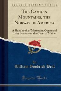
The Camden Mountains the Norway of America
rif. 0282905839.Gpaperback. Good. Access codes and supplements are not guaranteed with used items. May be an ex-library book. paperback
Bonita · Stati Uniti51,00 USD≈ 45,56 €
2302 risultati
rif. SONG0529051583Used: Good unknown
rif. SONG0520285689Used: Good unknown
rif. SONG1107155657Used: Good unknown
rif. SONG177007175XUsed: Good unknown
rif. DADAX0195175697New unknown
rif. DADAX0195175700New unknown
rif. DADAX1575055910New unknown
rif. SONG1140685465Used: Good unknown
rif. DADAX1894898605New unknown
rif. SONG1560234407Used: Good unknown
rif. DADAX1560234407New unknown
rif. 0282905839.Gpaperback. Good. Access codes and supplements are not guaranteed with used items. May be an ex-library book. paperback
rif. DADAX9814304255New unknown
rif. 1332839193.Gpaperback. Good. Access codes and supplements are not guaranteed with used items. May be an ex-library book. paperback
rif. DADAX0754671704New unknown
1971cm. 15 x 23, viii-418 pp. Rilegato. Fondazione Giorgio Cini - Civilt? veneziana - Studi 724 gr. viii-418 p.
rif. 589118Paris, Calamnn Lévy éditeur, 1895. In-12, rel. de l'ép. demi-chagrin poli rouge, dos à nerfs, titre et date dorés, tranches mouchetées, 59 pp. Première édition.
rif. CORV-BBP-18833Unknown. Spiral Bound. Very Good. Very good. Oblong spiral-bound 11 in x 17. in Resources mapped include Pelagic Fish Reef Fish Invertebrates Tourism and more. 53pp. References. B/w and color maps. > Language: English > Size: Oblong Folio > Media/Binding: Spiral Bound Unknown unknown
rif. CORV-BBP-18830Unknown. Plastic Comb. Very Good. Some wear to covers o/w very good. Oblong comb-bound 11 in x 17. in Resources mapped include Pelagic Fish Reef Fish Invertebrates Sand Dredging Areas Archaeological Sites and more. 67pp. References. B/w and color maps. > Language: English > Size: Oblong Folio > Media/Binding: Comb Bound Unknown unknown
2001rif. LFA017e6Revue mensuelle conernant la philatélie : environ 110 pages en couleurs, format 300 x 210 mm, illustrée, brochée couverture couleurs + fiches détachables
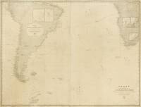
1882rif. 143690Washington: United States Hydrographic Office 1882. Fair. Washington United States Hydrographic Office 1882/ 1868 and 1869. A very large engraved chart in two sheets combined size approximately 940 × 1230 mm overall total size 954 × 1252 mm with minimal hand-colouring mounted together on linen. Some foxing and light soiling with a few light stains and creases and trifling surface loss from insect damage; light wear to the edges; verso of the linen backing a little waterstained; overall a working map in decent condition. A large United States Navy Hydrographic Office chart with five inset charts showing the anchorages of Walwich Bay Walvis Bay Angra Pequena Lüderitz Bay and St Helena and channels through the Abrolhos and Manoel Luiz Banks. The two sheets incorporate corrections to December 1881 and January 1882 respectively. Pencil annotations show the tracks of three voyages two south-east towards the Cape of Good Hope in March-April and November-December 1883 and one in the opposite direction in April-May 1886 this is identified in the right-hand margin as part of a voyage from Hong Kong to London made by one J.B. Newcomb. A further partial track is given in purple ink dated only 'Route in October November and December'. Lighthouses are highlighted with spots of red and yellow colouring. United States Hydrographic Office unknown
1943rif. LFA-126735004Une revue de 56 pages, format 165 x 245 mm, illustrée, brochée couverture couleurs, bon état
1944rif. LFA-126735016Une revue de 56 pages, format 165 x 245 mm, illustrée, brochée couverture couleurs, bon état
rif. 018813[Philippe Briet, Parallela geographiae veteris et novae] La division de nostre océan - Afrique, Europe, Asie, Australie. Gravure originale, 1649, environ 240*170mm. Gravure tirée de l'ouvrage du savant jésuite Philippe Briet (1601-1668) publié en 1648-1649. Texte au dos. [437]
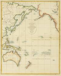
1797rif. 146755London: John Lodge 1797. Very Good. London John Lodge circa 1797. A hand-coloured engraved map printed surface 424 × 342 mm sheet size 450 × 385 mm. 'Engrav'd by J.Lodge Junr. Islington'. Several light horizontal creases two with short marginal splits outside the plate mark expertly sealed; minimal foxing; in excellent condition. An attractive chart of the Pacific Ocean including Australia from Bankes' 'New Royal and Authentic System of Universal Geography'. McCorkle #11-1a 'The geographical works of Thomas Bankes are a bibliographical nightmare'; Beddie 505; Tooley 870. John Lodge unknown