1 858 résultats
1999Broch?. 312 pages.
réf. 562513Limoges, Marc Barbou, s.d. [1900]. Petit in-folio, rel. d’éditeur pleine percaline rouge, dos lisse orné en doré, premier plat titré en argenté orné d’un décor doré et estampé, bords biseautés, tr. dorées, 328 pp., portrait gravé de la reine Ranavalo III en frontispice et 84 gravures dans le texte, certaines à pleine page.
réf. 42836Du N°I, Juillet-Décembre 1962 au N°VII, Juillet-Décembre 1965, soit 7 numéros reliés en deux volumes in 8° reliés demi-basane boire à coins, dos à faux nerfs, 163-110-150-157 pages et 126-189-249 pages ; très importante iconographie.
1962150p., illus. Hardcover Very good condition good
réf. 126204Editions Paulsen - 2013 - In-4 carré, reliure pleine toile sous jaquette illustrée, signet - 329 pages - Ouvrage tiré à 1000 exemplaires, celui-ci porte le numéro 337 - Nombreuses illustrations en couleurs et en N&B, in et hors texte, dans l'ouvrage
réf. 200818203Paris, Editions atlas, 1991 ; in-folio, 135 pp., cartonnage d'éditeur avec jaquette.
réf. CORV-BBP-18833Unknown. Spiral Bound. Very Good. Very good. Oblong spiral-bound 11 in x 17. in Resources mapped include Pelagic Fish Reef Fish Invertebrates Tourism and more. 53pp. References. B/w and color maps. > Language: English > Size: Oblong Folio > Media/Binding: Spiral Bound Unknown unknown
réf. DADAX022614139XUniversity of Chicago Press 2015-11-17. hardcover. New. 9.20x6.20x1.20. Buy with confidence. Excellent Customer Service & Return policy. University of Chicago Press hardcover
réf. SONG022614139XUniversity of Chicago Press 2015-11-17. hardcover. Used: Good. 9.20x6.20x1.20. Buy with confidence. Excellent Customer Service & Return policy. University of Chicago Press hardcover
réf. 022614139X.Ghardcover. Good. Access codes and supplements are not guaranteed with used items. May be an ex-library book. hardcover
900Ancient and original map of Malekula (Mallicolo) Island Northern part with portion of Malo Island Surveyed by Lieut. & Comm. G.C. Frederick, assisted by Lieut.ts H.J. Gedge, E.A. Day & H.B.T. Somerville, and Lieut. & Comm. H.E. Purey-Cust, assisted by Lieut.ts W. Pudsey-Dawson, F.C.C. Pasco & A.E.H. Marescaux, H.M. Surveying Ship "Dart" 1891-92. The West Coast: South of Malua Bay from a Sketch Survey by Lieut. K. Dixon, assisted by M.r G.J. Pacey, Gunner, H.M.S. "Archer" 1903. London Published at the Admiralty, 11th Dec. 1893, under the Superintendence of Captain W.J.L. Wharton, Hydrographer. Small corrections: 1928. Folded editorially. Autore: Admiralty Charts. Luogo: Pacific Ocean South - Malekula Island. Anno: '900. Tecnica: incisione. Dimensioni: 986x640 mm
900Ancient and original map of Malekula (Mallicolo) Island Southern part - The East Coast surveyed by Lieut. & Comm. G.C. Frederick, assisted by Lieut.ts H.J. Gedge, E.A. Day & H.B.T. Somerville, H.M. Surveying Ship "Dart" 1891. The South and Ambrym I surveyed by Lieut. & Comm. H.E. Purey-Cust, assisted by Lieut. s W. Pudsey-Dawson, F.C.C. Pasco & A.E.H. Marescaux H.M.Surveying Ship "Dart" 1893. The West Coast North of South West Bay from a Sketch Survey by Lieut. K. Dixon, assisted by M.r G.J. Pacey, Gunner, H.M.S. "Arker", 1903. Additions to Ambrym I. from a Survey by Lieut. Comm. R.L. Hancock and the Officers of H.M. Surveying Ship "Sealark" 1914. In the left side insert of Pangkumu Bay From a French Government Plan 1906. London Published at the Admiralty, 26th June 1893, under the Superintendence of Captain W.J.L. Wharton, Hydrographer. Small corrections: 1931. Folded editorially. Autore: Admiralty Charts. Luogo: Pacific Ocean South - Malekula Island. Anno: '900. Tecnica: incisione. Dimensioni: 650x985 mm
réf. Juanpebooks058396WE ship worldwide. Brand new 100%guarentee unknown
réf. 20192035-nnew. unknown
réf. 20192035like new. unknown
1979réf. Q-9027705003Springer 1979-07-31. Hardcover. New. New. In shrink wrap. Looks like an interesting title! Springer hardcover
1979réf. x-9027709025Springer 1979. Paperback. New. reprint edition. 208 pages. 9.20x6.10x0.47 inches. Springer paperback
réf. 8449416213-11-1-29Oceano Group. Very Good. With dust jacket. It's a well-cared-for item that has seen limited use. The item may show minor signs of wear. All the text is legible with all pages included. It may have slight markings and/or highlighting. Oceano Group unknown
1828In 12°, pp. XII, 112, (4). Brossura editoriale ril. in cartonato con tassello al dorso. Nel primo Ottocento la diffusione dei bagni di mare porta, in Inghilterra e Francia, alla commissione e alla stampa di diversi manualetti che gratificano e incoraggiano l’abitudine. Lavori come questo (che succede di un anno a un libro omologo pubblicato a Nizza) vanno a costituire fra l’altro la premessa all’avvento del turismo ricreativo come settore economico. An early title about the turism.
réf. ORD-3732Avec Cartes et Illustrations. Colombo. George J. A. Skeen. Ceylan. (1900). In-8 (139 x 215mm) broché, dos toile verte, couverture illustrée couleurs sur les 2 plats avec publicités en vert au verso, XXI, 156 pages (texte dans un cadre rouge), 2 cartes hors texte couleurs et très nombreuses illustrations photo en noir dans et hors texte. 1er plat, frontispice et titre un peu poussiéreux, sinon bel exemplaire. Rare.
1943réf. 246021943 bon état,pliée
900Marau Sound Surveyed by Lieut. J.S.C. Bower, assisted by Sub-Lieut. A.T. Stuart, H.M.S. "Danae" 1879. In the lower left corner of the chart insert of Danae Bay By Sub-Lieutenant A.T. Stuart 1879. London Re_published at the Admiralty, 25th April 1893, under the Superintendence of Captain W.J.L. Wharton, Hydrographer. Small corrections: 1923. Autore: Admiralty Charts. Luogo: Marau Sound - Salomon Islands - Pacific Ocean. Anno: '900. Tecnica: incisione. Dimensioni: 479x649 mm
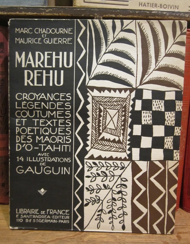
1925réf. 003212Librairie de France, F. Sant'Andrea éditeur, 1925
1956réf. 1179471956 Paris, Imprimerie Nationale - 1956 - Grand in-8, broché - 28 pages
2001réf. Q-0309072867National Academies Press 2001-06-01. Hardcover. New. In shrink wrap. Looks like an interesting title! National Academies Press hardcover