Keate (George) - Wilson (Henri) :Livre Rare Book
1 733 résultats
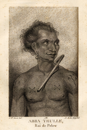
1788réf. 14520Paris, Le Jay et Maradan, 1788 ; 2 tomes in-8 ; demi-chagrin noisette (reliure moderne) ; (4), 282 pp., portrait du capitaine Henri Wilson en frontispice, gravé par Mme Massard d'après I. Russell, grande carte géographique dépliante, 7 planches gravées dont 6 dépliantes ; (4), 274 pp., (3) ff. Errata et Approbation, 8 planches gravées dont 6 dépliantes, soit 17 planches au total ; vocabulaire de la langue Pelew pp. 251-267 du tome II.
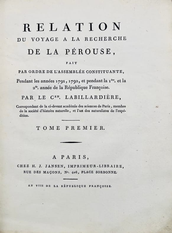
1800réf. 43698Paris, H.-J. Jansen, 1800 (an VIII). 2 vol. in-4 de XVI-442 pp. et 332-113 pp. pour les deux volumes de texte, et 1 atlas in-folio de 1 titre, 43 planches gravées hors texte et 1 grande carte dépliante, demi-basane verte, dos lisses ornés, entièrement non rogné, couvertures muettes conservées, l'atlas est en demi-veau à coins.
1668réf. PHO-1821Paris, Jean de la Tourette, 1668. In-12, 340pp., vélin époque (Sali avec petits manques) titre manuscrit au dos, ex-libris au titre, mouillure angulaire sur 20 feuillets, pages 79-82 et 338, déchirées avec manque (copies), page 339-340 en copie, écritures en dernière page
1774In-8 gr. (mm. 248x188), 4 volumi, elegante legatura in p. pelle bazana coeva (picc. spacchi alle cerniere), dorso a cordoni con ricche decorazioni e tit. oro su due tasselli, sottili cornici dorate ai piatti, tagli marmorizzati, pp. (4),IV,XVI,(2),XXXII,388; (8),536; (8),394,(2); (4),VIII,367; illustrati f.t., come da Indice, da 52 tavole inc. in rame di cui 30 carte geografiche, più volte ripieg., e 22 magnifiche tavole (anche a doppia pag.) che raffigurano usi e costumi degli indigeni, paesaggi, flora e fauna, scene storiche, tutte molto ben conservate. L’opera, tradotta dall’inglese, è così suddivisa: 1° vol. “Relation d’un voyage fait autour du monde, dans les années 1764, 1765 et 1766, par le Commodore Byron, Commandant le vaisseau du Roi le ‘Dauphin’ (segue) Voyage.. dans les années 1766, 1767, 1768 et 1769, par Philippe Carteret, Ecuyer, Commandant du ‘Swallow Sloup’ de Sa Majesté Britannique” - 2° vol. “Voyage.. dans les années 1766, 1767 et 1768, par Samuel Wallis, Commandant le vaisseau du Roi ‘le Dauphin’ (segue) Voyage.. dans les années 1769, 1770 et 1771, par le Lieutenant Jacques Cook, Commandant le vaisseau du Roi ‘l’Endeavour’” - 3° et 4° volumi “continuation et fin du ‘Voyage du Capitaine Cook”. "Prima edizione della versione francese". Cfr. The Hill Collection of Pacific Voyages (2004),782, per la prima ediz. inglese del 1773: “Important collection chronicling English maritime expeditions. John Byron visited the Tuamoto Islands and Nikunau in what would later be called the Gilbert Islands. Captain Wallis discovered the volcanic island of Tahiti and Morea.. Captain Carteret discovered Pitcairn Island and some remote atolls in the South Seas. The first voyage under the not-yet-famous Captain Cook’s command was primarly of a scientific nature. The expedition was to sail to Tahiti in order to observe the transit of Venus across the disk of the sun, to determine the earth’s distance from the sun, and also to carry on the geographical discovery that John Byron had started. Entering the Pacific around Cape Horn, Cook reached Tahiti in 1769 and carried out the necessary astronomical observations.. Leaving Tahiti in July, Cook discovered, named and charted the Society Islands, and then, heading southwest, explored New Zealand. Cook then headed towards Australia and discovered and charted the eastern coast for 2.000 miles, naming the area New South Wales. He nearly lost his ship on the Great Barrier Reef. Both Australia and New Zealand were annexed by Britain as a result of this voyage, which began in 1768 and ended in 1771. Cook’s discoveries won him prominence, promotion, and the opportunity to sail again. They also ensured J. Hawkesworth’s position in maritime literary history, as the official chronicler of Cook’s first voyage”. Pagine ingiallite per la qualità della carta, altrimenti esemplare ben conservato.
1818In-16 p. (mm. 163x95), 2 volumi in 1 tomo, mz. pelle coeva, fregi e titolo oro su tassello al dorso, pp. XXII,231; 246,(2); corredato fuori testo, come da Indice, di un ritratto dell'A., 1 carta geografica, più volte ripiegata, delle isole Pelew e 8 belle tavole a colori fuori testo, inc. in rame. “Composta sui giornali, e sulle notizie comunicate dal capitano Enrico Wilson e da alcuni de' suoi uffiziali che in Agosto del 1783 vi fecero naufragio sull'Antelope, nave mercantile della compagnia inglese delle Indie Orientali”. L’opera fa parte della “Raccolta di viaggi dopo quelli di Cook” eseguiti tanto per mare quanto per terra, e non pubblicati finora in lingua italiana (Tomi V-VI). Esempl. ben conservato.
1828Note: In 16°, rilegatura in m. perg. coeva, pp. 255,(1); minima gor all'ang. interno delle ultime pp.; fioriture sparse; firma prec. prop. al frontesp.; manca la prima c, bianca; discreto es.. Editore: Tipografia Vignozzi - Livorno.
réf. 46307Washington Government Printing Office 1890 in 8 (22x14) 1 volume reliure demi chagrin havane, dos à nerfs, pièce de titre de cuir noir, couverture illustrée conservée, 300 pages [1], avec 2 carte et 34 gravures hors texte. Ex-libris R. V. F. Préface de R. E. Priestley. Traduction française du commandant Beauvais. Collection ''Bibliothèque Historiique''. Bel exemplaire, très bien relié ( Photographies sur demande / We can send pictures of this book on simple request )
Hardcover in-8 in very good condition.- Reprint Très bel exemplaire - VG+++. [TX-13]
réf. OCE191MP., Ancienne Librairie Martinon, s.d. (v. 1874). In-8, reliure d'époque, demi-dos basane, dos long, XXIV-363pp. Chasses frottées. Coins cassés. Dos convenable. Plats convenables. Intérieur épidermé. Bonne pièce de témoignage
réf. OCE192MP., Ancienne Librairie Martinon, s.d. (v. 1874). In-8, relié, demi-dos basane grenat, plats marbrés, dos long, XXIV-363pp. 200 illustrations gravées sur bois, 700 sujets. Dessins de Denis, Desjours, V. Gilbert, Mathon, D. Vierge, E. Hareux, etc. Volume fatigué
1958réf. 10BnMonte Carlo Cap 1958 18 x 21 90 pages - broché - revue Septembre 1958 - N. 19 -etat tres correct
1958réf. 10BnMonte Carlo Cap 1958 18 x 21 90 pages - broché - revue Septembre 1958 - N. 19 -etat tres correct
réf. 13975659Paris: Editions Revue Noire, 1995 in-folio, 96 pages, illustrations. Boché, très bon état.
1993This is a very good softcover copy with almost no wear. Completely clean inside and out. Spine not creased. This catalog was prepared to accompany the exhibition in New York at the Gagosian Gallery in 1992. Essay by Jack Flam. Bibliography. Exhibition history. 14 color plates + a number of black & white reproductions of paintings in the text. 11" high X 9" wide, 76 pages. This book will be securely wrapped and packed in a sturdy box and shipped with tracking.
1939xv, 17-234 p. : incl. front., illus. ; 27 cm. Hardcover Very good condition
réf. 9435adaptation de Suzie Jacqueline. In 8 broché couverture illustrée, titre, 34 pages, 16 illustrations à pleine page de THOMEN, suivi des aventures du fameux Don Quichotte d’après Miguel de CERVANTES adaptation de Suzie Jacqueline. Titre 8 pages, 7 illustrations à pleine page et dans le texte, de Jacques TOUCHET. Editions CHAGOR, imprimé en Belgique et édité par GORDINNE. Liège
2025réf. __1948701782Pace Wildenstein 2025. Paperback. New. 100 pages. 12.00x9.75x0.50 inches. Pace Wildenstein paperback
réf. OCE145MAlbin Michel, 1930. In-8, relié, demi-cuir rouge, couverture non conservée, dos lisse orné, 318pp. Usure normale. Quelques frottements aux coins et tanches. Charmant exemplaire
1998réf. 1651931998 RODRIGUES - La troisième île des Mascarignes.L' Harmattan , 1998 , in8 broché,208pp . Cartes , tableaux.
900Rough Sketches of Anchorages in the Solomon Islands. By M.r W.T. Wawn, Master, Brigantine "Ariel", 1888. In the left side of the chart insert of Tasman I.s or Niumanno Atoll, Atta Cove, Ariel Harbour From a Survey by Lieut. A.L. Jackson, under the direction of Lieut. Com. R.L. Hancock, H.M. Surveying Ship "Sealark", 1914, Manna Kwoi H.r. In the middle part of the chart insert of Deep Bay, Uras Cove, North Sister Anchorage, Double Bay. In the right side of the chart insert of Maramasike Passage. London Published at the Admiralty, 7th Oct. 1889, under the Superintendence of Captain W.J.L. Wharton, Hydrographer. Small corrections: 1930. Folded editorially. Autore: Admiralty Charts. Luogo: Salomon Islands - Pacific Ocean. Anno: '900. Tecnica: incisione. Dimensioni: 512x741 mm
1851réf. PACIFICO015869Longman Brown Green and Longmans London. 1851. First edition. Octavo. Two volumes in one: pp xii 352; xii 371. Four chromolithograph plates. Original blue cloth decorated in blind lettered in gilt.On the front free endpaper are two 19th century inscriptions one of which has been crossed through. Some foxing here and there. Head and tail of spine a bit scuffed. Some wear to edges. Very good. Very scarce in the intact publishers' binding. Longman, Brown, Green, and Longmans, London. hardcover
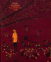
2008réf. 77505Harry N. Abrams Distribution . New. Paperback. FREE UPGRADE to Courier/Priority Shipping Upon Request - IN STOCK AND IMMEDIATELY AVAILABLE FOR SHIPMENT - Flawless copy brand new pristine never opened -- Text in English. 192 pp. With 218 ills. 211 col. . 24 x 20 cm. -- with a bonus offer--; The Royal Academy of Art’s Summer Exhibition in London has been an annual event since 1768. Today about a thousand works are selected to be shown each year from over 10000 entries. The exhibition which includes paintings drawings prints sculpture and architectural designs and models continues to be the largest open exhibition in the UK. First published in the 1870s Royal Academy Illustrated is an excellent way to stay current with trends in contemporary British art by surveying the highlights of each year’s show. This colorful collection features a cross-section of the works on display at the Summer Exhibition accompanied by installation shots of the galleries and an insightful introduction to the theme of the show. . 2008. 1905711123 . Harry N. Abrams (Distribution) paperback
1930réf. 56514London UK & Hamilton Bermuda: The Royal Mail Steam Packet Company; The Herrington Co.; Trimingham Brothers 1930. Three pieces. 1st - 8vo. 16 4 pp. Colour-illustrated covers cover art of the RMSP Arcadian yapp edges NF; 2nd - 12mo. 2.75 x 3.5 in. 24 pp unpaginated. w/ photo illustrations double-page centerfold map colour-illustrated softcovers wraparound cover art of the Road around Harrington Sound; 3rd - 16mo. 3.75 x 5.25 in. which folds out to 21 x 7.5 in. pictorial map printed in black & light blue decorative borders lettering text on verso minor shelfwear still all VG from the library of noted opera singer Marion Talley 1906-1983 whose name along with her sister & mother appear in the list of passengers. First editions thus of these travel items to Bermuda in January of 1930 including the passenger list for the RMSP Arcadian which would be taken out of service later that year in October as well as two souvenir travel guides and maps. The RMSP Arcadian was originally built as the HMHS Asurias turned Hospital Ship and torpedoed during World War I and later as ammunition hulk before Royal Mail purchased her back and converted her into the Arcadian in 1923. Trimingham Brothers was a venerable Bermuda department store in Hamilton which sold everything from china to perfume golf shoes to rugs which sadly closed in 2005 due to severely falling sales. Herrington Co. was a very successful publisher of postcards travel guides maps and souvenirs in Bermuda. No copies in Worldcat. The Royal Mail Steam Packet Company; The Herrington Co.; Trimingham Brothers, paperback
réf. QWA-15237Economica, 1992, in-8 br. (15,5 x 24), 338 p., Commission Française d'Histoire Maritime, coll. "Etudes d'histoire maritime", 32 cartes, bon état.
réf. QWA-15243Economica, 1992, in-8 br. (15,5 x 24), 338 p., Commission Française d'Histoire Maritime, coll. "Etudes d'histoire maritime", 32 cartes, bon état.