CollectifLivre Rare Book

1 863 résultats
réf. 10962Tableau géographique et statistique de l’Ile Bourbon. Baudoin frères éditeurs. Imprimerie de D’Urtubie et Worms, sans date (1831) 590x460mm avec le texte et la marge. 220 x240mm, carte en couleur seule. Très bon état
réf. 10964Tableau géographique et statistique de la Guadeloupe et de ses dépendances. . Baudoin frères éditeurs. Imprimerie Rignoux. Sans date. 515x396mm avec marges. 245x230mm carte seule. Une pliure, verso poussiéreux avec de petites déchirures en marge inférieure et en marge supérieure, réparées. Rousseurs, visibles au verso avec de petites déchirures en marges, éparées.
réf. 10963Tableau géographique et statistique de la Guyane. Baudoin frères éditeurs. Imprimerie Rignoux. Sans date. 492x395mm avec marges. 240x225mm carte seule. Rousseurs, visibles au verso avec de de petites déchirures en marges, éparées.
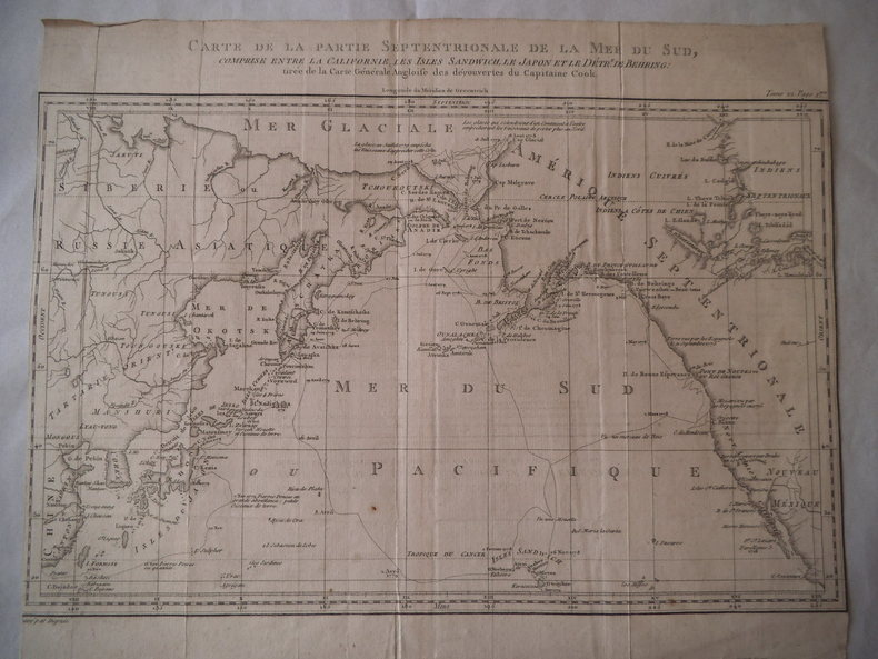
réf. 12570tirée de la carte générale angloise des découvertes du capitaine Cook gravée par DUPRE 360x295mm. Marge inexistante. Traces de pliures.
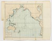
1790réf. 143934Paris: F. Dufart 1790. Very Good. Paris F. Dufart circa 1790. A hand-coloured engraved map printed surface 378× 415 mm sheet size approximately 420 × 540 mm. 'Gravée par Tardieu l'Ainé . Dessiné par Poirson . Ecrit par Beaublé'. Original folds as issued; some minor uneven tanning; in very good condition. An uncommon chart of the Pacific Ocean and Australia showing magnetic variation and dip drawing on observations made in the course of Pacific voyages after 1775 most notably Cook's third voyage. It is most likely from a duodecimo edition of Buffon's 'Histoire naturelle générale et particulière' around the end of the eighteenth century 'PL. III. Tome XVI' and 'Page 58' are printed in the top margin. It is based on a larger chart in four sheets attributed to Jean-Charles de Borda. The engraver Tardieu is one of half a dozen members of the family working as engravers at the period one of whom P.A.F. Tardieu would engrave the charts published in the official account of the Baudin voyage. F. Dufart unknown
1818Uncommon French Sea Chart of the Pacific ocean, separtely publisheb by the Depot General de la Marine. This work is significantly revised and improved from the 1797 edition, to be noticed the improvements and additions to the coastline of Australia. The first edition showed very little of the Southern Coastline and did not specifically delineate Tasmania as an island. Also the coastline of Argentina is also greatly improved. Perfect status of conservation.
réf. 0266011780.Gpaperback. Good. Access codes and supplements are not guaranteed with used items. May be an ex-library book. paperback
réf. OCE183MFRATERNITE NOTRE DAME DU SACRE COEUR. 1984. In-8, broché sous jaquette illustrée, 541 pages. Jaquette faiblement éraflée. Intérieur bon. Aimable exemplaire
réf. 6415in 12 broché,couverture illustrée,faux-titre,titre,92 pages,2 pages de publicités.Ernest Flammarion sans date.
réf. 50754Stock, Les Livres de Nature, 1950 13 x 19, 275 pp., planches photos N/B, broché, ill. dessin vert, Bon état - qques soulignages crayon, 2 inscriptions pages de garde, 16ème édition
réf. 9788592649449AYINE EDITORA. new. Um Vietn dilacerado pela guerra e pelo comunismo AYINE EDITORA unknown
1931In 16°, br. edit. ill. (modeste tracce d'uso, alcune gore ai bordi e lievi fioriture sparse), pp. (4),237,(3) con 32 ill. b/n in tavv. f.t.; coll. "Opere di Arnaldo Fraccaroli", nota di possesso alla prima carta ma nel complesso buona copia. (m309) (spedizione standard SEMPRE tracciata con raccomandata - piego di libri, eventuale FATTURA da richiedere all'ordine)
réf. 65903Bruxelles, éd. Labor er chez l'auteur, 2002, gd. in-8, cartonnage souple à rabats, couv. photo coul. éd., 248 pp., nb. cartes et photos en coul. et en noir, Sommaire, Bibliographie, Ce livre raconte la tentative de la plus longue traversée de l'océan Arctique jamais entreprise. Un échec mais avec panache ! Très bon état
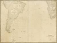
1882réf. 143690Washington: United States Hydrographic Office 1882. Fair. Washington United States Hydrographic Office 1882/ 1868 and 1869. A very large engraved chart in two sheets combined size approximately 940 × 1230 mm overall total size 954 × 1252 mm with minimal hand-colouring mounted together on linen. Some foxing and light soiling with a few light stains and creases and trifling surface loss from insect damage; light wear to the edges; verso of the linen backing a little waterstained; overall a working map in decent condition. A large United States Navy Hydrographic Office chart with five inset charts showing the anchorages of Walwich Bay Walvis Bay Angra Pequena Lüderitz Bay and St Helena and channels through the Abrolhos and Manoel Luiz Banks. The two sheets incorporate corrections to December 1881 and January 1882 respectively. Pencil annotations show the tracks of three voyages two south-east towards the Cape of Good Hope in March-April and November-December 1883 and one in the opposite direction in April-May 1886 this is identified in the right-hand margin as part of a voyage from Hong Kong to London made by one J.B. Newcomb. A further partial track is given in purple ink dated only 'Route in October November and December'. Lighthouses are highlighted with spots of red and yellow colouring. United States Hydrographic Office unknown
1860Carta nautica dell'Oceano Atlantico in cui sono segnate le rotte navali. Interessante evidenziare la presenza del cavo telegrafico "Telegraphic Cable" la cui collocazione si era da poco terminata. Questo cavo telegrafico adagiato sul fondo dell'oceano rappresentò un enorme passo avanti nel campo delle comunicazioni tra il Nord America e l'Europa. Da quel momento un messaggio poteva essere trasmesso e ricevuto nel giro di qualche minuto, quando fino a poco tempo prima erano necessari almeno dieci giorni di navigazione. Piccoli fori di tarlo che non compromettono l'ottimo stato di conservazione generale. Attraente coloritura coeva all'acquerello.
1976réf. LFA-126740976Un ouvrage de 254 pages, format 120 x 180 mm, illustré, relié skyvertex, publié en 1976, Editions Famot, bon état
2005réf. LFA-126725030Un ouvrage de 238 pages, format 270 x 320 mm, illustré, relié cartonnage sous jaquette couleurs, publié en 2005, Editions Place des Victoires, bon état
1903Volume in 4°, brossura editoriale con sovracoperta, titolo al piatto ed al dorso, sguardie, occhiello, frontespizio, prefazione, ritratto fotografico dell'autore, VI, 407 pp., 200 illustrazioni fotografiche, di cui 50 tavole f.t e 2 grandi mappe ripiegate f.t.. Uno fra i libri di viaggio più rari in assoluto, racconta il viaggio esplorativo compiuto dal Conte R. F. de Tolna, in compagnia della moglie, in occasione delle loro nozze, attraverso l'Oceano Pacifico. Viaggio che durò ben otto anni e diede loro modo di visitare luoghi ancora inesplorati di entrare a stretto contatto con popolazioni selvagge, dagli usi e costumi differenti e curiosi, tra cui quella decisamente suggestiva del cannibalismo. Un affascinante viaggio attraverso una cultura ormai perduta, arricchito da splendide e suggestive illustrazioni. Edizione originale in ottimo stato. Un gioiello di eccezionale rarità.
réf. 116754532X.Gpaperback. Good. Access codes and supplements are not guaranteed with used items. May be an ex-library book. paperback
réf. 1164123122.Gpaperback. Good. Access codes and supplements are not guaranteed with used items. May be an ex-library book. paperback
réf. 1436605547.Ghardcover. Good. Access codes and supplements are not guaranteed with used items. May be an ex-library book. hardcover
2008réf. DADAX1436605547Kessinger Publishing 2008-06-02. hardcover. New. 6.00x0.63x9.00. Buy with confidence. Excellent Customer Service & Return policy. Kessinger Publishing hardcover
2013réf. 2081502111907098Naruyama-do shoten 2013. Soft Cover. Fine. The book is in fine condition. Naruyama-do shoten paperback
réf. 9782073110688Gallimard
réf. ORD-1097Un réveillon dans la Brousse. Les Chercheurs d'or. Le Seigneur-de-la-Baie. Le Paradis perdu. La Danse devant le feu. Illustrations en couleurs de G. GAUDION. Édité par Roger Dacosta pour les laboratoires de l'Hépatrol. Paris. 1939. 5 histoires dans un volume in-8 (156 x 235mm) en feuilles sous chemise jaune imprimée en violet et saumon, nombreuses illustrations en couleurs, souvent à pleines pages par G. GAUDION. Bel exemplaire. Concerne l'Afrique du Nord, Madagascar, l'Indochine, La Réunion et l'Afrique Occidentale Française.