1 862 résultats
1949réf. LFA-126734989Une revue de 148 pages, format 165 x 230 mm, illustrée, brochée couverture couleurs, bon état
réf. 25704France, Editions du Tadorne-Kerdavid, 1999. 23 x 28, 112 pp., très nombreuses illustrations en N/B, cartonnage d'édition + jaquette, état neuf.
réf. 64663Coll. "Iles", Paris, Nathan, 2001, gd. in-8, cartonnage souple, couv. photos coul. éd., cartes sur les gardes, 192 pp., papier glacé, très nb. photos, cartes et reproductions de documents anciens en coul. et en noir, Sommaire, Guide pratique, Bibliographie, Index toponymique, Un guide idéal pour découvrir l'île Maurice et celle de Rodrigues. Très bon état
19368vo., First Edition, with frontispiece and plates, neat contemporary inscription on front free endpaper; orange and black cloth to Cunard house design, backstrip lettered in red, a very good, bright, clean copy. SCARCE IN THIS CONDITION.
réf. 72749Coll. "Les qutre éléments", Paris, éd. du Chêne, 1946, EDITION ORIGINALE, in-12, cartonnage pleine percaline bleue, auteur, titre et ancre de marine dorés sur dos lisse, couv. ill. coul. d'origine conservée, 224 pp., table des matières, cachet sur la page de titre, La vie dans les océans. Très bon état
réf. 187Genève, Atar - in-8 : 52 pp. ; ill. in-texte, airs notés - br., couv. ill. , pap. crème
1992réf. dk1435Economica Etudes d'histoire maritime Broché 1992 In-8 (15,5 x 24 cm), broché, 224 pages, tome 3 seul ; ex-libris tamponné, par ailleurs très bon état général. Livraison a domicile (La Poste) ou en Mondial Relay sur simple demande.
1991réf. vk668Economica Etudes d'histoire maritime Broché 1991 In-8 (15,6 x 24 cm), broché, 237 pages ; très bon état général. Livraison a domicile (La Poste) ou en Mondial Relay sur simple demande.
réf. OCE122MRetaux et fils. 1892. In-8° sous reliure pleine toile moderne. 340 pages. (4) pp. de catalogue ; nombreuses figures gravées d'après des photographies. Ouvrage historique construit à partir de documents authentiques, fournis par le commandant Candeau. Ancien exemplaire de bibliothèque paroissiale (multiples traces de tampon sur page de titre et première page). Résidu de vignette ex-libris sur page de garde. Intérieur plaisant. Reliure soigné et saine. Bon exemplaire
1982réf. dl2259Imprimerie Nationale Notre siècle Relié 1982 In-8 (18 x 25 cm), relié demi-basane, dos à 5 nerfs avec tire et auteurs dorés, couverture d'origine illustrée conservée, 499 pages, iconographie en noir hors-texte ; petites taches d'usage aux plats, quelques rousseurs aux tranches, bel état. Livraison a domicile (La Poste) ou en Mondial Relay sur simple demande.
2009488 pages. Glossary. Index. Clean and unmarked with moderate external wear. Binding intact. A sound copy of this excellent arctic marine systems text. Book
2001réf. Q-0309072867National Academies Press 2001-06-01. Hardcover. New. In shrink wrap. Looks like an interesting title! National Academies Press hardcover
1956réf. 1179471956 Paris, Imprimerie Nationale - 1956 - Grand in-8, broché - 28 pages
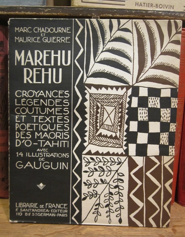
1925réf. 003212Librairie de France, F. Sant'Andrea éditeur, 1925
900Marau Sound Surveyed by Lieut. J.S.C. Bower, assisted by Sub-Lieut. A.T. Stuart, H.M.S. "Danae" 1879. In the lower left corner of the chart insert of Danae Bay By Sub-Lieutenant A.T. Stuart 1879. London Re_published at the Admiralty, 25th April 1893, under the Superintendence of Captain W.J.L. Wharton, Hydrographer. Small corrections: 1923. Autore: Admiralty Charts. Luogo: Marau Sound - Salomon Islands - Pacific Ocean. Anno: '900. Tecnica: incisione. Dimensioni: 479x649 mm
1943réf. 246021943 bon état,pliée
réf. ORD-3732Avec Cartes et Illustrations. Colombo. George J. A. Skeen. Ceylan. (1900). In-8 (139 x 215mm) broché, dos toile verte, couverture illustrée couleurs sur les 2 plats avec publicités en vert au verso, XXI, 156 pages (texte dans un cadre rouge), 2 cartes hors texte couleurs et très nombreuses illustrations photo en noir dans et hors texte. 1er plat, frontispice et titre un peu poussiéreux, sinon bel exemplaire. Rare.
1828In 12°, pp. XII, 112, (4). Brossura editoriale ril. in cartonato con tassello al dorso. Nel primo Ottocento la diffusione dei bagni di mare porta, in Inghilterra e Francia, alla commissione e alla stampa di diversi manualetti che gratificano e incoraggiano l’abitudine. Lavori come questo (che succede di un anno a un libro omologo pubblicato a Nizza) vanno a costituire fra l’altro la premessa all’avvento del turismo ricreativo come settore economico. An early title about the turism.
réf. 8449416213-11-1-29Oceano Group. Very Good. With dust jacket. It's a well-cared-for item that has seen limited use. The item may show minor signs of wear. All the text is legible with all pages included. It may have slight markings and/or highlighting. Oceano Group unknown
réf. 20192035-nnew. unknown
réf. 20192035like new. unknown
1979réf. Q-9027705003Springer 1979-07-31. Hardcover. New. New. In shrink wrap. Looks like an interesting title! Springer hardcover
1979réf. x-9027709025Springer 1979. Paperback. New. reprint edition. 208 pages. 9.20x6.10x0.47 inches. Springer paperback
900Ancient and original map of Malekula (Mallicolo) Island Southern part - The East Coast surveyed by Lieut. & Comm. G.C. Frederick, assisted by Lieut.ts H.J. Gedge, E.A. Day & H.B.T. Somerville, H.M. Surveying Ship "Dart" 1891. The South and Ambrym I surveyed by Lieut. & Comm. H.E. Purey-Cust, assisted by Lieut. s W. Pudsey-Dawson, F.C.C. Pasco & A.E.H. Marescaux H.M.Surveying Ship "Dart" 1893. The West Coast North of South West Bay from a Sketch Survey by Lieut. K. Dixon, assisted by M.r G.J. Pacey, Gunner, H.M.S. "Arker", 1903. Additions to Ambrym I. from a Survey by Lieut. Comm. R.L. Hancock and the Officers of H.M. Surveying Ship "Sealark" 1914. In the left side insert of Pangkumu Bay From a French Government Plan 1906. London Published at the Admiralty, 26th June 1893, under the Superintendence of Captain W.J.L. Wharton, Hydrographer. Small corrections: 1931. Folded editorially. Autore: Admiralty Charts. Luogo: Pacific Ocean South - Malekula Island. Anno: '900. Tecnica: incisione. Dimensioni: 650x985 mm
900Ancient and original map of Malekula (Mallicolo) Island Northern part with portion of Malo Island Surveyed by Lieut. & Comm. G.C. Frederick, assisted by Lieut.ts H.J. Gedge, E.A. Day & H.B.T. Somerville, and Lieut. & Comm. H.E. Purey-Cust, assisted by Lieut.ts W. Pudsey-Dawson, F.C.C. Pasco & A.E.H. Marescaux, H.M. Surveying Ship "Dart" 1891-92. The West Coast: South of Malua Bay from a Sketch Survey by Lieut. K. Dixon, assisted by M.r G.J. Pacey, Gunner, H.M.S. "Archer" 1903. London Published at the Admiralty, 11th Dec. 1893, under the Superintendence of Captain W.J.L. Wharton, Hydrographer. Small corrections: 1928. Folded editorially. Autore: Admiralty Charts. Luogo: Pacific Ocean South - Malekula Island. Anno: '900. Tecnica: incisione. Dimensioni: 986x640 mm