Philips George & Son edit.MareMagnum

7338 resultados
1860Carta geografica raffigurante le isole dell'Oceano Pacifico. Piccoli fori di tarlo che non compromettono l'ottimo stato di conservazione generale. Attraente coloritura coeva all'acquerello.
ref. SONG9810215290Used: Good unknown
1920ref. 64773Portland OR: Shaver Transportation; Sowell Studio Photos 145 1/2 3rd St. ca. 1920. Three oblong folio original silver gelatin photographs sized 14 x 9.75 in. all w/ photographer’s rubber stamp on verso two w/in negative at lower fore-edge very slight age toning minor shelfwear a couple corners creased still an excellent set of three. These scarce three large original silver gelatin photographs depict the expanding fleet of tugboats from the Shaver Transportation Company from before World War I into the Roaring 20’s. Those depicted here included the “Hercules” the “Cascades” originally built by the US Army Corps of Engineers for constructing the Cascade Locks and used by the Shaver Company until World War II; the historic “Henderson” wooden-hulled sternwheeler first built in 1901 as freight carrier and towboat operated for decades towing log rafts pushing barges and by 1950 was one of the last two wooden-hulled sternwheelers working the river and starred in the “River Queen” film in 1952; the “Sarah Dixon” another sternwheeler named for George Shaver’s wife; and the “No Wonder” originally built in Portland in 1889 from dismantled components from the 1877 Wonder and served as workhorse for the log-towing operations until retired and abandoned in 1933. Also depicted are the tugs such as the “James W” designed by Captain Delmar Shaver owned by the Shaver Transportation Co. powered by a direct-reversible 350 Atlas Diesel engine with electrically powered monkey rudder system and during the height of the Kaiser World War II shipyard boom she worked around the clock as she was built for speed and minimal wake effect eventually being retired by the company in the 1950’s. Also featured are the “Echo” which was the Shaver Transportation Co.’s first propeller-driven gasoline-powered boat as well as the large Shaver sternwheeler which later was converted into a twin-screw semi-tunnel diesel tug. Founded originally in 1880 by George Washington Shaver and partner’s as the People’s Freighting Co. with their steamboat Manzanillo the company was later incorporated in 1893 as Shaver Transportation by George with his two sons James and George and by the post-World War I era as depicted in these photos had expanded to 7 and then 10 tugs and their diesel power and scientific hull designs dominated Pacific Northwest waterways towing. Gustin 1884-1959 began as a photographer in The Dalles and then Pendleton before established as photographer and proprietor of Sowell Studio formerly Simon-Sowell Studio in 1914-1916 and operated as a photographer for the next three decades. Simon 1890-1986 became the manager for the Sowell Studio sometime in the early 1920’s and continued as professional photographer until his later retirement. Shaver Transportation; Sowell Studio Photos, 145 1/2 3rd St., unknown
1930ref. 44298St. Louis: A.D. Bell Passenger Traffic Manager Missouri Pacific Railroad n.d. ca 1930. ca 1930. 8 3/4" x 5" in bright colorful pictorial wrappers showing a market scene on the front wrapper. 50pp. Illustrations. Map. Written with the potential tourist in mind the brochure discusses a trip from St. Louis to Mexico City describing what one will see and experience on the trip. Black and white photographs include Chapultepec Castle scenery caverns various falls Saddle Mountain street scenes monuments important buildings churches locals etc. Fold-out colored system map at end of brochure showing the Missouri Pacific Railway lines and its connections from St. Louis southward thru Texarkana Austin San Antonio and down to Mexico City. Chart showing how to pronounce Spanish and Indian names. Light soiling to wrappers and with minor wear to the extremities. A nicely produced and informative brochure. A.D. Bell, Passenger Traffic Manager, Missouri Pacific Railroad, n.d. [ca 1930]. unknown
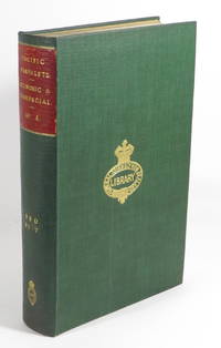
1921ref. 24190various: various. Very Good with no dust jacket. 1921-1926. First Edition. Hardcover. Ex-library General Assembly Library New Zealand. Parliamentary Library. Gilt library stamps on spine and front board. ; Bound volume of 18 tracts on the pacific. Spine title: "PACIFIC PAMPHLETS. ECONOMIC & COMMERCIAL. No. 4." Typed list of contents bound in at front. Page dimensions: 238 x 148mm. Contents: 1."Department of Overseas Trade. Report on the Economic and Commercial Situation of Australia to June 1923" by S. W. B. McGregor. London: His Majesty's Stationery Office 1923. 83 1 blank pages. Original printed wrappers bound in.2."Australia : A Survey of Its Resources and Foreign Trade" by Emmett A. Chapman. United States Department of Commerce - Bureau of Foreign and Domestic Commerce. 34 pages.3."Trading Under the Laws of Australia" by Guerra Everett. Trade Information Bulletin No. 412. United States Department of Commerce - Bureau of Foreign and Domestic Commerce. Washington: 73 1 pages. 4."Australia's Trade in the Future" by Harry S. Gullett. Extracted article. 59-64 pages.5."Department of Overseas Trade. Report on the Economic Financial and Commercial Conditions of the Republic of Panama and the Panama Canal Zone to September 1924" by R. Keith Jopson. London: His Majesty's Stationery Office 1924. 36 pages. Original printed wrappers bound in.6."Iron and Steel Trade of the Pacific Area" by Marshall Teel Jones. United States Department of Commerce - Bureau of Foreign and Domestic Commerce. 25 5 blank pages. 7."Furniture Markets of the Far East" by Kenneth M. Hill. United States Department of Commerce - Bureau of Foreign and Domestic Commerce. 33 1 blank pages.8."United States Department of Commerce : Supplement to Commerce Reports Published by the Bureau of Foreign and Domestic Commerce : February 1925: Trade Information Bulletin No. 317 : Foreign Markets for Confectionary : II. Far East". Washington: Government Printer 1925. 16 2 blank pages.9."Protesting Drafts in Japan Dutch East Indies Samoa and Tahiti : Compiled in the Division of Laws". United States Department of Commerce - Bureau of Foreign and Domestic Commerce. 15 1 2 blank pages.10. "Report of the Special Mission on Investigation to the Philippine Islands to the Secretary of War". Washington: Government Printing Office 1921. 58 2 blank pages 1 colour folding map. Original printed wrappers bound in.11. "Department of Overseas Trade : Report on the Commercial and Economic Situation of the Philippine Islands to June 1925" by Thomas Harrington. London: His Majesty's Stationery Office 1926. 26 pages. Original printed wrappers bound in.12. "Resources and Trade of the Philippine Islands" by M. A. Pugh. United States Department of Commerce - Bureau of Foreign and Domestic Commerce. 40 2 blank pages. 13. "Philippine Trade Financing and Exchange" by Edwin B. George. United States Department of Commerce - Bureau of Foreign and Domestic Commerce. 16 2 blank pages.14. "Department of Overseas Trade. Report on the Economic Situation of the Netherlands East Indies to June 1923" by H. A. N. Bluett. London: His Majesty's Stationery Office 1923. 112 pages. Original printed wrappers bound in.15. "Department of Overseas Trade. Report on the Economic Situation of the Netherland East Indies to July 1924" by H. A. N. Bluett. London: His Majesty's Stationery Office 1924. 80 pages. Original printed wrappers bound in.16. "Cotton-Goods Market in the Netherlands East Indies" by Edwin B. George. United States Department of Commerce - Bureau of Foreign and Domestic Commerce. 25 1 blank pages.17. "Machinery Markets of Netherlands East Indies" by J. F. Van Wickel. United States Department of Commerce - Bureau of Foreign and Domestic Commerce. 43 3 blank pages.18. "Trading with Malaysia" by F. R. Eldridge. United States Department of Commerce - Bureau of Foreign and Domestic Commerce. 21 1 blank pages. . [various] hardcover
1901ref. 63360Chicago: Scroll Publishing Co. 1901. Thick 12mo. 437 1 pp. Red pictorial publisher’s cloth cover art illustration of Western explorer and wagon train by Palenske white lettering front cover & spine uniform interior toning as usual very slight worming to very lower left corner textblock faint ex-lib marking on spine still G copy from the Clark County Historical Society Collections recently deaccessioned bookplate on front pastedown. First edition of this surprisingly scarce history tracking the Westward movement of Euro-caucasian settlers and explorers into the Pacific Northwest drawn from oral interviews with Elisha Lindsay Applegate 1832-1896 brother of Jesse Applegate who helped establish the Applegate trail as well as Jacksonville & Ashland OR; Charles Taplin while in his 90’s provided details on the 1843 Fremont Expedition from The Dalles along the Columbia River to Sutters Fort on the Sacramento River in California; and Frederick Barneburg 1836-1907 who originally came to the Rogue Valley OR in 1854 returned via wagon train in 1860 and purchased Barneburg Hill from Abraham Bish. Worldcat locates only microfilm & electronic copies. Scroll Publishing Co., hardcover
1848ref. DEMO015778IParis & Lyon: Librairie de Poussielgue-Rusand 1848. First French edition. Hardcover. Very Good. lithographs. 12mo 408 pages quarter red calf marbled boards lacks half-title. Ex libris Francis Reynolds Dickinson. Howes D286; Graff 3826; Field 1425; Sabin 82266; Smith 9549; Strathern 511:iii "Contains Father Smet's description of his travels through and about the central Columbia River plateau . he continued . to the country of the Assiniboines and arrived at Fort Augusta . He returned to Fort Vancouver by way of Fort Colville -- Wagner- Camp - Becker 141:3." Contains only 8 trimmed of its 13 chromolithographed plates lacking also its illustrated half-title. Librairie de Poussielgue-Rusand hardcover
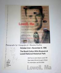
ref. 51-4243Lowell Massachusetts: The Boott Cotton Mills Museum at Lowell National Historic Park.1996 . Oriingal poster. Inscribed by Massimo Pacifico to Jeffrey Weinberg. About fine. Lowell MA: October 2nd - November 8 1996. Photographs by Massimo Pacifico. The Boott Cotton Mills Museum at Lowell National Historic Park. 49.5x45 cm 19¼x13¾". 1996.Massimo Pacifico has been a photojournalist since 1977. Enrolled in the Register of Journalists List of Publicists since 1978 Professionals since 1991. He carries out his activity based in Florence where he graduated in Political Science in 1976. At first free-lance he was later director of Agenzia Fos and therefore of the monthly magazines Verve and Bogart. As a freelance he has collaborated with dozens of international newspapers and as a correspondent for the magazines Weekend Gente Viaggi Class Dove Case & Country. Lowell, Massachusetts: The Boott Cotton Mills Museum at Lowell National Historic Park.1996 unknown
ref. 16-3218San Francisco: Pacific States Telephone and Telegraph Company 1906. 238 2 pp. 8vo 22x15 cm 8½x5¾" remnants of original wrappers. With names and addresses. Lacking or defective pages among the preliminary 12 pages with addenda. Lacking covers.San Francisco Telephone Directory published in August 1906. One of the earlier telephone directories published after the quake following the volumes issued in May and June. San Francisco: Pacific States Telephone and Telegraph Company, 1906 unknown
ref. 56-0314San Francisco Calif.: Southern Pacific Company 1951. Map. Pencil sketch 8.5" x 11". "Only important tracks shown." From E Main to Wildberg Butler Road to E Grand Ave. Includes Con West store Swift Armour United Pkg scales tresle pit track magnet track Southern Pacific depot probable route of movement. Not drawn to scale. San Francisco, Calif.: Southern Pacific Company, 1951. unknown
ref. 56-0315San Francisco Calif.: Southern Pacific Company n.d. Map. Blueline print 19" x 24" with red highlighting. From Tranforan Ave to Sierra Point. Includes South San Francisco Union Stock Yards Co W.P. Fuller and Co. Metal and Thermit Corporation Bayshore Highway tunnel no. 5 dredged channel. No scale indicated. San Francisco, Calif.: Southern Pacific Company, [n.d.] unknown
ref. 56-0275San Francisco Calif.: Thomas Bros n.d. Map. Green on green print 11" x 9" Includes street index with approx 150 streets listed. Scale 1" = 1750'. Back side includes partial road map of Danville Alamo scale not listed. San Francisco, Calif.: Thomas Bros, [n.d.] unknown
ref. 56-0336San Francisco Calif.: Thomas Bros Maps addition of switching zones approved 1961. Map. Blueline print 24" x 19" with orange green red and brown pencilling indicating switching zones. From French Camp to Eight Mile and Bucley Cove to Windsor. With index to streets and points of interest on back. Scale approx 1" = 0.5 mile. San Francisco, Calif.: Thomas Bros Maps, addition of switching zones approved 1961. unknown
ref. 56-0329San Francisco Calif.: Southern Pacific Company 1945. Map. Blueprint 12" x 39". Faded but legible. From Burns Cut Off to Mormon Channel. Includes Stockton Deep Water Channel Country Club Turning Basin. Scale 1" = 800'. San Francisco, Calif.: Southern Pacific Company, 1945. unknown
ref. 56-0251Southern Pacific Company 1951. Map. Blueline print 22" x 22" with red and green highlighting. From Riverside Dr to Vernon Ave and Hatch Rd to Briggsmore Ave. Includes U.S. highway 99 railroad lines Modesto Municipal Airport. Scale: 1 inch = 3/4 mile. Southern Pacific Company, 1951. unknown
ref. 56-0291San Francisco Calif.: Southern Pacific Company 1955. Map. Blueline print 16" x 15" with red outline of proposed pickup and delivery limits and green lines indicating proposed extensions of present limits. From Los Gatos and Edenvale to Wayne and Kirk Ave. Not drawn to scale. San Francisco, Calif.: Southern Pacific Company, 1955. unknown
ref. 56-0252Southern Pacific Company 1954. Map. Blueline print 16" x 21" with red and green highlighting. From Whitmore Rd to Staniford Ave and Dakota Ave to Claus Rd. Includes U.S. highway 99 railroad lines Modesto Municipal Airport irrigation district laterals. Not drawn to scale. Southern Pacific Company, 1954. unknown
ref. 56-0255San Francisco Calif.: Southern Pacific Company 1960. Map. Blueline print 24" x 58" Globe branch - Bowie to Live Oak including switching zone map affixed with glue with red pencilling. Includes Crook National Forest. With Schedule of Property listing approx. 20 transfers 1909-1960. Includes Scale 1" = 400'. San Francisco, Calif.: Southern Pacific Company, 1960. unknown
ref. 01-0056San Francisco Calif.: Southern Pacific Los Angeles Division 1934. Map. Scale: 1 inch = 100 feet. Blueprint. August 4 1943. San Francisco, Calif.: Southern Pacific, Los Angeles Division, 1934. unknown
ref. 56-0278San Jose Calif.: Regal Map Co approved with additions 1961. Map. Purple on white print 17" x 21". Street map of Madera indicating U.S. highways state highways county roads schools and city limits. Backside includes tourist attractions. Pencil marks indicate zones 1 and 2 and the Southern Pacific rail lines. Scale 1 inch = 0.3 miles. San Jose, Calif.: Regal Map Co, approved with additions 1961. unknown
ref. 56-0269San Francisco Calif.: Southern Pacific Company 1909 reviewed 1961. Map. Set of thirteen blueline prints. Each approximately 13 x 55 inches. With multicolor lines indicating joint use of facilities by Southern Pacific Co. and Atchinson Topeka and Santa Fe Railway Co. Scale not indicated. San Francisco, Calif.: Southern Pacific Company, 1909, reviewed 1961. unknown
ref. 56-0374San Francisco Calif.: Southern Pacific Company 1945. Notes added 1961. Map. Blueline print 18" x 65" with red pencil indicating switching limits. Two maps joined together to indicate switching zones. From Wellsdale to Cantonment. Includes US Army Camp Adair. With Schedule of Property listing approx 15 transfers 1879-1945. Scale not indicated. San Francisco, Calif.: Southern Pacific Company, 1945. Notes added 1961. unknown
1965ref. 61662Washington DC: U. S. Government Printing Office 1965. Presumed first edition/first printing. Wraps. Good. No dust jacket as issued. Cover has some wear and soiling. Some page discoloration. 26r iv 412 p. Includes maps. Exhibits. 89th Congress 1st Session. House Document No. 237. This set of hearings heard from a broad spectrum of scholars and notables from the middle of the 20th century. U. S. Government Printing Office paperback
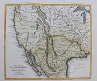
1861ref. M9549New York: Thomas Ford c.1861. Very Good. Notes: Detailed map of the western United States and Mexico. Size : 180x208 mm 7.09x8.19 Inches Coloring: Hand Colored Category: Maps Central America Mexico; Maps United States; Thomas Ford unknown
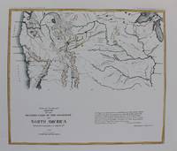
1861ref. M9550New York: Thomas Ford c.1861. Very Good. Notes: Map of the Western United States. Size : 178x205 mm 7.01x8.07 Inches Coloring: Hand Colored Category: Maps United States West; Thomas Ford unknown