6901 resultados
ref. 56-0408San Francisco Calif.: Southern Pacific Company 1923 rev. 1960. Blueline print 24" x 56". From Foribunda Avenue and California Drive to Villa Terrace Street. Includes Burlingame Public Park Burlingame High School business names along railroad tracks plot numbers within 1100' each side of tracks. Scale 1" = 100'. San Francisco, Calif.: Southern Pacific Company, 1923, rev. 1960. unknown
ref. 58-0559San Francisco Calif.: Southern Pacific Company 1947. Blueline print 24 inches x 55 inches red pencilling indicates cannery. Top half of map runs from S. Twelfth Street to Front Street along Trade Street bottom half runs from Trade Street to D Street along Front Street. Includes California Packing Company Williamette University Oregon Paper and Pulp Co. many other businesses. Scale: 1 inch = 100 feet. San Francisco, Calif.: Southern Pacific Company, 1947. unknown
ref. 56-0272San Francisco Calif.: Southern Pacific Company 1960. Map. Blueline print 24" x 59" Pencil note indicates "Sh 1 of 2." From Emerald St in University Addition to Oak St. With Williamette River Eugene Mill and Elevator Company Pacific Highway. Scale 1" = 100'. San Francisco, Calif.: Southern Pacific Company, 1960. unknown
ref. 56-0340Sacramento Calif.: Southern Pacific Company 1923. Map. Blueprint 24" x 55". Including Essex Lumber Co. Essex Lumber turn off Stock Corral. Scale 1" = 100'. Sacramento, Calif.: Southern Pacific Company, 1923. unknown
ref. 58-0474San Francisco Calif.: Southern Pacific Company 1924 rev. 1935. Blueprint 24 inches x 56 inches. From Charter Street to Seventh Avenue. Includes Dumbarton Dumbarton Oaks North Fair Oaks abandoned station Beston Progress Lumber Co San Francisco Water Dept. Scale 1 inch = 100 feet. San Francisco, Calif.: Southern Pacific Company, 1924, rev. 1935. unknown
ref. 58-0519San Francisco Calif.: Southern Pacific Company 1930 rev. 1941. Blueline print 24 inches x 55 inches. From railroad tracks beyond Front Street to Thirteenth Street. Includes San Joaquin Cotton Oil Compnay New Fertilizer Plant California Land and Cattle Company Giffin & Trout Cotton Gin Madera County Fairgrounds. Scale 1 inch = 100 feet. San Francisco, Calif.: Southern Pacific Company, 1930, rev. 1941. unknown
ref. 56-0351San Francisco Calif.: Southern Pacific Company 1930 revised 1940. Map. Blueline print 24" x 55". Includes San Tomas Aquino Road Pollard Road Pacific Coast Aggregates Inc Isabel R. Smith tract Growers' Packing and Warehousing Ass'n Plant and station points Vasona Vasona Junction Bulwer. Scale 1" = 100'. San Francisco, Calif.: Southern Pacific Company, 1930, revised 1940. unknown
ref. 56-0388Portland Ore.: Southern Pacific Company 1958 rev. 1961. Blackline print 24" x 56". Sheet two of two. From Calapooia River to Main Street. Includes Monteith's Southern Addition Hackleman's First Addition Willamette River Albany Planing Mill Ryal's Feed and Seed. Scale 1" = 100'. Portland, Ore.: Southern Pacific Company, 1958, rev. 1961. unknown
ref. 56-0312San Francisco Calif.: Southern Pacific Company 1923 revised 1954. Map. Blueline print 24" x 55" From Linden Ave to beyond San Bruno Ave. Includes Herman St San Mateo Ave E.I. du Pont de Nemours Co Colorado Fuel and Iron Co. Scale 1" = 100'. San Francisco, Calif.: Southern Pacific Company, 1923, revised 1954. unknown
ref. 56-0395Sacramento Calif.: Southern Pacific Company 1945 Rev. 1959. Blueline print 24" x 56". From Placer High and Junior College to Colfax Avenue. Includes station point Auburn buildings on Linden Avenue Auburn Lumber Hotel Walsh Bros Diamond Gardner Corp businesses along railroad tracks Railroad Street and Borland Street. Scale 1" = 100'. Sacramento, Calif.: Southern Pacific Company, 1945, Rev. 1959. unknown
ref. 56-0318San Francisco Calif.: Southern Pacific Company 1923 revised 1947. Map. Blueline print 24" x 55" With 10" and three smaller tears no missing material. From railroad tracks beyond Tanforan Ave to beyond San Bruno Ave. Includes station points Tanforan and San Bruno Herman St Heintz and Kaufman Inc American Brake Shoe & Foundry Co Richmond Pottery. Scale 1" = 100'. San Francisco, Calif.: Southern Pacific Company, 1923, revised 1947. unknown
ref. 56-0406Sacramento Calif.: Southern Pacific Company 1946 Rev 1952. Blueline print 24" x 56". From beyond Folsom Boulevard and 65th Street to Sutter Avenue and Railroad Avenue. Includes Brighton townsite Sacramento Box and Lumber McGillvray Construction A Teichert and Sons Contractors Harelson Feed. Scale 1" = 100'. Sacramento, Calif.: Southern Pacific Company, 1946, Rev 1952. unknown
ref. 56-0368San Francisco Calif.: Southern Pacific Company revised 1952. Map. Blueline print 24" x 56". From slough to Weeks St. Includes Chipman Chemical Co Calstone Co W.A. Horab plot proposed subdivision of HILP Property Ravenswood station point. Scale 1" = 100'. San Francisco, Calif.: Southern Pacific Company, revised 1952. unknown
ref. 56-0217Southern Pacific Company 1940. Map. Blackline print. 22 x 51 inches. Green and red highlighting. Includes all switching points between Cowden and Tempe. Scale: 1 inch = 1/2 mile. Southern Pacific Company, 1940. unknown
ref. 58-0500San Francisco Calif.: Southern Pacific Company n.d. Blueline print 36 inches x 42 inches. From Portola Avenue to Giant Sobrante Avenue. Includes Richmond Belt San Pablo Bridge Giant Harbor Channel Inner Harbor Basin station points Stege and Richmond. Scale 1 inch = 1000 feet. San Francisco, Calif.: Southern Pacific Company, [n.d.] unknown
ref. 56-0457San Francisco Calif.: Southern Pacific Company 1933. Blueline print 24" x 56". From approx 3 miles southwest of station point Lockeford to 1 1/2 mile northeast of station point. Includes Small Farms Improvement Tract. With Schedule of Property listing 18 transfers 1882 - 1933. Scale 1" = 400'. With inset showing details of property scale 1" = 100'. San Francisco, Calif.: Southern Pacific Company, 1933. unknown
1946ref. 1492Washington DC: U. S. Government Printing Office 1946. Presumed First Edition First printing thus. Hardcover. Good. Volume I xv 1 1-286 pages. Volume II 287-576 pages. 2 volumes. Illustrations. Maps. Tables. Index. Boards scuffed rough spots inside boards. Name in ink inside front board. Ex-Library with usual library markings such as library stamp on fore-edges & page iii. The United States Strategic Bombing Survey was a written report created by a board of experts assembled to produce an impartial assessment of the effects of Anglo-American strategic bombing of Nazi Germany during the European theater of World War II. After publishing its report the Survey members then turned their attention to the efforts against Imperial Japan during the Pacific War including a separate section on the recent use of the atomic bombs. In total the reports contained 208 volumes for Europe and another 108 for the Pacific comprising thousands of pages. The reports' called strategic bombing "decisive". This is designated OPNAV-P-03-100. It includes lists of Interrogations arranged numerically and by subject matter. It has an index of major battles operations and Japanese officials It includes in volume II Japanese notes of battles and brief biographies of Interrogated Japanese Officials. The interrogations were conducted in Tokyo during the final months of 1945. The purpose of the interrogations was to gain evidence for an assessment of the role of airpower in the war with Japan. Permission was obtained from General MacArthur to retain a nucleus of experienced officers at the Naval War College at Hiyoshi. In addition to being interrogated on their particular specialties and experiences these officers performed research at the direction of the Naval Analysis Division and together with the Japanese Naval Liaison Officer gave useful assistance in identifying and procuring other officers for interrogation. U. S. Government Printing Office hardcover
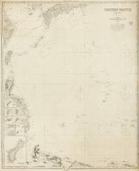
1884ref. 143681London: James Imray and Son 1884. Very Good. London James Imray and Son 1884. A very large engraved chart printed on two sheets combined printed surface 1268 × 1015 mm overall total size 1280 × 1048 mm mounted on the original blue backing paper with the publisher's title-label on the verso. Chips and short tears to the margins in a few places clear of the printed surface; a few small light stains and other minor signs of age and handling; in very good condition with faint pencil annotations tracking a voyage to Hangzhou in September 1888. A very large and detailed blueback chart of the western rim of the Pacific Ocean including the East China Sea Philippine Sea and parts of the coastlines of Japan Korea China Taiwan the Philippines and New Guinea. It features eight inset charts: Guajan Island; Borodino Island; Umata Bay; Farralon de Medinilla; Rota; Alamagan; Guguan; and Rosario Island. Both sheets incorporate corrections to June 1884. The title-label on the verso reads 'Chart No 193. Western Pacific in Seven Charts. Chart No. 4. Price 8s.'. James Imray and Son unknown
1999430 pages, b&w photos, book shows light wear to covers only, text/interior is clean and free of marking of any kind. Inscribed on half-title page. Table of contents available as photo. 12 chapters in three parts: Where the lagoon is not lonely: rediscovering a forgotten aspect of Polynesian culture, As tide goes by: the anthropology of the Tonan land and seascape, and Coral gardens and their "science": the ethnobiological aspects of marine gathering. Bibliography, 26 item list of tables, 75 item list of figures.
2001Roy. 8vo., Second Edition, with title-vignette, numerous photographs and illustrations throughout, and endpaper maps; green cloth, upper board blocked in colours, backstrip lettered in yellow, a near fine copy. Much-needed reissue of the original edition of 1949. NOW SCARCE IN ITS OWN RIGHT. Enser, p.456 (recording the original edition).
1999ref. x-041517886XRoutledge 1999. Hardcover. New. 1st edition. 255 pages. 8.50x5.50x1.00 inches. Routledge hardcover
1983ref. 2080202102502077Kogyosho Oki Shou Education Publishing 1983. Soft Cover. Fine. The book is in fine condition. Kogyosho Oki Shou Education Publishing paperback
2004ref. x-0415280567Curzon Pr 2004. Hardcover. New. 1st edition. 288 pages. 9.25x6.25x1.00 inches. Curzon Pr hardcover
1998ref. x-0415183022Routledge 1998. Hardcover. New. 1st edition. 348 pages. 9.75x6.50x1.25 inches. Routledge hardcover
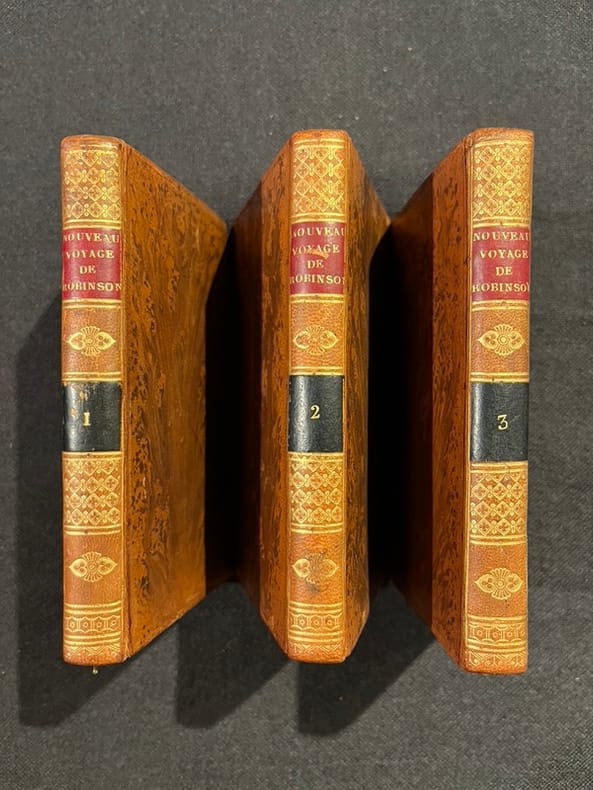
1804ref. 15855Paris, Cordier et Legras, 1804. 3 volumes in-12 de [4]-VIII-182; [4]-176 et [4]187-[1] pages, plein veau raciné, dos lisses ornés de filets et fleurons dorés, pièces de titres et tomaison rouge et noire.