Admiralty ChartsMareMagnum

7.338 Ergebnisse
900Anchorages in the Solomon Islands. In the left part of the chart insert of Kunggava Bay From a sketch by Lieut. Com. R. Crookshank, 1928, Queen Carola Harbour From a German Government Survey, 1883, Wanderer Bay By Capt. H.M. Denham, 1855. In the middle part of the chart insert of Port Adam By W. Hilliard, Master H.M.S. Havannah 1850, Mallu Harbour By M.r Haddock, 1877, Astrolabe Harbour By Mons.r Marescot, Enseigne de Vaisseau Corvette Astrolabe French Royal Navy 1838, Cockatoo Anchorage By T.C. Tilly, Master, H.M.S. Cordelia, 1861, Aowawa Roadstead By Capt. H.M. Denham, 1854. In the right part of the chart insert of Hada or Recherche Bay By T.C. Tilly, Master, H.M.S. Cordelia, 1861, Kwakwaru and Kwi Harbours Sketch by M.r W.T. Wawn 1888, Port Mary By Lieut. C.F. Oldham, 1882, Makira Bay By Capt. H.M. Denham, 1855, Hunter Roadstead By Capt. H.M. Denham, 1854, Popau H.r Sketch by M.r R. Haddock, 1877. London Published at the Admiralty March 10th 1864, under the Superintendence of Capt. G.H. Richards, Hydrographer. Small corrections. Autore: Admiralty Charts. Luogo: Salomon Islands - Pacific Ocean. Anno: '900. Tecnica: incisione. Dimensioni: 643x495 mm
900Anchorages in Ysabel Island. In the left side of the chart insert of Kesuo Cove Surveyed by Lieutenant F.C.C. Pasco, assisted by Lieuts. C.E. Stainer, R. Aylen and K. Mackenzie-Grieve, H.M. Surveying Ship "Dart" 1902. In the right side of the chart insert of Tunnibuli Surveyed by Lieutenant F.C.C. Pasco, assisted by Lieuts. C.E. Stainer, R. Aylen and K. Mackenzie-Grieve, H.M. Surveying Ship "Dart" 1902. London Published at the Admiralty, 21st Dec. 1903, under the Superintendence of Rear Admiral Sir W.J.L. Wharton, Hydrographer. Small corrections: 1919. Autore: Admiralty Charts. Luogo: Ysabel Island - Salomon islands - Pacific Ocean. Anno: '900. Tecnica: incisione. Dimensioni: 461x662.
900Anchorages in Ysabel Island. In the left side of the chart insert of Korrigole Harbour Surveyed by Lieutenant F.C.C. Pasco, assisted by Lieuts. C.E. Stainer, R. Aylen and K. Mackenzie-Grieve, H.M. Surveying Ship "Dart" 1902. In the right side of the chart insert of Vulavu Anchorage Surveyed by Lieutenant F.C.C. Pasco, assisted by Lieuts. C.E. Stainer, R. Aylen and K. Mackenzie-Grieve, H.M. Surveying Ship "Dart" 1902. London Published at the Admiralty, 11th Dec. 1903, under the Superintendence of Rear Admiral Sir W.J.L. Wharton, Hydrographer. Small corrections: 1920. Autore: Admiralty Charts. Luogo: Ysabel Island - Salomon islands - Pacific Ocean. Anno: '900. Tecnica: incisione. Dimensioni: 457x652 mm
900Rough Sketches of Anchorages in the Solomon Islands. By M.r W.T. Wawn, Master, Brigantine "Ariel", 1888. In the left side of the chart insert of Tasman I.s or Niumanno Atoll, Atta Cove, Ariel Harbour From a Survey by Lieut. A.L. Jackson, under the direction of Lieut. Com. R.L. Hancock, H.M. Surveying Ship "Sealark", 1914, Manna Kwoi H.r. In the middle part of the chart insert of Deep Bay, Uras Cove, North Sister Anchorage, Double Bay. In the right side of the chart insert of Maramasike Passage. London Published at the Admiralty, 7th Oct. 1889, under the Superintendence of Captain W.J.L. Wharton, Hydrographer. Small corrections: 1930. Folded editorially. Autore: Admiralty Charts. Luogo: Salomon Islands - Pacific Ocean. Anno: '900. Tecnica: incisione. Dimensioni: 512x741 mm
1886In 8. Dim. 19x12 cm. Pp. 281+(3). Interessante opera di viaggi del 1886 di Albert David che descrive il suo viaggio lungo l'Oceano Pacifico. All'interno sono presenti dieci incisioni fuori testo che mostrano vedute: Baie Borja, Lima, Indiani peruviani, Tahiti ecc... Tra i luoghi descritti: Distretto di Magellano e Canali laterali della Patagonia, Lima durante vl'occupazione cilena, Valparaiso e i Cileni dopo la Guerra del Pacifico, Peru e Cile, Callao, Pisco, Pisagua, Arica e Tacna, Iquique, Lota, Una necropoli degli Incas, Honolulu, Un mese a Noukahiva, Tahiti ecc... In buone condizioni e completo Copertina editoriale in buone condizioni generali con lievi usure ai margini e dorso. Legatura in buone condizioni. All'interno le pagine si presentano in buone condizioni con fioriture. Interesting work of travel of 1886 written by Albert David describing his travel in the Pacific Ocean. Inside there are ten out of text planches showing different views: Baie Borja, Lima, Peruvian Indians, Tahiti ecc... Between the places described: District of Magellano and channels of Patagonia, Lima during Chile occupation, Valparaiso and Cileni after Pacific war, Peru and Cile, Callao, Pisco, Pisagua, Arica e Tacna, Iquique, Lota, a city of Incas, Honolulu, a month in Noukahiva, Tahiti ecc... In good conditions and complete. Editorial cover in good general conditions slightly worn in the edges and spine. Binding in good conditions. Inside pages are in good conditions with foxings.
1879In 8 (cm 18 x 27), pp. 14. Piatto anteriore originale, piatto posteriore rifatto con carta d'epoca. Rara e importante pubblicazione con l'accordo siglato da Balmaceda con Manuel Montes de Oca: l'accordo prevedeva che l'Argentina avrebbe mantenuto una posizione di neutralita' e non avrebbe tratto vantaggio dalle difficolta' del Cile nel conflitto del Pacifico. La guerra del Pacifico fu un combattuta tra il Cile e le forze alleate di Bolivia e Peru' dal 1879 al 1884; e' anche conosciuta come guerra del salnitro.
Best.-Nr. LBW02e67circa 1840 217 x 288 mm.
1998Best.-Nr. EA414601998 [4], 223 p., 7 figures, cloth. Monographs on Invertebrate Taxonomy Volume 6. Library stamps, else a very good copy.
1782Best.-Nr. LBW-5810[1782]. 172 x 221 mm.
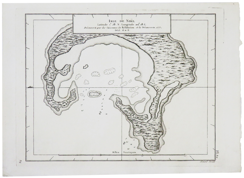
1774Carta geografica tratta dall'atlante della relazione di James Hawkesworth "Cartes et figures des voyages entrepris par ordre de sa Majesté Britannique pou fair des découvertes dans l'hémisphère méridional; exécutes par Byron, Carteret, Wallis & Cook dans les vaisseaux le Dauphin, Le Swallow & l'Endeavour" pubblicata in più edizioni di lingua francese, inglese, olandese ed italiano. Incisione in rame, in ottimo stato di conservazione. Map of the atlas is the report by James Hawkesworth "Cartes et figures des voyages entreprise par ordre de sa Majesté Britannique pou fair des découvertes dans l'Hémisphère southern exécutes par Byron, Carteret, Wallis and Cook dans les vaisseaux le Dauphin, Le Swallow & Endeavour "published in multiple editions of the English, French, Dutch and Italian.
1774Carta geografica tratta dall'atlante della relazione di James Hawkesworth "Cartes et figures des voyages entrepris par ordre de sa Majesté Britannique pou fair des découvertes dans l'hémisphère méridional; exécutes par Byron, Carteret, Wallis & Cook dans les vaisseaux le Dauphin, Le Swallow & l'Endeavour" pubblicata in più edizioni di lingua francese, inglese, olandese ed italiano. Incisione in rame, in ottimo stato di conservazione. Map of the atlas is the report by James Hawkesworth "Cartes et figures des voyages entreprise par ordre de sa Majesté Britannique pou fair des découvertes dans l'Hémisphère southern exécutes par Byron, Carteret, Wallis and Cook dans les vaisseaux le Dauphin, Le Swallow & Endeavour "published in multiple editions of the English, French, Dutch and Italian.A map of the southernmost part of van Diemens Land.
1774Carta geografica tratta dall'atlante della relazione di James Hawkesworth "Cartes et figures des voyages entrepris par ordre de sa Majesté Britannique pou fair des découvertes dans l'hémisphère méridional; exécutes par Byron, Carteret, Wallis & Cook dans les vaisseaux le Dauphin, Le Swallow & l'Endeavour" pubblicata in più edizioni di lingua francese, inglese, olandese ed italiano. Incisione in rame, in ottimo stato di conservazione. Map of the atlas is the report by James Hawkesworth "Cartes et figures des voyages entreprise par ordre de sa Majesté Britannique pou fair des découvertes dans l'Hémisphère southern exécutes par Byron, Carteret, Wallis and Cook dans les vaisseaux le Dauphin, Le Swallow & Endeavour "published in multiple editions of the English, French, Dutch and Italian.A map of Tasmania surveyed by Captain James Cook (1728-79), explorer, circumnavigator and hydrographer.
1774Carta geografica tratta dall'atlante della relazione di James Hawkesworth "Cartes et figures des voyages entrepris par ordre de sa Majesté Britannique pou fair des découvertes dans l'hémisphère méridional; exécutes par Byron, Carteret, Wallis & Cook dans les vaisseaux le Dauphin, Le Swallow & l'Endeavour" pubblicata in più edizioni di lingua francese, inglese, olandese ed italiano. Incisione in rame, in ottimo stato di conservazione. Map of the atlas is the report by James Hawkesworth "Cartes et figures des voyages entreprise par ordre de sa Majesté Britannique pou fair des découvertes dans l'Hémisphère southern exécutes par Byron, Carteret, Wallis and Cook dans les vaisseaux le Dauphin, Le Swallow & Endeavour "published in multiple editions of the English, French, Dutch and Italian.Four clear and detailed charts of landing places on Tahiti and the Society Islands. Based on Captain Cook's surveys of the area, these charts are notable for their depictions of treacherous coral reefs in addition to hidden rocks and sandbanks. Depths, watering-places and safe anchorage points are shown.
1774Carta geografica tratta dall'atlante della relazione di James Hawkesworth "Cartes et figures des voyages entrepris par ordre de sa Majesté Britannique pou fair des découvertes dans l'hémisphère méridional; exécutes par Byron, Carteret, Wallis & Cook dans les vaisseaux le Dauphin, Le Swallow & l'Endeavour" pubblicata in più edizioni di lingua francese, inglese, olandese ed italiano. Incisione in rame, in ottimo stato di conservazione. Map of the atlas is the report by James Hawkesworth "Cartes et figures des voyages entreprise par ordre de sa Majesté Britannique pou fair des découvertes dans l'Hémisphère southern exécutes par Byron, Carteret, Wallis and Cook dans les vaisseaux le Dauphin, Le Swallow & Endeavour "published in multiple editions of the English, French, Dutch and Italian.A map of Tasmania surveyed by Captain James Cook (1728-79), explorer, circumnavigator and hydrographer.
1797Carta geografica tratta dall'atlante della relazione di James Hawkesworth "Cartes et figures des voyages entrepris par ordre de sa Majesté Britannique pou fair des découvertes dans l'hémisphère méridional; exécutes par Byron, Carteret, Wallis & Cook dans les vaisseaux le Dauphin, Le Swallow & l'Endeavour" pubblicata in più edizioni di lingua francese, inglese, olandese ed italiano. Incisione in rame, in ottimo stato di conservazione. Map of the atlas is the report by James Hawkesworth "Cartes et figures des voyages entreprise par ordre de sa Majesté Britannique pou fair des découvertes dans l'Hémisphère southern exécutes par Byron, Carteret, Wallis and Cook dans les vaisseaux le Dauphin, Le Swallow & Endeavour "published in multiple editions of the English, French, Dutch and Italian.
1785Best.-Nr. PHO-2103Paris, Hôtel de Thou, 1785, 1 volume in-4 (20x26cm), reliure d’attente, frottements, manque au dos, à grandes marges, tel que paru, sans les planches qui n’ont pas été relié dans cet exemplaire
1928Best.-Nr. PHO-2641London, Faber & Gwyer, 1928, in-8, XII-341pp., reliure éditeur en toile, plats muets, titre au dos, cartes aux gardes, dos décoloré, 2 illustrations, étiquette de Berkelouw Booksellers, Sydney, ex-libris H.A.H. Driessen, historien et chercheur spécialiste de la Polynésie et de l’histoire du Pacifique.
1974Best.-Nr. 011773Cymbalum Pataphysicum, 9 haha 104 - 14 octobre 1976 - ?Coll. "Maramoutéenne" n° 1 1974 In-4 En feuilles sous chemise rabat
Best.-Nr. 500344965EDITIONS DE CREMILLE Sans date. Le livre 'Pacifique Sud' de James A. Michener est un roman qui plonge le lecteur dans l'univers exotique de cette région évoquant les paysages l'océan et les îles. Il s'agit d'un voyage poignant qui met en lumière les marques indélébiles laissées par l'amour et la perte en temps de tourmente faisant du Pacifique Sud à la fois une scène de drame déchirant et un sanctuaire d'espoir
2007Best.-Nr. CO344532007 vii, 433 p., 187 figs & pls, hardbound. Crustaceana Monographs 7. First free end-paper with Dr. L.B. Holthuis’s library stamp, outer ends text a little wrinkled, but else very good copy.
1897Best.-Nr. IC267041897 xi, 174 p., num. figs, 1 folded map, modern boards. . With library stamp on first blank end-paper. Scarce.
1903Best.-Nr. BT056641903-1907 Parts 1-9. [6], 294 p., 44 pls, roy. 4to, in issues all in original printed covers. Good copy of the first 9 parts of this great standard work on Eucalyptus trees.
1910Best.-Nr. BT085001910-1914 Parts 11-20 & title-page & index (= volume 2);. xi, 1-133 & 165-311, [1] p., 36 (of 40) pls, roy. 4to, in issues (all in original printed covers). Part 14 is missing, almost complete copy of the second volume of this great standard work on Eucalyptus trees.
1980Best.-Nr. EC407081980-1997 50, 64, 60, 68, 67, 75, 61 p., numerous figures and plates, paperbound. Library stamps, else good set.
1888Best.-Nr. 1318127Leipzig, E. Baldamus, 1888. 6, 487, (1) S. Hldrbd d. Zeit m. eingebund. OUmschlag (beschabt, innen gebräunt u. teils etwas fingerfleckig, mehrere Bibl.-Stempel u. handschriftl. Sign.).