7.039 Ergebnisse
1986Best.-Nr. 777309PN. New. 1986. Soft Cover. Date is original print. This is a reprint edition. . PN paperback
Best.-Nr. DADAX0313293260New unknown
Best.-Nr. MA11Q-00095Union Pacific Railroad. Collectible - Very Good. n.p.: Union Pacific Railroad n.d. ca. 1955. Sm 4to. Loose leaf bound with brass fasteners. Unpaginated. Near Fine book. Light wear to covers else Fine. Railroads Cookbook Inquire if you need further information. Union Pacific Railroad unknown
1998Best.-Nr. x-0415183030Routledge 1998. Paperback. New. 1st edition. 348 pages. 9.50x6.50x1.25 inches. Routledge paperback
Best.-Nr. MA07C-04408Union Pacific Railroad. Collectible - Good. Union Pacific Railroad No date stated ca. 1940's-50's. Sm 4to Paperback. Paginated by section. Near Very Good book. trains locomotives cookbook cooking recipes Inquire if you need further information. Union Pacific Railroad paperback
2010Best.-Nr. 1350728PN. New. 2010. Soft Cover. Date is original print. This is a reprint edition. . PN paperback
Best.-Nr. ria9781806860142_inpHardcover. New. New Book; Fast Shipping from UK; Not signed; Not First Edition; With an emphasis on the cognitive transformation that often accompanies such travels A Guidebook to Ethical Spiritual Travel provides both historical context and practical advice to navigate the complex landscape of contemporary spirit hardcover
Best.-Nr. ria9781806860180_inpHardcover. New. New Book; Fast Shipping from UK; Not signed; Not First Edition; With an emphasis on the cognitive transformation that often accompanies such travels Spiritual Tourism and Landscape provides both historical context and practical advice to navigate the complex landscape of contemporary spiritual tour hardcover
Best.-Nr. DADAX0230013309New unknown
Best.-Nr. DADAX0387715428New unknown
Best.-Nr. 19488Paris, Boivin, collection "Voyages Excentriques", 1931, 1 pleine toile rouge restaurée, illustration originale rouge et noire du 1er plat conservée (ballon, avion, dirigeable, automobile, paquebot, locomotive), titre dans un médaillon central ornemental. in-4 de 420 pages, illustrations de Louis Tinayre ;
1990Best.-Nr. 201740Broadbeach QLD. Pacific Books. 1990. 4to. Or.cloth-backed boards. 317274256230pp. With fold-out maps. Fine set. Originally published in 1944-45. The set Volume 3. Malaya Thailand Indo China the China Coast and the Japanese Empire. Volume 4. With an introduction by General Douglas MacArthur United States Army Broadbeach, QLD. Pacific Books. hardcover
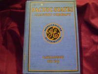
1929Best.-Nr. 217023np.: General Electric. 1929. First edition. . Decorated hard cover. . Fine copy very light soiling to covers. 4to. Illustrated. Important reference work. Very scarce in this condition. General Electric. hardcover
Best.-Nr. DADAX0898382904New unknown
1970Best.-Nr. 510089University of Washington 1970. Hardcover. GOOD. Complete in two volumes. 706pp printed one-sided. 8x11 black cloth. Some foxing and dampstains occasional penciling. An extensively researched record of the subject with a great deal of unique material. Feig's dissertation was never published; her scholarly attention turned towards the Holocaust after receiving her Ph.D. publishing the acclaimed work Hitler's Death Camps in 1979. University of Washington hardcover
Best.-Nr. SONG0851157211Used: Good unknown
1915Best.-Nr. 13800San Francisco: Pacific Novelty Co 1915. Limited Edition. Very Good. 10x13in oblong unpaginated 32 pp. 31 tipped in color prints from images including a fold out aerial view by photographer Gabriel Moulin with tissue guard; Light green heavy paper wrapper with embossed dark green lettering designs and embossed light blue frame border with mounted color print of Exposition buildings from the San Francisco bay on front green cord three point tied binding prints are 6.5x8.5in and fold out print 9x23.5in; Some shelf wear to covers edges and corners with some fading creases at corners and edges some rubbing and soiling several prints have minor creases at corners one print with several light red markings tissue guard at fold out print creased page six is blank and shows no evidence of a print removed. The Panama-Pacific International Exposition PPIE was a major west coast event in 1915. This was an early promotional souvenir albums of the PPIE. The prints are vibrant in colors and clarity. The fold out "Aeroplane View. from Silas Christofferson .at an altitude of 1500 feet" is especially impressive with the color printing of the PPIE grounds over a black and white image of San Francisco. The image -is dated 1914 likely just prior to the official opening by Gabriel Moulin 1872-1945. Moulin was a well known San Francisco architectural photographer of building interiors and views of San Francisco. Likely he hired aviator Silas Christofferson 1890-1916 to take the aerial images. Christofferson was a partner with another early aviator Fred Bennett in an Airship company. In 1914 he set a national record of reaching an altitude of almost 16000 feet flying over Mt. Whitney. The 1915 Panama-Pacific International Exposition PPIE was a significant event for San Francisco California and the United States. The planning for the exposition began in 1904 two years before the devastating 1906 earthquake and fire destroyed most of the City and caused significant damage to most of the bay area. As part of the rebuilding and recovery efforts for San Francisco the PPIE world fair opened in February 1915 to enthusiastic crowds. The over 600 acres were beautifully designed and promoted as a community of eleven exhibition "palaces" 21 foreign pavilions 48 State buildings and a 65 acre amusement zone. The design of the buildings and grounds was an inspirational mix of Greco Romanesque style with modern architectural artistic and technological elements. Until closing in December 1915 over 18 million visitors enjoyed the exposition the City and California. After closing most of the "temporary" buildings were demolished except for the Fine Arts Palace lake and grounds designed by Bernard Maybeck and still in use in 2021 and a few others relocated. The San Francisco Legion of Honor art museum is a replica of the PPIE French pavilion. The land was intended to be sold off for residential and commercial development which is now known as the Marina District. Pacific Novelty Co unknown
Best.-Nr. 9290614196.Gpaperback. Good. Access codes and supplements are not guaranteed with used items. May be an ex-library book. paperback
Best.-Nr. A9789210035040Paperback / softback. New. paperback
1971Best.-Nr. 741194PN. New. 1971. Soft Cover. Date is original print. This is a reprint edition. . PN paperback
1787Carta geografica tratta dal “Atlas encyclopédique, contenant la géographie ancienne et quelques cartes sur la géographie du Moyen Âge, la géographie moderne, et les cartes relatives à la géographie physique” di Rigobert Bonne e Nicolas Desmarest, edito a Parigi nel 1787-88, "Par M. Bonne, Ingénieur-Hydrographe de la Marine, et par M. Desmarest, de L'Académie Royale des Sciences".Il Bonne è stato uno tra i cartografi francesi più influenti del settecento, tanto da venir scelto quale successore di Jacques Nicolas Bellin al Depot de la Marine come idrografo di Sua Altezza Reale Luigi XVI.L'Atlas Encyclopédique, opera che il Bonne portò a termine con l'ausilio di Nicholas Desmarest, costituisce il suo lavoro di maggior fama.Incisione in rame, in buono stato di conservazione. Map taken from the “Atlas encyclopédique, contenant la géographie ancienne et quelques cartes sur la géographie du Moyen Âge, la géographie moderne, et les cartes relatives à la géographie physique” by R. Bonnè and Nicolas Desmarest, printed in Paris "Par M. Bonne, Ingénieur-Hydrographe de la Marine, et par M. Desmarest, de L'Académie Royale des Sciences", 1787-88.Bonne was one of the most influential French cartographers of the eighteenth century, so much so that he was chosen as the successor of Jacques Nicolas Bellin to the Depot de la Marine as a hydrograph of His Royal Highness Louis XVI.The Atlas Encyclopédique, that Bonne completed with the help of Nicholas Desmarest, constitutes his most famous work.Copperplate, in good conditions.
Best.-Nr. P28632Canadian Pacific: ca. 1920 Canada large deck-plan with many photos of the interior of the Empress of Britain I. On the edges Vulnerable overall in fair condition unknown
Best.-Nr. P21823Canadian Pacific: 1912 Canada softcover folding-out 16 pages with the traject on the map of Canada and the layout of some Coaches. The other side the outside and the interior of the different Coaches and Steamtrain Loc. Brochure in very good condition and very rare. paperback
1774Carta geografica tratta dall'atlante della relazione di James Hawkesworth "Cartes et figures des voyages entrepris par ordre de sa Majesté Britannique pou fair des découvertes dans l'hémisphère méridional; exécutes par Byron, Carteret, Wallis & Cook dans les vaisseaux le Dauphin, Le Swallow & l'Endeavour" pubblicata in più edizioni di lingua francese, inglese, olandese ed italiano. Incisione in rame, in ottimo stato di conservazione. Map of the atlas is the report by James Hawkesworth "Cartes et figures des voyages entreprise par ordre de sa Majesté Britannique pou fair des découvertes dans l'Hémisphère southern exécutes par Byron, Carteret, Wallis and Cook dans les vaisseaux le Dauphin, Le Swallow & Endeavour "published in multiple editions of the English, French, Dutch and Italian.Map of the harbour of Tongataboo, one of the Tonga Islands.
1774Carta geografica tratta dall'atlante della relazione di James Hawkesworth "Cartes et figures des voyages entrepris par ordre de sa Majesté Britannique pou fair des découvertes dans l'hémisphère méridional; exécutes par Byron, Carteret, Wallis & Cook dans les vaisseaux le Dauphin, Le Swallow & l'Endeavour" pubblicata in più edizioni di lingua francese, inglese, olandese ed italiano. Incisione in rame, in ottimo stato di conservazione. Map of the atlas is the report by James Hawkesworth "Cartes et figures des voyages entreprise par ordre de sa Majesté Britannique pou fair des découvertes dans l'Hémisphère southern exécutes par Byron, Carteret, Wallis and Cook dans les vaisseaux le Dauphin, Le Swallow & Endeavour "published in multiple editions of the English, French, Dutch and Italian.A map of the Tonga islands.