7001 risultati
rif. 56-0243Denver Colo.: The Weiland Engineering Co. 1930. Insets and notes 1937 1940. Map. Blueprint 41.5" x 51". Some tape on face some tearing no missing material. Map of Nogales within city limits. With additional engineering and survey notes and official approval notation by mayor and city hall. Zones labelled. Scale 1" = 200'. Denver, Colo.: The Weiland Engineering Co., 1930. Insets and notes, 1937, 1940. unknown
rif. 58-0511San Francisco Calif.: Southern Pacific Company 1950. Blueline print 34 inches x 67 inches. From Sacramento City Park beyond Marconi Avenue and Auburn Boulevard along railroad tracks. With Rancho Del Paso station points Swanston Haggin Benali. Includes Schedule of Property listing 18 transfers 1865-1950. Scale 1 inch = 400 feet. San Francisco, Calif.: Southern Pacific Company, 1950 unknown
rif. 56-0375Los Angeles Calif.: Southern Pacific Company 1942 revised 1962. Map. Blueline print. 24 x 91 inches. Light scuffmarks. Along San Fernando Road from Kellogg Avenue to Goodwin Avenue. Includes Los Angeles Channel Ralph's Grocery Co Cinch Products Stires Drill California Zonolight Co. With Schedule of Property listing approx 15 transfers 1925-1942. Scale: 1 inch = 100 feet. Los Angeles, Calif.: Southern Pacific Company, 1942, revised 1962. unknown
rif. 56-0469Stockton Calif.: Southern Pacific Company 1928 rev. 1941. Blueline print 24 inches x 13 feet. Three maps joined securely. From 3400' west of First Street Los Banos to 3000' east of Abatto along railroad tracks. With 6" tear no missing material. Details of all industries along railroad tracks. Including Los Banos Lumber & Supply Co Standard Oil Co Central California Creameries. Scale 1" = 100'. Stockton, Calif.: Southern Pacific Company, 1928, rev. 1941. unknown
rif. 58-0496San Francisco Calif.: Southern Pacific Company 1918 rev. 1945. Blueline print 24 inches x 47 inches. From Aqua station beyond South San Francisco to 3rd & Townsend Station Visitacion to Daly City. Includes track plans for South San Francisco Visitacion San Francisco Cemetaries. Scale not indicated. San Francisco, Calif.: Southern Pacific Company, 1918, rev. 1945. unknown
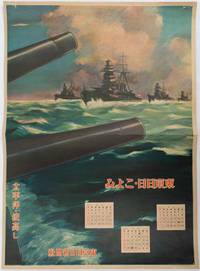
1619rif. 176888東京. Tokyo.: 東京日日新聞社. Tōkyō Nichinichi Shinbunsha. Showa 16 1941. Colour poster from a 1941 calendar. 53.5 x 38.5cm small holes at corners central horizontal fold. Some light even browning but overall a striking WWII image from a Japanese calendar. This colour illustrated calendar shows the months of March April and May 1941. The illustration features four Japanese war ships at sea with two naval guns in the foreground. The calendar is titled "Rough Sea on the Pacific Ocean". The implication being military threats are coming from across the Pacific. . 東京日日新聞社. [Tōkyō Nichinichi Shinbunsha]. unknown
1721rif. 011121Lucca: Per Vicenzo Giuntini A spese di Gio: Riccomini 1721 Book. Good. Full vellum. 227 1 pages. In old full vellum the boards having worming but this only goes into the text block as far as page 4. Spine damaged by worming. Some pages browned. Armorial bookplate to the front pastedown of Sylvester Lord Glenbervie and armorial bookplate to the front free end paper of H.F. Davies Elmley Castle. Ink letter R to the upper outer corner of the front free end paper. Per Vicenzo Giuntini A spese di Gio: Riccomini hardcover
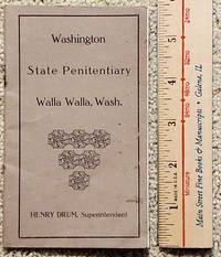
1916rif. 2306011Walla Walla: Washington State Penitentiary 1916. First Edition. Soft cover. Very Good. Original printing. Circa 1916. This rare little circa 1916 booklet 24pp features the mug shots front-facing and profile of twelve 12 escapees from various units of the prison system in Washington State. Each entry faces a blank page except the center two pages which features two entries. Most escapes occurred in 1915 and the reward was good until 1917. All rewards were for $100 except that R. H. Cook who only justified a $50 reward. He escaped from the Meskill Rock Quarry Lewis County Aug. 8 1915. He was a machinest who burgled. He is described as a "Nativity sic American." Bound with two staples the staples are rusted and the middle two sets of leave are just folded in. Rust showing showing of course on paper next to the staples. Henry Drum was the Superintendent serving as such 1913-1921. He was also a member of the first Washington State Senate as noted in his obit published in the Bellingham Herald. . We have located no other copies. Other than the rust staples vg condition. The "Pen" at Walla Walla was known not so affectionately as the "Concrete Mama." RARE. Washington State Penitentiary unknown
2002rif. DBS-9781402071430kluwer 2002. 1st. Hardcover. New. kluwer hardcover
2002rif. DBS-9781402071430kluwer 2002. 1st. Hardcover. New. kluwer hardcover
1851Decorativa carta geografica pubblicata in The Illustrated Atlas, And Modern History Of The World Geographical, Political, Commercial & Statistical… edito da John Tallis. Le mappe del The Illustrated Atlas non solo fornivano conoscenze geografiche aggiornate, ma utilizzavano anche viste a vignetta all'interno del disegno per mostrare i popoli nativi e le loro occupazioni, le città e i punti di interesse. Le mappe si rifanno alla tradizione cartografica dei cartografi olandesi del XVII secolo, con bordi decorativi finemente incisi. Le tavole sono state disegnate e incise da John Rapkin con vedute realizzate da una serie di artisti di spicco. Le mappe furono pubblicate in volume completo dal 1851 fino al 1865 circa. Alcune delle mappe furono pubblicate anche in altri libri di storia pubblicati da Tallis, tra cui quello sulle British Colonies e, senza le vignette, in dizionari geografici ed enciclopedie fino al 1880 circa. John Tallis (1817-1876) era un editore di mappe britannico. Nato nelle Midlands, Tallis arrivò a Londra negli anni '40 del XIX secolo. Tallis iniziò la sua carriera londinese con una serie di notevoli vedute stradali di Londra. Iniziò una collaborazione con un certo Frederick Tallis, forse suo fratello, ma la loro collaborazione terminò nel 1849. In occasione della Grande Esposizione del 1851, Tallis pubblicò il The Illustrated Atlas. Le mappe furono successivamente ristampate dalla London Printing & Publishing Company, che lasciò intatta l'imprint di Tallis, assicurandogli così una fama duratura. Incisione su acciaio, coloritura dei confini all'acquarello, in ottime condizioni. Islands outlined with gold and surrounded by illustrations of Auckland, Mount Egmont, a New Zealander, and the port of Wellington. Border in a New Zealand motif. Decorative map taken from The Illustrated Atlas, And Modern History Of The World Geographical, Political, Commercial & Statistical by John Tallis The maps from The Illustrated Atlas were first published in serial form to a target audience that led insular lives due to the expense and hardship of travel. All that changed as the progress of the nineteenth century brought swift and dramatic changes in public awareness of far away places. Tallis' maps no doubt played an important role in this dramatic awakening. These maps not only provided up-to-date geographical knowledge, but also used vignette views within the map's design to show the native people and their occupations, cities and points of interest. The maps hark back to a cartographic tradition from the Dutch mapmakers of the seventeenth century with finely engraved decorative borders. The maps were drawn and engraved by John Rapkin with views drawn and engraved by a number of prominent artists. The maps were issued as a complete volume from 1851 until about 1865. Some of the maps were also published in other history books published by Tallis including British Colonies and, without the vignettes, in geographical dictionaries and encyclopedias until about 1880. John Tallis (1817-1876) was a British map publisher. Born in the Midlands, Tallis came to London in the 1840s. Tallis began his London career with a series of remarkable London street views. He began a partnership with a Frederick Tallis, possibly his brother, but their collaboration ended in 1849. For the Great Exhibition of 1851, Tallis published the Illustrated World Atlas, one of the last series of decorative world maps ever produced. The maps were later reissued by the London Printing & Publishing Company, who left the Tallis imprint intact, thus ensuring his enduring fame. In 1858, he began publication of the popular Illustrated News of the World and National Portrait Gallery of Eminent Personages, selling it in 1861 (it ceased publication in 1863). Engraving, hand-coloured outlines, in very good condition.
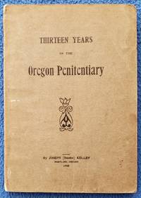
1908rif. 1812050Portland: Privately printed 1908. First Edition. Soft cover. Fair. 1st printing. Decorated wraps. 142pp. Illustrated with half-tone portraits & a drawing. Back cover detached & moderately edge chipped; last 25 pages coffee stained across bottom & top; slight page curling. The paper is good paper & very flexible. Graded fair with the various issues and price accordingly 6-guns 1218 references Harry Tracy & Dave Merrill material. A rare outlaw item. Privately printed unknown
rif. DADAX1741043042New unknown
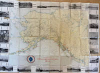
1917rif. List1730Chicago: Poole Brothers 1917. Folding map measuring 38 ½ x 26 ¾ inches. Tape repairs to verso some tears at folds and edges still bring and attractive good to very good overall with excellent restoration potential. A map of the canneries in Alaska British Columbia and Washington operated by the Deming and Gould Company who were influential in the growth of the Alaskan salmon trade. The map's date of printing 1917 suggests that perhaps it was related to the war effort as salmon demand increased during this period. The Demings based in Chicago were influential in the growth of the salmon trade in Alaska and the Pacific Northwest founding Pacific American Fisheries Inc. in 1899 and continuing in various iterations until their sale of the firm in 1934 due to president E.B. Deming's ailing health. The map shows seventeen different canneries several on the Alaska peninsula and the one in Bellingham. We find no record of this imprint only a later and small version held at the University of Washington. Poole Brothers unknown
1917rif. List1730Chicago: Poole Brothers 1917. Folding map measuring 38 ½ x 26 ¾ inches. Tape repairs to verso some tears at folds and edges still bring and attractive good to very good overall with excellent restoration potential. A map of the canneries in Alaska British Columbia and Washington operated by the Deming and Gould Company who were influential in the growth of the Alaskan salmon trade. The map's date of printing 1917 suggests that perhaps it was related to the war effort as salmon demand increased during this period. The Demings based in Chicago were influential in the growth of the salmon trade in Alaska and the Pacific Northwest founding Pacific American Fisheries Inc. in 1899 and continuing in various iterations until their sale of the firm in 1934 due to president E.B. Deming's ailing health. The map shows seventeen different canneries several on the Alaska peninsula and the one in Bellingham. We find no record of this imprint only a later and small version held at the University of Washington. Poole Brothers unknown books
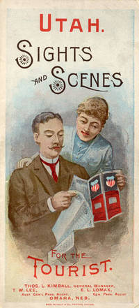
1888rif. 52275Chicago: Rand McNally & Co. Printers 1888. 1888. UTAH RAILROAD. First Edition. 8vo. 21.5 x 10 cm. 8 1/2" x 4" color pictorial wrappers. 48 pp. illustrated from photographs fold-out map 'Tourist Map of Union Pacific and Connecting Lines' 20.5 x 59 cm. 8 1/4" x 23 1/2" present at the rear. The map is in nice condition and provides an excellent panorama of the Union Pacific Railway. Lines in red and run from Kansas City Atchison and Omaha to Denver and south to Gunnison or west through Cheyenne Granger and onto Portland with a spur up to Helena or west through Ogden and onto San Francisco with a spur down to Los Angeles. Blue shaded illustrations surround the lines which include a plowing scene Union Depot Salt Lake City Garfield Beach a mining scene Falls of the Yellowstone a ranching scene etc. Union Pacific produced guide for the would-be tourist of Salt Lake City including a description of the Mormons and their customs. Illustrated with nine full-page engravings from photographs by C.R. Savage. Also provided are List of Agents. Pullman Palace Car rates. Information on Salt Lake City tours Salt Lake City and the area surrounding "The Temple City" Beck's Hot Springs the Great Salt Lake Giant's Cave at Garfield Beach Echo Canon Weber Canon the Devil's Gate Ogden Ogden Canon etc. Detailed information on 9 different tours touting what the tourist might see and do. Covers lightly used light wear to fore-edges else a very good copy. Rand, McNally & Co., Printers, [1888]. unknown
1785rif. 20120Paris, Hôtel de Thou, 1785. 4 volumes in-4 de [4]-CXXXII-437-[5]; [4]-422-[2]; [4]-488; [4]-552 pages, demi-basane brune à coins, dos lisses ornés de filets dorés, pièces de titre et tomaison beiges.
1856rif. 120572Washington D. C. A. O. P. : Nicholson Printer 1854-1856 1856. First Edition. Hardback. Very good copy in the original gilt-blocked cloth. Professionally recased with the original spine laid back; very impressively finished. Remains particularly well-preserved overall; tight bright clean and strong. Scans and additional detail on request. ; 1 pages; Physical desc. : 1 vol. various pagings : ill ; 30 cm. Subjects; Natural history - West U. S. . Indians of North America - West U. S. . Geology - California. Washington, D. C. , A. O. P. : Nicholson, Printer [1854-1856] hardcover
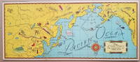
1934rif. 3798This delightful pictorial map focusing on the North Pacific Ocean was distributed as a premium in connection with the syndicated radio program "Air Adventures of Jimmie Allen." The program featuring Jimmie Allen as an adventurous 16-year old pilot ran from 1933 to 1937 and from 1946 to 1947 and was sponsored initially by the Skelly Oil Company. Background on the show appears on the Radio Days Theater of the Mind Museum website http://radiodaysmuseum.org: "Broadcast History: 1933 to 1937 and 1946 to 1947. The writers of Jimmie Allen had been flying aces in World War I. They came up with the idea of a show about a boy pilot while at a party in Kansas City and used their experience as pilots to create and write the show. The show was one of the first to capitalize on the idea of a club as a promotional tool. To join the Jimmie Allen Flying Club all a child had to do was apply at any Skelly Gas Station the initial sponsor. As a member the child received a whole host of goodies ranging from a set of wings through to a "personal" letter from Jimmie himself. An incredible 600000 club newspapers were sent out to children each week and many thousands attended the Jimmie Allen Air Races that were held in Midwest cities. The show was first broadcast between 1933 and 1937 and then came back to the air with brand new stories after the war between 1946 and 1947. The post-war stint in no way lived up to the fascination for the show in the 1930s." http://radiodaysmuseum.org/index.php/our-collection-1/2-old-time-radio-shows/7-juvenile/265-air-adventures-of-jimmie-allen-the An uncommon map. References: David Rumsey Map Collection: List no. 11105.001. No examples on OCLC. Condition: Two vertical fold lines which may have been partially separated. Mounted on backing board. Very good. ICN 7719.3 Skelly Oil Co.
1880rif. 38887Chicago: Rand McNally & Co. n. d. ca 1880. 1880. First edition. 5 3/4" x 4" oblong color pictorial wrappers 16 pp. black & white engraved view of the "Hotel Colfax at Colfax Springs Iowa 333 miles west of Chicago and 24 miles east of Des Moines on the Chicago Rock Island & Pacific Railway." "Accommodations for three hundred and fifty guests. On the site of the famous Magnesium Chalybeate and Colfax Mineral Springs. A sanitarium for invalids and fashionable Summer Resort." Descriptive paragraphs about all the fishing grounds along the routes mostly in Illinois and Iowa with some mention of Missouri Dakota and Minnesota. Small agent's stamp at bottom of title page light evidence of a fold crease to the front cover else a near fine bright clean copy. Rand, McNally & Co., n. d. (ca 1880). unknown
1836rif. 508917Crocker and Brewster / Leavitt Lord & Co 1836. Fifth Edition. Hardcover. VERY GOOD. First Edition of what became the standard scholarly reference for New Testament Greek for the better part of the 19th century. 920pp. 4to half sheepskin leather over marbled boards marbled endpapers speckled edges. Some modest rubbing to the extremities spine a bit parched and cracking as usual with sheep tidemark to top edge of the first few pages typical age spotting otherwise a very clean sound copy. With multiple provenance inscriptions to the front matter notably for this Oregonian cataloger one 'F. W. Cathey' which is Rev. Frankly Warren Cathey b. Gresham 1863 d. Seattle 1941. Loosely tucked in between pp. 12 adn 13 is a notice of a meeting led by A. C. Scott. Both men were Methodist ministers in Oregon. Edward Robinson was one of the most prominent English-speaking Biblical Scholars in the 19th century holding professorships first at Andover-Newton and later Union Theological Seminary. 'His most important fruit . was the preparation of an independent Greek and English Lexicon of the New Testament which at once took the place of the his own translation of Wahl's Clavis. He made frequent use of his predecessors — Bruder Schleussner Wahl Bretschneider and all exegetic sources of importance; and. in the later editions particularly of the commentaries of De Wette and Meyer which he preferred on account of their great philological advantages and concise brevity without however allowing them to disturb his American orthodoxy in any important point. This extremely valuable and sterling work first appeared in 1836 and was at once welcomed as the best English lexicon of the New Test. and reprinted in three different editions in England. A new edition greatly improved and in part entirely altered appeared in 1850 and made it the first work of its kind to the present time. It is likewise an almost complete concordance and enables the student to nearly dispense with Bruder. This work is a monument of labor and industry. Its motto is 'Dies diem docet' and 'Nulla dies sine linea.'' McClintock & Strong 'Robinson was born near Southington Connecticut the-son of a Congregational minister. He was educated at Hamilton College in Clinton New York 1812-16. On a visit to Andover in 1822 Robinson fell under the spell of Moses Stuart who persuaded him to study in the seminary. In 1826 Robinson went to Europe where he studied four years primarily at Halle and Berlin. Returning to Andover he was named Professor of Biblical Literature in 1830. In 1837 Robinson was appointed to the faculty of Union Theological Seminary in New York which had been founded the year prior. William Baird History of New Testament Research II/28. Crocker and Brewster / Leavitt, Lord & Co hardcover
rif. DADAX0415024560New unknown
rif. 9780879933357Book Is Clean from Marking. Initial few pages and back few pages are waterdamaged from corner. However each page can be in totally readable condition. hardcover
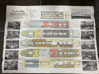
1948rif. 49014Montreal Canada & Liverpool UK: Canadian Pacific n.d. ca 1948. ca 1948. First edition. Double Atlas Folio. 30 3/4" x 41" folded to 5 1/4" x 10 1/4." Illustrated on recto and verso with 6 large color deck plans delineating decks amenities cabins for first class and tourist class passengers together with black and white photo illustrations. Scarce deck plan for the Empress of Canada SS Duchess of Richmond and the Empress of France SS Duchess of Richmond after the two 20400 tons ocean liners had been refitted following World War II. Initially launched as the "Mini-Empresses" but also referred to as the "Drunken Duchesses" as they tended to roll in heavy seas. They were designed to allow travelers to sail further up the St. Lawrence River to Montreal as well as to those wishing to travel into the Great Lakes. The ships were fitted with enough capacity to hold 400 first class passengers and 300 tourist class passengers. The ships entered service from Liverpool to Montreal in July 1947 and September 1948 respectively. Sadly the Empress of Canada caught fire in 1953 and after re-floating was scrapped in Italy the following year. The Empress of France was refitted in 1958/1959 and continued to sail until retired in 1960. Some age toning slight closed tear at one fore-edge and with creasing at folds. Very good. Canadian Pacific, n.d. [ca 1948]. unknown
1857rif. 1004304to 11 ½ x8 ¾ original law calf morocco illustrated 4 134 85102 114 2 iv 64 pp. Some scuffing and wear to covers slight gouge to front joint chipping to edges. Two plates detached one with a chipped corner. Overall very good. Organized by the War department under the direction of Jefferson Davis who was Secretary of War at that time a collection of volumes was produced in the quest for the best route for a railroad to the West. Jefferson Davis wrote part of the introduction to this series and outlines the goals of the project. This report is on routes explored in Northern California and Oregon. Specifically the expedition was to look for a railroad route crossing the Sierra Nevada near the source of the Carson River and to see if it was feasible to connect the Sacramento valley with the Oregon Territory. Most of the color plates in this volume are located in the first three parts of the publication which is focused on topography geology and botanical subjects. This volume includes 23 color lithographs of scenery and botanical subjects 2 hand colored plates of birds and 24 steel engraved plates. Wagner-Camp 264a. Beverly Tucker, unknown