7.039 Ergebnisse
Best.-Nr. 56-0290San Francisco Calif.: Southern Pacific Company 1920 revised 1937. Map. Blueline print 24" x 54". From Cypress Ave to Phelan Ave. Only streets indicated west of Meridian Road approx. 50 industries indicated directly on map. Scale 1" = 500'. San Francisco, Calif.: Southern Pacific Company, 1920, revised 1937. unknown
Best.-Nr. 56-0289San Francisco Calif.: Southern Pacific Company 1920 revised 1926. Map. Blueline print 24" x 54" with mauve red and green highlighting. From Cypress Ave to Phelan Ave. Only streets indicated west of Meridian Road approx. 40 industries indicated in downtown and West San Jose. Scale 1" = 500'. San Francisco, Calif.: Southern Pacific Company, 1920, revised 1926. unknown
Best.-Nr. 56-0226San Francisco Calif.: Southern Pacific Company 1947 revised 1949. Map. Blueline print on vellum. 35 x 78 inches. With multicolor lines indicating switching zones. Map from San Francisco Bay to San Leandro and North Berkeley to Alameda and Oakland Airport. Index of Industries with approximately 600 entries. Scale: 1 inch = 1000 feet. San Francisco, Calif.: Southern Pacific Company, 1947, revised 1949. hardcover
Best.-Nr. 56-0367Portland Ore.: Southern Pacific Company 1923 rev. 1949. Map. Blueline print 39" x 96". Along Williamette River extending approx 1 mile each direction from banks from Clackamas County border to east end of Southern Pacific railroad yard. With Index to Industries sorted by location and owner approx 650 listings indexed by number to map. Scale 1" = 400'. Portland, Ore.: Southern Pacific Company, 1923, rev. 1949. unknown
Best.-Nr. 58-0491San Francisco Calif.: Board of State Harbor Commissioners n.d. Blueline print 50 inches x 11 feet. Several small tears no missing material. From Twenty-fourth Street to Ferry Building Mission Rock to Van Ness Avenue Kansas Street. With inset map of The Presidio. No scale indicated. San Francisco, Calif.: Board of State Harbor Commissioners, [n.d.] unknown
Best.-Nr. 56-0444San Francisco Calif.: Southern Pacific Company 1940 rev. 1964. Blueline print 24" x 78". From Goodwin Avenue San Fernando Road to Glendale Boulevard Brand Boulevard along Los Angeles street Los Angeles city limits railroad tracks. With Los Felix Boulevard Gardena Avenue. Includes names of businesses along and near railroad tracks. Scale 1" = 100'. With insert profile of track grade. San Francisco, Calif.: Southern Pacific Company, 1940, rev. 1964. unknown
Best.-Nr. 56-0240Oakland Calif.: Southern Pacific Company 1930 revised 1960. Map. Blueline prints each 25" x 56". Station plan of Oakdale railroad property with approx. four blocks on each side along tracks from north of Stanislaus River to south of South St. Scale 1" = 100'. Oakland, Calif.: Southern Pacific Company, 1930, revised 1960. unknown
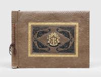
1940Best.-Nr. 182459Manila: 1940s. A graphic album showing fighting in the Philippines the Marshall Islands Papua New Guinea Guam the Solomon Islands and Palau. The compiler chose to include violent images displaying the brutality of the campaign. The album opens with portrait shots of individual Marines or groups along with photographs of American encampments and ships. The scenes then turn more distressing with images of dead locals including children lying on the beach or next to tanks. The photographs were taken across the Pacific theatre: one shows an American soldier holding a flame-thrower on Kwajalein Atoll another shows a beach landing at Luzon and a third shows a Marine posing next to a sign in Bougainville. Most were taken in the final years of the conflict including at Guadalcanal and Peleliu. There are also shots of the end of the war one showing a Japanese soldier surrendering with a white flag and another showing Japanese prisoners of war in a camp in Guam. The final photograph is the most famous "Raising the Flag on Iwo Jima" showing six Marines raising the US flag on Mount Suribachi during the Battle of Iwo Jima. This photograph won the 1945 Pulitzer Prize for Photography. The majority of the photographs are commercial with a few opening portrait shots of the unidentified compiler. Oblong folio 286 x 390 mm. With 55 gelatin silver photographs one lacking approximately 90 x 130 mm landscape or portrait corner-mounted with tape recto and verso on 7 leaves remainder blank. With 2 additional gelatin silver photographs loosely inserted. Contemporary brown sheep commercial album tied through punched holes with brown cord front board stamped with central armourial panel in blind gilt and black. Boards chipped at extremities especially front board bottom left corner rear board rubbed leaves nicked at fore edge photographs moderately toned and creased some slightly torn and abraded: a good example. hardcover
1865Best.-Nr. 3621262(Batavia, Koninkl. Natuurkundig Vereeniging in Ned. Indie, 1851-1865). Zusammen etwa 680 S. mit einigen Tabellen, 2 Tafeln, 21 mehrfach gefalteten, teils farbigen Tafeln mit zahlreichen Abbildungen und Karten, separat 1 mehrfach gefaltetee und auf Leinen gezogene farbige Karte in Tasche. Hlwd der Zeit mit Rückenvergoldung. Gr.-8vo. (etwas beschabt, Vorsätze und Tasche etwas fleckig, einige Bl. mit kleinen Randläsuren und Fehlstellen ohne Textverlust, einige Bl. bzw. Tafeln staubrandig und fingerfleckig).
1907Best.-Nr. 10701Paris, Dunod et Pinat, 1907 ; in-8, broché ; (4), 305, (3) pp., grande planche dépliante (profils en long des 3 projets), figures et 11 planches hors-texte dont 2 plans et 9 photographies, couverture brique imprimée.
1798- EDIZIONE ORIGINALE, COLORITURA COEVA -Decorativa mappa dell'arcipelago Tonga tratta dal "Nuovo Atlante Geografico Universale delineato sulle ultime osservazioni", edito a Roma dal 1792 fino al 1801, opera che la Calcografia Camerale commissionò al Cassini al fine di sostituire l’ormai obsoleto "Mercurio Geografico".I primi ad approdare alle isole Tonga furono J. Lemaire e W. C. Schouten, ai quali questo gruppo di isole non si presentò ospitale, per il carattere degli abitanti (1616). Migliore accoglienza incontrarono nel 1643 Abel Tasman, che toccò il solo gruppo meridionale, e Samuel Wallis nel 1767. Il Cook, che vi approdò nel 1773, vi si trovò tanto bene, che le chiamò "Le isole degli Amici" (Friendly Islands); quando vi tornò nel 1777 vi indugiò quasi due mesi, mantenendo sempre ottimi rapporti con quegli abitanti. Le isole settentrionali furono scoperte nel 1781 dallo spagnolo F. A. Mourelle.Giovanni Maria Cassini, Chierico Regolare Somasco fu geografo e cartografo, ma anche intagliatore di architetture e prospettive - uno dei migliori discepoli di Giovanni Battista Piranesi - Cassini fu uno degli ultimi sferografi italiani del Settecento ed i suoi globi ebbero una notevole diffusione, come pure questo "Nuovo Atlante Geografico".Incisione in rame, coloritura coeva dei contorni, leggere bruniture, per il resto in ottimo stato di conservazione. FIRST EDITION, CONTEMPORARY OUTLINE COLOUR -The Italian painter and engraver, Giovanni Maria Cassini, produced this attractive map of the Tonga Islands, with Cook's tracks decoratively traced between them. Tonga became known as the Friendly Islands because of the hospitable reception given to Captain James Cook on his first visit in 1773.Published in: Nuovo atlante geografico universale delineato sulle ultime osservazioni. Roma, Calcografia camerale, 1792-1801.Cassini was geographer and cartographer but he was also good at engraving architectural items and perspectives – he was one of the best disciples Giovanni Battista Piranesi had. Moreover, Cassini was one of the last artists to engrave spheres in the XVIII century and his globes were quite famous and widespread, and realized the most important Italian Atlas of the XVIII century; his maps always bear a cartouche, extremely rich in colours and details. Copperplate with fine original hand colour, some foxing, otherwise in very good condition.
1798- EDIZIONE ORIGINALE, COLORITURA COEVA -Decorativa mappa dell'arcipelago Tonga tratta dal "Nuovo Atlante Geografico Universale delineato sulle ultime osservazioni", edito a Roma dal 1792 fino al 1801, opera che la Calcografia Camerale commissionò al Cassini al fine di sostituire l’ormai obsoleto "Mercurio Geografico".L'arcipelago è costituito da due distinti gruppi di isolette vulcaniche: quello delle Isole Sopravento (o del Vento), a Sud, che include Tahiti, Moorea, Maiao, Mehetia, Tetiaroa; quello delle Sottovento, a Nord, che comprende Raiatea, Huahine, Bora-Bora, Maupiti, Tahaa, e gli atolli Scilly e Bellingshausen. Già scoperte nel 1607 da P. Fernandes Queirós, furono riscoperte da S. Wallis nel 1767 e chiamate Isole della Società da J. Cook nel 1769, in onore della Royal Society.L'Isola di Natale deve il suo nome al capitano inglese William Mynors, che avvistò l'isola nel Natale del 1643 a bordo della nave Royal Mary.Giovanni Maria Cassini, Chierico Regolare Somasco fu geografo e cartografo, ma anche intagliatore di architetture e prospettive - uno dei migliori discepoli di Giovanni Battista Piranesi - Cassini fu uno degli ultimi sferografi italiani del Settecento ed i suoi globi ebbero una notevole diffusione, come pure questo "Nuovo Atlante Geografico".Incisione in rame, coloritura coeva dei contorni, leggere bruniture, per il resto in ottimo stato di conservazione. FIRST EDITION, CONTEMPORARY OUTLINE COLOUR -The Italian painter and engraver, Giovanni Maria Cassini, produced this attractive map of the Tonga Islands and Christmas Island.The Society Islands are a group of islands located in the Pacific Ocean and part of French Polynesia. It includes Bora Bora, Tahiti, Moorea, Taha'a and Huahine. The archipelago is suspected to have been named by Captain James Cook supposedly in honour of the Royal Society, the sponsor of the first British scientific survey of the islands; however, Cook himself stated in his journal that he called the islands Society "as they lay contiguous to one another."Christmas Island was first discovered on in 1615 by Captain John Milward of the East India Company ship, and it was named Christmas Island on 25 December 1643.Cassini was geographer and cartographer but he was also good at engraving architectural items and perspectives – he was one of the best disciples Giovanni Battista Piranesi had. Moreover, Cassini was one of the last artists to engrave spheres in the XVIII century and his globes were quite famous and widespread, and realized the most important Italian Atlas of the XVIII century; his maps always bear a cartouche, extremely rich in colours and details. Copperplate with fine original hand colour, some foxing, otherwise in very good condition.
19131st separate edition, 16mo (small) 39 pages. Includes portrait ; 15 cm. 1 of 100 copies printed. "Reprinted in 100 copies from the anniversary number of the Jewish tribune, Portland, Oregon, December 19, 1913" [from the Title page verso]. Henry Ward Beecher ( 1813 1887) was an American Congregationalist clergyman, social reformer, and speaker, known for his support of the abolition of slavery, his emphasis on God's love, and his 1875 adultery trial . Several of his brothers and sisters became well-known educators and activists, most notably Harriet Beecher Stowe, who achieved worldwide fame with her abolitionist novel Uncle Tom's Cabin ..Over the course of his ministry, he...grew interested in social reform, particularly the abolitionist movement. In the years leading up to the Civil War, he raised money to purchase slaves from captivity and to send riflesnicknamed Beecher's Biblesto abolitionists fighting in Kansas and Nebraska . After the war, Beecher supported social reform causes such as women's suffrage and temperance. He also championed Charles Darwin's theory of evolution, stating that it was not incompatible with Christian beliefs . Beecher's long career in the public spotlight led biographer Debby Applegate to call her biography of him The Most Famous Man in America (Wikipedia, 2019) . OCLC: 17882630. OCLC lists 14 copies worldwide. Light wear, about Very Good- Condition. (KH-8-54)
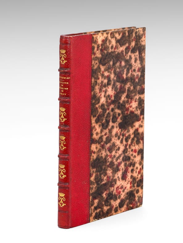
1806Best.-Nr. 665231 vol. in-12 reliure demi-maroquin rouge, dos à 5 nerfs ornés (chiffres LL entrelacés surmontés d'une couronne), toutes tranches peignées, Chez P. F. Bottier, A Bourg, s.d. [ 1806 ], 1 f. blanc, 143 pp.
1806Best.-Nr. 3025Edinburgh, A. Constable, 1806. In-8 de VII-232-LXI pp., cartonnage de l'époque.
Best.-Nr. awd-1023Paris, Mercure de France, 1999. In-8 br., couverture imprimée à rabats, 350 pp.
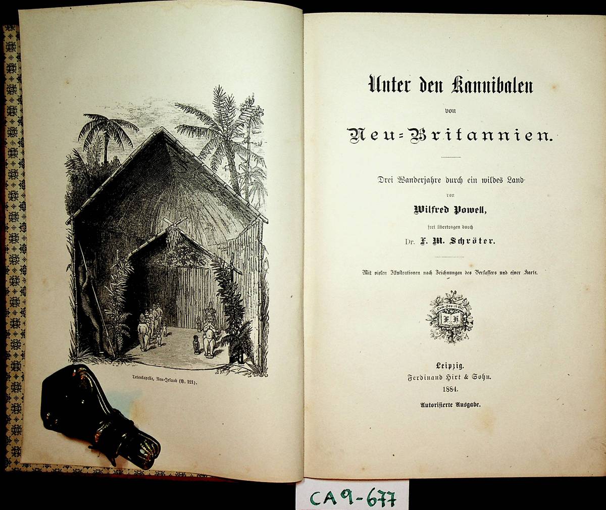
1884Best.-Nr. GC10-643Leipzig, Verlag Fedrinand Hirt, 1884. original Leinenband, gr.-8?, 262 SeitenMit vielen Illustrationen nach Zeichnungen des Verfassers und einer Karte. und X (10) Seiten, Zustand: Einband etwas fleckig, innen sehr guter Zustand
1914Best.-Nr. ZB583608San Francisco: Southern Pacific Company 1914. gathering in one custom binding eleven brochures promoting business residential agricultural and other opportunities in the State of California and several of its counties COMPLETE CONTENTS: California for the Settler by A. J. Wells; Glenn County California by Arthur Dunn; Sonoma County by W. Russell Cole; Fresno County by Walter B. Clausen; Sacramento County by M. B. Levick; Tullare County by M. B. Levick; Kern County by A. J. Wells; Monterey County by Arthur Dunn; Shasta County by M. E. Dillmar; Tuolumne County by Arthur Dunn; Siskiyou County by Bourdon Wilson; approximately 400 pages in all PROFUSELY ILLUSTRATED some in color original gilt stamped leather now slightly worn or discolored; overall very good. - If you are reading this this item is actually physically in our stock and ready for shipment once ordered. We are not bookjackers. Buyer is responsible for any additional duties taxes or fees required by recipient's country. Photos available upon request. San Francisco: Southern Pacific Company hardcover
Best.-Nr. DADAX0295987359New unknown
Best.-Nr. PA8815 loose original gelatin silver photographs each ca. 181x124 cm 7x5 in. Nine photos with captions either on negatives or on the verso. Glue residues on the verso of most photos two photographs with minor tears at the edges but otherwise a very good collection with strong interesting photos. Historically important collection of well-executed photos of the Pacific Northwest including rare early views of the Puget Sound Naval Station in Bremerton Washington. The Puget Sound Naval Shipyard was established as a repair facility in 1891. Early construction included dry docks shipways and support facilities making it the first repair yard in the Northwest capable of handling the largest ships. In 1902 the station was redesignated Navy Yard Puget Sound and expanded during WWI to accommodate major shipbuilding and repair programs. By WWII it had become the West Coast’s premier yard for ship repair and modernization and the only facility capable of servicing capital ships. In 1965 it also became the first West Coast yard to maintain nuclear-powered submarines and today continues to operate as a nuclear-capable maintenance facility. The collection comprises fifteen excellent original gelatin silver photographs apparently taken by an American traveler and his companion captured from the back in several photos in the late 1890s. Especially interesting is a well-executed photo of the U.S.S. Nipsic gunboat docked at the Puget Sound Naval Shipyard. The Nipsic arrived at the yard in 1892 and at the time the photograph was taken was serving as both a receiving ship and a prison hulk. The image shows the gunboat with a large roof built over the amidships section used to accommodate personnel and prisoners. Another important photo from the Naval Shipyard shows officer’s quarters constructed to provide adequate housing for the officers responsible for the shipyard and industrial area. The images depict early grounds of the quarters with several similar buildings erected side by side. The other photographs from the collection feature excellent views of the Columbia River Gorge and its environs showing Latourelle Falls Rooster Rock Beacon Rock Oneonta Gorge and Mount Hood. Overall historically important collection of well-executed photos of the Pacific Northwest including rare early views of the Puget Sound Naval Station in Bremerton Washington. unknown
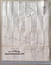
1909Best.-Nr. 2507062Coeur D'Alene: n.p. 1909. First Edition. Soft cover. Very Good. Original issue. Size 31 ½" x 39." folds to 4" x 10". Mapped according to townships and sections and showing Flathead Guide Meridian and Fourth Standard Parallel. Portions of Sanders and Flathead counties. Shows large portions of Flathead Lake Flathead and Little Bitterroot Rivers and maps tiny lakes. Roads ferry crossings U. S. Power Reserve Northern Pacific Railroad Buffalo Reserve Indian Agency and Settlement St. Ignatius Mission towns of Ronan and Polson. Just a few small splits at corners and one longer split which we decided not to repair in case buyer wants professional restoration. Old tape on some folds. Overall in very good condition. Very very scarce. Of note is that it was in 1909 that a buffalo roundup took place on the reserve and the great Montana painters Charlie Russell was present. Rare. n.p. unknown
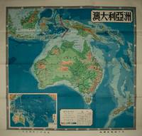
1954Best.-Nr. 224585上海 Shanghai.: 地圖出版社 Ditu chubanshe. 1954. Coloured topographical map of the Australian continent inluding Papua New Guinea and New Zealand 106 x 112cm text in traditional Chinese characters. Legend includes desert coral reef seasonal rivers and lakes continental boundaries and so on. Inset map of Australia and the Pacific Islands also with key indicating altitude and sea depth. Folds into lightly worn original paper envelope measuring 38 x 25.5cm. Pinholes upper right and left corners small hole at fold point and tear in upper margin now repaired with archival washi paper 澳大利亞handwritten on reverse. Both envelope and the reverse of the map have small production labels attached. Map very bright with clear strong colours. Striking map in very good condition. . 地圖出版社 [Ditu chubanshe]. unknown
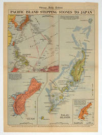
1944Best.-Nr. 208880Chicago.: Chicago Daily Tribune. 28 September1944. Colour pictorial map on a single newspaper leaf archivally laid down on linen 50 x 39.2 cms; 59.3 x 43.3 cms sheet including captions faint toning to fold lines very good condition. Vivid colour maps of the Palau Islands Guam and Saipan in the Marianas and an inset location map published in the "Chicago Daily Tribune" in September 1944 months after the landing of US and Allied Forces in the offensive against the Japanese during the Pacific War. . Chicago Daily Tribune. unknown
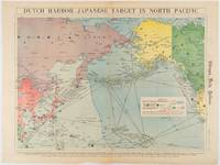
1942Best.-Nr. 180751Chicago.: Chicago Daily Tribune. Friday June 51942. Printed colour map on a single newspaper leaf 37.5 x 53.2 cm; 44.7 x 59.8 cm sheet inset legend marginal browning and at the folds some undulation of paper and tide mark along lower section but in remarkably bright very good condition. Strategic map published in the Chicago Daily Tribune "The World's Greatest Newspaper" on June 5th 1942 two days after the Japanese attack on Dutch Harbor the site of the US army and navy bases in the Aleutians and as it transpired at the outset of the Battle of MIdway. The owner and proprietor of the Tribune Robert McCormick was staunchly against the United States entering the war and had firm views once it had occurred that American resources should not be used defending the British Empire. Famously the Tribune published the "Victory Program" Roosevelt’s military plan to prepare the United States for possible entry into World War II and was subject to prosecution for an alleged violation of the Espionage Act relating to the newspaper’s front-page account of the Battle of Midway 4-7 June 1942. It became an important test case for the limits of free speech and censorship during war-time. The Legend shows territorial Control of Ocean Areas marking Japanese Naval and Air bases as of 1941 and "according to latest reports" those established in the first six months of 1942. Also shown are pre-war sovereignties as at the bombing of Pearl Harbour on December 7th 1941. The Anson Archipelago is shown but a question mark "indicates islands etc. whose existence or give position is doubtful…". . Chicago Daily Tribune. unknown
1995Best.-Nr. 2009038Eugene & Salem: Privately printed & Your Town Press 1995. Limited/Numbered. Hardcover. Fine/Very Good. Limited edition to 20 special copies bound in gilt-stamped dark cowhide of which this is #10. Quarto. 204pp. Illustrated with vintage photos maps & facsimiles. Bibliography. Laid into this limited edition is a printed limitation card 4 3/4" x 8 1/2" signed by Gray and three card stock full page prints of cowboy/cattle drawings limited to 20 copies to go with this edition. French was a famous Oregon rancher and lived 1849-1897. Fine as new. The dj has a small corner tear/chop to the lower front corner of the back panel. This edition rare. Privately printed & Your Town Press hardcover