6.911 Ergebnisse
2001Best.-Nr. 17125San Francisco CA: Pacific Book Auction Galleries /PBA Galleries. New. Paperback. FREE UPGRADE to Courier/Priority Shipping Upon Request - IN STOCK AND IMMEDIATELY AVAILABLE FOR SHIPMENT - Flawless -- with a bonus offer--; 017125 . 2001. Pacific Book Auction Galleries /PBA Galleries paperback
1997Best.-Nr. 27720San Francisco CA: Pacific Book Auction Galleries /PBA Galleries. New. Paperback. FREE UPGRADE to Courier/Priority Shipping Upon Request - IN STOCK AND IMMEDIATELY AVAILABLE FOR SHIPMENT - FLAWLESS COPY BRAND NEW PRISTINE NEVER OPENED -- with a bonus offer--; T-PBA12497; Pacific Book Auction Galleries /PBA Galleries The Library of Louis F. Javete Part II - John Muir - Hawaii - Alaska - Sir Francis Drake - James Cook - Western Americana - Travel - Exploration - Maps - Pacific Book Auction Galleries /PBA Galleries San Francisco - 12/4/97 . 1997. Pacific Book Auction Galleries /PBA Galleries paperback
1994Best.-Nr. 27247San Francisco CA: Pacific Book Auction Galleries /PBA Galleries. New. Paperback. FREE UPGRADE to Courier/Priority Shipping Upon Request - IN STOCK AND IMMEDIATELY AVAILABLE FOR SHIPMENT - TEXT PRISTINE -- with a bonus offer--; T-PBA12151994; Pacific Book Auction Galleries /PBA Galleries Winter Miscellany with Alchemy Witchcraft & Related Arts - Pacific Book Auction Galleries /PBA Galleries - San Francisco CA - 12/15/94 . 1994. Pacific Book Auction Galleries /PBA Galleries paperback
1996Best.-Nr. 28019San Francisco CA: PBA / Pacific Book Auction Galleries. New. Paperback. FREE UPGRADE to Courier/Priority Shipping Upon Request - IN STOCK AND IMMEDIATELY AVAILABLE FOR SHIPMENT - FLAWLESS COPY BRAND NEW PRISTINE NEVER OPENED -- with a bonus offer--; T-PBA41896; PBA / Pacific Book Auction Galleries Golf: The Library of Hal Conefry with Additions - PBA / Pacific Book Auction Galleries - April 18 1996 . 1996. PBA / Pacific Book Auction Galleries paperback
1996Best.-Nr. 27979San Francisco CA: PBA / Pacific Book Auction Galleries. New. Paperback. FREE UPGRADE to Courier/Priority Shipping Upon Request - IN STOCK AND IMMEDIATELY AVAILABLE FOR SHIPMENT - FLAWLESS COPY BRAND NEW PRISTINE NEVER OPENED -- with a bonus offer--; T-PBA11896; PBA / Pacific Book Auction Galleries L. Frank Baum & The Wizard of Oz: The Collection of The Reverend George M. Breslin Jr. with Additions - PBA / Pacific Book Auction Galleries San Francisco - 1/18/96 . 1996. PBA / Pacific Book Auction Galleries paperback
Best.-Nr. elala2550Montreal: Canadian Pacific Railway 1912. Descriptive timetable of the western Canadian tour from Toronto to Vancouver and back by rail and steamship by the new Governor-General of Canada H.R.H. Prince Arthur William Patrick Albert first Duke of Connaught and Strathearn 1850-1942. The royal party consisted of the Duke and Duchess Princess Patricia two ladies in waiting Lt.-Col. H.C.Lowther Capt. T.H.Rivers 2 aides-decamp Major E.S.Worthington medical officer and Mr. W.R.Baker representing the CPR. The work is illustrated by photographic based views of the countryside and cities of western Canada. This would appear to be one of a limited number of copies specially bound for presentation. No records have been located. Prince Arthur Arthur William Patrick Albert first Duke of Connaught and Strathearn was posted to Canada on military duty in 1869-70 serving during the Red River Rebellion and the Fenian Raid of 1870. In 1911 he was appointed Governor-General of Canada a position he held until 1916. Not in Peel or Edwards and Lort. Not found in the Amicus data base Library of Congress or British Library catalogues. No copies found in the Canadian auction records. narrow 8vo. pp. 3 p.l. 89. printed in red & dark brown ink. 26 plates. bound for presentation to H.R.H. Prince Arthur third son of Queen Victoria and H.R.H. Albert in full padded dark green sheep gilt title on front cover with mounted colour royal coat of arms gilt inside dentelles all edges gilt dark green watered silk endleaves spine damaged & with 3 cloth tape repairs corners worn internally very good [Montreal: Canadian Pacific Railway], 1912 hardcover
1930Best.-Nr. P2531Montreal: Canadian Pacific c. 1930. Very Good; laid down on acid-free canvas for long-term preservation. Image Size : 685x908 mm 26.97x35.75 Inches Platemark Size : Paper Size : 724x948 mm 28.50x37.32 Inches Coloring: Printed in Color Medium: Lithograph Categories: Advertising; Transportation Ships; Posters; Canadian Pacific unknown
1860Best.-Nr. 100432Large thick 4to contemporary calf spine and tips with marbled boards 70 very attractive color lithograph plates 358 41 pp. Extremeties worn minor aging one map has tear in lower corner plates bright and clean. The Pacific Railroad Surveys 1853-1855 explored possible routes for a transcontinental railroad. However the surveys went beyond looking for a place for a railroad they included and incredible amount of information on natural history and the peoples that inhabited the areas where the surveys explored. Representing the first part of the final volume of these surveys this installment focused on the northern route for a railroad. The 12 volumes included in these surveys is also known for rich illustrations many of which were in color. With 70 color plates one folding and three folding maps in Volume XII part 1 this edition is particularly rich in illustration and the plates are bright and clean. Thomas A. Ford hardcover
1860Best.-Nr. 100432Large thick 4to contemporary calf spine and tips with marbled boards 70 very attractive color lithograph plates 358 41 pp. Extremeties worn minor aging one map has tear in lower corner plates bright and clean. The Pacific Railroad Surveys 1853-1855 explored possible routes for a transcontinental railroad. However the surveys went beyond looking for a place for a railroad they included and incredible amount of information on natural history and the peoples that inhabited the areas where the surveys explored. Representing the first part of the final volume of these surveys this installment focused on the northern route for a railroad. The 12 volumes included in these surveys is also known for rich illustrations many of which were in color. With 70 color plates one folding and three folding maps in Volume XII part 1 this edition is particularly rich in illustration and the plates are bright and clean. Thomas A. Ford hardcover books
1837Best.-Nr. PHO-2280Paris, Arthus Bertrand, 1837, 2 volumes (3) grand in-4° (30x24,5cm), VIII pp., 742 pp., demi chagrin et coins époque, dos lisse avec auteur, titre et tomaison, frottements au dos, quelques rousseurs, défaut à la coiffe supérieure. Édition originale du texte du voyage du Bougainville autour du monde, manque l’atlas.
1774Edizione francese della mappa della Nuova Zelanda del capitano J. Cook, che riporta le rotte seguite intorno alle due grandi isole (Isola del Nord e Isola del Sud) dal 6 ottobre 1769 al primo aprile 1770.James Cook fu il primo a operare il rilevamento integrale delle coste.Esemplare tratto dalla prima edizione dell'opera "Relation des voyages entrepris par ordre de Sa Majesté Britannique . . ." di John Hawkersworth, pubblicata a Parigi nel 1774.Incisione su rame, carta irregolare il solo margine sinistro, per il resto in perfetto stato di conservazione. French edition of Cook’s foundation map of New Zealand, showing the track of the Endeavour around both islands, from October 6, 1769, to April 1, 1770.From John Hawkesworth’s "Relation des voyages entrepris par ordre de Sa Majesté Britannique . . ." (Paris, 1774). Copperplate, in very good condition.Endeavour came within sight of land on April 19, well north of the area charted by Tasman 125 years earlier. The New Holland (Australia) coast was exasperating, however, and Cook could not find a safe place to land until the afternoon of Saturday, April 28, when they entered Botany Bay (part of today’s Sydney Harbor), which Cook later named for the wide variety of plant life found there. The Aborigines that they saw there were unintelligible to Tupaia and kept away, avoiding contact. Through May and into June, Endeavour sailed north, arcing northwest, following the Great Barrier Reef coastline. On the evening of June 10, when most of the men were sleeping, the ship struck coral, stuck fast, and began leaking. Quick thinking and decisive action by Cook and his men—pumping furiously and jettisoning fifty tons of decayed stores, stone ballast, and cannons—kept the ship afloat and allowed a temporary underwater repair. A few days later, the damaged ship was safely beached on a barren shore (near today’s Cooktown, by the EndeavourRiver), and a fury of activity began more permanent work: the expedition had avoided a real disaster. (Henceforth, the British Admiralty would send Cook out with two ships for safety.) During this time, the men enjoyed more favorable interactions with the natives, but not without miscommunications and incidents of distrust. By August 13, the ship was ready to resume its journey.The labyrinth of treacherous islands and reefs was threaded slowly and carefully, with vigilance and some luck, as the expedition sailed northward through the Great Barrier Reef, westward around the northernmost point of New Holland, and into what Cook called Endeavour Strait. He stopped briefly at Possession Island (his name) where, now knowing he was in territory explored by the Dutch, he claimed the whole coastline he had just charted for King George III. It was a proud moment, essentially marking the end of Cook’s first Pacific voyage’s geographical discoveries.
1823Best.-Nr. PHO-1666London, John Murray, 1823 et 1828, 2 volumes In-4, relié pleine toile orange, dos lisse avec pièce d’auteur et titre, date en pied, xvi-768pp. et xxvi-320pp.cvii-1f., tome 1, tâche sur les 5 premiers feuillets, petites rousseurs, mouillure angulaire sur les planches au tome 2, petits frottements à la reliure. Édition originale, illustrée de 30 planches dont 11 en couleurs pour le tome et de 31 planches au tome 2, les cartes manquent, Cachet Émile Petitot, Ex-libris manuscrit, Ex-libris Jean-Pierre Legrand-Deloron. Avec une mention signée : "membre de l'Expédition arctique T.A. 23 , 1972-1973" .
1839Best.-Nr. 14879Pourrat frères Paris 1839 2 vol. 2 vol. in-8 de 2 ff.n.ch. 510 pp. 1 f.n.ch. (table) et 2 ff.n.ch. 547 pp. 1 f.n.ch. (table), demi-veau romantique de l'époque, dos à faux nerfs orné.
1908Best.-Nr. 138240High Bluff Manitoba: Edwin C. Blair c1908. Undetermined. very good. 24pp. Oblong quarto. Black cloth photo album rubbed with some loss of cloth on front board. Spine reinforced with additional patterned cloth. 24 albumen photographs loosely inserted between 12 double-mounted leaves. 10 photos are signed "Blair" a few with additional titling in pen to photo. 23 photos with a stamp on verso: "Real photographs of real life in Canada by Edwin C. Blair High Bluff Manitoba; 1 photo stamped "Photo by E.C. Blair. Two photos are dated 1908. Photos measure approximately 6.75" X 5". very good A fantastic collection of photographs documenting the construction of the Grand Trunk Railway in Alberta. Includes a variety of subjects such as horse-drawn lumber operations steam-powered construction equipment hard rock excavation construction of the Battle River and Clover Bar bridges steam locomotives and camp life. 1908 Edwin C. Blair unknown
1866Best.-Nr. 15863Hachette et Cie Paris 1866 2 vol. 2 vol. petit in-8 de 2 ff.n.ch. 352 pp. et 2 ff.n.ch. 376 pp., demi-chagrin de l'époque, dos à nerfs orné.
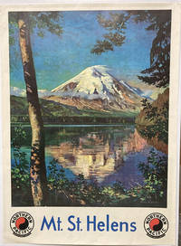
1932Best.-Nr. 49308N. P.: Published for the Northern Pacific Railway Company n. d. ca 1932. 1932. Color illustrated poster 40" x 30" after the painting by Gustav Wilhelm Krollman with his name and "Cascade Mountains State of Washington U.S.A. Northern Pacific Railway" in print. This striking vintage travel poster shows a view of Mount Saint Helens with its reflection in Spirit Lake many years before its dramatic eruption in 1980. Starting in the late 1920s Austrian-born artist and commercial illustrator Gustav Krollman produced a series of scenic paintings for the Northern Pacific. This view of Spirit Lake and Mt. St. Helens was one of the few that did not have a locomotive in it. Colorful original mounted poster with a tiny pinhole in each corner else in fine condition. Suitable for framing. Published for the Northern Pacific Railway Company, n. d. (ca 1932). unknown
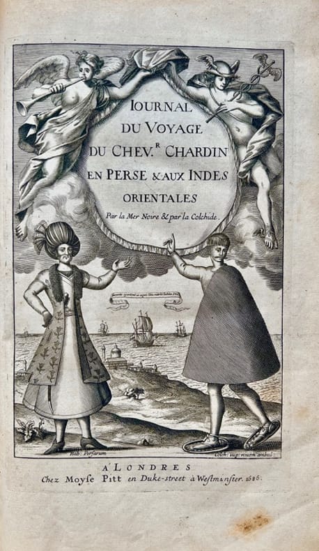
1686Best.-Nr. 42700Londres, Moses Pitt, 1686. In-folio de (10)-349-(5) pp., veau havane marbré, dos orné à nerfs, pièce de titre en maroquin rouge, tranches rouges (reliure de l'époque).
18304to, 8vo [33.5 x 26.5 & 23 x 14.5 cm]; 3 volumes including plate volume, xlviii, 536; iv, 332, clxxix pp,with large folding map, 92 plates including 10 finely hand-colored aquatints, large folding plan, music notation, other maps, tables, index. original red cloth with title lettering on front cover or spine, plate volume spine worn, mostly lacking, light foxing on some plates, heavier on a few, colored plates clean with tissue guards, text volumes bit faded but near fine, plate volume very good. First printed in 1817 in only 900 copies with only 66 plates, this edition being expanded to 92 plates and map. The plates are reputed to be by William Daniell. The author travelled extensively on the island. Abbey Travel 554; Tooley 391; Hill I, 245. According to Abbey, the atlas of plates was published separately for the second edition which was published in 1830 and printed in only a small number. Bastin p. 5: 'The book was got together with considerable haste and was published in 1817 in two quarto volumes. . .a total of 900 copies were published. Apart from its originality. . .the outstanding feature of the book is its 66 plates, ten or which are coloured aquatints illustrating Javanese life and costume and the Papuan boy who accompanied Raffles to England in 1816'. The plates of this edition include all the plates of the first edition plus additional plates of Javanese antiquities and topography. Prideaux: 'a monumental work. . . still a standard book'. Von Hunersdorff: 'An influential work valued for the author's firsthand observations on the customs and condition of the Javanese under his administration as Governor General during the British occupation of the Dutch East Indies'. The text volumes printed in 1830 have a great deal of data, much in tabular form including statistics, populartion, vocabularies, etc. with much of the author's text describing the people and country in great detail. from natural history and anitiquities to musical instruments, hunting methods, literature, games of skill, language, etc. All of the plates are present according to the plate list.
1791Best.-Nr. 6424A Paris, Chez F. Buisson, Imprimeur-Libraire, rue Hautefeuille, n°20. (1791). 1791 2 vol. in-8° (200 x 125 mm.) de : I. [2] ff. (titre, f. t.), viii, 466 pp.; II. [2] ff. (titre, f. t.), 486 pp. Initiales manuscrites à l'encre "L R" surles faux titres. Demi-basane dépoque, dos lisses ornés et titrés à l'or, coins de parchemin, plats recouverts de papier à la colle bleu.
1791Raro secondo stato della carta, proveniente dal quinto volume dell’opera Raccolta di tutti i viaggi fatti intorno al mondo da diverse nazioni dell’Europa di Jean Pierre Berenger edito nel 1794-96 illustrato con carte dell’editore veneziano Zatta. Rispetto alla medesima carta inserita in “Atlante novissimo”, cambiano il titolo e la data. Bel cartiglio figurato.Buono stato di conservazione con pieghe editoriali e traccia di restauri agli angoli delle medesime.La carta viene per la prima volta pubblicata in Atlante Novissimo dello Zatta, edito tra il 1779 ed il 1785. Atlante fra i più belli e completi mai pubblicati in Italia nel XVIII secolo, l'opera più famosa dello Zatta. L’Atlante Novissimo, come si specifica anche nel titolo, è “accresciuto sulle osservazioni scoperte fatte dai più celebri e più recenti geografi”. Tra le novità più significative vi è la comparsa delle nuove isole scoperte nell'Oceano Pacifico da James Cook e la prima carta italiana della Nuova Zelanda. Le illustrazioni furono ideate e disegnate dai suoi collaboratori Giovanni Marco Pitteri, Anton Friedrich Busching, Pietro Antonio Novelli ed incise da Giuliano Zuliani. Il primo tomo dell’atlante è introdotto da un breve saggio di geografia generale dove l’autore definisce in modo sintetico e preciso gli elementi che compongono i reticoli eclittico ed equatoriale usati nelle tavole. Interessante la sezione dove si sofferma a descrivere il fenomeno della precessione degli equinozi e quello della variazione ciclica dell'obliquità dell'eclittica. Acquaforte, stampata su carta vergata coeva, coloritura coeva dei contorni, in buone condizioni. - THE VERY RARE SECOND EDITION OF 1794 - Taken from 'Raccolta di tutti i viaggi fatti intorno al mondo da diverse nazioni dell’Europa' by Jean Pierre Berenger. The date is changed into 1794Antonio Zatta's map of New Zealand is not only one of the first to show the results of Cook's voyages, but is also one of the most attractive of the islands. Considerable coastal detail, with reference to the Endeavour's path, and a little and surmised internal detail. The map delineates two islands, tentatively identifying the Southern Island separate. The map shows Cook's tracks around the island, along with the astronomical observations. Nice topographical detail is shown, along with a blend of native and European place names on the islands. The map includes several annotations. The decorative cartouche, in full original colour, shows a native village scene. New Zealand, though discovered by Tasman in 1642, received no further European exploration until the first Pacific voyage of James Cook. Cook sailed the coast of New Zealand for 6 months, proving that it was not part of the Great Southern Continent, as many had believed. Cook visited New Zealand several times, with Zatta's map drawn from information provided in the latest of his voyages.
1868Best.-Nr. 58056Washington: Government Printing Office 1868. With Johnson's Great Map of the Northern Pacific Route This copy is inscribed on the front wrapper: "With Regards of James Tilton C.E." Tilton 1819–78 was then chief engineer of the Washington Division of the Northern Pacific Railroad. Thanks in part to his support for Franklin Pierce's presidential campaign Tilton was appointed the first Surveyor General of Washington Territory and served from 1853-61. Both the Tilton River and Fort Tilton near Fall City Washington are named for him. An important report to Congress by the Northern Pacific Railroad headed by Minnesota railroad magnate James J. Hill for federal aid to support the Railroad's expansion to the West Coast. The petition reviews the railroad's original charter printing with it a memorial from the NPRR's Board of Directors and supporting communications from military figures including Montgomery Meigs and Ulysses S. Grant. Since the early 1850s Edwin Johnson described by Wheat as a "visionary" engineer had been associated with the plan to build a railroad across the northern part of the United States from the Great Lakes to the Pacific Coast. In 1867 he was named chief engineer of the Northern Pacific and this memorial is a work of major importance for the history of the railroad. It includes Johnson's topographical survey of the route to the Pacific a discussion of potential problems that may be encountered and a detailed economic and military survey of the area in justification of construction. The exceptional large folding "Map of the Country from Lake Superior to the Pacific Ocean from the Latest Explorations and Surveys" was produced by the Colton firm in New York. One of the finest maps of the region to date it shows the area from Detroit to the Pacific well into Canada and south to about the 39th parallel. Johnson has drawn the route of the Northern Pacific from Lake Superior to Washington Territory where the line splits with one branch heading toward Fort Vancouver and the other to Puget Sound. Among the details shown on the map are the Pony Express route wagon routes and overland mail routes exploration routes and other proposed railroad routes the locations of Indian tribes mineral deposits military forts and much more. Wheat gives a long description of the map and remarks that "the detail of such a map defies cataloging." Construction on the Northern Pacific Railroad began in 1870 and was completed in 1883. Edwin Johnson did not see its completion dying in 1872. An edition of this report with the supporting documents and map was also privately published in Hartford. A significant early account of railroad expansion in the Northwest. We could find only ten copies listed in OCLC and this is the first copy we have seen in wrappers and with a presentation from an important engineer on the project. Original printed wrappers. Presentation inscription on front wrapper see below. Wrapper edges chipped minor soiling and tanning to wrappers spine partially chipped old vertical fold to pamphlet. Light foxing and tanning and occasional soiling throughout Map with a few small closed tears at cross-folds with no loss. About very good. RAILWAY ECONOMICS pp.242-43. SABIN 55819 Hartford edition. WHEAT TRANSMISSISSIPPI V item 1169 pp.205-09. PHILLIPS MAPS p.916. DECKER 37:266 Hartford ed. MIDLAND NOTES 68:164. OCLC 60578657. unknown
1868Best.-Nr. 58056Washington: Government Printing Office 1868. With Johnson's Great Map of the Northern Pacific Route This copy is inscribed on the front wrapper: "With Regards of James Tilton C.E." Tilton 1819–78 was then chief engineer of the Washington Division of the Northern Pacific Railroad. Thanks in part to his support for Franklin Pierce's presidential campaign Tilton was appointed the first Surveyor General of Washington Territory and served from 1853-61. Both the Tilton River and Fort Tilton near Fall City Washington are named for him. An important report to Congress by the Northern Pacific Railroad headed by Minnesota railroad magnate James J. Hill for federal aid to support the Railroad's expansion to the West Coast. The petition reviews the railroad's original charter printing with it a memorial from the NPRR's Board of Directors and supporting communications from military figures including Montgomery Meigs and Ulysses S. Grant. Since the early 1850s Edwin Johnson described by Wheat as a "visionary" engineer had been associated with the plan to build a railroad across the northern part of the United States from the Great Lakes to the Pacific Coast. In 1867 he was named chief engineer of the Northern Pacific and this memorial is a work of major importance for the history of the railroad. It includes Johnson's topographical survey of the route to the Pacific a discussion of potential problems that may be encountered and a detailed economic and military survey of the area in justification of construction. The exceptional large folding "Map of the Country from Lake Superior to the Pacific Ocean from the Latest Explorations and Surveys" was produced by the Colton firm in New York. One of the finest maps of the region to date it shows the area from Detroit to the Pacific well into Canada and south to about the 39th parallel. Johnson has drawn the route of the Northern Pacific from Lake Superior to Washington Territory where the line splits with one branch heading toward Fort Vancouver and the other to Puget Sound. Among the details shown on the map are the Pony Express route wagon routes and overland mail routes exploration routes and other proposed railroad routes the locations of Indian tribes mineral deposits military forts and much more. Wheat gives a long description of the map and remarks that "the detail of such a map defies cataloging." Construction on the Northern Pacific Railroad began in 1870 and was completed in 1883. Edwin Johnson did not see its completion dying in 1872. An edition of this report with the supporting documents and map was also privately published in Hartford. A significant early account of railroad expansion in the Northwest. We could find only ten copies listed in OCLC and this is the first copy we have seen in wrappers and with a presentation from an important engineer on the project. Original printed wrappers. Presentation inscription on front wrapper see below. Wrapper edges chipped minor soiling and tanning to wrappers spine partially chipped old vertical fold to pamphlet. Light foxing and tanning and occasional soiling throughout Map with a few small closed tears at cross-folds with no loss. About very good. RAILWAY ECONOMICS pp.242-43. SABIN 55819 Hartford edition. WHEAT TRANSMISSISSIPPI V item 1169 pp.205-09. PHILLIPS MAPS p.916. DECKER 37:266 Hartford ed. MIDLAND NOTES 68:164. OCLC 60578657. unknown books
Best.-Nr. PF4Oblong Folio album ca. 27 x 33 cm or 10 ½ x 13 in. 24 card stock leaves. With 138 original gelatin silver photos mostly ca. 8 x 12 cm 3 x 4 ¾ in. With 17 printed postcards ca. 9x13 cm 3 ½ x 5 in; all mounted in windows. All postcards withprinted captions on the margins. Some of the photos are captioned in German on versos. Period green full cloth album; red gilt-tooled ornamental border and generic title in German on the front board. Binding slightly rubbed on extremities several images previously removed from the album a few photos mildy faded but overall a very good album. A historically interesting extensive collection of original gelatin silver vernacular photos and printed postcards taken and collected by a German traveller to the colonies of German New Guinea and German Samoa in the early 20th century before both were occupied by Australia and New Zealand during WW1. The album opens with twenty-one photos and seven printed postcards dating back to the compiler’s voyage to the South Pacific through the Dutch East Indies modern-day Indonesia showing streets and waterfront of Makassar Sulawesi volcanoes and settlements of Banda Islands Banda Neira Banda Api Banda Papenberg peak the ocean steamer which transported the travelling party anchored in harbours the steamer crew and native Indonesians on board the steamer &c. Over forty photos and five postcards show the views and people of German New Guinea - mostly of the Bismarck Archipelago modern-day Islands Region of Papua New Guinea: native children and families from “Matupi” and “Neu Pommern Bismarck Archipel” views of Ralum and Herbertshöhe Kokopo “Landschaft bei Nusa” harbours with the travellers’ steamship cutter boats and native outrigger canoes villages and palm groves a large communal building in construction portraits of Papuan farmers members of local militia people wearing traditional costumes decorations and headdresses Papuan men listening to a gramophone on board the steamer a native couple captioned “Gruss aus dem Bismarck Archipel” on the mount &c. Very interesting are over sixty original photos and a printed postcard of German Samoa. About seventeen photographs document a public ceremony of hoisting a German Imperial flag at an open space likely in the colonial capital Apia with government officials colonial troops and a crowd of spectators. Two scenes with colonial residents feature Wilhelm Solf the first Governor of German Samoa in office: 1900-1911 wearing a white uniform and peaked cap. Two photos portray an elderly Samoan chief - most likely Mata’afa Josefo ca. 1832-1912 a Paramount Chief of German Samoa posing with a colonial resident in front of a German Imperial flag. There is also a view of the wreck of SMS “Adler” in Apia harbour which was destroyed alongside several German and U.S. warships during the 1889 Apia cyclone. Other photos show Samoan rivers coastal views portraits of Samoans in traditional costumes families children German residents &c. The printed postcard is a view of “Samoa Inseln – Apia nach Süden zu.” The album also contains several printed postcards and original photos of Fiji showing “A peep of Suva” “Fijian canoe” “Village scene – Fiji” “Attacked” “Cannibal feast – Fiji” portraits of native warriors and young women &c. Overall an historically interesting extensive collection of original gelatin silver amateur photos documenting life in German New Guinea and German Samoa in the early 20th century. hardcover
1945Best.-Nr. 61-1310US Army Dec. 1945 1945. Parts 1-6 in Three massive volumes. Recent black cloth binding with gilt spine lettering. Offset printing. Evidence of Yamashita's war crimes. 382 exhibits. Photos. Illustrations. Maps. Facsimilies of documents. Very heavy set. Near Fine Set. 1st. Hardcover. Near Fine. US Army, Dec. 1945 hardcover
17894to [30.5 x 23.5 cm]; xxix, [ii, errata, directions leaf], 360, 47 pp, 22 plates and maps including 6 folding maps and charts, tables, with the half title page (often lacking). contemporary leather backed marbled boards, gilt spine title lettering, joints rubbed, corners worn round, some light staining to about 5 plates at rear, mostly marginal, generally clean and unmarked, very good, a tall copy with wide margins. A picture of Two ships, the King George commanded by Portlock and the Queen Charlotte, commanded by George Dixon, visited the Falkland Islands, made a long stay at Hawaii, then proceeded to survey the American coast, to more accurately map the coast and to establish a British presence in the region's fur trade. National Maritime Museum 140: 'Dixon discovered Queen Charlotte Island, named after his ship'. Buck 35. Sabin 20364. Howes D365. Wickershaam 6574. Lada-Mocarski 43. Hill 352: 'This expedition set out to establish a trade in furs in North America. Dixon visited Hawaii three times in the course of the voyage. . .discovered Queen Charlotte Islands, Port Mulgrave, Norfolk Bay, Dixon Entrance and Archipelago while continuing down the coast and trading with the Indians.. . . Dixon's contribution to the work also includes the valuable maps. The accounts of this expedition relate to the geography, ethnology, and natural history of the American coast from Nootka Sound northward'. The fine plates including many views, birds, portrait, etc. One of the detailed appendices is on the natural history encountered. Dixon had earlier sailed with Cook on the Resolution