MARCHAND (Étienne).Livre Rare Book
6911 risultati
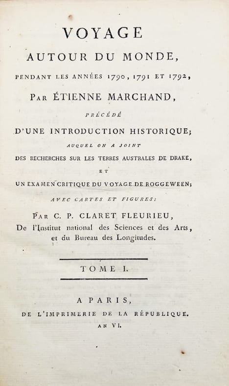
1798rif. 42678A Paris, de l'Imprimerie de la République, 1798-1800. 5 vol. in-8 de (4)-VIII-(2)-CCI-(3)-294-(2) pp. ; VII-529 (1) pp., 3 tableaux dépliants ; (2)-VIII-474-(2) pp., 8 tableaux dépliants ; VIII-494-(2) pp.; XII-559-(4) pp. et 1 atlas in-folio de (2)-VIII-158-(2)- pp., 16 cartes dépliantes, basane racinée, dos lisse orné, pièces de titre et de tomaison en veau noir, tranches marbrées (reliure de l'époque).
1827Carta apparsa nella sesta parte, "Océanique", dell'Atlas universel de géographie physique, politique, statistique et minéralogique di Vandermaelen. L'atlante fu prodotto in un'unica edizione nel 1827; furono venduti solo 810 esemplari completi. Questa grande opera, che comprende circa 378 mappe uniche e che fu compilata nell'arco di tre anni, fu il primo atlante litografico e il primo a rappresentare il mondo con la stessa proiezione e in una scala uniforme. Philippe Marie Guillaume Vandermaelen è stato un cartografo fiammingo attivo a Bruxelles nella prima parte del XIX secolo. A Vandermaelen si deve uno dei più notevoli sviluppi dell'impresa privata nella cartografia, ovvero il suo straordinario Atlas Universel de Geographie in sei volumi. Vandermaelen, nato a Bruxelles il 23 dicembre 1795, viene considerato come il più grande cartografo belga dopo Mercatore e Ortelius. Figlio di un medico che era diventato un ricco produttore di sapone, muovendosi in un ambiente commerciale e da autodidatta, divenne un commerciante di prodotti chimici e farmaceutici. Fanatico di geografia, la sua carriera subisce una svolta definitiva quando, nel 1825, inizia a pubblicare un rivoluzionario Atlas universel che lo consacra come cartografo. Primo atlante al mondo a rappresentare la Terra su una scala unica ed eccezionalmente grande, l'Atlas universel offriva la rappresentazione più ampia, completa e precisa mai realizzata. I suoi contemporanei lo capirono, come la Chiesa cattolica romana, che era in una fase di espansione. Negli anni Trenta del XIX secolo, Roma sosteneva che questo atlante era assolutamente il miglior atlante disponibile, prezioso strumento della sua politica missionaria nell'Oceano Pacifico e nelle isole meridionali. Bibliografia Marguerite Silvestre, Philippe Vandermaelen, Mercator de la jeune Belgique, 2016. Map appeared in the sixth part, 'Océanique,' of Vandermaelen's Atlas universel de géographie physique, politique, statistique et minéralogique. The atlas was produced in one edition in 1827; only 810 complete sets were sold. This great work, featuring some 378 unique maps and compiled over three years, was the first lithograph atlas, and the first to render the world on the same projection and at a uniform scale. Philippe Marie Guillaume Vandermaelen (December 23, 1795 - May 29, 1869) was a Flemish cartographer active in Brussels during the first part of the 19th century. Vandermaelen is created with "one of the most remarkable developments of private enterprise in cartography," namely his remarkable six volume Atlas Universel de Geographie. No one could have foreseen that Philippe Vandermaelen, born in Brussels on 23 December 1795, would become the greatest Belgian cartographer since Mercator and Ortelius. Son of a doctor who had become a wealthy soap maker, moving in a business environment and self-taught, he became a dealer of chemical and pharmaceutical products. As a geography fanatic, there was a definitive shift in his career when, in 1825, he began to publish a revolutionary Atlas universel which established him as a cartographer. As the first atlas in the world to represent the Earth on a single and exceptionally large scale, the Atlas universel offered the widest, most complete and most precise representation ever achieved. His contemporaries understood this, such as the Roman Catholic Church, which was in a phase of expansion. In the 1830s, Rome claimed that this atlas was “the best atlas available” and was the instrument of its missionary policy in the Pacific Ocean and the southern islands. Litograph, with original outline colour, very good condition. Bibliografia Marguerite Silvestre, Philippe Vandermaelen, Mercator de la jeune Belgique, 2016.
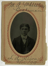
1890rif. COL26-181890. Tintypes 57. A remarkable typological assemblage of portraits showing employees of the Los Angeles division of the Southern Pacific and two of the company's Yuma division. The majority of the men are identified on the photographs' accompanying paper mats with many also noting their occupation division and date the photo was taken. A few also note the subject's date of birth. Occupations represented in the collection include fireman brakeman switchman night car sealer and more. Affixed to one of the paper mats is a some sort of health survey which has been filled out by the subject. There are a number of unusual and fascinating aspects of the collection. First the exact purpose of their creation. Given the relative uniformity of the information present on the mats these were clearly done for internal record-keeping and not created as the kind of "souvenir" one often associates with the tintype. Relatedly the second intriguing aspect of the collection is its chosen format. By the 1890s paper photography was readily available and we have encountered similar "in-house" photographic employee records from around time. These are usually albumen or silver prints tipped into an album similar to mugshot books. Why exactly the tintype was used is not entirely clear. It is possible due to the transient nature of railroad work that it was easier or more efficient to take their portrait in the field. Perhaps these were done in a tintype studio at a railway depot one usually catering to travelers or tourists. We have been unable to locate another collection of this kind. It is a compelling example of the use of the tintype and a fascinating compendium of Los Angeles railroad history. Each 5 x 3 inches overall ; Most with subject ID and occupation to paper mat. unknown
1800rif. 14586Jansen Paris An VIII (1800) - MCIIIXVII 3 vol. 2 vol. in-4 de XVI 442 pp., 332 pp. 114 pp. (vocabulaire et tables) et un atlas in-folio de 1 f.n.ch. (page de titre) 44 ff.n.ch. (carte et planches), demi-maroquin grain long, dos lisse orné, pièces de titre et de tomaison (reliure à l'imitation).
1785rif. 42677Paris, Hôtel de Thou, 1785. Ensemble de 18 vol. in-8 et 3 vol. d'atlas in-4 de 52-67-88 planches, demi-veau havane, dos lisse orné de filets dorés, pièces de titre et de tomaison en veau vert (reliure de l'époque).
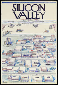
rif. 14949California: Pacific Ventures 1984. 912 by 610mm. 36 by 24 inches. Colour printed poster laid down on foamcore. A view of Silicon valley in its early days parodying Saul Steinberg's classic New Yorker cover "View of the World from 9th Avenue". This view shows Silicon Valley and the offices of its important technology companies looming large in the foreground. Among the companies named are Apple Hewlett Packard and Intel. As the view recedes across San Francisco bay there is a humorously foreshortened view of North America with much smaller views of Lake Tahoe Las Vegas New York and Boston with of course MIT. North Carolina and Texas' computer industry centres are competitively nodded at as well with Piedmont NC's Research Triangle and Austin's Silicon Gulch both shown. Further in the distance is the Atlantic Ocean with France and Germany shown as long islands followed by the Pacific Ocean culminating in Japan. "Silicon Valley" is written at the top of the image in the New Yorker's instantly recognisable font. By appropriating Steinberg's image a self-aware joke about New York City's self-centredness Silicon Valley lays claim to its own importance in the world. Funnily enough they weren't entirely wrong as the next few decades of innovation and economic success would prove. The company behind this image Pacific Ventures appears to have been a venture capital firm in the area that was involved in the technology sector. However we have been unable to find any mention of a Pacific Ventures operating at this time in Silicon Valley though there was a explosion of such companies in the area following Apple's 1980 IPO. Nonetheless the statement behind this image would have served a Silicon Valley based investment firm well. Saul Steinberg's "View of the World from 9th Avenue" appeared on the cover of the New Yorker in March 1976. It has since become one of the most popular and recognisable covers in the magazine's history and it spawned countless parodies as every city from Boston to Omaha clamoured to make a version of their own. Steinberg is quoted in a 2001 New York Times article as having said that if he had received the proper royalties " I could have retired on this painting." Pacific Ventures, unknown
rif. 60409 ½ inches 24 cm. diameter; 21 inches 53 cm. total height. Single pedestal globe with horizon ring armature & meridian all of wood wear and staining on meridian at point where fits into stand some chipping at extremities else fine; globe with vibrant original color and clear sharp patina; some abrasion & losses mostly in lower and upper extremities; overall very good plus condition. An attractive very capably executed table or desk globe in the distinctive style of the Delamarche firm "the most successful French entrepreneurs in maps and globes" Dekker/ van der Krogt. This was an original work by the son Felix who succeeded his father in the management of the firm in 1817. The globe is geographically up-to-date notably in the South Pacific and Alaska with information from then recent Russian voyages such as Krusenstern's. Related to this at the time the globe appeared and reflected on it Europeans were beginning to differentiate between various regions of the Pacific. These were based on a better understanding of cultural and other differences between the peoples of various areas encountered on these recent voyages. For example in 1831 the French explorer Dumont d'Urville proposed the use of the terms "Micronesia" and "Melanesia" for various parts of the Pacific as distinguished from Polynesia. Printed dashed lines on this globe labeled "Division Oceanique" roughly approximate the three eventually accepted divisions of what is referred to as the South Pacific though the regions are not named on the globe. Delamarche also clearly identifies on the globe the more traditional divisions of the Pacific between "Grand Ocean Boreal" "Grand Ocean Equinoxial" and "Grand Ocean Austral." The Delamarche firm was the first to successfully reach a fairly sizable general market of globe buyers. It accomplished this by reducing the cost of constructing globe stands and other parts while maintaining a high level of quality in the maps of their globes which are cleanly and attractively engraved. Traditional brass meridians were replaced by wooden ones and the horizon rings and armatures supporting the rings were greatly simplified and made from either wood or stiff board. Also the firm generally used simpler single-pedestal stands rather than four-legged designs. Yet as this well-preserved example demonstrates Delamarche's design and materials proved to be very durable. Charles-Francois Delamarche 1740-1817 the founder of the family firm was the successor of the great map and globe-making family the Robert De Vaugondys as is cited in the title of this globe. Delamarche in fact seemed to have cornered the globe market in France by also incorporating the stocks of Jean Fortin and Jean Lattre. Delamarche's son Felix took over the firm upon his father's death and managed it until 1848 when Gosselin succeeded him. The firm continued well into the latter 19th century under yet another Delamarche descendent. Dekker/ Van der Krogt Globes from the Western World pp. 63 74; Dekker E. Globes at Greenwich pp. 321-25; Suarez T. Early Mapping of the Pacific p. 25.
rif. 60409 ½ inches 24 cm. diameter; 21 inches 53 cm. total height. Single pedestal globe with horizon ring armature & meridian all of wood wear and staining on meridian at point where fits into stand some chipping at extremities else fine; globe with vibrant original color and clear sharp patina; some abrasion & losses mostly in lower and upper extremities; overall very good plus condition. An attractive very capably executed table or desk globe in the distinctive style of the Delamarche firm "the most successful French entrepreneurs in maps and globes" Dekker/ van der Krogt. This was an original work by the son Felix who succeeded his father in the management of the firm in 1817. The globe is geographically up-to-date notably in the South Pacific and Alaska with information from then recent Russian voyages such as Krusenstern's. Related to this at the time the globe appeared and reflected on it Europeans were beginning to differentiate between various regions of the Pacific. These were based on a better understanding of cultural and other differences between the peoples of various areas encountered on these recent voyages. For example in 1831 the French explorer Dumont d'Urville proposed the use of the terms "Micronesia" and "Melanesia" for various parts of the Pacific as distinguished from Polynesia. Printed dashed lines on this globe labeled "Division Oceanique" roughly approximate the three eventually accepted divisions of what is referred to as the South Pacific though the regions are not named on the globe. Delamarche also clearly identifies on the globe the more traditional divisions of the Pacific between "Grand Ocean Boreal" "Grand Ocean Equinoxial" and "Grand Ocean Austral." The Delamarche firm was the first to successfully reach a fairly sizable general market of globe buyers. It accomplished this by reducing the cost of constructing globe stands and other parts while maintaining a high level of quality in the maps of their globes which are cleanly and attractively engraved. Traditional brass meridians were replaced by wooden ones and the horizon rings and armatures supporting the rings were greatly simplified and made from either wood or stiff board. Also the firm generally used simpler single-pedestal stands rather than four-legged designs. Yet as this well-preserved example demonstrates Delamarche's design and materials proved to be very durable. Charles-Francois Delamarche 1740-1817 the founder of the family firm was the successor of the great map and globe-making family the Robert De Vaugondys as is cited in the title of this globe. Delamarche in fact seemed to have cornered the globe market in France by also incorporating the stocks of Jean Fortin and Jean Lattre. Delamarche's son Felix took over the firm upon his father's death and managed it until 1848 when Gosselin succeeded him. The firm continued well into the latter 19th century under yet another Delamarche descendent. Dekker/ Van der Krogt Globes from the Western World pp. 63 74; Dekker E. Globes at Greenwich pp. 321-25; Suarez T. Early Mapping of the Pacific p. 25. books
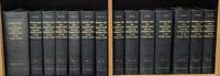
1861rif. 55725Washington DC: Beverley Tucker; A. O. P. Nicholson; George W. Bowman; Thomas H. Ford 1861. Mixed Senate and House editions. Leather bound. Very Good. Twelve volumes in thirteen books Volume twelve in two parts plus one thick volume with the following title in gilt on the spine: "Explorations and Surveys for a Railroad Route from the Mississippi River to the Pacific Ocean. General Report." Large quartos 30 cm Bound in modern black leather with the title stamped in gilt on the spines and blind-tooled embellishments on the spines and boards. "Senate" and "House" stamped in gilt at the head of the spines. "War Department" stamped at the foot. New endpapers. Spines of a couple volumes a bit faded. Sporadic foxing and toning throughout though a large majority of the color lithographs remain in excellent condition. Stitching periodically visible in the inside margins. Occasional moisture stains other light stains and darkening to the pages. Tide mark staining more frequent in volume VI and the General Report. Volumes VIII and XII Book 1 are ex-library with discreet markings. Volume XI with maps and plates is heavily foxed at the beginning mostly affecting the text. This volume contains Warren's great map. Many of the large maps and profiles are fragile and have many splits normally encountered in these kinds of sets. "General Map of Explanations and Surveys in California" in Volume XI completely detached from binding but present. With 665 illustrated plates 64 maps/sections/profiles and 15 diagrams. Collation Notes: Volume II: 12 scenic plates one nearly detached; 20 botanical plates; 4 geological plates; 1 large folding map; 1 large folding geological section. Volume III: 12 scenic plates; 7 diagrams; 8 Native American plates missing illustration titled "Pictographs at Yampais Spring"; 3 geological plates; 2 folding sections and 1 folding map at the rear. Not present in this volume: "General Map from Fort Smith to Rio Del Norte" "General Map from Rio del Norte to the Pacific Ocean" and "Profile of a route for the Pacific Railroad from Fort Smith to Martinez." Volume IV: 1 large folding botanical plate with explanation of signs; 24 plates related to Cacti; 25 other botany plates; 10 plates devoted to Mosses and Liverworts. Volume V: 12 views; 4 maps; 14 sections; 13 views missing plate XII- "Mirage on the Colorado Desert"; 11 fossil and shell plates missing plate X; 28 botany plates. Volume VI: 13 General Report plates; 5 geology plates; 14 botany plates missing Plate I- "Quercus Hindsii"; missing plate X- "Juniperus occidentalis"; 11 fish plates; 3 mammal plates; 2 bird plates. Volume VII: 8 scenic plates; 10 paleontological plates; 14 geological plates; 2 fold-out maps; 8 botanical plates; 11 meteorological plates. Volume VIII: 20 mammal plates plates XVII-LX. Volume X: 33 reptile plates missing plate VI- "Dipsosaurus dorsalis Hallow & Sceloporus biseriatus Hallow"; reptile plate II mislabeled as III; 51 fish plates; 9 mammal plates plate XI- "Sciurus fremonti Towns" mislabeled as plate VI; plate VIII- "Lepus audubonii Baird" mislabeled XIII; 28 bird plates. Volume XI: 4 map plates; 13 sketches of Route of Forty-First Parallel- Beckwith's Report Vol. II; Warren Map plus 31 maps and profiles. Volume XII Book I: 70 lithographs. Volume XII Book II: 6 botany plates; 2 insect plates; 5 mammal plates missing plate VIII- "Texas Mouse etc."; 8 bird plates; 10 reptile plates; 21 fish plates. Some fish plates that are listed in Volume XII Book II as being present in Volume X appear to be absent LXXVI XXVb XXV XXVI LXX LXXV. General Report: 8 diagrams; 3 large folding maps/profiles at rear one with tape repairs- "Milk R. to the Crossing of the Columbia R."; 120 illustrated plates lacking "View of Fort Smith" and "Pictographs at Yampais Spring". No general title page. A mixed Senate and House set in attractive modern leather bindings. The quarto edition of the Pacific Railroad Reports first appeared in 1855 and concluded in 1861 with volume XII. The Surveys aimed at determining the best route for a transcontinental railroad. It embodied the most comprehensive information source on the American West in the mid-19th century. Numerous illustrators engravers lithographers cartographers and printing firms contributed to the publication. This monumental work is rarely found in such nice condition. ".it was the best cartographical work on the West up to its time." - Wright Howes. ".these volumes contain a monumental collection of scientific information geographical zoological botanical geological of the still mysterious American West." - Henry Wagner. Howes P3. Moffat 3536 & 49. Wagner/Camp 262-267 pp. 468-507. Beverley Tucker; A. O. P. Nicholson; George W. Bowman; Thomas H. Ford unknown
1861rif. 55725Washington DC: Beverley Tucker; A. O. P. Nicholson; George W. Bowman; Thomas H. Ford 1861. Mixed Senate and House editions. Leather bound. Very Good. Twelve volumes in thirteen books Volume twelve in two parts plus one thick volume with the following title in gilt on the spine: "Explorations and Surveys for a Railroad Route from the Mississippi River to the Pacific Ocean. General Report." Large quartos 30 cm Bound in modern black leather with the title stamped in gilt on the spines and blind-tooled embellishments on the spines and boards. "Senate" and "House" stamped in gilt at the head of the spines. "War Department" stamped at the foot. New endpapers. Spines of a couple volumes a bit faded. Sporadic foxing and toning throughout though a large majority of the color lithographs remain in excellent condition. Stitching periodically visible in the inside margins. Occasional moisture stains other light stains and darkening to the pages. Tide mark staining more frequent in volume VI and the General Report. Volumes VIII and XII Book 1 are ex-library with discreet markings. Volume XI with maps and plates is heavily foxed at the beginning mostly affecting the text. This volume contains Warren's great map. Many of the large maps and profiles are fragile and have many splits normally encountered in these kinds of sets. "General Map of Explanations and Surveys in California" in Volume XI completely detached from binding but present. With 665 illustrated plates 64 maps/sections/profiles and 15 diagrams. Collation Notes: Volume II: 12 scenic plates one nearly detached; 20 botanical plates; 4 geological plates; 1 large folding map; 1 large folding geological section. Volume III: 12 scenic plates; 7 diagrams; 8 Native American plates missing illustration titled "Pictographs at Yampais Spring"; 3 geological plates; 2 folding sections and 1 folding map at the rear. Not present in this volume: "General Map from Fort Smith to Rio Del Norte" "General Map from Rio del Norte to the Pacific Ocean" and "Profile of a route for the Pacific Railroad from Fort Smith to Martinez." Volume IV: 1 large folding botanical plate with explanation of signs; 24 plates related to Cacti; 25 other botany plates; 10 plates devoted to Mosses and Liverworts. Volume V: 12 views; 4 maps; 14 sections; 13 views missing plate XII- "Mirage on the Colorado Desert"; 11 fossil and shell plates missing plate X; 28 botany plates. Volume VI: 13 General Report plates; 5 geology plates; 14 botany plates missing Plate I- "Quercus Hindsii"; missing plate X- "Juniperus occidentalis"; 11 fish plates; 3 mammal plates; 2 bird plates. Volume VII: 8 scenic plates; 10 paleontological plates; 14 geological plates; 2 fold-out maps; 8 botanical plates; 11 meteorological plates. Volume VIII: 20 mammal plates plates XVII-LX. Volume X: 33 reptile plates missing plate VI- "Dipsosaurus dorsalis Hallow & Sceloporus biseriatus Hallow"; reptile plate II mislabeled as III; 51 fish plates; 9 mammal plates plate XI- "Sciurus fremonti Towns" mislabeled as plate VI; plate VIII- "Lepus audubonii Baird" mislabeled XIII; 28 bird plates. Volume XI: 4 map plates; 13 sketches of Route of Forty-First Parallel- Beckwith's Report Vol. II; Warren Map plus 31 maps and profiles. Volume XII Book I: 70 lithographs. Volume XII Book II: 6 botany plates; 2 insect plates; 5 mammal plates missing plate VIII- "Texas Mouse etc."; 8 bird plates; 10 reptile plates; 21 fish plates. Some fish plates that are listed in Volume XII Book II as being present in Volume X appear to be absent LXXVI XXVb XXV XXVI LXX LXXV. General Report: 8 diagrams; 3 large folding maps/profiles at rear one with tape repairs- "Milk R. to the Crossing of the Columbia R."; 120 illustrated plates lacking "View of Fort Smith" and "Pictographs at Yampais Spring". No general title page. A mixed Senate and House set in attractive modern leather bindings. The quarto edition of the Pacific Railroad Reports first appeared in 1855 and concluded in 1861 with volume XII. The Surveys aimed at determining the best route for a transcontinental railroad. It embodied the most comprehensive information source on the American West in the mid-19th century. Numerous illustrators engravers lithographers cartographers and printing firms contributed to the publication. This monumental work is rarely found in such nice condition. ".it was the best cartographical work on the West up to its time." - Wright Howes. ".these volumes contain a monumental collection of scientific information geographical zoological botanical geological of the still mysterious American West." - Henry Wagner. Howes P3. Moffat 3536 & 49. Wagner/Camp 262-267 pp. 468-507. Beverley Tucker; A. O. P. Nicholson; George W. Bowman; Thomas H. Ford unknown books
2007rif. N4333Belin, 2007, 288 p.