Burlamacchi, PacificoBiblio.com

7 387 résultats
réf. 1286487544.Gpaperback. Good. Access codes and supplements are not guaranteed with used items. May be an ex-library book. paperback
réf. 620618594X.Gpaperback. Good. Access codes and supplements are not guaranteed with used items. May be an ex-library book. paperback
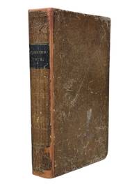
1838réf. 9126Ithaca NY: Published by the Author 1838. First edition. 8vo xii 13-371pp. Folding map of Oregon Territory at front and one plate here between pgs 208 and 209. Contemporary sheep with black spine label gilt lettering. Rebacked with original spine laid down. Front pastedown stained mild to moderate foxing throughout. Map with single small tear at fold neat tape repair at edge few spots of foxing. A very good example with attractive fragile map. First edition in contemporary binding of this popular book which went through at least four editions in the 1840s and contained one of the first widely circulated maps to contain reliable information about the Oregon Territory. Parker's journal details his fur trading expedition in the Rockies in 1835 for part of which he was accompanied by Marcus Whitman. The group arrived in Walla Walla in October 1835 and returned East 2 years later via ship around Cape Horn. A cornerstone Pacific Northwest title. Howes P89. Wagner-Camp 70. Washington 89 60. Published by the Author unknown
réf. 1333637004.Gpaperback. Good. Access codes and supplements are not guaranteed with used items. May be an ex-library book. paperback
2005réf. 012510Lake Grove OR: Western Places 2005. Soft cover. Very Good. Paper covers. 107 pages. Illustrated. Bibliography. Index. Signed by the author. Stains to covers price in ink to front cover. Contents solid. Uncommon. "This publication is the result of several years of research. It documents the notable incidents describes town life and the success and failures of the mines. It is well-indexed and supplies a list of over 1300 people who lived in Belmont at one time or another." Western Places paperback
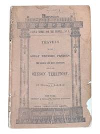
1843réf. 9124New York: Greeley & McElrath 1843. Third edition. 23.5x15.5cm 112pp. Printed in two columns with tables ads on inner wrappers. Stitched in original printed brown wraps. Damp staining to upper corner of first 35 or so pages more pronounced at title and near the front. Spine cocked and with ends chipped chipping along edges of wraps. Pencil annotation to front cover. A very good copy. Third edition following the 1841 and 1843 Poughkeepsie printings of this popular text issued as an "Extra" of the New York Tribune. The book is essentially an account of the first overland to Oregon migration of emigrants bound for the territory led by Farnham and known as the "Peoria Party." They left Independence Missouri on May 20th 1839 and as a substantially smaller group arrived in Oregon on September 23 1839 with Marcus Whitman. Scarce in the original wrappers. Howes F50. Wagner-Camp 85:3. Washington 89 20. Greeley & McElrath unknown
1911réf. 000011106Winnipeg: The Western Land and Townsite Co. Limited 1911. Map. Very Good. 55 cm x 86 cm. Map. Printed in red and black. The map directs the reader to the townsites on that year's construction which they state: "practically all of which will afford excellent openings for all lines of business necessary in a new and developing country and particularly to the divisional point: Coronation. The lines under construction are printed in red. The map directs those looking for plans and prices to contact the Land Department of the Canadian Pacific Railway Co. F.T. Griffin the land commissioner or J.L. Doupe the assistant land commissioner. A large and informative map of two Canadian provinces which experienced development at the hands of railroad tycoons and the descendants of European colonists. A fascinating look at Canada's political and railroad history. With three vertical folds and five horizontal folds the map has about three small splits all at the folds but is holding up quite well. The Western Land and Townsite Co. Limited unknown
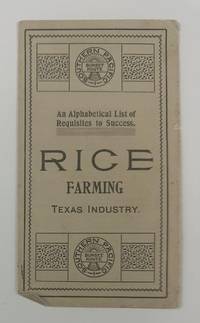
1900réf. 2733Houston: Southern Pacific Sunset Route 1900. Very good. 4pp. on a single folded sheet. Minor toning and creasing. A simple but still interesting promotional leaflet touting the advantages of rice farming in Texas. The text was taken from the Southern Pacific Rice Book and lists twenty-six points of advice about the rice industry and how it is a good investment. These points are listed alphabetically by letter and each entry begins with that letter. For example: "H. Harvest rice same as wheat using a rice harvester." OCLC records just a single copy at the Autry Museum. Southern Pacific Sunset Route unknown
réf. 0265157315.Ghardcover. Good. Access codes and supplements are not guaranteed with used items. May be an ex-library book. hardcover
réf. mon0003909001Tony Raiola Publishing. paperback. Good. . Tony Raiola Publishing paperback
réf. 929061479X.Gpaperback. Good. Access codes and supplements are not guaranteed with used items. May be an ex-library book. paperback
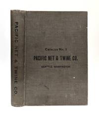
1904réf. 654536Pacific Net & Twine Company 1904. First Edition. Hardcover. Very Good. A scarce surviving copy of the first catalog issued by this important Seattle supplier of maritime equipment. A very good copy in the original gray cloth some soiling and wear. Includes the first 3 supplements: No 1: Marine Plumbing Specialties; No. 2: Michigan Speed Wheels; No. 3: Shipmate Stoves and Parts. 596 16 plus supplements. Profusely illustrated in b/w. Founded in 1897 Pacific Net & Twine survived in some form through the 1980s. It was located on Pier 6 the address for this catalog from 1904 through 1913 when it moved to Pier 8. This copy has at least two ink stamps of the Walstad Machine Company of Tacoma. Pacific Net & Twine Company hardcover
réf. 1258784920.Gpaperback. Good. Access codes and supplements are not guaranteed with used items. May be an ex-library book. paperback
réf. 1258780917.Ghardcover. Good. Access codes and supplements are not guaranteed with used items. May be an ex-library book. hardcover
réf. 124758688X.Gpaperback. Good. Access codes and supplements are not guaranteed with used items. May be an ex-library book. paperback
1980réf. KOS00600146TBD 1980. Soft Cover. Fine. KOS00600146 TBD paperback
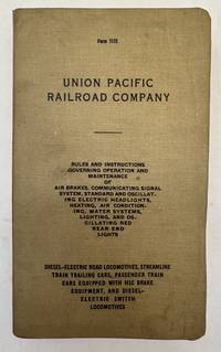
1947réf. 104398Omaha: Union Pacific Railroad Company 1947. Hardcover. Minor to mild damp staining and rippling chielfy to baords and first few pages; else overall very good- thus Binding tight; leaves otherwsie clean. Octavo in tan printed cloth-backed boards; 525 pages; 20 cm. Uncommon. // Air-brakes Chemins de fer Sécurité Dispositifs États-Unis Chemins de fer Wagons Chauffage et ventilation Freins à air comprimé Railroad cars Heating and ventilation Railroads Safety appliances Railroads Safety appliances United States United States. Union Pacific Railroad Company hardcover
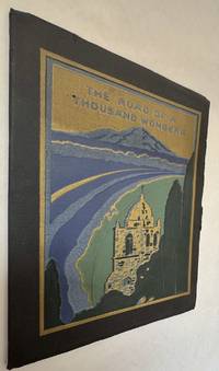
1908réf. 103941San Francisco: Southern Pacific 1908. 1st edition presumably. Paperback. Fine with minor wear. Uncommon thus. 4to illus color stamped black wrappers numerous colored photos 73p. Beautiful design. Advertising. Brochures. Travel railroads wester americana. Southern Pacific paperback
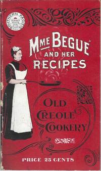
1900réf. 10228San Francisco; Chicago: Southern Pacific Railroad; Printed by Poole Bros 1900. Duodecimo-size booklet 14.75 x 8.5 cm. 80 pages. Blue and brown ink on pink paper. Two photographic portraits Monsieur and Madame Bégué. Illustrations. List of railway agents. Title from cover. In logo at head of title: Southern Pacific Sunset Route. ~ Evident FIRST EDITION. A souvenir anthology of writings including sixty recipes from two landmark New Orleans restaurants offered for sale to customers traveling the Sunset Route San Francisco–New Orleans by the Southern Pacific Railroad Company. A sampling: Mutton Feet à la Créole Liver à la Bégué Jambalaya of Chicken Codish with White Beans Bisque of Crayfish Creamed Cauliflower Onion Salad Eggplant with Rice and Ham Mayonaise of Celery and Shrimps Pineapple with White Wine. ~ The title displayed on the wrappers is misleading: the atmospheric essays and testimonials – arranged by a literary journalist who contributed to Southern Pacific's promotional magazine Sunset Henry Monroe Mayo 1868-1950 – reveal little regarding the eponymous originator of the recipes or the history of the cuisine that brought her fame. Only pages 47-68 contain recipes by Elizabeth née Elisabetha Kettenring Dutreuil Bégué 1831-1906 the proprietary chef of the beloved restaurant in the Vieux Carré – the second oldest such establishment in New Orleans – located on the Rue de la Levée Decatur Street after 1870 downriver from Jackson Square and across from the French Market. An immigrant from southern Germany she had opened a coffee shop with her husband Louis Dutreuil in 1863. After his death in 1875 she married again and with her second husband Hippolyte Bégué 1842-1917 reopened in the same location with the aim of serving one meal per day – a “second breakfast” beginning at 11:00 a.m. – to accommodate laborers in the meat markets and on the docks who started work at dawn. A fuller history by David Shields is available in his The Culinarians Chicago: University or Chicago Press 2017 pages 270-273. By the mid-1880s trade fairs held in the city were bringing tourists as well and Bégué’s became a destination on its own. Madame Bégué died in 1906. The restaurant continued under management of her daughter but was sold in 1914 to relatives of the family Tujague competitors since 1856 on Decatur Street a few doors away. ~ A shorter tribute with recipes pages 69-74 is accorded another restaurateur presumably Victor Béro d. 1904 an immigrant from Belgium who had presided over Victor's Restaurant since 1873. Mayo appears to confuse the "Monsieur Victor" of his time with the founder and namesake of the establishment Victor Martin 1812-1865; cf. Shields page 136 445. ~ The Sunset Route of the Southern Pacific Company was the southernmost of the transport lines to the West Coast originally contemplated by the series of Pacific Railroad Acts between 1862 and 1866. Of the resulting publicly subsidized corporate consortia that would transform western North America – known collectively as the transcontinental railroads – Southern Pacific was already a mammoth system in 1900 including smaller subsidiaries such as the Texas and New Orleans Railroad and extending across territories that would later become New Mexico and Arizona as well as northwards through Nevada Utah and much of California. The in-house Sunset magazine appears to have been printed close to headquarters in San Francisco but like many publications issued by the transportation industry Mme. Bégué and Her Recipes was printed by Poole Brothers of Chicago who advertised as "railway printers" and also produced tickets brochures and mileage tables. ~ Internally clean and sound; in publisher's red wrappers decorated in black and white with an image of Madame Chef in kitchen apron. Wrappers with some rubbing and two small chips to the spine Near very good. Rare. OCLC locates thirteen copies; Uhler 28; New Orleans Culinary History Group page 13; not in Bitting Brown or Cagle. Southern Pacific Railroad]; [Printed by] Poole Bros unknown
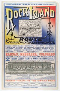
réf. 5510Chicago: Cameron Amberg & Co. Printers ca. 1880. Illustrated chromolithographic broadside with map 21.25” x 13.125” plus margins inset map measuring 4.5” x 5.875” illus. measuring 3.25” x 12.5”. CONDITION: Very good margin chipped at upper right corner a few minor stains. A rare and striking broadside issued by the Chicago Rock Island & Pacific Railway advertising the Rock Island through-express route and promoting the railroad’s numerous destinations connections and amenities. Featuring the eye-catching mix of typefaces and colors that characterized railroad advertising in this era this attractive broadside promotes the numerous midwestern stops and destinations accessible via the Chicago Rock Island & Pacific R’y. At this time two through-express trains for Kansas and Nebraska ran daily in connection with the Atchison Topeka & Santa Fe and Union Pacific railroads. As noted here meals were served in palace dining cars for seventy-five cents each and 150 pounds of baggage were allowed on each full ticket and seventy-five pounds on each half ticket free. The line’s various destinations included Iowa City Council Bluffs Denver Salt Lake City and San Francisco as well as “all points in Kansas Nebraska Colorado Arizona New Mexico Utah Montana and California.” Showing the Rock Island R.R. in bold the inset map spans from Chicago and Lake Michigan in the east to Omaha and Council Bluffs in the west and reaches from St. Paul in the north to St. Louis and Kansas City in the south—with Lake Michigan lying in the upper-right corner. One axis of the line extends from Milwaukee and Racine Wisconsin to Leavenworth Kansas and another stretches from Chicago to Omaha. Various spurs connect to both. The lower section of the broadside features a marvelously detailed illustration of the interior of a palace dining car showing numerous fashionably dressed passengers seated and dining among African American waiters who are shown in the small kitchen and serving food. In the far-right end of the train men are depicted in drawing rooms—reading newspapers and smoking—and various railway operators and ticket-men appear at the ends of the car. Also included is a table of connections with various railroads that could be made in “Union depots.” Through-tickets via this route could be found on sale at all coupon offices in the U.S. and Canada. Those seeking additional information folders maps and times-tables are encouraged to contact any of the ten agents and managers of the Rock Island R.R. listed at the bottom who were based in New York Toronto Philadelphia Chicago etc. Established in 1847 as the Rock Island & LaSalle R.R. the company was reincorporated in 1851 as the Chicago & Rock Island R.R. Co.—its rails during this period reaching to Morris Illinois and later Ottawa. After acquiring the Mississippi & Missouri R.R. in 1866 the company was renamed Chicago Rock Island & Pacific R.R. Co. Expanding between 1873 and 1882 the company built more branch lines that reached into Iowa as well as Kansas City. In 1880 the firm was reorganized under the name Chicago Rock Island and Pacific R’y Co. and by 1883 extended nearly to the southern boundary of Kansas. After Congress granted passage across Indian Territory in 1887 the Rock Island R.R. began developing through Texas to Galveston as well as New Mexico Territory. During the 1920s the railroad enjoyed considerable success. In 1926 the company began constructing a freight line between Amarillo Texas and Liberal Kansas which was finished in 1929 and served to make accessible a country of rich grain. While the railroad industry continued fairly steadily through 1930 between 1931 and 1935 the Depression took a toll on the Rock Island R.R. and went into decline. The company ceased operation in 1980. OCLC records just one copy held at Yale. REFERENCES: “Chicago Rock Island and Pacific Railway Records” at Kansas Historical Society online. Chicago: Cameron, Amberg & Co., Printers, [ca. 1880] unknown
1900réf. 2716ml1900. Soft Cover. Good. Gd. condition : Gay Literature . A mag to match the movie . . L6a paperback
1856réf. 1004314to original cloth rebacked with original spine strip laid on new endpapers. Illustrated with 20 of 21 color lithographs several steel engraved charts and shell engravings and three color lithographed folding maps. Table of contents list 20 color plates but some copies seem to have twenty-one. Two of the folding maps/charts have been placed in a rear endpaper pocket; one has a neat repair. A little rubbing to cloth and some minor darkening within. Could be missing one plate. Overall very good and nicely restored. One of the great sources of information on the west the Pacific Railroad Reports also contains some great illustrations. This installment Vol. III is no exception. Included are some interesting and colorful pictures of the Mojave Indians and their territory. This report contains intelligence on an expedition near the 35th parallel which took the southern route due west to the Pacific Ocean from Fort Smith Kansas that was conducted by Lieutenant A.W. Whipple and assisted by Lieutenant J.C. Ives. Ives would make his own mark on western expansion a few years later in his travels on the Colorado River. Wagner-Camp 263 Beverly Tucker hardcover
1857réf. 1004304to 11 ½ x8 ¾ original law calf morocco illustrated 4 134 85102 114 2 iv 64 pp. Some scuffing and wear to covers slight gouge to front joint chipping to edges. Two plates detached one with a chipped corner. Overall very good. Organized by the War department under the direction of Jefferson Davis who was Secretary of War at that time a collection of volumes was produced in the quest for the best route for a railroad to the West. Jefferson Davis wrote part of the introduction to this series and outlines the goals of the project. This report is on routes explored in Northern California and Oregon. Specifically the expedition was to look for a railroad route crossing the Sierra Nevada near the source of the Carson River and to see if it was feasible to connect the Sacramento valley with the Oregon Territory. Most of the color plates in this volume are located in the first three parts of the publication which is focused on topography geology and botanical subjects. This volume includes 23 color lithographs of scenery and botanical subjects 2 hand colored plates of birds and 24 steel engraved plates. Wagner-Camp 264a. Beverly Tucker, unknown
1856réf. 1006214to leather spine and tips with marbled boards 36 Illustrations include 21 tinted/color lithographs one folding diagram two folding maps and a couple of black and white plates 36 14 136 127 175 pp. Binding with some wear at the spine and extremities hinges cracked some pages are a bit loose plates all present but probably not bound in correct order folding maps have a few tears some staining to front endpapers but not into the balance of the text plates and text show some aging foxing and browning but most plates resonably are clean. One of the great sources of information on the west the Pacific Railroad Reports also contains some great illustrations. This installment Vol. III is no exception. Included are some interesting and colorful pictures of the Mojave Indians and their territory. This report contains intelligence on an expedition near the 35th parallel which took the southern route due west to the Pacific Ocean from Fort Smith Kansas that was conducted by Lieutenant A.W. Whipple and assisted by Lieutenant J.C. Ives. Ives would make his own mark on western expansion a few years later in his travels on the Colorado River. The substantial amount of information on various Indain tribes makes this installment an important one. Since many of these volumes are broken for the plates they are getting somewhat scarce. Beverly Tucker, hardcover
1860réf. 100432Large thick 4to contemporary calf spine and tips with marbled boards 70 very attractive color lithograph plates 358 41 pp. Extremeties worn minor aging one map has tear in lower corner plates bright and clean. The Pacific Railroad Surveys 1853-1855 explored possible routes for a transcontinental railroad. However the surveys went beyond looking for a place for a railroad they included and incredible amount of information on natural history and the peoples that inhabited the areas where the surveys explored. Representing the first part of the final volume of these surveys this installment focused on the northern route for a railroad. The 12 volumes included in these surveys is also known for rich illustrations many of which were in color. With 70 color plates one folding and three folding maps in Volume XII part 1 this edition is particularly rich in illustration and the plates are bright and clean. Thomas A. Ford hardcover