6 911 résultats
réf. 56-0219Tucson Ariz.: Southern Pacific Company 1947 revised 1950. Map. Blackline print. 24 x 164 inches. Very detailed map of West Phoenix from Ninth Avenue to Thirty-Fifth Avenue including names of plot owners and businesses. Scale: 1 inch = 100 feet. Tucson, Ariz.: Southern Pacific Company, 1947, revised 1950. unknown
réf. 56-0394Oakland Calif.: Southern Pacific Company 1927 rev. 1947. Blueline print 24" x 56". From East Sixth Street to Benicia Junction. Includes Straits of Carquinez Benicia Arsenal Army Point station point Maia Point abandoned station Yuba Co Macadam Roadway Wharf. Scale 1" = 100'. Oakland, Calif.: Southern Pacific Company, 1927, rev. 1947. unknown
réf. 56-0380Oakland Calif.: Southern Pacific Company 1945 rev. 1961. Blueline print 24" x 62". From Estuary and Pierhead line to Eagle Avenue along Webster Street. Includes Air Force Intransit Depot Federal Housing Authority Bethlehem Shipbuilding Corporation Associated Oil Company. Scale: 1" = 100'. Oakland, Calif.: Southern Pacific Company, 1945, rev. 1961. unknown
réf. 01-0056San Francisco Calif.: Southern Pacific Los Angeles Division 1934. Map. Scale: 1 inch = 100 feet. Blueprint. August 4 1943. San Francisco, Calif.: Southern Pacific, Los Angeles Division, 1934. unknown
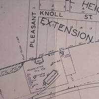
réf. 56-0396Sacramento Calif.: Southern Pacific Company 1947. Blueline print 24" x 56". From Sacramento Street to beyond Virginia Street and Davenport Subdivision. Includes Bernhard Subdivision College Heights and College Heights Extension Texaco Oil Standard Oil Telephone Co Associated Oil Henny & Berquist Contractors. Scale 1" = 100'. Sacramento, Calif.: Southern Pacific Company, 1947. unknown
réf. 56-0335San Francisco Calif.: Southern Pacific Company 1926. Map. Blueline print 24" x 55" with red and black pencil. From Little John Creek and French Camp Slough to beyond French Camp crossing. Includes Sperry Flour Western Lumber Sales Co Mosswood Park. Scale approx. 1" = 100'. San Francisco, Calif.: Southern Pacific Company, 1926. unknown
réf. 58-0478San Francisco Calif.: Southern Pacific Company 1924 rev. 1952. Blueline print 24 inches x 56 inches. From Winslow Avenue to Charter Street. Includes station points Redwood City and Redwood Junction Eastern Addition Hancock Addition Diller's Addition Davies Chevrolet. Scale 1 inch = 100 feet. San Francisco, Calif.: Southern Pacific Company, 1924, rev. 1952. unknown
réf. 58-0560San Francisco Calif.: Southern Pacific Company 1947 rev. 1955. Blueline print 24 inches x 56 inches red and green pencilling. From Rosemont Street and Williamette River to 9th Street and Wallace Road. Includes Kingwood Park Addition Blue Lake Cannery National Battery Company. Scale 1 inch = 100 feet. San Francisco, Calif.: Southern Pacific Company, 1947, rev. 1955. unknown
réf. 58-0471San Francisco Calif.: Southern Pacific Company 1925 rev. 1937. Blueprint 24 inches x 56 inches. From St. Francis Way to Broadway and Winslow Street. Includes Mezesville Wellesley Park Dingee Park Pacific Gas and Electric Standard Oil Co. Proposed lease limits to Redwood City for fence and cultivation purposes. Scale 1" = 100'. San Francisco, Calif.: Southern Pacific Company, 1925, rev. 1937. unknown
réf. 56-0469Stockton Calif.: Southern Pacific Company 1928 rev. 1941. Blueline print 24 inches x 13 feet. Three maps joined securely. From 3400' west of First Street Los Banos to 3000' east of Abatto along railroad tracks. With 6" tear no missing material. Details of all industries along railroad tracks. Including Los Banos Lumber & Supply Co Standard Oil Co Central California Creameries. Scale 1" = 100'. Stockton, Calif.: Southern Pacific Company, 1928, rev. 1941. unknown
réf. 56-0277San Francisco Calif.: Southern Pacific Company 1926 revised 1949. Map. Blueline print 24" x 56" notes indicate "Sheet 1 of 3." Includes Fresno River Johnsons Addition town of Madera between Central Ave and Third Street and between C Street and H street. Scale 1" = 100'. San Francisco, Calif.: Southern Pacific Company, 1926, revised 1949. unknown
réf. 56-0391San Francisco Calif.: Southern Pacific Company 1940. Blackline print 24" x 56". Sheet two of two. From Pit River to 1700' east of Alturas station. Includes Alturas station point Willow Park Subdivision State Highway Mary C. Miller plot PS Dorris plot Churchill Street. Scale 1" = 100'. San Francisco, Calif.: Southern Pacific Company, 1940. unknown
réf. 56-0382Oakland Calif.: Southern Pacific Company 1949 rev. 1959. Blueline print 24" x 56". Sheet two of two. From US Naval Air Station entrance to Main Street and Todd Shipyards Corporation. Includes US Naval Air Station with Officer's Quarters and Club Oakland Estuary Todd Shipyards Company. Scale 1" = 100'. Oakland, Calif.: Southern Pacific Company, 1949, rev. 1959. unknown
réf. 56-0341San Francisco Calif.: Southern Pacific Company 1931. Map. Blueline print 24" x 55". Includes Salt River station points Tempe and Tempe Junction. Includes Schedule of Property with approx 20 transfers 1875-1931. Scale 1" = 400' San Francisco, Calif.: Southern Pacific Company, 1931. unknown
réf. 56-0268San Francisco Calif.: Southern Pacific Company 1946. Map. Blueline print 24" x 220". Detailed map of Fresno along railroad lines from Roeding Park to Atchison Topeka and Santa Fe building at California Ave and Belgravia Ave. Scale 1" = 100'. San Francisco, Calif.: Southern Pacific Company, 1946. unknown
réf. 56-0281San Francisco Calif.: Southern Pacific Company 1949 revised 1954. Map. Blueline print 24" x 36" with pencil notation. Includes State Highway 4 & 24 Standard Oil Co Camp Stoneman U.S. Government building. Scale 1" = 100' San Francisco, Calif.: Southern Pacific Company, 1949, revised 1954. unknown
réf. 56-0403Oakland Calif.: Southern Pacific Company 1948 rev 1960. Blueline print 24" x 56". From West Third Street to East Sixth Street E Street to Union Street. Includes Kullman Salz & Co American Sardine River Steamer Landing Benicia Food Products Co Plant Martinez-Benicia Auto Ferry. Scale 1" = 100'. Oakland, Calif.: Southern Pacific Company, 1948, rev 1960. unknown
réf. 56-0414San Francisco Calif.: Southern Pacific Company 1947 rev. 1961. Blueline print 24" x 56". No buildings described other than General Office and Section Foreman. Includes signal descriptions within railroad yard Del Norte Street. Scale 1" = 100'. San Francisco, Calif.: Southern Pacific Company, 1947, rev. 1961. unknown
réf. 58-0476San Francisco Calif.: Southern Pacific Company 1925 rev. 1944. Blueline print 24 inches x 56 inches. From Redwood City Harbor Company to West Point Creek. Includes Redwood City Harbor Co Pacific Portland Cement Co Redwood Creek West Point Creek city of Redwood City station point Redwood Harbor. Scale 1 inch = 100 feet. San Francisco, Calif.: Southern Pacific Company, 1925, rev. 1944. unknown
réf. 56-0240Oakland Calif.: Southern Pacific Company 1930 revised 1960. Map. Blueline prints each 25" x 56". Station plan of Oakdale railroad property with approx. four blocks on each side along tracks from north of Stanislaus River to south of South St. Scale 1" = 100'. Oakland, Calif.: Southern Pacific Company, 1930, revised 1960. unknown
réf. 56-0270San Francisco Calif.: Southern Pacific Company 1956. Map. Blueline print 24" x 56" Includes Fruit Growers Supply Co F. G. S. Co Store and Office Pond. Scale 1" = 100'. San Francisco, Calif.: Southern Pacific Company, 1956. unknown
réf. 56-0294San Francisco Calif.: Southern Pacific Company 1926 revised 1942. Map. Blueline print 24" x 36". From North Ninth St to Seventeenth St along Berryessa Road including approx 2 1/2 blocks in each direction. Includes California Packing Corp Modern Ice and Cold Storage Co. Scale 1" = 100'. San Francisco, Calif.: Southern Pacific Company, 1926, revised 1942. unknown
réf. 56-0411San Francisco Calif.: Southern Pacific Company 1919 rev. 1955. Blueline print 24" x 56". From orchard beyond Hopkins Avenue and Harrison Street to Kennedy Avenue Camden Avenue. With Schedule of Property listing 6 transfers 1877-1886. Includes Cambell station point Drew Canning J.C. Ainsley & Co Western Gravel Campbell Lumber. Scale 1" = 100'. San Francisco, Calif.: Southern Pacific Company, 1919, rev. 1955. unknown
réf. 56-0412Tucson Ariz.: Southern Pacific Company 1926 rev 1961. Blueline print 24" x 56". Few buildings primarily details measurements along railway line. From US Department of Interior reclamation road to W.R. Whitman plot. Includes Aluminum Company of America Campo station point buildings leased to Covington Stevens Aill Roofing and Copper Metwis Co. Scale 1" = 100'. Tucson, Ariz.: Southern Pacific Company, 1926, rev 1961. unknown
réf. 56-0387Portland Ore.: Southern Pacific Company 1958 rev. 1961. Blackline print 24" x 72". Sheet one of two. From Vine Street and Albany and Santiam Canal to Santiam Highway. Includes Vollstedts Feed Mills Firestone Buchauan Cellars Central Junion High School Railroad Yard Madison School. Scale 1" = 100'. Portland, Ore.: Southern Pacific Company, 1958, rev. 1961. unknown