IndiaBiblio.com
13 306 résultats
réf. 45398079-nnew. unknown
réf. A9781345179644Hardback. New. hardcover
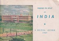
réf. 223137New Delhi.: The Tourist Division. Ministry of Transport. Black and white photographic plates 149pp. 13 x 19cm. A little rubbed and browned wrappers from the library of Professor A. L. Basham with his handwritten title on the spine. . The Tourist Division. Ministry of Transport. unknown
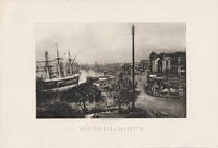
1890réf. 217858London. circa1890s. Engraving 11.5 x 18cms image only; 18.2 x 26.5cms sheet including caption a little marginal wear but the image with deep tone in very good condition. Atmospheric photogravure of Kolkata after an original photograph by Francis Frith 1822-1898 one of the most successful English commercial photographers in the 1850s & 1860s. . unknown
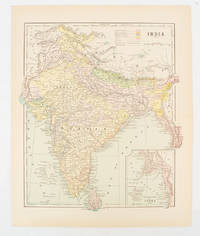
1910réf. 174839New York. circa1910. Printed colour map 29 x 25 cm with inset map of the Eastern Part of India colour key reference key to the ruling divisions current and projected railways and telegraphs also shown central fold slight toning; in very good condition. Interesting map shaded by Divisions: the Presidencies of Bengal Madras Bombay Ceylon "Native States under British Protection" and "Independent States" Nepal and Bhutan. . unknown
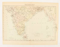
1910réf. 174841London. circa1910. Printed colour map on conjoined pages 22.3 x 33.7 railways submarine cables and heights above sea level marked faded but in very good condition. Map showing the ruling divisions by shading borders with Burma and the Andaman and Nicobar Islands also shown. . unknown
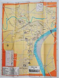
1960réf. 178269Circa1960. Folding colour tourist map of Varanasi in Uttar Pradesh province two inset maps of India and a gude map of Sarnath legend and key select Ghats shown railways "western style" and "Indian style" hotels marked in very good condition. 42.9 x 33.1 cm. . unknown
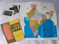
1970réf. 223132Government of India. Circa1970s. One booklet in stapled wrappers one large folding brochure and an envelope from the Indian Museum including six postcards with black and white photographic illustrations of which one inscribed by a prior owner. "India": Colour and black and white photographic illustrations 36pp. 21.8 x 20.3cm. Lacking map in envelope at rear a small closed tear near tail of first leaf. "India Tourist Map" brochure: Colour and black and white maps 22.2 x 10.2cm. Several closed tears mended with acid free tape. Overall a little rubbed and browned still a good set. . Government of India. unknown
réf. SONG0521663601Used: Good unknown
1990réf. 040447Lexington: The University Press of Kentucky. 1990. viii 327pp index bibliography notes bw ills maps endpaper maps. Or brown cloth in jacket. Prev owner name at top of front free endpaper some foxing to edges slight edgewear to jacket. . First Edition. Hard Cover. Very Good/Very Good. 8vo. The University Press of Kentucky. Hardcover
réf. SONG0520377060Used: Good unknown
réf. SONG1501752030Used: Good unknown
réf. DADAX1436779650New unknown
réf. DADAX1436793289New unknown
réf. 0366151371.Gpaperback. Good. Access codes and supplements are not guaranteed with used items. May be an ex-library book. paperback
réf. A9781166618346New. unknown
réf. DADAX0548772711New unknown
réf. SONG0521052297Used: Good unknown
réf. DADAX0548899398New unknown
réf. DADAX0822353199New unknown
réf. SONG0226736334Used: Good unknown
réf. DADAX0548316368New unknown
réf. DADAX1437361064New unknown
réf. B9781019562536Hardback. New. hardcover