11 974 résultats
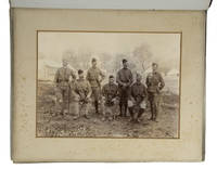
1898réf. ABC_457021898. 2 PARK Superintendent. 1898. Catalogue of photographs by Sergeant A.J. Clarke R.E. taken during Tirah Expedition 1897-1898. Kirkee Pune India Sappers and Miners' Press 1898. Small folio 22 x 14.5 cm 4 pp. With a lithographed title-page. Loosely inserted in the album. Collection of photographs taken by a British Indian Army officer who served in the Peshawar Column during the Tirah Expedition in the Northwest Frontier of India from June 1897 to April 1898 including a manuscript Key that identifies seven British officers that are in the first photo of the album and a list of captions to 10 photos in the album.The Tirah Expedition was aimed against the Afridi and Orakzai tribes in British Indias Northwest Frontier modern-day Khyber Pashtunkhwa province of Pakistan. One of many Northwest Frontier campaigns of British India the Tirah campaign concentrated on the area west and south of Peshawar in the mountainous region between the valleys of the Bara and Kohat Rivers. The album primarily documents the actions of the Tirah field forces Peshawar Column under command of Brigadier-General Arthur George Hammond 1843-1919 which followed the route of the Bara Valley.The present photo album contains 8 large albumen photos documenting the movement of the Peshawar Column. The large photos were taken by W. Rahn according to the memoirs of Peshawar Column officer Richard Thomsett we had a photographer named Rahn with the column and he accompanied us until we arrived at Ali Masjid in December 1897 when an accident necessitated his returning to India. Rahn was a German who had come out to the East some twenty years before and seemed to be ubiquitous for wherever we were there he was with his camera ready and I must say he took some very excellent pictures.The present album also includes 43 smaller gelatin photos with manuscript captions for 10 of them on a small piece of paper perfectly describing the photos on leaves 5 and 9 of the album. The album is supplemented with a rare 4-page brochure no doubt produced in a small print-run that lists 99 photos. About 20 have been marked by hand in pencil probably by the albums compiler. The brochure indicates that the present photos could be purchased from the Bombay Sappers and Miners.8 of the large photos have contemporary manuscript captions in ink on the mounts. 2 marks on the front paste-down reading "photographs by British Royal Engineers. Tirah Expedition 1897-1898 North India. Binding slightly rubbed on extremities the original 5 cords replaced with 3 new black cords hinged to stubs . A few images mildly faded. The additional manuscript leaves foxed and worn. Otherwise in good condition.l The navy and army illustrated V no. 53 24 December 1897 pp. 150-152 4 of the 8 large photographs & no. 57 18 February 1898 p. 275; R.G. Thomsett With the Peshawar olumn. Tirah expeditionary force London 1899 pp. 103-104. unknown
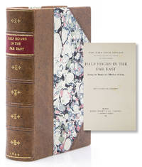
1908réf. 318465London: Church Missionary Society 1908. First edition. 8vo. Bound in three quarters modern polished brown polished calf and marbled boards. Fine. First edition. 8vo. Church Missionary Society hardcover
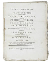
1799réf. ABC_45147Calcutta: Honorable Companys Press 1799. Never bound but side stitched through 3 holes. Super Royal 4to 33.5 x 25 cm. A British propaganda publication printed in Calcutta transcribing secret documents that the British supposedly found in the palace of Seringapatam: primarily Tipu Sultans correspondence with the French considered a betrayal of the British. Tipu Sultan 1750-1799 ruler of the Kingdom of Mysore in southern India took part in a long-standing military feud with the British but made peace with them in 1792. When the French under Napoleon made a push for India in 1798 the British attacked Tipus forces once again starting the Fourth Anglo-Mysore War and eventually killing Tipu Sultan in the attack on Seringapatam. He had a fearsome reputation as the Tiger of Mysore and the present publication attempts to discredit him as a traitor. His supposed affiliation with the French Jacobin Club would have especially concerned British readers. Most of the correspondence between Tipu Sultan the French and their allies including Zaman Shah Durrani ruler of what was to become Afghanistan is printed in parallel columns in English and French. Also included is the text of a letter from Tipu Sultan printed letterpress in Persian in the nastaliq script: 9 lines of type apparently set in the nastaliq type cut under the direction of Charles Wilkins 1749-1836 who served the East India Company in India and became their leading orientalist. It was first used at Calcutta in 1781. The only earlier type for the script that has been clearly documented is thought to have been cut in the 1590s for the Propaganda Fide in Rome who used it around 1633. Neil Benjamin Edmonstone translated the Persian and G.G. Keble the French. Although the book is a true very large quarto point holes along the fold at the head and deckles at the foot and fore-edge the chainlines are vertical though one would not expect sheets this large to be made in double moulds the usual reason for chainlines parallel to the long axis of the sheet.In good condition. Wholly untrimmed and with most bolts unopened and the point holes present.l Shaw Printing in Calcutta 359; Shaw SABREB sab00086; not in Cat. East-India Comp. Honorable Companys Press, unknown
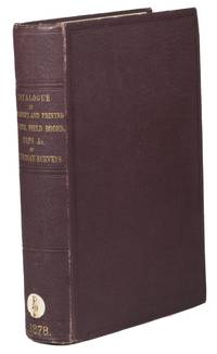
1878réf. ABC_45484London: George E. Eyre & William Spottiswoode colophon 1878. Contemporary cloth title in gold on spine. Large 8vo. First and only edition of a catalogue of the material held in the London India Office that was produced by the Indian Surveys for the East India Company. The catalogue was printed by order of her Majesty's Secretary of State for India in council. It is a key reference work for all studies on the East India Company era in Indian and British history.Shelf mark on spine library plate on front paste-down Scheepvaartmuseum Amsterdam. Slight foxing on the first and last couple pages. Otherwise in very good condition.l Kaul Early writings on India: a union catalogue of books on India in the English language published up to 1900 and available in Delhi libraries 1975 92. George E. Eyre & William Spottiswoode (colophon), hardcover
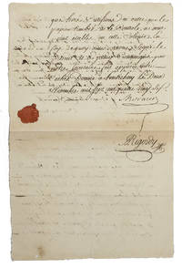
1786réf. ABC_45537Puducherry Pondichéry 1786. Folio. Manuscript death certificate including a red wax seal of a former employee of the French East India Company who is buried in the cemetery of the Église Notre-Dame-des-Anges in Puducherry which was the capital of the Indian district and later also the larger union territory of the same name which was ruled by the French from 1673 to 1954. The certificate is signed by the reverend father Damas who was superior of Puducherry and was authenticated by the authorizing officer of the French East India Company Jean-François de Moracin who was also commissioner general of the ports and naval arsenals in the colonies.In good condition. unknown
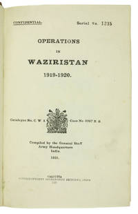
1921réf. ABC_45215Calcutta: Superintendent of Government Printing 1921. Contemporary half calf green cloth sides gold-stamped red spine labels. 8vo. With frontispiece 31 plates 7 maps 3 in pocket on inside of back board and 8 panoramas mostly folding. First edition of the British-Indian armys official account of the 1919-20 Waziristan campaign marked "Confidential" on the title-page. The operations followed unrest that arose in the aftermath of the Third Anglo-Afghan War; they were conducted in the mountainous region of Waziristan now in Pakistan by British and Indian forces against the fiercely independent Waziri and Mahsud tribesmen that inhabited it. Since the 1870s the British government agencies were assiduous in compiling internally published histories of their military frontier operations with the intention of providing a "valuable guide" to such British commanders and policymakers as "might have future dealings with these turbulent neighbours" as the Punjab Government phrased it in 1866.The title-page reports the catalogue number and location of what may be the original report: Catalogue no. C.W. 4 - Case no. 8987 N.S..Serial No. 1235 stamped on the title-page. Occasional light marginal staining. A few edge flaws consistent with army use repaired by a contemporary owner. Otherwise in very good condition.l WorldCat 11497145. Superintendent of Government Printing, hardcover
1997réf. AME_9781883001346Eye On Education 1997. 1St. Paperback. New/New. _ Eye On Education paperback
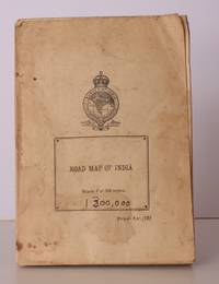
1946réf. 42874Survey of India 1946. Folding coloured map on paper measuring 44 x 31 ins approx. 112 x 79 cms folding in 36 panels to 7.5 x 5.25 ins approx. 19 x 13 cms; printed wrapper covers mildly age-soiled but map itself remakably bright and clean a bright copy. A SCARCE SURVIVAL. Survey of India, unknown
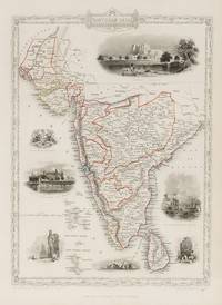
1851réf. 200109AG1851. London & New York John Tallis & Company 1851. Original steel engraving / Vintage map. Drawn and engraved by John Rapkin. Partly hand-coloured. Illustrations by A.H. Wray and Engraved by J.H. Kernot. Plate Size: 31.8 cm x 25.5 cm. Sheet Size: 37.2 cm x 27.2 cm. Vintage 19th century map in very good condition. Beautiful map of the southern Indian subcontinent from Sinde at the mouth of the Indus Estuary in the north down through Gujerat Bejapor and Mysore and down into the Carnatic region in the south. Hydrabad and Circars border the Bay of Bengal. Ceylon is also included in the map as are the Laccadive and Maldive islands in the Indian Ocean. Relief is depicting with hachuring. The major cities such as Bombay Sernigapatam and Madras are shown as are the rivers - including the Godavery and Beema rivers. This was an India dominated by the East India Company the British joint-stock company that came to rule large areas of India with its private armies exercising military power and seizing administrative functions. Formed in the early 1600s to compete with the Dutch for trade and commerce in the East the company rose to account for half of the world's trade at one point. Company rule in India lasted until 1858 when following the Indian Rebellion of 1857 the Government of India Act 1858 led to the British Crown's assuming direct control of the Indian subcontinent in the form of the new British Raj. The company was dissolved in 1874 as a result of the East India Stock Dividend Redemption Act passed one year earlier as the Government of India Act had by then rendered it vestigial powerless and obsolete. The official government machinery of British India assumed the East India Company's governmental functions and absorbed its navy and its armies in 1858. Wikipedia John Tallis 7 November 1817 3 June 1876 was an English cartographic publisher. His company John Tallis and Company published views maps and atlases in London from roughly 1838 to 1851. Tallis set up as a publisher with Frederick Tallis in Cripplegate in 1842; the business moved to Smithfield in 1846 and was dissolved in 1849. From 1851 to 1854 Tallis operated as John Tallis and Company. He started The illustrated news of the world and national portrait gallery of eminent personages in 1858 selling it for £1370 in 1861; it folded in 1863. Wikipedia The most important project John Tallis undertook was the 'Illustrated Atlas' from 1851. The original map we offer here was part of this exceptional Atlas and all the maps it contained are still today considered as the last reminder of an era of lavish map production. Tallis worked the project together with John Rapkin 1815-1876 and it was Rapkin's style and talent that we have to thank for when we marvel at these maps today. What makes these maps so special is the detail of engraved vignettes that surround the map and often show indigenous scenes people in their environment and even more so historical buildings or historical views of towns and cities architecture and landscape. The project of 'The Illustrated Atlas' was designed to be finished just in time for the anxiously awaited "Great Exhibition of the Works of Industry of All Nations" or The Great Exhibition sometimes referred to as the Crystal Palace Exhibition in reference to the temporary structure in which it was held was an international exhibition that took place in Hyde Park London from 1 May to 11 October 1851. It was the first in a series of World's Fairs exhibitions of culture and industry that became popular in the 19th century and it was a much anticipated event. The Great Exhibition was organized by Henry Cole and Prince Albert husband of the reigning monarch Queen Victoria. It was attended by numerous notable figures of the time including Charles Darwin Samuel Colt members of the Orléanist Royal Family and the writers Charlotte Brontë Charles Dickens Lewis Carroll George Eliot and Alfred Tennyson. Music for the opening was under the direction of Sir George Thomas Smart and the continuous music from the exhibited organs for the Queen's procession was "under the superintendence of William Sterndale Bennett". Wikipedia unknown
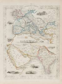
1851réf. 200124AG1851. London & New York John Tallis & Company 1851. Original steel engraving / Vintage map. Drawn and engraved by John Rapkin. Partly hand-coloured. Illustrations by H. Warren and Engraved by J. Rogers. Plate Size: 34.5 cm x 34 cm. Sheet Size: 27.2 cm x 37.4 cm. Vintage 19th century map in very good condition. Published in the Illustrated Atlas And Modern History Of The World Geographical Political Commercial & Statistical Edited By R. Montgomery Martin. Beautifully bordered and fascinating double map of the overland route between Britain and India. The upper map shows Europe and the links - both land and sea - running from England through to Alexandria Egypt. The routes are; the 'Mail Steam Packet Route' which runs around Gibraltar through Malta and onto Egypt; the 'Marseilles Overland Route' that runs across France to Marseilles and onto Alexandria via Malta and; the 'German Overland Route' that runs through across Belgium Germany before reaching Trieste and then onto the Mediterranean and then Egypt. The second map shows the differing routes on the next part of the journey - either across the Turkish controlled Middle East and through the Persian Gulf or down the Red Sea and across the Indian Ocean. What the map clearly illustrates is the importance attached to India 'Hindoostan' in the Imperial mind and the need for secure communication and transport links which necessitated control of certain choke points on the link such as Gibraltar Malta Suez etc. John Tallis 7 November 1817 3 June 1876 was an English cartographic publisher. His company John Tallis and Company published views maps and atlases in London from roughly 1838 to 1851. Tallis set up as a publisher with Frederick Tallis in Cripplegate in 1842; the business moved to Smithfield in 1846 and was dissolved in 1849. From 1851 to 1854 Tallis operated as John Tallis and Company. He started The illustrated news of the world and national portrait gallery of eminent personages in 1858 selling it for £1370 in 1861; it folded in 1863. Wikipedia The most important project John Tallis undertook was the 'Illustrated Atlas' from 1851. The original map we offer here was part of this exceptional Atlas and all the maps it contained are still today considered as the last reminder of an era of lavish map production. Tallis worked the project together with John Rapkin 1815-1876 and it was Rapkin's style and talent that we have to thank for when we marvel at these maps today. What makes these maps so special is the detail of engraved vignettes that surround the map and often show indigenous scenes people in their environment and even more so historical buildings or historical views of towns and cities architecture and landscape. The project of 'The Illustrated Atlas' was designed to be finished just in time for the anxiously awaited "Great Exhibition of the Works of Industry of All Nations" or The Great Exhibition sometimes referred to as the Crystal Palace Exhibition in reference to the temporary structure in which it was held was an international exhibition that took place in Hyde Park London from 1 May to 11 October 1851. It was the first in a series of World's Fairs exhibitions of culture and industry that became popular in the 19th century and it was a much-anticipated event. The Great Exhibition was organized by Henry Cole and Prince Albert husband of the reigning monarch Queen Victoria. It was attended by numerous notable figures of the time including Charles Darwin Samuel Colt members of the Orléanist Royal Family and the writers Charlotte Brontë Charles Dickens Lewis Carroll George Eliot and Alfred Tennyson. Music for the opening was under the direction of Sir George Thomas Smart and the continuous music from the exhibited organs for the Queen's procession was "under the superintendence of William Sterndale Bennett". Wikipedia unknown
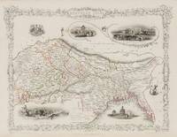
1851réf. 200119AG1851. London & New York John Tallis & Company 1851. Original steel engraving / Vintage map. Drawn and engraved by John Rapkin. Partly hand-coloured. Illustrations by A.H. Wray and Engraved by J.H. Kernot. Plate Size: 31.5 cm x 25 cm. Sheet Size: 37.2 cm x 27.2 cm. Vintage 19th century map in very good condition. Beautifully bordered map of northern India from Cambay to Chittagong and Aracan in the Bay of Bengal. The political subdivisions are colourfully included marking out independent Nepal and Bhutan. The regions of Jemer Malwa Allahabade and Assam can also be seen on the map along with the names of many towns and cities The regions rivers including the Ganges are shown and relief is depicted with hachuring. John Tallis 7 November 1817 3 June 1876 was an English cartographic publisher. His company John Tallis and Company published views maps and atlases in London from roughly 1838 to 1851. Tallis set up as a publisher with Frederick Tallis in Cripplegate in 1842; the business moved to Smithfield in 1846 and was dissolved in 1849. From 1851 to 1854 Tallis operated as John Tallis and Company. He started The illustrated news of the world and national portrait gallery of eminent personages in 1858 selling it for £1370 in 1861; it folded in 1863. Wikipedia The most important project John Tallis undertook was the 'Illustrated Atlas' from 1851. The original map we offer here was part of this exceptional Atlas and all the maps it contained are still today considered as the last reminder of an era of lavish map production. Tallis worked the project together with John Rapkin 1815-1876 and it was Rapkin's style and talent that we have to thank for when we marvel at these maps today. What makes these maps so special is the detail of engraved vignettes that surround the map and often show indigenous scenes people in their environment and even more so historical buildings or historical views of towns and cities architecture and landscape. The project of 'The Illustrated Atlas' was designed to be finished just in time for the anxiously awaited "Great Exhibition of the Works of Industry of All Nations" or The Great Exhibition sometimes referred to as the Crystal Palace Exhibition in reference to the temporary structure in which it was held was an international exhibition that took place in Hyde Park London from 1 May to 11 October 1851. It was the first in a series of World's Fairs exhibitions of culture and industry that became popular in the 19th century and it was a much anticipated event. The Great Exhibition was organized by Henry Cole and Prince Albert husband of the reigning monarch Queen Victoria. It was attended by numerous notable figures of the time including Charles Darwin Samuel Colt members of the Orléanist Royal Family and the writers Charlotte Brontë Charles Dickens Lewis Carroll George Eliot and Alfred Tennyson. Music for the opening was under the direction of Sir George Thomas Smart and the continuous music from the exhibited organs for the Queen's procession was "under the superintendence of William Sterndale Bennett". Wikipedia unknown
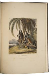
1842réf. M2ACVI942UQXLondon: Thomas McLean 1842. Contemporary half calf with cloth sides gold tooled title on front cover. Large folio 545 x 375 cm. With 6 hand coloured lithograph plates and a lithographed title. First and only edition of an ethnographic study of native Indian people by William Tayler 1808-1892 who was at that time Acting Salt Agent of the Central Division of Cuttack for the East India Company. He dedicated his work to "Lady William Bentinck" born Lady Mary Acheson 1809-1850 who was the wife of the Governor-General of India. The illustrations were drawn by Tayler himself who was an amateur artist and drew much of the Indian daily life that he encountered. He selected the present 6 drawings to be published and had them lithographed by J. Bouvier. The first 3 plates not only show the ways of Indian people but even more so the luxurious life of the English in India. The first plate The Young Civilian's Toilet shows a young man relaxing while being treated by several servants who are named Anglo-Indians. The room is strewn with objects of leisure. The next 2 plates The Young Ladies Toilet & The Breakfast show equal scenes. The other 3 plates are more ethnographic in nature showing native Indians in their everyday life: Women grinding at the mill; the Sunyasees Sannyasis & The village barber. Tayler later became a controversial figure for his excessively harsh oppression of Indian people when he was the commissioner of Patna.Spine and covers slightly worn pages a little frayed some foxing on the text pages. Dedication page broened. Plate 2 detached and inserted loosely. Plates in good condition.l Abbey Travel 465; Bobins I 272; H.K. Kaul Early Writings on India 454; Prasannajit De Silva Colonial Self-Fashioning in British India c. 1785-1845 2018 pp. 116-119. Thomas McLean, hardcover
1915réf. 56328Bangalore: Office of the Director Southern Circle Survey of India P.B. No. 44 1915. 4to. 7.25 x 9.75 in. which holds a 32-panel linen backed colour-printed map which folds out into double atlas folio sized map sized 36.5 x 53 in. Mounted within Navy-blue linen portfolio printed label w/ manuscript annotations on front cover indicating the sheet number minor shelfwear slight rubbing still NF copy. First edition thus of this map of Bangalore prepared under the auspices of the Survey of India Office of the Director in the opening years of World War I. This remarkable topographical map featuring a scale of 1” to 1 mile is based on the surveys first launched by William Lambton in the 19th Century known as the Great Trigonometrical Survey of India led successively by Lambton George Everest Andrew Waugh and James Walker. These fulfilled the premise that geodetic survey was the only option for accurate maps of large areas and much of this work in the survey of India was based upon the base lines in Bangalore originally measured by Warren and the base lines of Kumta by De Penning. These original linen-backed survey maps of India from the early 20th Century have become quite scarce. No copies located in Worldcat; See; Rama Deb Roy The Great Trigonometrical Survey of India in a Historical Perspective Pre-Census Population Studies Unit Indian Journal of History of Science 1986 Vol. 21 1 pp. 22-32. Office of the Director, Southern Circle, Survey of India, P.B. No. 44, unknown
1876réf. 318010London: T. Nelson & Sons 1876. viii 9-319pp. 12mo. Modern three quarters mottled calf. Fine. viii 9-319pp. 12mo. T. Nelson & Sons unknown
1898réf. 318005London: Chatto & Windus 1898. First edition. xxviii 210pp 32 Illus. 8vo. Three quarters polished brown modern mottled calf. Fine. First edition. xxviii 210pp 32 Illus. 8vo. Chatto & Windus unknown
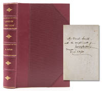
1873réf. 316648New York: Nelson & Phillips 1873. Eighth edition. Illus. with a map and 42 illustraions. 557pp. Three quarters crimson morocco and cloth sides. Fine. Eighth edition. Illus. with a map and 42 illustraions. 557pp. Inscribed on ffep"Mr David Smith/ with trhe compliments of/ Jno. W. Butler/ Mexico/ June 22/80. Nelson & Phillips unknown
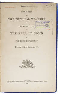
1898réf. ABC_45361Calcutta: Office of the Superintendent of Government printing India 1898. Blind-stamped blue cloth title in gold on spine blue decorated endpapers. Folio. With armorial vignette on the title page. The official Summary always published at the end of a Viceroy-ship by the Office of the Superintendent of Government printing in Calcutta containing the narrative of proceedings of the Home Department in this case from January 1894 to December 1898 the time the 9th Earl of Elgin served in that function. The extensive contents pp. i-iv refers always to the pages in the appendices pp. 1-6156 ! not present.During his time as Viceroy famine broke out in India in which Elgin reportedly admitted that up to 4.5 million people died. Other estimates have put the death toll at 11 million people. His administration in India was otherwise notable for the Afridi frontier uprisings of 1897-1898.With the label of the Home Department Juridical Branche on the front board and a second label with the shelfmark and stamps of the Ministry of Home Affairs on the title page and elsewhere including a Confidential stamp. Head of both boards damaged and damp-stained front hinge worn front endpapers loose slightly browned throughout.l Bence-Jones Mark. The Viceroys of India London 1982. Office of the Superintendent of Government printing, India, hardcover
1900réf. 316898London: Macmillan and Co 1900. New Edition in One Volume. With 42 Illus. ii 601pp. 8vo. Bound in three quarters mottled brown calf and marbled boards green leather title label. Fine. New Edition in One Volume. With 42 Illus. ii 601pp. 8vo. Macmillan and Co unknown
1934réf. 317965London: Edinburgh House Press 1934. First edition. Map and Illiustrations. 144pp. 8vo. Bound in half tan polished calf and marbled boards. Fine. First edition. Map and Illiustrations. 144pp. 8vo. Edinburgh House Press hardcover
1899réf. 317966London: James Nisbet 1899. Illus.xiii 1 354 adspp. 8vo. Bound in three quarters mottled brown calf and marbled boards. Fine. Illus.xiii 1 354 adspp. 8vo. James Nisbet hardcover
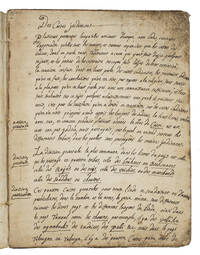
1743réf. ABC_45492Karaikal 1743. Blue mottled stiff paper wrappers. 4to ca. 24 x 18.5 cm. Manuscript written in dark brown ink on beige laid paper. French manuscript written in Karaikal French India since 1739 which gives a detailed explanation of the Indian caste system: the author explains in the beginning of the text that the French people are ill-informed about it. To illustrate the Indian caste system the anonymous author tells lively anecdotes and makes comparisons with French social classes and parallels to biblical stories. The author not only describes the details of the four castes Brahmin Raj Vaisya and Sudra including their hierarchy and advantages the purpose of this social structure and the experience of those who lose their caste. He goes further speculates about the way different cultures criticize each others morals. He argues that all nations criticize each other in some way simply because the habits of cultures differ each with its own good reasons. He also wrote about the extent of superstition in the customs of Indian people for example the beliefs surrounding cows. He concludes that not all their customs are superstitious. The author clearly views Indian cultural practices with a certain gentleness.Somewhat worn at the extremities and spine slightly foxed on the front paste-down and a little dust soiled on the first page. Otherwise in good condition. unknown
1871réf. 316630London: Strahan & Co 1871. Illus. 376 4 adspp. 8vo. Half modern mottled brown calf green title label. Fine. Illus. 376 4 adspp. 8vo. Strahan & Co unknown
1828réf. 317758London: James Duncan and Thomas Tegg and Son 1828. Folding engraved map 15 engraved views. 4 vols. Small 8vo. Bound in half contemporary morocco and cloth. Very Good. Folding engraved map 15 engraved views. 4 vols. Small 8vo. James Duncan and Thomas Tegg and Son unknown
1865réf. 311412Madras: Lawrence Asylum Press 1865. Illustrated with 12 mounted albumen photographs captioned in ink. Text within braided rule borders. ii 65 pp. 1 vols. 8vo. Full black morocco spine with gilt rules boards with gilt roll borders ornamental cornerpieces titled in gilt on upper cover yellow endsheets with orange ticket Bound at the Lawrence Asylum Press within border. Some minor rubbing occasional foxing. Fine. Gift inscription on first blank "J. Michael with the kindest regards of J.C.H. July 17th 1875. Illustrated with 12 mounted albumen photographs captioned in ink. Text within braided rule borders. ii 65 pp. 1 vols. 8vo. Spectacular unrecorded privately printed diary recounting a hunting expedition in Kerala southern India from 27 July to 22 September 1865 "the best shikar trip I have ever had". The narrator and his companion A.M.D. bagged 43 heads of eleven different types of big game including tiger bear elephant bison chettul and others with original albumen photographs mounted and captioned in a neat hand. The unnamed narrator mentions passing hunting parties one such Brown Jones and Robinson suggests that he read Trollope when the novel appeared as a serial in the Cornhill; the terrain around Hassanoor Ghaut was familiar to him for he had planted fruit trees and roses near a camp building; mention is made also of Hamilton Brooke and Faulkener hunting the area the previous year. This may be Douglas Hamilton who in 1892 published a long retrospective 'Records of Sport in Southern India'. The narrator buys prepared photographic plates from a departing hunter who had ordered them from the Patent dry Collodion Co. of Birmingham. The two hunters were accompanied by the dog Scamp chief among a pack that included Tinker and a plucky three-legged dog Pinko both killed by a panther and bearers of cowardly deportment save for the plucky Rajii who stood by when the narrator faced bear and elephant. At times the grass was too high for a man to get through easily. Notably the hunter describes many photographic incidents including how the frontispiece "The Tiger's Siesta" came to be made. One day D. encountered a a tigress atop the head of a young elephant and shot her despite the commotion. The young elephant ran off. The next day going to photograph the tigress the narrator was charged by a herd of elephants. He shot an elephant cow and they moved on to photograph the elephant "taking the tigress with us. The men who carried her threw her body into the elephants arms and it looked so strange the tigers mouth being curiously drawn up as if she were laughing that I thought I would try a picture in that position.". UNRECORDED in all the usual references and catalogues Lawrence Asylum Press unknown
réf. DADAX0847845060Rizzoli 2015-03-31. Illustrated. hardcover. New. 9.42x1.26x11.25. Buy with confidence. Excellent Customer Service & Return policy. Rizzoli hardcover