12 696 résultats
2020réf. AME_9781774071953ARCLER PRESS 2020. UNKNOWN. Hardcover. New/New. _ ARCLER PRESS hardcover
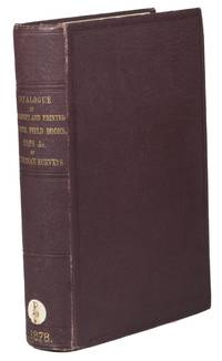
1878réf. ABC_45484London: George E. Eyre & William Spottiswoode colophon 1878. Contemporary cloth title in gold on spine. Large 8vo. First and only edition of a catalogue of the material held in the London India Office that was produced by the Indian Surveys for the East India Company. The catalogue was printed by order of her Majesty's Secretary of State for India in council. It is a key reference work for all studies on the East India Company era in Indian and British history.Shelf mark on spine library plate on front paste-down Scheepvaartmuseum Amsterdam. Slight foxing on the first and last couple pages. Otherwise in very good condition.l Kaul Early writings on India: a union catalogue of books on India in the English language published up to 1900 and available in Delhi libraries 1975 92. George E. Eyre & William Spottiswoode (colophon), hardcover
1997réf. AME_9781883001346Eye On Education 1997. 1St. Paperback. New/New. _ Eye On Education paperback
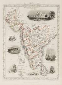
1851réf. 200109AG1851. London & New York John Tallis & Company 1851. Original steel engraving / Vintage map. Drawn and engraved by John Rapkin. Partly hand-coloured. Illustrations by A.H. Wray and Engraved by J.H. Kernot. Plate Size: 31.8 cm x 25.5 cm. Sheet Size: 37.2 cm x 27.2 cm. Vintage 19th century map in very good condition. Beautiful map of the southern Indian subcontinent from Sinde at the mouth of the Indus Estuary in the north down through Gujerat Bejapor and Mysore and down into the Carnatic region in the south. Hydrabad and Circars border the Bay of Bengal. Ceylon is also included in the map as are the Laccadive and Maldive islands in the Indian Ocean. Relief is depicting with hachuring. The major cities such as Bombay Sernigapatam and Madras are shown as are the rivers - including the Godavery and Beema rivers. This was an India dominated by the East India Company the British joint-stock company that came to rule large areas of India with its private armies exercising military power and seizing administrative functions. Formed in the early 1600s to compete with the Dutch for trade and commerce in the East the company rose to account for half of the world's trade at one point. Company rule in India lasted until 1858 when following the Indian Rebellion of 1857 the Government of India Act 1858 led to the British Crown's assuming direct control of the Indian subcontinent in the form of the new British Raj. The company was dissolved in 1874 as a result of the East India Stock Dividend Redemption Act passed one year earlier as the Government of India Act had by then rendered it vestigial powerless and obsolete. The official government machinery of British India assumed the East India Company's governmental functions and absorbed its navy and its armies in 1858. Wikipedia John Tallis 7 November 1817 3 June 1876 was an English cartographic publisher. His company John Tallis and Company published views maps and atlases in London from roughly 1838 to 1851. Tallis set up as a publisher with Frederick Tallis in Cripplegate in 1842; the business moved to Smithfield in 1846 and was dissolved in 1849. From 1851 to 1854 Tallis operated as John Tallis and Company. He started The illustrated news of the world and national portrait gallery of eminent personages in 1858 selling it for £1370 in 1861; it folded in 1863. Wikipedia The most important project John Tallis undertook was the 'Illustrated Atlas' from 1851. The original map we offer here was part of this exceptional Atlas and all the maps it contained are still today considered as the last reminder of an era of lavish map production. Tallis worked the project together with John Rapkin 1815-1876 and it was Rapkin's style and talent that we have to thank for when we marvel at these maps today. What makes these maps so special is the detail of engraved vignettes that surround the map and often show indigenous scenes people in their environment and even more so historical buildings or historical views of towns and cities architecture and landscape. The project of 'The Illustrated Atlas' was designed to be finished just in time for the anxiously awaited "Great Exhibition of the Works of Industry of All Nations" or The Great Exhibition sometimes referred to as the Crystal Palace Exhibition in reference to the temporary structure in which it was held was an international exhibition that took place in Hyde Park London from 1 May to 11 October 1851. It was the first in a series of World's Fairs exhibitions of culture and industry that became popular in the 19th century and it was a much anticipated event. The Great Exhibition was organized by Henry Cole and Prince Albert husband of the reigning monarch Queen Victoria. It was attended by numerous notable figures of the time including Charles Darwin Samuel Colt members of the Orléanist Royal Family and the writers Charlotte Brontë Charles Dickens Lewis Carroll George Eliot and Alfred Tennyson. Music for the opening was under the direction of Sir George Thomas Smart and the continuous music from the exhibited organs for the Queen's procession was "under the superintendence of William Sterndale Bennett". Wikipedia unknown
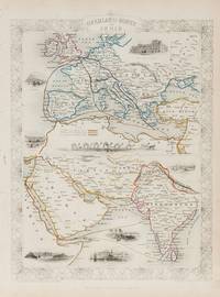
1851réf. 200124AG1851. London & New York John Tallis & Company 1851. Original steel engraving / Vintage map. Drawn and engraved by John Rapkin. Partly hand-coloured. Illustrations by H. Warren and Engraved by J. Rogers. Plate Size: 34.5 cm x 34 cm. Sheet Size: 27.2 cm x 37.4 cm. Vintage 19th century map in very good condition. Published in the Illustrated Atlas And Modern History Of The World Geographical Political Commercial & Statistical Edited By R. Montgomery Martin. Beautifully bordered and fascinating double map of the overland route between Britain and India. The upper map shows Europe and the links - both land and sea - running from England through to Alexandria Egypt. The routes are; the 'Mail Steam Packet Route' which runs around Gibraltar through Malta and onto Egypt; the 'Marseilles Overland Route' that runs across France to Marseilles and onto Alexandria via Malta and; the 'German Overland Route' that runs through across Belgium Germany before reaching Trieste and then onto the Mediterranean and then Egypt. The second map shows the differing routes on the next part of the journey - either across the Turkish controlled Middle East and through the Persian Gulf or down the Red Sea and across the Indian Ocean. What the map clearly illustrates is the importance attached to India 'Hindoostan' in the Imperial mind and the need for secure communication and transport links which necessitated control of certain choke points on the link such as Gibraltar Malta Suez etc. John Tallis 7 November 1817 3 June 1876 was an English cartographic publisher. His company John Tallis and Company published views maps and atlases in London from roughly 1838 to 1851. Tallis set up as a publisher with Frederick Tallis in Cripplegate in 1842; the business moved to Smithfield in 1846 and was dissolved in 1849. From 1851 to 1854 Tallis operated as John Tallis and Company. He started The illustrated news of the world and national portrait gallery of eminent personages in 1858 selling it for £1370 in 1861; it folded in 1863. Wikipedia The most important project John Tallis undertook was the 'Illustrated Atlas' from 1851. The original map we offer here was part of this exceptional Atlas and all the maps it contained are still today considered as the last reminder of an era of lavish map production. Tallis worked the project together with John Rapkin 1815-1876 and it was Rapkin's style and talent that we have to thank for when we marvel at these maps today. What makes these maps so special is the detail of engraved vignettes that surround the map and often show indigenous scenes people in their environment and even more so historical buildings or historical views of towns and cities architecture and landscape. The project of 'The Illustrated Atlas' was designed to be finished just in time for the anxiously awaited "Great Exhibition of the Works of Industry of All Nations" or The Great Exhibition sometimes referred to as the Crystal Palace Exhibition in reference to the temporary structure in which it was held was an international exhibition that took place in Hyde Park London from 1 May to 11 October 1851. It was the first in a series of World's Fairs exhibitions of culture and industry that became popular in the 19th century and it was a much-anticipated event. The Great Exhibition was organized by Henry Cole and Prince Albert husband of the reigning monarch Queen Victoria. It was attended by numerous notable figures of the time including Charles Darwin Samuel Colt members of the Orléanist Royal Family and the writers Charlotte Brontë Charles Dickens Lewis Carroll George Eliot and Alfred Tennyson. Music for the opening was under the direction of Sir George Thomas Smart and the continuous music from the exhibited organs for the Queen's procession was "under the superintendence of William Sterndale Bennett". Wikipedia unknown
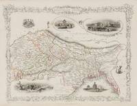
1851réf. 200119AG1851. London & New York John Tallis & Company 1851. Original steel engraving / Vintage map. Drawn and engraved by John Rapkin. Partly hand-coloured. Illustrations by A.H. Wray and Engraved by J.H. Kernot. Plate Size: 31.5 cm x 25 cm. Sheet Size: 37.2 cm x 27.2 cm. Vintage 19th century map in very good condition. Beautifully bordered map of northern India from Cambay to Chittagong and Aracan in the Bay of Bengal. The political subdivisions are colourfully included marking out independent Nepal and Bhutan. The regions of Jemer Malwa Allahabade and Assam can also be seen on the map along with the names of many towns and cities The regions rivers including the Ganges are shown and relief is depicted with hachuring. John Tallis 7 November 1817 3 June 1876 was an English cartographic publisher. His company John Tallis and Company published views maps and atlases in London from roughly 1838 to 1851. Tallis set up as a publisher with Frederick Tallis in Cripplegate in 1842; the business moved to Smithfield in 1846 and was dissolved in 1849. From 1851 to 1854 Tallis operated as John Tallis and Company. He started The illustrated news of the world and national portrait gallery of eminent personages in 1858 selling it for £1370 in 1861; it folded in 1863. Wikipedia The most important project John Tallis undertook was the 'Illustrated Atlas' from 1851. The original map we offer here was part of this exceptional Atlas and all the maps it contained are still today considered as the last reminder of an era of lavish map production. Tallis worked the project together with John Rapkin 1815-1876 and it was Rapkin's style and talent that we have to thank for when we marvel at these maps today. What makes these maps so special is the detail of engraved vignettes that surround the map and often show indigenous scenes people in their environment and even more so historical buildings or historical views of towns and cities architecture and landscape. The project of 'The Illustrated Atlas' was designed to be finished just in time for the anxiously awaited "Great Exhibition of the Works of Industry of All Nations" or The Great Exhibition sometimes referred to as the Crystal Palace Exhibition in reference to the temporary structure in which it was held was an international exhibition that took place in Hyde Park London from 1 May to 11 October 1851. It was the first in a series of World's Fairs exhibitions of culture and industry that became popular in the 19th century and it was a much anticipated event. The Great Exhibition was organized by Henry Cole and Prince Albert husband of the reigning monarch Queen Victoria. It was attended by numerous notable figures of the time including Charles Darwin Samuel Colt members of the Orléanist Royal Family and the writers Charlotte Brontë Charles Dickens Lewis Carroll George Eliot and Alfred Tennyson. Music for the opening was under the direction of Sir George Thomas Smart and the continuous music from the exhibited organs for the Queen's procession was "under the superintendence of William Sterndale Bennett". Wikipedia unknown
1904réf. 19785Lawrence and Bullen 1904. 8vo. First Edition on laid paper with 35 plates on 34 plates 11 full-page maps and plans large folding panorama and 2 large folding coloured maps on one folder; original green cloth upper board elaborately blocked and lettered in gilt gilt back faded expertly rebacked with old backstrip laid down a very good bright clean crisp copy. With 2pp publisher's catalogue bound in at end. Published in the series 'The Story of Exploration' edited by J. Scott Keltie. SCARCE ESPECIALLY IN THIS CONDITION Lawrence and Bullen, hardcover
2000réf. 29179Boston: Houghton Mifflin Company 2000. First Edition; First Printing. Hardcover. Lean to spine else Near Fine in a Near Fine dust jacket. Houghton Mifflin Company hardcover
2012réf. H-787-603INDES SAVANTES 2012. Paperback. Very Good. Ammareal gives back up to 15% of this item's net price to charity organizations. INDES SAVANTES paperback
2021réf. H-755-981PHAIDON FRANCE 2021. Hardcover. Good. Former library book. Edition 2021. Ammareal gives back up to 15% of this item's net price to charity organizations. PHAIDON FRANCE hardcover
réf. 6384635935Papeback. New. 240 unknown
réf. RGW24876No Binding. Very good. 13 colour maps from Letts's "Popular Atlas" showing railways roads canals hills boundaries and telegraph lines scale central fold few nicks on left margin of general map A detailed set of maps of India the first map shows Ceylon/Sri Lanka. No Jacket issued unknown
réf. 6132190750Papeback. New. pp. 376 unknown
réf. 6132190600Papeback. New. pp. 246 unknown
réf. ING9780847845064Rizzoli. New. Special order direct from the distributor Rizzoli unknown
réf. A9789354226304Paperback / softback. New. paperback
réf. A9781258117627Paperback. New. paperback
réf. B9781020424939Hardback. New. hardcover
réf. B9781021783899Paperback / softback. New. paperback
réf. B9781021152909Hardback. New. hardcover
réf. B9781018610979Hardback. New. hardcover
réf. B9781017410099Hardback. New. hardcover
réf. B9781018183664Hardback. New. hardcover
réf. A9780275959715Hardback. New. Providing legal analysis and touching upon social history and art history themes this work offers an objective review of five art trials. Spanning the last 20 years specific areas of law are examined with each trial: First and Fifth Amendments copyright law contract law valuation of art and misrepresentation. hardcover