SWAAN, WAntiquariat.de
Swami Shraddhananda Giri.Livre Rare Book
Samkhya Karika.
rif. 119322Paris, Editions du 210x150Trigramme 1990, 210x140mm, 276pages, broché. Bon état.

Bouquinerie du Varis · Russy, Svizzera25,00 CHF≈ 27,19 €
1966rif. 1094654New York, Putnam, (1966). 4to. 175, (1) S., 103 teils farb. Taf. OLwd m. OUmschl.
rif. 20299Paris : Albin Michel, 1967. Un volume in-4°, reliure toilée de l'aditeur, photographies, jaquette.
rif. 119322Paris, Editions du 210x150Trigramme 1990, 210x140mm, 276pages, broché. Bon état.
rif. 6255A.c Bhaktivedanta In-12° , broché , couverture souple ill éd , ensemble en très bon état , 238 pages.
1994In 8°, br. ed. con ali, p.p. 152, (6); copia molto buona (xb1/b) isbn 9788834405901. (spedizione standard SEMPRE tracciata con raccomandata-piego di libri, eventuale FATTURA da richiedere all'ordine) (xb01/b)
2020New English Original cloth bdg. 4to. (27 x 20 cm). In English. 68 p., b/w photos. Gravity of you. Designed by Ece Eldek. [Photobook]. Signed by Suzan Pektas.
rif. PHO525M1990, Thames & Hudson Ltd. Préface d'Ismail Merchant et James Ivory. In-4, relié, toilé sous jaquette illustrée, 314 pages. Riche iconographie couleurs. Exemplaire satisfaisant
2018rif. 1159472018 Editions Bragelonne - 2018 - In-4, cartonnage de l'éditeur illustré - 215 p. - Riche iconographie en couleurs in et hors-texte
1971A clean, unmarked copy with a tight binding. 122 pages. Small tears on dust jacket. Full green cloth boards. A general conspectus of the Library's European and oriental books, manuscripts, and drawings, and other resources.
2003Folio, First Edition; pictorial wrappers, a fine copy.
2021rif. DBS-9781774076750Society Publishing 2021. 1st. Hardcover. New. Society Publishing hardcover
2021rif. DBS-9781774076750Society Publishing 2021. 1st. Hardcover. New. Society Publishing hardcover
rif. 45436846-nnew. unknown
1946Folding coloured map on paper measuring 44 x 31 ins (approx. 112 x 79 cms), folding in 36 panels to 7.5 x 5.25 ins (approx. 19 x 13 cms); printed wrapper, covers mildly age-soiled (but map itself remakably bright and clean), a bright copy. A SCARCE SURVIVAL.
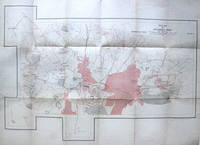
1934rif. 275256India: Survey of India 1934. Colored offset Lithograph. Sheet maps 22" x 29.5". This 1934 pocket map depicts the plan of the Gulbarga Fort and vicinity located in the northern part of the state of Karnataka at the time Hyderabad State in southern India. Beautifully detailed the map notes the fort important roads lakes wells vegetation and a host of other topographic elements. Originally built by Raja Gulchand a feudatory of the Warangal Kakatiyas it was further fortified and enlarged in 1327 by Sultan Al-ud-din Bahmani of Bahmani Sultanate in 1327 and Adil Shah. Various monuments such as mosques palaces tombs and other structures were also built. Most notable of these is the Jami Masjid built on the lines of the Great Mosque of Cordoba in Spain is one of the first mosques in southern India. The fort remained the capital of the Bahmani Kingdom until 1424. Later the fort would be razed by the Vijaynagar Emperor and subsequently rebuilt by Yusuf Adil Shah the founder of the Bujapur Sultanate. This map was published under the authority of Brigadier H. J. Couchman Surveyor General of India. It is in good condition with minor wear along the original folds and some offsetting. The map is lined with silk. Survey of India unknown books
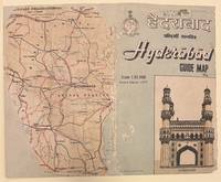
1980rif. 318087Survey of India Offices 1980. unbound. Map. Colored offset lithograph. Hyderabad Guide Map image size 31.5 x 44.5 inches Bus Routes image size 30 x 21.5 inches verso. Sheet size 35 x 46.5 inches. Both Hyderabad Guide and Bus Routes Maps both show some repairs to tears along original folds and some light staining. Guide Map is backed with sturdy paper to support Bus Routes map. Detailed key for Hyderabad Guide Map Second edition includes extensive list of places of interest including galleries cinemas offices and cultural centers among others. Bus routes supplied by Andhra Pradesh State Road Corporation up to date to June 1977. Survey of India Offices unknown books
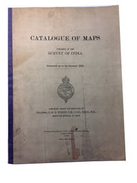
1923rif. 85606Calcutta: Printed at the Photo-Litho. Office Survey of India 1923. Paperback. Very Good. 7 maps 1- 13-61p. Softcover in original wrapper. 34cm. Modest cover staining and wear. Printed at the Photo-Litho. Office, Survey of India paperback books
rif. 9353899125.Gpaperback. Good. Access codes and supplements are not guaranteed with used items. May be an ex-library book. paperback
rif. A9781344851664Hardback. New. hardcover
rif. A9781345040128Hardback. New. hardcover
rif. A9781346128795Hardback. New. hardcover
rif. A9781343724822Hardback. New. hardcover
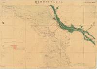
rif. 66212Dehradun: Published under the direction of Colonel Sir S.G. Burrard K.C.S.I. R.E. F.R.S. Surveyor General of India 1917. Original heliozincographed map 73 x 105 cm printed at the Survey of India Offices in partial colour folding between publisher's original buff paper covers printed in black and with key map to back cover. The map compiled from ground and air reconnaissance is centred on Basrah and the Shatt al-Arab River with its date groves printed in green. The map shows roads suitable for wheeled traffic camel roads mule paths foot paths telegraph lines wells oil wells Mosques imamzadehs a shrine-tomb of a holy person in Shi'a Islam forts watch-towers deserted villages and springs pipelines graves trigonometrical stations post offices and telegraph offices and camping grounds. Map overprinted with numeric reference grid. Old ownership inscription to front cover. Some light toning some splits along folds some dampstaining and a few spots some light wear to covers scribbling to one panel of verso generally very good. A very scarce map with just one copy traced by OCLC at the Staatsbibliothek zu Berlin focusing on the key strategic regions of Basra-Zubair in south-eastern Iraq and the adjacent Khorramshahr area of Persia and it is one of the first maps to show Abadan the first oil boomtown of the Middle East. While there are oil wells marked throughout the map there is a particular accumulation of wells and refineries in and around Abadan on the far right which was the Middle East's first oil 'boomtown.' It appears here along with the Anglo-Persian Oil Company A.P.O.C. Refinery. Rich oil fields were discovered here in the early 20th century and in 1909 secret negotiations with the British led to the formation of the Anglo-Persian Oil Company which completed its refinery here in 1912. This company would play a central role in Iran's political and economic life throughout the 20th century. As military cartography it is marked 'For Official use only' in red to upper margin. Reg. No.888 D.D.D. 1917 2.D.O. S.I. 2000. Mesopotamia. Sheet No. 1. OCLC: 1235951984 Dehradun: Published under the direction of Colonel Sir S.G. Burrard, K.C.S.I., R.E., F.R.S., Surveyor General of India, 1917. unknown
1923rif. 85606Calcutta: Printed at the Photo-Litho. Office Survey of India 1923. Paperback. Very Good. 7 maps 1- 13-61p. Softcover in original wrapper. 34cm. Modest cover staining and wear. Printed at the Photo-Litho. Office, Survey of India paperback
1934rif. 275256India: Survey of India 1934. Colored offset Lithograph. Sheet maps 22" x 29.5". This 1934 pocket map depicts the plan of the Gulbarga Fort and vicinity located in the northern part of the state of Karnataka at the time Hyderabad State in southern India. Beautifully detailed the map notes the fort important roads lakes wells vegetation and a host of other topographic elements. Originally built by Raja Gulchand a feudatory of the Warangal Kakatiyas it was further fortified and enlarged in 1327 by Sultan Al-ud-din Bahmani of Bahmani Sultanate in 1327 and Adil Shah. Various monuments such as mosques palaces tombs and other structures were also built. Most notable of these is the Jami Masjid built on the lines of the Great Mosque of Cordoba in Spain is one of the first mosques in southern India. The fort remained the capital of the Bahmani Kingdom until 1424. Later the fort would be razed by the Vijaynagar Emperor and subsequently rebuilt by Yusuf Adil Shah the founder of the Bujapur Sultanate. This map was published under the authority of Brigadier H. J. Couchman Surveyor General of India. It is in good condition with minor wear along the original folds and some offsetting. The map is lined with silk. Survey of India unknown