11.974 Ergebnisse
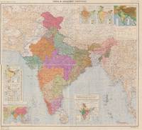
1949Best.-Nr. 666470Office of the Director Southern Circle Survey of India 1949. First Edition. Map. Very Good. Published by Brigadier G.F. Heaney C.B.E. F.R.I.C.S. Surveyor General of India 1946-1951. Office of the Director Southern Circle Survey of India. Bangalore. 1949. A color map scale 67.8 miles to 1inch with detailed key; featuring thirty-two 5 x 8 in panels mounted on linen and folded into sections between two blue cloth boards with a mounted printed label to the front. Folding out rectangularly to approximately 41 x 32 in. Light wear to the linen the two folds near the boards are split about 2 inch at the top; overall a clean map colors are vibrant. Very Good. // The Survey of India which began after WWII and on through the partition of India and Pakistan in 1947 producing this railway map. As noted on the map: "The Indo-Pakistan boundary shown on this map has not yet been demarcated as an international boundary. alignment therefore is to be regarded as approximate and is not authoritative." // Brigadier G.F. Heaney was in charge of the massive undertaking of surveying India 1946-1951 mapping out the topography canals systems and railroads often facing under the duress of the then brutal partition into the separate nations states of India and Pakistan the hardships and lack of man power to complete the task. Office of the Director, Southern Circle, Survey of India unknown
Best.-Nr. 59553Printed at the 101 H.L.O. Printing Group of Survey of India 1969. Extremely large colour-printed folding map of India and the adjacent countries 82 x 173 cm mounted onto linen with seven inset maps showing Density of Population Principal Industries Geology and Principal Minerals Orographical Features Average Rainfall Isothermal Lines and a small version of India and Surrounding Countries. Remnants of original paper wrappers printed in red still present to verso. Light spotting to verso only generally a very good copy of this large-scale map. First published in 1951. Printed at the 101 (H.L.O.) Printing Group of Survey of India, 1969. unknown
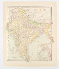
1910Best.-Nr. 174839New York. circa1910. Printed colour map 29 x 25 cm with inset map of the Eastern Part of India colour key reference key to the ruling divisions current and projected railways and telegraphs also shown central fold slight toning; in very good condition. Interesting map shaded by Divisions: the Presidencies of Bengal Madras Bombay Ceylon "Native States under British Protection" and "Independent States" Nepal and Bhutan. . unknown
1961Coperta maggiormente imbrunita al dorso e ai margini, sovraccoperta parimenti imbrunita e leggermente segnata da fattore tempo ai bordi, alle punte e alle cuffie, tagli e pagine con imbrunitura, libro completamente fruibile, con presentazione di S. N. Haksar (Ambasciatore dell'India), testo del dr. G. K. Mookerjee, edizione italiana curata dalla dott. Giovanna Borgese, presenti tabelle nel testo e tavole in nero fuori testo, numero pagine 332 (237, XCV) USATO
1985Volume rilegato con titoli in oro al piatto anteriore e al dorso, sovraccoperta illustrata a colori, tagli lievemente imbruniti, pagine in buono stato, testo completamente fruibile, con presentazione di Riccardo Ricas Castagnedi (Presidente del Touring Club Italiano), impaginazione di Bob Noorda, presenti fotografie di Antonio Martinelli e Roberto Meazza, numero pagine 288 USATO
In 16°, br. edit. ill a col., pp.490. Con 30 belle ill. fotografiche f.t.
19281 Vol. In-16 gr p. tela, tit. oro su tass. al dorso pag. 501 30 ill.f.t PROG 3488 CATT_ATT 51
Garzanti 1942. 16°:pp.276n. bross.origin.
1991in 4°, pp. 192, leg. edit. con sovracop. ill. Storia, vita e cultura della società indiana con le belle foto di Jean-Louis Nou. In ottimo stato. 249/37
1846IN 8°, pp.604, LEGATURA D'EPOCA IN MEZZA PELLE CON TITOLO E FREGI IN ORO, PIATTI RIGIDI MAREZZATI. TAVV. 84 DI CUI LA 1° GEOGRAFICA DELL'INDIA ANTICA , SEGUONO DUE CARTE + v.r. ( 1 DELL'INDIA SOTTO LA DOMINAZIONE DE' MONGOLI, E L'ALTRA DELL'INDIA CONTEMPORANEA ), IL TUTTO f.t.in b/n. OPERA FACENTE PARTE DELLA COLLANA " L'UNIVERSO " O STORIA E DESCRIZIONE DI TUTTI I POPOLI, ECC. TESTO SU DUE COLONNE, TRADUZIONE DI F. FALCONETTI. OTTIMA CONSERVAZIONE, COMPLETA DI TUTTE LE TAVOLE. ID, 5375
1968Mm 130x195 "Storia Universale Feltrinelli", 17 - Brossura editoriale di 376 pagine, in buone-ottime condizioni. SPEDIZIONE IN 24 ORE DALLA CONFERMA DELL'ORDINE.
1990Un volume di 151 pagine, brossura editoriale illustrata. Dimensioni: 32x22,5 cm. (oblungo). Minime tracce d’uso alla brossura, per il resto ottime condizioni. 71 fotografie in b/n a piena pagina. Seconda edizione, tiratura limitata di 1000 copie.
1993530 pages, illustrated, maps, tables, further reading, index, (Cadogan Guides). eng
Mondadori 1960. 16°:pp.191n. con illustrazioni nel testo. Bross.origin. Prima edizione.
Best.-Nr. 1024370879.Ghardcover. Good. Access codes and supplements are not guaranteed with used items. May be an ex-library book. hardcover
19411st edition. Near VG in decorated boards. Small tear to the cover spine. Light foxing to the prelims and endpages. (The British Commonwealth in pictures). 14797. eng
1888Volume della seconda metà dell'800 in 8.o, stato discreto, coperta in cartoncino semimorbido, tracce di fioritura sparsa, normali segni del tempo, bruniture, tagli leggermente ambrati con barbe, pagine in buono stato, minimamente ambrate. IV edizione con una Prefazione dell'Autore e illustrata da 32 incisioni. Numero pagine 533 USATO
1988Copia buona, sporadiche tracce di polvere angoli lievemente esterni piegati interno perfetto
1988Mm 270x350 Volume cartonato di pp. 191 interamente illustrato da foto a colori, sovraccoperta figurata, astuccio protettivo muto in cartoncino. All'interno testi di John Kenneth Galbraith e Pietro Tarallo. Opera in ottime condizioni. SPEDIZIONE IN 24 ORE DALLA CONFERMA DELL'ORDINE
1980Cartonato con legatura in tela e sovracoperta illustrata: fotografie a colori e bn; pp. 190; Ottimo
Near fine (pictorial card covers, tiny bump to few page corners and pencil mark outside page edges, contents clean tight and bright without fault) octavo 273pp. Updated edition with new preface. Indian environment and history, society, arts and sciences, religion and philosophy.
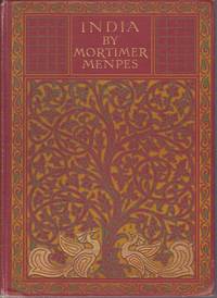
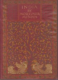
1912Best.-Nr. 20853London: A & C Black. Very Good. Second Edition. Hardcover. Boards with light rubbing to extremities. Slight bumping to one corner. First and last few pages browned. Light foxing to half-title page and very light occasional foxing but not affecting the illustrations.; Dark red cloth boards with gilt lettering and ornate design in gilt green and orange. Top edge gilt. 75 tissue guarded illustrations from watercolors by the famous artist Mortimer Menpes. 20 Shilling Series. Inman 38; 8vo 8" - 9" tall; 216 pages . 1912. A & C Black hardcover
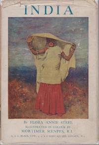
1929Best.-Nr. 20614London: A & C Black. Very Good in Very Good- dust jacket. Hardcover. DJ darkened and with light chipping. Slight loss to spine ends. Very light foxing to fore edge bottom edge and first few pages. Else a handsome and tight copy.; This is the more popular version of the rare India guide from the 20 Shilling series. Blue cloth with beautiful blindstamped decoration. Gilt spine lettering and black lettering to front board. 32 illustrations from watercolors by Mortimer Menpes.; Black Popular Series of Colour Books; 8vo 8" - 9" tall; 220 pages . 1929. A & C Black hardcover
1912Best.-Nr. 20480London: A & C Black. Very Good. Second Edition. Hardcover. Light dampstaining to bottom of back boards. Tanning and extremely light foxing to first and last few pages. Former owner's name on front free endpaper. An unusually handsome and tight copy; Dark red cloth boards with gilt lettering and ornate design in gilt green and orange. Top edge gilt. 75 tissue guarded illustrations from watercolors by the famous artist Mortimer Menpes. Inman 38; 8vo 8" - 9" tall; 216 pages . 1912. A & C Black hardcover
1912Boards with light rubbing to extremities. First and last few pages browned. One page with light foxing; 75 tissue guarded color from watercolors by the famous artist Mortimer Menpes; 8vo; 216 pages