677 résultats
réf. ORD-11805Edité par Pierre Berès. Paris. La Palme. 1951. Petit in-4 (186 x 227mm) cartonnage couleurs de l'éditeur, reprenant la couverture du manuscrit original de Gauguin, lithographiée par Mourlot, cartonnage d'Engel. Manuscrit original de Gauguin reproduit intégralement d'après l'original conservé au Musée du Louvre, 53, (1) pages, illustrations en noir et en couleurs (37 aquarelles de l'artiste). Présentation de l'ancien culte mahorie par René Huyghe, La Clef de Noa-Noa, 31 pages. Appendices, (5) pages. Bien complet des 4 pages d'annonce du livre imprimé en sanguine sur papier bleu (lgt insolé). Rhodoïd conservé (petit manque au bas du dernier plat). Bel exemplaire.
réf. 67826Langue française, édition revue et augmentée par Denise et Robert Koenig, Haere Po No Tahiti, 1986, 354 pp., relié, jaquette un peu défraîchie et fendillée sur les bords, étata satisfaisant.
1929réf. PHO-813Paris, Société D'Éditions Géographiques, Maritimes et Coloniales ,1929. In-8, XXIII-334pp, broché, couverture illustrée éditeur - Édition Originale, 8 planches photographiques n/b hors-texte, 35 figures in-texte , manque au dos , couv. fatiguée
réf. 10521Paris, Ernest Leroux Editeur, 1882. 1 fort volume in-8, reliure moderne plein cuir noir, 409 pp., enrichi d'unre grande carte des Iles de la Polynésie in fine, quelques rousseurs et mouillures claires sur le coin supérieur droit de certains feuillets, sinon bon exemplaire.
1977réf. 53553Imprimerie Nationale, coll. « Voyages et Découvertes » 1977 2 volumes. In-4. Reliures de l’éditeur pleine toile bleue, sous étui à l’identique avec illustrations contrecollées, premiers plats ornés d’une reproduction contrecollée, XIV-516-579 pp., 162-207 illustrations en noir et en couleurs. Exemplaire en bon état.
1995réf. 175364New York: Harperone 1995. First Edition; Fifteenth Printing. Hardcover. Near Fine in boards. Harperone hardcover
réf. 1824Paris, Chez Grassart, Libraire, 1867. 1 volume in-12, VII-368 pp., reliure moderne toile grenat, orné de trois gravures, d'un frontispice, et d'un plan dépliant du Protectorat Français in-fine, un tampon de bibliothèque sur la page de titre, quelques rousseurs, bon exemplaire.
18388° grande (23,4x14,4 cm); (4), 411, (2) pp. 104 tav. e (4), 416 pp. e 100 c. di tav. fuori testo e due cartine più volte ripiegate. Nel 1843 uscì un terzo volume. Esemplare ancora in barbe. Bellissime legature in mezza pelle rossa con titolo e ricchi fregi in oro al dorso e piatti foderati con carta coeva rossa a rilievo. L'opera uscì nella celebre collana di monografie a se stanti dedicata ognuna ad un paese del mondo pubblicata con il titolo "L'universo o storia e descrizione di tutti i popoli". Prima edizione italiana di quest'opera curata dal celebre viaggiatore, politico e geografo francese Domeny de Rienzi che raccoglie la storia, la geografia ma anche gli usi e costumi, le lingue e l'economia dei territori ed isole dell'Oceania, Borneo, Melanesia, Micronesia e Polinesia, Malesia. Bellissime le duecento tavole fuori testo con immagini di luoghi, costumi e personaggi celebri. Esemplare in buone-ottime condizioni di conservazione, in barbe ed in bella legatura.
réf. 13979027Paris: Firmin Didot, 1836-1937 3 vol. in-8, (4)-399-(2) pages, 2 cartes, 84 planches; (4)-397-(2) pages, 2 cartes, 116 planches; (4)-635-(4) pages, 1 carte, 104 planches. Demi-reliure toile, couvertures conservées, qq rousseurs sur les planches, petites taches sur les dos, bon état. Ouvrage bien complet des 304 planches et des 5 cartes dépliantes, placées dans un ordre différent de celui annoncé dans les tables des planches. De la collection "L'Univers pittoresque, histoire et descriptions de tous les peuples, moeurs, coutumes, industries". EDITION ORIGINALE.
1855réf. 4619Murray, London 1855. XVI, 333 S. mit gest. Frontispiz, gest. Titelvignette, 11 Tafeln, 2 Abbildungen u. mehreren Notenbeispielen. Grünes Illustr.-Ln. Einband verblichen. Rücken stärker beschädigt. Gelenke locker. Teils etwas stärker stockfleckig.
1997Includes the following 1997 issues: February, March, April, May, June, August, September, November, December. Features include: St. Paul Island; Antigua; Photography 101 - Cameras; Boat Diving; Tragic 'Northern Indiana'; Filming the Ocean Realm; Counting Lingcod; Queen Charlotte Strait; French Polynesia; Photography 101 - Macro; Tech Diving off Whitefish Point; Coastal Charter; Snorkeling with Salmon; Photography 101 - Normal Lens; Sleepless on the 'Seattle'; Caymans; Wrecks of the St. Lawrence; Techies on the 'Topline'; Photography 101 - Ambient Light; Kingston's 'Frontenac'; Hawaii and Kauai; Shipwreck Course; Divers build east coast bridge; Camouflage; Underwater Canada; Lake Huron - 'Emma E. Thompson'; Seastars - they are not fishes; Photography 101 - Lenses; The Once Mighty ' Metamora'; HMCS Saguenay - an ecosystem; Unbeatable Marshall Islands; Tribute to Jacques-Yves Cousteau; Sinking the Saskatchewan; Skookumchuck Narrows; Kingston, Ontario's 'Munson'; Costa Rica; Wreck of the Andalusia; Extreme Dive - stories from the Police Blotter; Cozumel; St. Lawrence River - Fleur Marie; Sanilac Shores, Lake Huron; Egmont, B.C.; 'America' shipwreck; Australia Artificial Reef - Swan. Moderate wear. Clean. Quality copies. Book
1907Passes and Anchorages in Tuamotu or Low Archipelago. In the left side of the chart insert of Rarola Pass and Anchorage From the French Government Survey, 1904, Makemo I.N.E. Pass and Anchorages From the French Government Survey, 1874. With additions from the United States Government Survey, 1899. In the upper middle part of the chart insert of Tahanea I. Passes From the French Government Survey, 1902. London Published at the Admiralty 9th July 1907, under the Superintendence of Rear Admiral A. Mostyn Field, Hydrographer.Small corrections: 1920. Folded editorially. Autore: Admiralty Charts. Luogo: Tuamotu Islands - Polynesia - Pacific Ocean. Anno: 1907 [1920]. Tecnica: incisione. Dimensioni: 619x977 mm
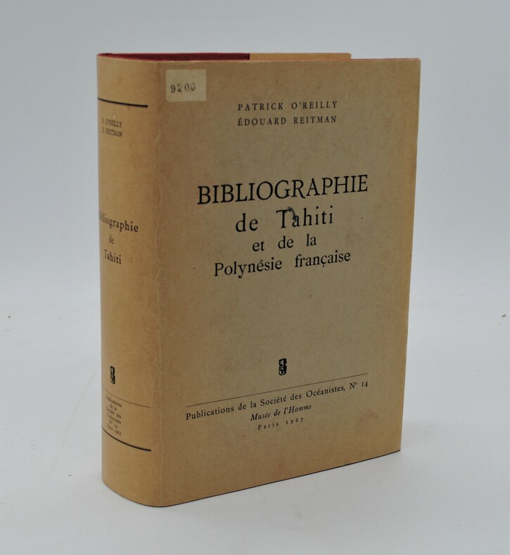
1967réf. PHO-772Musée de l'Homme ,Publications de la Société des Océanistes , n°14 , Paris 1967. In-8,1046pp., reliure pleine toile de l'éditeur, jaquette éditeur .Très bon état
1981réf. 177082Orstom Orstom, 1981. In-folio oblong (à l'italienne), relié toile bordeaux de l'éditeur, (maquette réalisée par Michel CARON d'après un modéle de pétroglyphe situé sur la commune de HIENGHENE). Imprimé sur papier de Renage. 120 pages + une carte sur rhodoïd transparent + 53 planches en couleurs en hors texte + nombreuses figures et croquis. Ouvrage de référence dressant l'état des connaissances suivant ce sommaire : L'ENVIRONNEMENT GEOGRAPHIQUE ET OCEANIQUE - LA NATURE DANS L'ARCHIPEL NEO-CALEDONIEN - LES POPULATIONS, LEUR ORIGINE ET LEUR IMPLANTATION - L'ESPACE RURAL : SON OCCUPATION ET SON UTILISATION - L'ECONOMIE CALEDONIENNE - L'ENCADREMENT, LES EQUIPEMENTS SOCIAUX. L'URBANISATION. Bon état
19844 volumes reliures de l'éditeur. 229+231+231+230 pages. (Reliure rouge décor floral). Tranches doréees. 22x28cm.
réf. ORD-15935Edité par Pierre Berès. Paris. La Palme. 1951. Petit in-4 (189 x 233mm) cartonnage couleurs de l'éditeur, reprenant la couverture du manuscrit original de Gauguin, lithographiée par Mourlot, cartonnage d'Engel, bien complet de la belle jaquette polychrome qui manque souvent. Manuscrit original de Gauguin reproduit intégralement d'après l'original conservé au Musée du Louvre, 53, (1) pages, illustrations en noir et en couleurs (37 aquarelles de l'artiste). Présentation de l'ancien culte mahorie par René Huyghe, La Clef de Noa-Noa, 31 pages. Appendices, (5) pages. Bien complet des 4 pages d'annonce du livre avec reproduction du 1er plat du livre et d'une page du manuscrit. Bel exemplaire.
réf. QWA-20223Librairie d'Amérique et d'Orient Adrien Maisonneuve, 1959, in-8 rel. toile bordeaux (13,5 x 21,5),XV-576 p. -VII-520 p. reproduction de l'édition princeps de 1837, 4 planches lithographiées (O'tahitienne et Tati, principal chef à Papara, Otahiti - Baie de Maïrépéhé et Montagnes de Taïarabou - Pafaï, chef à Otaïti, et Adams, seul survivant des révoltés du bâtiment de guerre anglais Bounty trouvé à l'île de Pitcairn- Baie de Papaïti à Otaïti), une grande carte dépl. in-fine (dessinée par Ambroise Tardieu d'après la carte dressée en 1824 par le capitaine Duperrey et les observations de Moerenhout), très bon état.
1907Sketches of Anchorages in the Tuamotu or Low Archipelago chiefly taken from the French Government charts to 1907. In the left side of the chart insert of Lagoon Entrance, Manihi Entrance, Avatoru Entrance, Tiputa Entrance, North passage to Rotoava , Passes into Amanu Atoll From the United States Goverment Chart, 1902, Pakaka Pass From the United States Government Chart, 1902. In the right side of the chart Lagoon Entrance, Amyot Bay, Mururoa Island, Fangahina I. From the United States Government Chart, 1902, Pakaka to Seignelay P.t.London Published at the Admiralty 9th July 1907, under the Superintendence of Rear Admiral A. Mostyn Field, Hydrographer. Small corrections: 1931. Autore: Admiralty Charts. Luogo: Tuamotu Islands - Polynesia - Pacific Ocean. Anno: 1907 [1931]. Tecnica: incisione. Dimensioni: 595x480 mm
2008réf. wq498Musée des Beaux-Arts de Chartres Dos carré collé 2008 In-4 (21 x 27 cm), dos carré collé, 157 pages, iconographie en couleurs, catalogue d'exposition ; quelques légères marques d'usage aux plats, par ailleurs très bon état général. Livraison a domicile (La Poste) ou en Mondial Relay sur simple demande.
1900réf. 100074540Paris. 16 5 cm x 25 cm. 1900. Broché. 119 pages. Paris Éditions Auguste Challamel 1900. Broché 16 5 cm x 25 cm 119 pages 6 cartes hors-texte. Texte de F. V. Picquenot .Dos factice sinon bon état intérieur. Rarissime
1908FIRST AND ONLY EDITION of this translation of the Lives of the Saints into Mangareva (or Mangarevan). 519 pp. PRINTED ENTIRELY IN MANGAREVA (the title-page has a few words in French, as transcribed above). Janeau (1859-1944) was a picpucien missionary in French Polynesia. Printed on very good wove paper. This volume covers the saints whose days fall through June 30; the second volume was never published. Small 8vo. Bound in original cloth-backed boards. Decorative endpapers. Boards a bit worn, but still structurally solid. Internally FINE AND BRIGHT, with no defects. EXTREMELY RARE: WorldCat locates only two copies, both in the South Pacific (Oceania and Hawaii).
réf. 14784In 4 broché,280x230mm.Couverture à rabats illustrée en couleurs.Faux titre,Beau frontispice en couleurs,sous serpente de Maurice de BECQUE,titre orné d'une vignette en couleurs,208 pages,Superbes illustrations en couleurs hors texte sous serpentes de Maurice de BECQUE.Reproduites par Jean SAUDE.Sur les presses du maître imprimeur COULOUMA.A Paris Librairie LEMERCIER 1927.Exemplaire numéroté 191 sur vélin pur fil LAFUMA.Etui cartonné.Trace insolation en marge extérieure du premier plat.
1908FIRST AND ONLY EDITION of this account of Biblical history--from the Creation to the Resurrection--in Mangareva (or Mangarevan). 415 pp. PRINTED ENTIRELY IN MANGAREVA (the front board has a single phrase in French, "Histoire sainte en langue mangarÈvienne"). Janeau (1859-1944) was a picpucien missionary in French Polynesia. Illustrated with several small and very dramatic wood engravings. Printed on very good wove paper. Small 8vo. Bound in original cloth-backed boards. Decorative endpapers. Boards a bit worn, but still structurally solid. Internally FINE AND BRIGHT, with no defects. EXTREMELY RARE: WorldCat locates only four copies, one at Yale and three in the South Pacific (Oceania and Hawaii).
1862réf. 97509London, Longman, Green, Longman, and Roberts 1862 In-8 20 x 12,5 cm. Cartonnage éditeur pleine percaline verte, fer doré sur le premier plat, plats encadrés de grecques noires, XXIII-423 pp., une carte repliée de l’archipel des Hawaii, 5 gravures hors-texte, table des matières. Exemplaire de travail d’un ouvrage peu courant. En l’état.
1851réf. 2027AG1851. London & New York J & F. Tallis 1851. Original steel engraving / Vintage map. Drawn and engraved by John Rapkin. Partly hand-coloured. Plate Size: 35.7 cm x 25.8 cm. Sheet Size: 37.5 cm x 27.3 cm. Vintage 19th century map in very good condition. John Tallis 7 November 1817 3 June 1876 was an English cartographic publisher. His company John Tallis and Company published views maps and atlases in London from roughly 1838 to 1851. Tallis set up as a publisher with Frederick Tallis in Cripplegate in 1842; the business moved to Smithfield in 1846 and was dissolved in 1849. From 1851 to 1854 Tallis operated as John Tallis and Company. He started The illustrated news of the world and national portrait gallery of eminent personages in 1858 selling it for £1370 in 1861; it folded in 1863. Wikipedia The most important project John Tallis undertook was the 'Illustrated Atlas' from 1851. The original map we offer here was part of this exceptional Atlas and all the maps it contained are still today considered as the last reminder of an era of lavish map production. Tallis worked the project together with John Rapkin 1815-1876 and it was Rapkin's style and talent that we have to thank for when we marvel at these maps today. What makes these maps so special is the detail of engraved vignettes that surround the map and often show indigenous scenes people in their environment and even more so historical buildings or historical views of towns and cities architecture and landscape. The project of 'The Illustrated Atlas' was designed to be finished just in time for the anxiously awaited "Great Exhibition of the Works of Industry of All Nations" or The Great Exhibition sometimes referred to as the Crystal Palace Exhibition in reference to the temporary structure in which it was held was an international exhibition that took place in Hyde Park London from 1 May to 11 October 1851. It was the first in a series of World's Fairs exhibitions of culture and industry that became popular in the 19th century and it was a much anticipated event. The Great Exhibition was organized by Henry Cole and Prince Albert husband of the reigning monarch Queen Victoria. It was attended by numerous notable figures of the time including Charles Darwin Samuel Colt members of the Orléanist Royal Family and the writers Charlotte Brontë Charles Dickens Lewis Carroll George Eliot and Alfred Tennyson. Music for the opening was under the direction of Sir George Thomas Smart and the continuous music from the exhibited organs for the Queen's procession was "under the superintendence of William Sterndale Bennett". Wikipedia unknown