2 913 résultats
réf. 686284to. 265 pp. 23-24 & 173-174 missing 11 pages unused page 71 repeated i.e. 251 of 300 numbered pages employed for the manuscript minutes of board meetings and for occasional other purposes; several typed pages or notes laid in or affixed to a page. Minutes in pen and pencil in the hands of recording secretaries Harry Hartmeir Frank Piaget John Connolly and others. Founded in 1895 as the Paterson Golf Club and incorporated as the North Jersey Country Club in 1897 this minute book covers an important period in club history as plans to build roads through the Paterson location occasioned a move to Wayne in 1917 the purchase of the 327 acre Greenbrook Farm in 1921 and the building of a new club house there in 1922; the construction of its new golf course designed by Walter Travis began the same year opening in 1923. The club and course continue today. Contemporary notebook half-leather and black pebbled cloth very worn leather spine gone leather corners mostly gone edges bumped and worn; interior very good and quite legible. unknown
réf. 686284to. 265 pp. 23-24 & 173-174 missing 11 pages unused page 71 repeated i.e. 251 of 300 numbered pages employed for the manuscript minutes of board meetings and for occasional other purposes; several typed pages or notes laid in or affixed to a page. Minutes in pen and pencil in the hands of recording secretaries Harry Hartmeir Frank Piaget John Connolly and others. Founded in 1895 as the Paterson Golf Club and incorporated as the North Jersey Country Club in 1897 this minute book covers an important period in club history as plans to build roads through the Paterson location occasioned a move to Wayne in 1917 the purchase of the 327 acre Greenbrook Farm in 1921 and the building of a new club house there in 1922; the construction of its new golf course designed by Walter Travis began the same year opening in 1923. The club and course continue today. Contemporary notebook half-leather and black pebbled cloth very worn leather spine gone leather corners mostly gone edges bumped and worn; interior very good and quite legible. unknown books
1776réf. 369284Burlington: Printed by Isaac Collins Printer to the King for the Province of New-Jersey 1776. viii 493 1 6 6 4 4 3 1 15 1 pp. 1 vols. Folio. Contemporary sheep morocco lettering piece worn. Foxing browning and dampstaining. Upper cover blindstamped "For the Use of the Clerk of Hopewell. viii 493 1 6 6 4 4 3 1 15 1 pp. 1 vols. Folio. The standard compendium of eighteenth-century statutes of New Jersey published after many delays and tribulations on the eve of the Revolution. Evans 14911; Felcone 158 Printed by Isaac Collins, Printer to the King, for the Province of New-Jersey unknown
1776réf. 319347Burlington: Printed by Isaac Collins Printer to the King for the Province of New-Jersey 1776. viii 493 1 6 6 4 4 3 1 15 1 pp. 1 vols. Folio. Contemporary sheep. Front joint worn spine label perished board edges rubbed. Internally clean. viii 493 1 6 6 4 4 3 1 15 1 pp. 1 vols. Folio. The standard compendium of eighteenth-century statutes of New Jersey published after many delays and tribulations on the eve of the Revolution. Evans 14911; Felcone 158 Printed by Isaac Collins, Printer to the King, for the Province of New-Jersey unknown
1776réf. 369284Burlington: Printed by Isaac Collins Printer to the King for the Province of New-Jersey 1776. viii 493 1 6 6 4 4 3 1 15 1 pp. 1 vols. Folio. Contemporary sheep morocco lettering piece worn. Foxing browning and dampstaining. Upper cover blindstamped "For the Use of the Clerk of Hopewell. viii 493 1 6 6 4 4 3 1 15 1 pp. 1 vols. Folio. The standard compendium of eighteenth-century statutes of New Jersey published after many delays and tribulations on the eve of the Revolution. Evans 14911; Felcone 158 Printed by Isaac Collins, Printer to the King, for the Province of New-Jersey unknown books
1776réf. 319347Burlington: Printed by Isaac Collins Printer to the King for the Province of New-Jersey 1776. viii 493 1 6 6 4 4 3 1 15 1 pp. 1 vols. Folio. Contemporary sheep. Front joint worn spine label perished board edges rubbed. Internally clean. viii 493 1 6 6 4 4 3 1 15 1 pp. 1 vols. Folio. The standard compendium of eighteenth-century statutes of New Jersey published after many delays and tribulations on the eve of the Revolution. Evans 14911; Felcone 158 Printed by Isaac Collins, Printer to the King, for the Province of New-Jersey unknown books
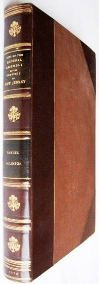
1776réf. 100869Folio contemporary sheep rejoined and crudely rehinged viii 493 1 6 6 4 4 1 15 pp. Binding is very worn especially at the extremities despite hinge repairs back cover is detached and top cover a bit loose browning and aging marginal dampstaining affecting appendices early ownership signatures including Belmont Perry and Thomas Hendry on title and elsewhere bookplate on front pastedown. Samuel Allison 1739-1791 was a Burlington attorney who had an interest in both politics and the law. In 1762 he was commissioned as one of the surrogates for West Jersey and was put to work compiling a new edition of provincial laws which is the current volume and covers the period from 1702 to 1776. Allison was a Quaker who opposed slavery and secession from the British Empire. He worked throughout his life to end slavery and became a spokesperson for a sizeable Quaker community in New Jersey. The present work includes coverage of relief of the poor raising money for public buildings preventing the waste of timber and the regulation of slaves. There are several manuscript corrections to the text in this copy which according to Felcone appear to be the rule for all copies. New Jersey in the American Revolution. Felcone 158. Evans 14911. Sabin 53046. Isaac Collins,
1910réf. 51160Collingswood NJ: E.L. Pardee 626 Park Ave. ca. 1910-1911. 4to. 23 original silver gelatin linen-backed images 7.5 x 9.5 in. printed on 9.25 x 11.5 sized photo stock paper w/ most having annotations and dates on verso in ink and pencil a few dated at lower right corner in white margin below image. Contemporary black pebbled cloth Shipman’s Common-Sense Binder w/ brass staples at gutter margin which slide to fastener at rear reinforced at margin w/ linen some wear rubbing wear to corners minor wear & creasing to gutter margin blanks of images still an excellent exemplar w/ ownership stamp on front pastedown. This remarkable photo album illustrates the building and improvement of infrastructure in and around Camden NJ and Gloucester NJ at the beginning of the 20th century for the Public Service Trolley Line Company. Pardee 1882-1932 was a New Jersey contractor and builder who worked on laying trolley tracks for the company. These images show the rebuilt timber fenders along the Pesauken Creek Bridge new retaining wall built for the Smith Property in Bellmawr NJ for the new Trolley Line bridge over the old sluiceway on Martha Pond on the Oswego River timber bridge along the White Horse Pike by Mooretown the rebuilding of the Electric Trolley line extending the Almonessen Branch to Blackwood as well as the Federal Street Bridge over Coopers Creek in Camden NJ. Of particular interest are the excellent series of photos showing the streets and houses through Gloucester NJ as the company ripped out the old wooden cord roads and laid brick for holding the trolley line ties. After World War I Pardee established the E. Brown Pardee Inc. brick stone and masonry supplies in Collingswood NJ expanding to other building materials through the 1920s until his death. After that the company was managed by his son Ernest Lewis Pardee until World War II. E.L. Pardee, 626 Park Ave., hardcover
1776réf. 100869Folio contemporary sheep rejoined and crudely rehinged viii 493 1 6 6 4 4 1 15 pp. Binding is very worn especially at the extremities despite hinge repairs back cover is detached and top cover a bit loose browning and aging marginal dampstaining affecting appendices early ownership signatures including Belmont Perry and Thomas Hendry on title and elsewhere bookplate on front pastedown. Samuel Allison 1739-1791 was a Burlington attorney who had an interest in both politics and the law. In 1762 he was commissioned as one of the surrogates for West Jersey and was put to work compiling a new edition of provincial laws which is the current volume and covers the period from 1702 to 1776. Allison was a Quaker who opposed slavery and secession from the British Empire. He worked throughout his life to end slavery and became a spokesperson for a sizeable Quaker community in New Jersey. The present work includes coverage of relief of the poor raising money for public buildings preventing the waste of timber and the regulation of slaves. There are several manuscript corrections to the text in this copy which according to Felcone appear to be the rule for all copies. New Jersey in the American Revolution. Felcone 158. Evans 14911. Sabin 53046. Isaac Collins, books
1898réf. 002932Librairie du Victor Hugo illustré, 1898
1854réf. 000501Genève et New-York (Jersey) s.n. (Imprimerie Universelle) 1854
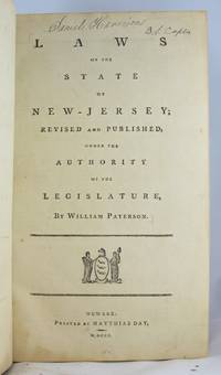
1800réf. 34661800. NEW JERSEY. LAWS. Laws of the State of New-Jersey; Revised and Published under the Authority of the Legislature by William Paterson. Newark: Matthias Day 1800. Lg. 8vo. 2 455 1 xxi 1 2 46 1 p. Modern full calf in antique style red and black spine labels. Minor marginal spotting at rear of text else a fine copy. The octavo edition of Paterson's Laws printed by Matthias Day from sheets of the folio edition as they came from Abraham Blauvelt's press. Blauvelt's folio was an essential but expensive book and Day saw a market for a less costly edition printed on super royal paper in octavo format. The text on each page was nearly identical to that in the folio edition so that a citation to one edition was also a citation to the other. For a detailed description of the evolution and printing of this edition see Felcone New Jersey Books 2nd edn. 1428-1430 and Felcone Printing in New Jersey 1754-1800 1113. This copy contains the original title page with the horse's head in the state arms facing to the left. When the remainder of the edition was purchased from Day by Newark printer and bookseller William Tuttle in 1814 Tuttle printed a new title page dated 1800 but most easily identified by a right-facing horse's head. Evans 38063; ESTC W7002. unknown books
réf. 15776NEW JERSEY. SUPREME COURT. Reports of Cases Adjudged in the Supreme Court of Judicature of the State of New-Jersey. By William S. Pennington. Newark: W. Tuttle & Co. 1806-1814. 2 vols. various paginations. Late 19th-century full calf red and black spine labels. A fresh clean beautiful set with extensive marginal and interleaved notes largely in the hand of Alphonso L. Eakin 1799-1866 a Salem lawyer with some notes in the hand of the set's earlier owner Daniel Garrison 1782-1851. The first published reports of a New Jersey court. Pennington's reports were issued in nine separate stitched pamphlets from 1806 to 1814. When bound up at the time the multiple title pages and lists of justices were superfluous and were invariably cancelled as they are in this set and in every other set I have seen. The reports are complete. Laid in is a detailed account of the make-up of this set. For a detailed bibliographical study of Pennington and his nine individual reports see J.J. Felcone New Jersey Books 1694-1900: A Descriptive Catalogue 2023 entries 1611-1619. unknown books
1917réf. 41252Washington D.C.: Published by the United States Coast and Geodetic Survey 1917. Nautical chart printed on heavy paper stock. Uncolored. A rare original coastal survey of the Hudson River including Ossining Nyack Tarrytown Yonkers and New York City as well as potential anchorage points in the Hudson for Naval use. Established by President Thomas Jefferson in 1807 as the Survey of the Coast the U.S. Coast and Geodetic Survey was the United States' first civilian scientific agency. This agency has followed its mission to survey the U.S. coastline create nautical charts of the coast and help increase maritime safety since its founding and has often played fascinating roles in significant chapters of U.S. history. It served in all theaters of the Civil War in the service of the Union Army and Navy pioneered acoustic exploration in the wake of the sinking of the Titanic and during WWI it worked to detect enemy submarines. In addition this agency worked to survey and produce detailed maps and renderings of the U.S. coast. These nautical survey maps commonly referred to as "T-sheets" provide fascinating insights into the history of the United States coastline which has and will continue to shift. These maps are the most important data source for understanding the physical and ecological characteristics of the U.S. shoreline. The present map is notable for the inclusion of various anchorage points for the "temporary anchorage of naval vessels" complete with a naval seal in the upper left corner of the sheet. This map is a highly detailed and accurate sea chart of the Hudson River and an important historical view of developing New York and New Jersey. Published by the United States Coast and Geodetic Survey unknown
1916réf. 41256Washington D.C.: Published by the United States Coast and Geodetic Survey 1916. Large folding nautical chart printed on heavy paper stock. Uncolored with minor stains. A rare original coastal survey of the Hudson River including New York City from 53rd St to Fort Washington Park Weehawken and Edgewater as well as potential anchorage points in the Hudson for Naval use. Established by President Thomas Jefferson in 1807 as the Survey of the Coast the U.S. Coast and Geodetic Survey was the United States' first civilian scientific agency. This agency has followed its mission to survey the U.S. coastline create nautical charts of the coast and help increase maritime safety since its founding and has often played fascinating roles in significant chapters of U.S. history. It served in all theaters of the Civil War in the service of the Union Army and Navy pioneered acoustic exploration in the wake of the sinking of the Titanic and during WWI it worked to detect enemy submarines. In addition this agency worked to survey and produce detailed maps and renderings of the U.S. coast. These nautical survey maps commonly referred to as "T-sheets" provide fascinating insights into the history of the United States coastline which has and will continue to shift. These maps are the most important data source for understanding the physical and ecological characteristics of the U.S. shoreline. The present map is notable for the inclusion of anchorage points for US Naval use according to size complete with a naval seal in the upper left corner of the sheet. This map is a highly detailed and accurate sea chart of the Hudson River and an important historical view of developing New York and New Jersey. Published by the United States Coast and Geodetic Survey unknown
1921réf. 41254Washington D.C.: Published by the United States Coast and Geodetic Survey 1921. Large folding nautical chart printed on heavy paper stock. Uncolored with minor wear. A rare original coastal survey of the New York Harbor including Staten Island Bayonne Jersey City Statue of Liberty Governors Island and Brooklyn with sectioned anchorage areas. Established by President Thomas Jefferson in 1807 as the Survey of the Coast the U.S. Coast and Geodetic Survey was the United States' first civilian scientific agency. This agency has followed its mission to survey the U.S. coastline create nautical charts of the coast and help increase maritime safety since its founding and has often played fascinating roles in significant chapters of U.S. history. It served in all theaters of the Civil War in the service of the Union Army and Navy pioneered acoustic exploration in the wake of the sinking of the Titanic and during WWI it worked to detect enemy submarines. In addition this agency worked to survey and produce detailed maps and renderings of the U.S. coast. These nautical survey maps commonly referred to as "T-sheets" provide fascinating insights into the history of the United States coastline which has and will continue to shift. These maps are the most important data source for understanding the physical and ecological characteristics of the U.S. shoreline. The present map is notable for the inclusion of anchorage areas including general anchorage sections as well as "anchorage explosives" and "man-of-war anchorage" sections. This map is a highly detailed and accurate sea chart of New York Harbor and an important historical view of developing Ne w York and New Jersey. Published by the United States Coast and Geodetic Survey unknown
1916réf. 41256Washington D.C.: Published by the United States Coast and Geodetic Survey 1916. Large folding nautical chart printed on heavy paper stock. Uncolored with minor stains. A rare original coastal survey of the Hudson River including New York City from 53rd St to Fort Washington Park Weehawken and Edgewater as well as potential anchorage points in the Hudson for Naval use. Established by President Thomas Jefferson in 1807 as the Survey of the Coast the U.S. Coast and Geodetic Survey was the United States' first civilian scientific agency. This agency has followed its mission to survey the U.S. coastline create nautical charts of the coast and help increase maritime safety since its founding and has often played fascinating roles in significant chapters of U.S. history. It served in all theaters of the Civil War in the service of the Union Army and Navy pioneered acoustic exploration in the wake of the sinking of the Titanic and during WWI it worked to detect enemy submarines. In addition this agency worked to survey and produce detailed maps and renderings of the U.S. coast. These nautical survey maps commonly referred to as "T-sheets" provide fascinating insights into the history of the United States coastline which has and will continue to shift. These maps are the most important data source for understanding the physical and ecological characteristics of the U.S. shoreline. The present map is notable for the inclusion of anchorage points for US Naval use according to size complete with a naval seal in the upper left corner of the sheet. This map is a highly detailed and accurate sea chart of the Hudson River and an important historical view of developing New York and New Jersey. Published by the United States Coast and Geodetic Survey unknown books
1917réf. 41252Washington D.C.: Published by the United States Coast and Geodetic Survey 1917. Nautical chart printed on heavy paper stock. Uncolored. A rare original coastal survey of the Hudson River including Ossining Nyack Tarrytown Yonkers and New York City as well as potential anchorage points in the Hudson for Naval use. Established by President Thomas Jefferson in 1807 as the Survey of the Coast the U.S. Coast and Geodetic Survey was the United States' first civilian scientific agency. This agency has followed its mission to survey the U.S. coastline create nautical charts of the coast and help increase maritime safety since its founding and has often played fascinating roles in significant chapters of U.S. history. It served in all theaters of the Civil War in the service of the Union Army and Navy pioneered acoustic exploration in the wake of the sinking of the Titanic and during WWI it worked to detect enemy submarines. In addition this agency worked to survey and produce detailed maps and renderings of the U.S. coast. These nautical survey maps commonly referred to as "T-sheets" provide fascinating insights into the history of the United States coastline which has and will continue to shift. These maps are the most important data source for understanding the physical and ecological characteristics of the U.S. shoreline. The present map is notable for the inclusion of various anchorage points for the "temporary anchorage of naval vessels" complete with a naval seal in the upper left corner of the sheet. This map is a highly detailed and accurate sea chart of the Hudson River and an important historical view of developing New York and New Jersey. Published by the United States Coast and Geodetic Survey unknown books
1921réf. 41254Washington D.C.: Published by the United States Coast and Geodetic Survey 1921. Large folding nautical chart printed on heavy paper stock. Uncolored with minor wear. A rare original coastal survey of the New York Harbor including Staten Island Bayonne Jersey City Statue of Liberty Governors Island and Brooklyn with sectioned anchorage areas. Established by President Thomas Jefferson in 1807 as the Survey of the Coast the U.S. Coast and Geodetic Survey was the United States' first civilian scientific agency. This agency has followed its mission to survey the U.S. coastline create nautical charts of the coast and help increase maritime safety since its founding and has often played fascinating roles in significant chapters of U.S. history. It served in all theaters of the Civil War in the service of the Union Army and Navy pioneered acoustic exploration in the wake of the sinking of the Titanic and during WWI it worked to detect enemy submarines. In addition this agency worked to survey and produce detailed maps and renderings of the U.S. coast. These nautical survey maps commonly referred to as "T-sheets" provide fascinating insights into the history of the United States coastline which has and will continue to shift. These maps are the most important data source for understanding the physical and ecological characteristics of the U.S. shoreline. The present map is notable for the inclusion of anchorage areas including general anchorage sections as well as "anchorage explosives" and "man-of-war anchorage" sections. This map is a highly detailed and accurate sea chart of New York Harbor and an important historical view of developing Ne w York and New Jersey. Published by the United States Coast and Geodetic Survey unknown books
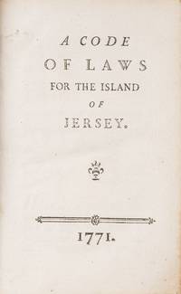
1771réf. 833871771. St. Helier s.n.: 1771. First edition. St. Helier s.n.: 1771. First edition. The Landmark 1771 Code of the Island of Jersey Still An Important Reference Today Jersey. Channel Islands. A Code of Laws for the Island of Jersey. St. Helier: s.n. 1771. ii vi 336 53 pp. Folding table. Octavo 7" x 4-1/2"; 18 x 11.5 cm. Contemporary vellum blind fillets to boards. Light soiling boards slightly bowed moderate rubbing to extremities corners bumped chip to head of front joint hinges starting. Moderate toning to interior faint spotting in a few places. A very good copy. $950. First edition. Main text in French. Text of the decree enacting the code in English. Located between the northern coast of France and the southern coast of England Jersey was originally part of Brittany. The island was eventually annexed to the Duchy of Normandy. When William the Conqueror conquered England in 1066 the duchy became part of his new kingdom. Jersey continued to be governed by a system derived from Norman customary law which was recorded in manuscript compilations. Over time this body of law became unwieldy and ineffective. Political events especially a protest in 1769 over the cost of wheat induced the Crown to reform Jersey's law and government. One of these reforms was the 1771 Code. The first printed collection of Jersey's laws it restated the island's law and legal procedures defined its legal and constitutional authority and clarified its relationship with the Crown. A second edition was published in 1860. As Jersey law firm Bedell Cristin notes in its history of the island's law "The legislative precedent set by the Code remains pertinent to this day." Baker An Introduction to English Legal History 29-30. Bedell Cristin The Code of Laws 1771: A Watershed in Jersey's Legal History accessed online. Sweet & Maxwell A Legal Bibliography of the British Commonwealth 1:586. unknown
1771réf. 833871771. St. Helier s.n.: 1771. First edition. St. Helier s.n.: 1771. First edition. The Landmark 1771 Code of the Island of Jersey Still An Important Reference Today Jersey. Channel Islands. A Code of Laws for the Island of Jersey. St. Helier: s.n. 1771. ii vi 336 53 pp. Folding table. Octavo 7" x 4-1/2"; 18 x 11.5 cm. Contemporary vellum blind fillets to boards. Light soiling boards slightly bowed moderate rubbing to extremities corners bumped chip to head of front joint hinges starting. Moderate toning to interior faint spotting in a few places. A very good copy. $950. First edition. Main text in French. Text of the decree enacting the code in English. Located between the northern coast of France and the southern coast of England Jersey was originally part of Brittany. The island was eventually annexed to the Duchy of Normandy. When William the Conqueror conquered England in 1066 the duchy became part of his new kingdom. Jersey continued to be governed by a system derived from Norman customary law which was recorded in manuscript compilations. Over time this body of law became unwieldy and ineffective. Political events especially a protest in 1769 over the cost of wheat induced the Crown to reform Jersey's law and government. One of these reforms was the 1771 Code. The first printed collection of Jersey's laws it restated the island's law and legal procedures defined its legal and constitutional authority and clarified its relationship with the Crown. A second edition was published in 1860. As Jersey law firm Bedell Cristin notes in its history of the island's law "The legislative precedent set by the Code remains pertinent to this day." Baker An Introduction to English Legal History 29-30. Bedell Cristin The Code of Laws 1771: A Watershed in Jersey's Legal History accessed online. Sweet & Maxwell A Legal Bibliography of the British Commonwealth 1:586. unknown books
1784réf. 58144Trenton: Printed by Isaac Collins 1784. First edition. 389 28 4 4 30 pp. 1 vols. Folio. Later half calf and marbled boards. Foxing and staining. First edition. 389 28 4 4 30 pp. 1 vols. Folio. Evans 18632; Felcone 162; Tower Collection of American Colonial Laws 564; Babbitt Hand-List of Legislative Sessions and Session Laws 325 Printed by Isaac Collins unknown
1784réf. 58144Trenton: Printed by Isaac Collins 1784. First edition. 389 28 4 4 30 pp. 1 vols. Folio. Later half calf and marbled boards. Foxing and staining. First edition. 389 28 4 4 30 pp. 1 vols. Folio. Evans 18632; Felcone 162; Tower Collection of American Colonial Laws 564; Babbitt Hand-List of Legislative Sessions and Session Laws 325 Printed by Isaac Collins unknown books
1776réf. 015742Burlington NJ: Isaac Collins 1776. First Edition. Hardcover. Light to moderate foxing typical for American paper of this period. Near Fine in an attractive binding. Folio 8-3/4" x 13-1/8" bound by Brentano's in twentieth century 3/4 polished calf leather with a gilt-decorated and lettered spine top edge gilt marbled endpapers; viii 493 1 6 4 4 3 1 15 1 pages appears to lack a 6-page appendix. Covers the period from 1702 to 14 January 1776 with an appendix three alphabetical tables and an index. With numerous acts described including those on regulating slaves taverns fire arms the militia gambling and horse races as well as acts dividing and forming counties. A wonderful compendium of colonial laws right up to the colonies' declaration of independence from England. Early calligraphic owner name of Joseph Stokes on the front endpaper and the bottom of the last page of the preface. Isaac Collins hardcover books
réf. VJ-38ML-UBGMFine. Brand new with tags and signature by Andy Hampsten!! unknown