[New York and New Jersey]Biblio.com

2 898 résultats
1917réf. 41252Washington D.C.: Published by the United States Coast and Geodetic Survey 1917. Nautical chart printed on heavy paper stock. Uncolored. A rare original coastal survey of the Hudson River including Ossining Nyack Tarrytown Yonkers and New York City as well as potential anchorage points in the Hudson for Naval use. Established by President Thomas Jefferson in 1807 as the Survey of the Coast the U.S. Coast and Geodetic Survey was the United States' first civilian scientific agency. This agency has followed its mission to survey the U.S. coastline create nautical charts of the coast and help increase maritime safety since its founding and has often played fascinating roles in significant chapters of U.S. history. It served in all theaters of the Civil War in the service of the Union Army and Navy pioneered acoustic exploration in the wake of the sinking of the Titanic and during WWI it worked to detect enemy submarines. In addition this agency worked to survey and produce detailed maps and renderings of the U.S. coast. These nautical survey maps commonly referred to as "T-sheets" provide fascinating insights into the history of the United States coastline which has and will continue to shift. These maps are the most important data source for understanding the physical and ecological characteristics of the U.S. shoreline. The present map is notable for the inclusion of various anchorage points for the "temporary anchorage of naval vessels" complete with a naval seal in the upper left corner of the sheet. This map is a highly detailed and accurate sea chart of the Hudson River and an important historical view of developing New York and New Jersey. Published by the United States Coast and Geodetic Survey unknown
1921réf. 41253Washington D.C.: Published by the United States Coast and Geodetic Survey 1921. Nautical chart printed on heavy paper stock. Colored. A rare original coastal survey of the border between New York and New Jersey at Kill Van Kull including Staten Island Elizabeth Newark Bay Bayonne and New York Bay. Established by President Thomas Jefferson in 1807 as the Survey of the Coast the U.S. Coast and Geodetic Survey was the United States' first civilian scientific agency. This agency has followed its mission to survey the U.S. coastline create nautical charts of the coast and help increase maritime safety since its founding and has often played fascinating roles in significant chapters of U.S. history. It served in all theaters of the Civil War in the service of the Union Army and Navy pioneered acoustic exploration in the wake of the sinking of the Titanic and during WWI it worked to detect enemy submarines. In addition this agency worked to survey and produce detailed maps and renderings of the U.S. coast. These nautical survey maps commonly referred to as "T-sheets" provide fascinating insights into the history of the United States coastline which has and will continue to shift. These maps are the most important data source for understanding the physical and ecological characteristics of the U.S. shoreline. The present map is a highly detailed and accurate sea chart of the coastal border between New York and New Jersey at Kill Van Kull and an important historical view of the developing states. Published by the United States Coast and Geodetic Survey unknown
1916réf. 41256Washington D.C.: Published by the United States Coast and Geodetic Survey 1916. Large folding nautical chart printed on heavy paper stock. Uncolored with minor stains. A rare original coastal survey of the Hudson River including New York City from 53rd St to Fort Washington Park Weehawken and Edgewater as well as potential anchorage points in the Hudson for Naval use. Established by President Thomas Jefferson in 1807 as the Survey of the Coast the U.S. Coast and Geodetic Survey was the United States' first civilian scientific agency. This agency has followed its mission to survey the U.S. coastline create nautical charts of the coast and help increase maritime safety since its founding and has often played fascinating roles in significant chapters of U.S. history. It served in all theaters of the Civil War in the service of the Union Army and Navy pioneered acoustic exploration in the wake of the sinking of the Titanic and during WWI it worked to detect enemy submarines. In addition this agency worked to survey and produce detailed maps and renderings of the U.S. coast. These nautical survey maps commonly referred to as "T-sheets" provide fascinating insights into the history of the United States coastline which has and will continue to shift. These maps are the most important data source for understanding the physical and ecological characteristics of the U.S. shoreline. The present map is notable for the inclusion of anchorage points for US Naval use according to size complete with a naval seal in the upper left corner of the sheet. This map is a highly detailed and accurate sea chart of the Hudson River and an important historical view of developing New York and New Jersey. Published by the United States Coast and Geodetic Survey unknown
1922réf. 41249Washington D.C.: Published by the United States Coast and Geodetic Survey 1922. Large folding nautical chart printed on heavy paper stock. Colored. A rare original coastal survey of New Jersey from Sea Girt to Little Egg Inlet including Manasquan Brielle Point Pleasant Beach Mantoloking Lafayette Seaside Park Island Beach State Park and Long Beach Island with an inset expanded map of Little Egg Inlet in the top left corner. Established by President Thomas Jefferson in 1807 as the Survey of the Coast the U.S. Coast and Geodetic Survey was the United States' first civilian scientific agency. This agency has followed its mission to survey the U.S. coastline create nautical charts of the coast and help increase maritime safety since its founding and has often played fascinating roles in significant chapters of U.S. history. It served in all theaters of the Civil War in the service of the Union Army and Navy pioneered acoustic exploration in the wake of the sinking of the Titanic and during WWI it worked to detect enemy submarines. In addition this agency worked to survey and produce detailed maps and renderings of the U.S. coast. These nautical survey maps commonly referred to as "T-sheets" provide fascinating insights into the history of the United States coastline which has and will continue to shift. These maps are the most important data source for understanding the physical and ecological characteristics of the U.S. shoreline. The present map is a highly detailed and accurate sea chart of Long Beach Island area and an important historical view of developing New Jersey. Published by the United States Coast and Geodetic Survey unknown
réf. 8891145548.Ghardcover. Good. Access codes and supplements are not guaranteed with used items. May be an ex-library book. hardcover
réf. 1112205861.Gpaperback. Good. Access codes and supplements are not guaranteed with used items. May be an ex-library book. paperback
2002réf. b28469West Jersey Chapter National Railway Historical Society 2002-01-01. paperback. Like New. 10x8x0. Book is in excellent condition text is unmarked and pages are tight. West Jersey Chapter, National Railway Historical Society paperback
1940réf. 179918Long Branch: Sponsored by the City of Long Branch 1940. Hardcover. xiv 211p. preface foreword chronology bibliography index illustrated with photos artworks folding map at rear illustrated endpapers first edition in somewhat dulled and soiled green cloth boards. Browning/some soiling to pages. Slight lean to spine. Dust jacket is edgeworn and soiled with a relatively nice bright front but long tears with loss up from bottom of both front and rear flap folds. American Guide Series. Dykes 195 Powell 986. The Summer White House resort to US Presidents since the 1800s. Sponsored by the City of Long Branch hardcover
réf. 12622Somerville New Jersey. 29 May 1835. 1p. 4to. Bifolium with address on reverse of second leaf: 'Charles Parker Esqr. Treasurer Trenton. N.J.' together with red circular Somerville postmark and docketing. Good on lightly-aged paper with light contemporary staining to second leaf from which the seal has been cut away. The letter begins: 'I have issued warrants for the two following visitors - vizt. 1. Hannah Alloways. Burlington Co. Warrant dated 20 May '35. 2. Mary Ann Daniels - Cumberland - Warrant dated 29 May '35. Both the beneficiaries are to go to Philadelphia.' Vroom asks Parker to add the two 'to your list' and having examined the statement which Parker gave him 'thought there could be found sufficient to warrant the admission of both'. Somerville [New Jersey]. 29 May 1835. unknown
réf. 13207RCA American Communications 400 College Road East Princeton N.J. At the Royal Institution London England. November 6 1980. 3 13 2pp. 4to. Twenty-five figures in text and photograph of Inglis above a brief biography at the rear. Stapled. In good condition on lightly-aged paper. From the Pat Hawker archive with his ownership inscription on the front cover and the addition by him of '& CABLE' to the title also the note by him 'Shows Cable penetration etc.' 'RCA American Communications Inc. owns and operates the RCA domestic satellite communications system. This consists of two in-orbit satellites plus a growing network of earth stations in major U.S. cities. This system provides satellite communication services to businesses the media and agencies of the Federal Government. In June and October 1981 RCA American plans to launch a third and fourth communications satellite to meet the increasing demand for services in the United States. In addition the company has filed with the FCC for authority to launch a fifth communications satellite.' Scarce: no copy on COPAC or OCLC WorldCat. RCA American Communications, 400 College Road East, Princeton, N.J. [At the Royal Institution, London, England.] November 6, 198 unknown
réf. A9781165446469New. unknown
1872réf. 46897Jersey City: John H. Lyon 1872. Hardcover. Very good. Hardcover. 5245pp. Small ink name on verso of front free endpaper minor spot of loss at the head of the spine else very good in publisher's brown cloth. John H. Lyon hardcover
1918réf. 66967John Royle & Son Paterson New Jersey 1918. Hardcover. Used - Very Good. Copyright 1918. 296 pages. Birdseye factory view medals routers saws planers trimmers bevelers ellipsograph mounting squaring and registering table grinders accessories. 6 x 4" cloth spine printed paper boards. Cover rubbed trifle shaken VG. John Royle & Son, Paterson, New Jersey hardcover
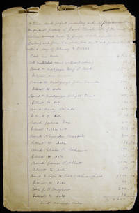
1888réf. 029369Salem New Jersey 1888. 8 pages; hand-written in a very eligible hand on lined paper; with titles of estate inventory items & appraisal values with a running monetary tally. Executor of the estate was Joseph Cook & Appraisers were Jeredis Dubois and John Campbell. Sheets approx. 7 3/4" x 12 1/2" size; bound at top with folding clips. Edge-worn & chipped especially at top of sheets; some darkening; in good condition. Manuscript. Good.
1950réf. H157New Brunswick: Rutgers University Press 1950. Hardcover. First Edition First Printing. Octavo. vii. 392pp. 2 fold-out maps. Bound in the publisher cloth boards. VERY GOOD. Shows minor shelf rubbing of the edges a few light handling marks of the cloth a former owner notation at the bottommost of the first page otherwise the binding is strong and tight the text is clean and unmarked and the boards remain bright and distinct. As pictured. Rutgers University Press hardcover
1943réf. 96143Newark NJ: Work Projects Administration New Jersey 1943. 1943. Good. - Small quarto 10-1/2 inches high by 8 inches wide softcover bound in printed tan wrappers backed with black cloth tape. The binding is bumped & chipped with pieces out. The rear cover is lightly foxed with a piece out of the bottom corner. The cloth tape is frayed at the head & tail of the spine. xxiii & 490 mechanically reproduced pages. Good. First edition. The bibliography was sponsored by Princeton University and cosponsored by the Library of Congress. Newark, NJ: Work Projects Administration, New Jersey, (1943). paperback
réf. 1982048670.Gpaperback. Good. Access codes and supplements are not guaranteed with used items. May be an ex-library book. paperback
1936réf. E30412New Jersey Telephone Company 1936. Wraps. Very Good. Staple bound in stiff wrappers printed in black. 48 pp. 10 page business listings directory featuring local adverts final page with rates and a 1936 calendar Ads printed on front and rear inside and outer covers. A relatively firm copy usual embrowning and brittleness to the pages. Front cover has "Masonic Lodge Roon 63W" and the names of four towns written in black ink. The directory covers the following central/ western New Jersey towns: Califon Chester Clinton Flemington Frenchtown Hampton High Bridge Lamberville Lebanon Long Valley Milford Peapack Somerville Uhlerstown PA Upper Black Eddy PA. Washington. New Jersey Telephone Company unknown
réf. 1022279939.Gpaperback. Good. Access codes and supplements are not guaranteed with used items. May be an ex-library book. paperback
réf. 1437462898.Gpaperback. Good. Access codes and supplements are not guaranteed with used items. May be an ex-library book. paperback
réf. 1344785883.Ghardcover. Good. Access codes and supplements are not guaranteed with used items. May be an ex-library book. hardcover
réf. 1343550882.Ghardcover. Good. Access codes and supplements are not guaranteed with used items. May be an ex-library book. hardcover
réf. 1344673538.Ghardcover. Good. Access codes and supplements are not guaranteed with used items. May be an ex-library book. hardcover
réf. 1021037443.Ghardcover. Good. Access codes and supplements are not guaranteed with used items. May be an ex-library book. hardcover
réf. 1358098840.Ghardcover. Good. Access codes and supplements are not guaranteed with used items. May be an ex-library book. hardcover