New Jersey, StocktonBiblio.com

2.938 resultados
1952ref. 0396361952. Original manuscript. Hardcover. Very Good. Oblong quarto. Contains 30 pages of handwritten entries more than 300 on printed forms: name home address home church date remarks. The first entry is dated May 11 1952; and the final one is dated 30 March 1986. Bound in red morocco all edges gilt cover gilt-stamped: Our Church Guests / Sandy Ridge Baptist Church. 9" x 12" The visitors include many from New Jersey as well as from New York City; Detroit MI; Willow Grove PA; Miami FL; Knoxville TN; Somerset OH; Kosciusko MS; Midland TX; Tulsa OK; Quincy IL; Arlington VA; Kannapolis NC; &c. hardcover
1835ref. 0391331835. Original manuscript. Good. One page tall quarto. Hutchinson rented to Danser "all that house and lot . in the Village of Assanpink including a Meadow Lot on the Assanping brook with the following exceptions viz. the Store Room a front Room above the Store Cellar and half the Smoke House . for one year for the sum of fifty Dollars Cash . &c." &c. Dated 1 July 1835. Signed by John Hutchinson and Wesley Danser and witnessed by Jefferson Ely. On the verso is a long list of "Receipts Paid by John Perrine Jr." and other computations. Original horizontal folds cancelled with seals. 12.25" x 7.75" The site of this Monmouth County property herein called Assunpink Village seems to be the present Cooley's Corner now part of the Assunpink Wildlife Management Area and along the Assunpink Creek. unknown
1882ref. 039049Trenton N.J.: Naar Day & Nar Book and Job Printers 1882. First Edition. Original Wrappers. Very Good. 12pp. Bound in printed tan wrappers; few minor spots on cover. 9" x 6" Describes military action in September 1778. Felcone New Jerseyana 1760. Naar, Day & Nar, Book and Job Printers unknown
1868ref. 038056Newark NJ: Wm. D. Roe & Co. Stationers 1868. Original documents. Good. Five engraved forms accomplished by hand in sepia ink signed by five different shareholders and five witnesses. For example: "Know all Men by these Presents that I Joseph L. Clark of Morristown N.J. do hereby constitute and appoint Samuel W. Corwin of Newark New Jersey my Attorney and Agent for me and in my name place and stead to vote in my proxy at any Annual or Special Meeting of the Morris & Essex Mutual Coal Co. according to the number of votes I should be entitled to vote if then personally present. In Witness whereof I have hereunto set my hand and seal this Twenty First day of January one thousand eight hundred and Sixty Eight. signed Jos. L. Clark. Sealed and Delivered in the presence of signed' H. Fred Scofield." Small paper seal on each document. Dated in January 1868. 7" x 8.5" WorldCat records only Charter and by-laws of the Morris and Essex Mutual Coal Company Morristown 1866 published two years before this group of proxy votes were accomplished. This company is not in the Rutgers U New Jersey collection catalog. Wm. D. Roe & Co., Stationers unknown
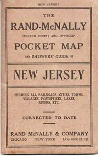
1914ref. 037640Chicago & NY: Rand McNally & Co 1914. Early edition. Printed Stiff Wrappers. Very Good. 38pp including six pages of pictorial hotel ads. Tipped in is a colored map opening to 26" x 18.5". Folded into brown card covers printed in black. 6.5" x 4 Rand, McNally & Co unknown
1918ref. 037120Philadelphia: N. Elliott 1918. First Edition. Printed Stiff Wrappers. Very Good. Foldout brochure 10 panels of card stock containing nine large photographic views with a map and text on the tenth panel; printed in sepia ink. The cover view shows a couple in a bi-plane sailing over the hotel. Other views are: The Chalfonte viewed from the water's edge; Exchange large lobby; Dining Room; Entrance to Dining Room; Yacht Club; Country Club; Parlor; Chalfonte from North Carolina Avenue. The map shows automobile routes to Atlantic City and the text promotes the Hotel. 6.75" x 8.75" WorldCat locates only the Columbia U holding. N. Elliott unknown
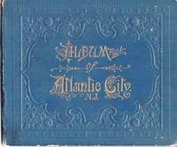
1890ref. 036828Portland Maine: Chisholm Brothers 1890. First Edition. Decorative Boards. Very Good. Contains 16 panels of Albertypes from photographs accordion-fold format including: Atlantic City from Lighthouse birdseye view; Pacific Avenue; Seaside Hotel; Bark Stafford Beached; The Elephant South Atlantic City; Hamilton Disston's Cottage; Beach View Showing Board Walk several; Hotel Brighton; The Traymore; Applegate Pier; Bathing in the Surf; &c. Folds into decorative embossed blue boards gilt cover title. 5" x 6" WorldCat finds six holdings of this attractive viewbook. Chisholm Brothers unknown
1914ref. 036827Somers Point: Wm. A. Haffert 1914. First Edition. Printed Wrappers. Good. 44pp; illus throughout from photographs mostly full-page. Views include: Shore Road Looking North from New Jersey Avenue; Somers' Homestead; Jane Anderson Homestead; Angler's Club; New $250000 Auto Bridge to Ocean City; Somers Point Fire Company; Wyndgale Residence; Bungalow of Miss Elizabeth Steen; Schick's Hotel; many private residences on Shore Road Annie Avenue Maryland Avenue Cedar Ave etc.; &c. Wrappers scuffed bit chipped; contents clean. 5" x 8" 6. WorldCat locates only the Rutgers U holding of this interesting viewbook. Wm. A. Haffert unknown
1914ref. 036843Somers Point: Wm. A. Haffert 1914. First Edition. Printed Stiff Wrappers. Very Good. 44pp; illus throughout from photographs mostly full-page. Views include: Shore Road Looking North from New Jersey Avenue; Somers' Homestead; Jane Anderson Homestead; Angler's Club; New $250000 Auto Bridge to Ocean City; Somers Point Fire Company; Wyndgale Residence; Bungalow of Miss Elizabeth Steen; Schick's Hotel; many private residences on Shore Road Annie Avenue Maryland Avenue Cedar Ave etc.; &c. Printed yellow wrappers. 5" x 8" 6. WorldCat locates only the Rutgers U holding of this interesting viewbook. Wm. A. Haffert unknown
1825ref. BOOKS013045IEast Windsor NJ 1825. Original manuscript. Very Good. Two documents 6pp; few spots of foxing. Dated March 15 1825. 12.5" x 7.75" Michael Lykes and his wife Elizabeth daughter of Thomas Morford deceased appoint East Windsor attorney Elijah Davis. The lawyer is to represent them in selling certain lands in Middlesex County to which Elizabeth has claim as the only daughter and heir of Thomas Morford who inherited the land from his grandfather William Updike of Middlesex County by terms of a will dated November 22 1778. On the back of this first document one Andrew Rowan attests that Elizabeth came before him on August 15 1824 at which time he examined her without her husband and she agreed to give power-of-attorney to Davis. The second document dated at Lamberton on 21 June 1825 comprises several testimonials that Elizabeth is the daughter of Thomas Morford and Lucy Reed who "for many years lived together and cohabited as man and wife." Elizabeth Dye attests that she believes Morford and Reed were legally married. Sarah Reed Lucy's mother states that Lucy was married to Morford at age 19 without Sarah's consent and that they had a daughter named Elizabeth. Inserted in this document is the testimonial of John Smith of Lambertville NJ who states that he officiated at the marriage of Elizabeth and Michael a few years earlier believing that she was the daughter of Thomas Morford who was the son of Mrs. Elizabeth Story wife of Joseph Story of Story Farm. Also signing this document are Robert and Ann Taylor who attest to the lineage and Abraham Creque who was in the house when Thomas Morford and Lucy Reed lived as man and wife. unknown
ref. Spink-9781907427381Spink & Son Ltd. Hardcover. New. Spink & Son Ltd. hardcover
ref. Spink-9781907427381Spink & Son Ltd. Hardcover. New. Spink & Son Ltd. hardcover
2011ref. 2-0788421344Heritage Books Inc 2011. Paperback. New. 410 pages. 10.50x8.00x0.93 inches. Heritage Books, Inc paperback
1921ref. 41250Washington D.C.: Published by the United States Coast and Geodetic Survey 1921. Large folding nautical chart printed on heavy paper stock. Colored. A rare original coastal survey of New Jersey from Little Egg Inlet to Hereford Inlet including Wildwood Stone Harbor Sea Isle City Ocean City Vetnor City Atlantic City and Brigantine with an inset expanded map of Atlantic City in the top left corner. Established by President Thomas Jefferson in 1807 as the Survey of the Coast the U.S. Coast and Geodetic Survey was the United States' first civilian scientific agency. This agency has followed its mission to survey the U.S. coastline create nautical charts of the coast and help increase maritime safety since its founding and has often played fascinating roles in significant chapters of U.S. history. It served in all theaters of the Civil War in the service of the Union Army and Navy pioneered acoustic exploration in the wake of the sinking of the Titanic and during WWI it worked to detect enemy submarines. In addition this agency worked to survey and produce detailed maps and renderings of the U.S. coast. These nautical survey maps commonly referred to as "T-sheets" provide fascinating insights into the history of the United States coastline which has and will continue to shift. These maps are the most important data source for understanding the physical and ecological characteristics of the U.S. shoreline. The present map is a highly detailed and accurate sea chart of the Atlantic City area and an important historical view of developing New Jersey. Published by the United States Coast and Geodetic Survey unknown
1921ref. 41254Washington D.C.: Published by the United States Coast and Geodetic Survey 1921. Large folding nautical chart printed on heavy paper stock. Uncolored with minor wear. A rare original coastal survey of the New York Harbor including Staten Island Bayonne Jersey City Statue of Liberty Governors Island and Brooklyn with sectioned anchorage areas. Established by President Thomas Jefferson in 1807 as the Survey of the Coast the U.S. Coast and Geodetic Survey was the United States' first civilian scientific agency. This agency has followed its mission to survey the U.S. coastline create nautical charts of the coast and help increase maritime safety since its founding and has often played fascinating roles in significant chapters of U.S. history. It served in all theaters of the Civil War in the service of the Union Army and Navy pioneered acoustic exploration in the wake of the sinking of the Titanic and during WWI it worked to detect enemy submarines. In addition this agency worked to survey and produce detailed maps and renderings of the U.S. coast. These nautical survey maps commonly referred to as "T-sheets" provide fascinating insights into the history of the United States coastline which has and will continue to shift. These maps are the most important data source for understanding the physical and ecological characteristics of the U.S. shoreline. The present map is notable for the inclusion of anchorage areas including general anchorage sections as well as "anchorage explosives" and "man-of-war anchorage" sections. This map is a highly detailed and accurate sea chart of New York Harbor and an important historical view of developing Ne w York and New Jersey. Published by the United States Coast and Geodetic Survey unknown
1917ref. 41252Washington D.C.: Published by the United States Coast and Geodetic Survey 1917. Nautical chart printed on heavy paper stock. Uncolored. A rare original coastal survey of the Hudson River including Ossining Nyack Tarrytown Yonkers and New York City as well as potential anchorage points in the Hudson for Naval use. Established by President Thomas Jefferson in 1807 as the Survey of the Coast the U.S. Coast and Geodetic Survey was the United States' first civilian scientific agency. This agency has followed its mission to survey the U.S. coastline create nautical charts of the coast and help increase maritime safety since its founding and has often played fascinating roles in significant chapters of U.S. history. It served in all theaters of the Civil War in the service of the Union Army and Navy pioneered acoustic exploration in the wake of the sinking of the Titanic and during WWI it worked to detect enemy submarines. In addition this agency worked to survey and produce detailed maps and renderings of the U.S. coast. These nautical survey maps commonly referred to as "T-sheets" provide fascinating insights into the history of the United States coastline which has and will continue to shift. These maps are the most important data source for understanding the physical and ecological characteristics of the U.S. shoreline. The present map is notable for the inclusion of various anchorage points for the "temporary anchorage of naval vessels" complete with a naval seal in the upper left corner of the sheet. This map is a highly detailed and accurate sea chart of the Hudson River and an important historical view of developing New York and New Jersey. Published by the United States Coast and Geodetic Survey unknown
1921ref. 41253Washington D.C.: Published by the United States Coast and Geodetic Survey 1921. Nautical chart printed on heavy paper stock. Colored. A rare original coastal survey of the border between New York and New Jersey at Kill Van Kull including Staten Island Elizabeth Newark Bay Bayonne and New York Bay. Established by President Thomas Jefferson in 1807 as the Survey of the Coast the U.S. Coast and Geodetic Survey was the United States' first civilian scientific agency. This agency has followed its mission to survey the U.S. coastline create nautical charts of the coast and help increase maritime safety since its founding and has often played fascinating roles in significant chapters of U.S. history. It served in all theaters of the Civil War in the service of the Union Army and Navy pioneered acoustic exploration in the wake of the sinking of the Titanic and during WWI it worked to detect enemy submarines. In addition this agency worked to survey and produce detailed maps and renderings of the U.S. coast. These nautical survey maps commonly referred to as "T-sheets" provide fascinating insights into the history of the United States coastline which has and will continue to shift. These maps are the most important data source for understanding the physical and ecological characteristics of the U.S. shoreline. The present map is a highly detailed and accurate sea chart of the coastal border between New York and New Jersey at Kill Van Kull and an important historical view of the developing states. Published by the United States Coast and Geodetic Survey unknown
1916ref. 41256Washington D.C.: Published by the United States Coast and Geodetic Survey 1916. Large folding nautical chart printed on heavy paper stock. Uncolored with minor stains. A rare original coastal survey of the Hudson River including New York City from 53rd St to Fort Washington Park Weehawken and Edgewater as well as potential anchorage points in the Hudson for Naval use. Established by President Thomas Jefferson in 1807 as the Survey of the Coast the U.S. Coast and Geodetic Survey was the United States' first civilian scientific agency. This agency has followed its mission to survey the U.S. coastline create nautical charts of the coast and help increase maritime safety since its founding and has often played fascinating roles in significant chapters of U.S. history. It served in all theaters of the Civil War in the service of the Union Army and Navy pioneered acoustic exploration in the wake of the sinking of the Titanic and during WWI it worked to detect enemy submarines. In addition this agency worked to survey and produce detailed maps and renderings of the U.S. coast. These nautical survey maps commonly referred to as "T-sheets" provide fascinating insights into the history of the United States coastline which has and will continue to shift. These maps are the most important data source for understanding the physical and ecological characteristics of the U.S. shoreline. The present map is notable for the inclusion of anchorage points for US Naval use according to size complete with a naval seal in the upper left corner of the sheet. This map is a highly detailed and accurate sea chart of the Hudson River and an important historical view of developing New York and New Jersey. Published by the United States Coast and Geodetic Survey unknown
1922ref. 41249Washington D.C.: Published by the United States Coast and Geodetic Survey 1922. Large folding nautical chart printed on heavy paper stock. Colored. A rare original coastal survey of New Jersey from Sea Girt to Little Egg Inlet including Manasquan Brielle Point Pleasant Beach Mantoloking Lafayette Seaside Park Island Beach State Park and Long Beach Island with an inset expanded map of Little Egg Inlet in the top left corner. Established by President Thomas Jefferson in 1807 as the Survey of the Coast the U.S. Coast and Geodetic Survey was the United States' first civilian scientific agency. This agency has followed its mission to survey the U.S. coastline create nautical charts of the coast and help increase maritime safety since its founding and has often played fascinating roles in significant chapters of U.S. history. It served in all theaters of the Civil War in the service of the Union Army and Navy pioneered acoustic exploration in the wake of the sinking of the Titanic and during WWI it worked to detect enemy submarines. In addition this agency worked to survey and produce detailed maps and renderings of the U.S. coast. These nautical survey maps commonly referred to as "T-sheets" provide fascinating insights into the history of the United States coastline which has and will continue to shift. These maps are the most important data source for understanding the physical and ecological characteristics of the U.S. shoreline. The present map is a highly detailed and accurate sea chart of Long Beach Island area and an important historical view of developing New Jersey. Published by the United States Coast and Geodetic Survey unknown
ref. 8891145548.Ghardcover. Good. Access codes and supplements are not guaranteed with used items. May be an ex-library book. hardcover
ref. 1112205861.Gpaperback. Good. Access codes and supplements are not guaranteed with used items. May be an ex-library book. paperback
2002ref. b28469West Jersey Chapter National Railway Historical Society 2002-01-01. paperback. Like New. 10x8x0. Book is in excellent condition text is unmarked and pages are tight. West Jersey Chapter, National Railway Historical Society paperback
1940ref. 179918Long Branch: Sponsored by the City of Long Branch 1940. Hardcover. xiv 211p. preface foreword chronology bibliography index illustrated with photos artworks folding map at rear illustrated endpapers first edition in somewhat dulled and soiled green cloth boards. Browning/some soiling to pages. Slight lean to spine. Dust jacket is edgeworn and soiled with a relatively nice bright front but long tears with loss up from bottom of both front and rear flap folds. American Guide Series. Dykes 195 Powell 986. The Summer White House resort to US Presidents since the 1800s. Sponsored by the City of Long Branch hardcover
ref. 12622Somerville New Jersey. 29 May 1835. 1p. 4to. Bifolium with address on reverse of second leaf: 'Charles Parker Esqr. Treasurer Trenton. N.J.' together with red circular Somerville postmark and docketing. Good on lightly-aged paper with light contemporary staining to second leaf from which the seal has been cut away. The letter begins: 'I have issued warrants for the two following visitors - vizt. 1. Hannah Alloways. Burlington Co. Warrant dated 20 May '35. 2. Mary Ann Daniels - Cumberland - Warrant dated 29 May '35. Both the beneficiaries are to go to Philadelphia.' Vroom asks Parker to add the two 'to your list' and having examined the statement which Parker gave him 'thought there could be found sufficient to warrant the admission of both'. Somerville [New Jersey]. 29 May 1835. unknown
ref. 13207RCA American Communications 400 College Road East Princeton N.J. At the Royal Institution London England. November 6 1980. 3 13 2pp. 4to. Twenty-five figures in text and photograph of Inglis above a brief biography at the rear. Stapled. In good condition on lightly-aged paper. From the Pat Hawker archive with his ownership inscription on the front cover and the addition by him of '& CABLE' to the title also the note by him 'Shows Cable penetration etc.' 'RCA American Communications Inc. owns and operates the RCA domestic satellite communications system. This consists of two in-orbit satellites plus a growing network of earth stations in major U.S. cities. This system provides satellite communication services to businesses the media and agencies of the Federal Government. In June and October 1981 RCA American plans to launch a third and fourth communications satellite to meet the increasing demand for services in the United States. In addition the company has filed with the FCC for authority to launch a fifth communications satellite.' Scarce: no copy on COPAC or OCLC WorldCat. RCA American Communications, 400 College Road East, Princeton, N.J. [At the Royal Institution, London, England.] November 6, 198 unknown