2.968 Ergebnisse
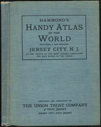
1910Best.-Nr. 135530New York: C.S. Hammond & Company 1910. Hardcover. Very Good. First edition. 97pp. Illustrated with color maps including a map showing Jersey City N.J. as the center of the most densely populated ten mile radius in the world. Owners stamps on title page foxing cloth lightly stained and faded spine ends worn very good without the dustwrapper as issued. Prepared and presented by the Union Trust Company of New Jersey. C.S. Hammond & Company hardcover books
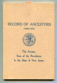
1971Best.-Nr. 600623Neshanic Station N.J.: The Society Sons of the Revolution In the State of New Jersey 1971. Softcover. Very Good. First edition. ix 44pp. Printed wrappers. Light foxing on front cover very good or better. "Compliments of M.M. Wilson" card paperclipped to title page. The Society, Sons of the Revolution In the State of New Jersey unknown books
1873Best.-Nr. 42435New Brunswick N.J.: Fredonian Printing House 36 Dennis-street 1873. First edition. Top and bottom edges chipped remnants of mounting paper just touching the top of two letters two small internal holes affecting a few letters; folds minor smudging overall still about very good. 1 sheet. 17 3/4 x 12 inches. Orphans' Courts which were predominant in Delaware Maryland New Jersey and Pennsylvania dealt with probate matters as well as having jurisdiction of orphans. Both of this lots to be auctioned were on the road leading from Plainsboro to Dayton. There was a machinery manufacturer in Jamesburg N.J. part of Middlesex county named "Snedeker & Voorhees." Fredonian Printing House, 36 Dennis-street unknown books
1921Best.-Nr. 41250Washington D.C.: Published by the United States Coast and Geodetic Survey 1921. Large folding nautical chart printed on heavy paper stock. Colored. A rare original coastal survey of New Jersey from Little Egg Inlet to Hereford Inlet including Wildwood Stone Harbor Sea Isle City Ocean City Vetnor City Atlantic City and Brigantine with an inset expanded map of Atlantic City in the top left corner. Established by President Thomas Jefferson in 1807 as the Survey of the Coast the U.S. Coast and Geodetic Survey was the United States' first civilian scientific agency. This agency has followed its mission to survey the U.S. coastline create nautical charts of the coast and help increase maritime safety since its founding and has often played fascinating roles in significant chapters of U.S. history. It served in all theaters of the Civil War in the service of the Union Army and Navy pioneered acoustic exploration in the wake of the sinking of the Titanic and during WWI it worked to detect enemy submarines. In addition this agency worked to survey and produce detailed maps and renderings of the U.S. coast. These nautical survey maps commonly referred to as "T-sheets" provide fascinating insights into the history of the United States coastline which has and will continue to shift. These maps are the most important data source for understanding the physical and ecological characteristics of the U.S. shoreline. The present map is a highly detailed and accurate sea chart of the Atlantic City area and an important historical view of developing New Jersey. Published by the United States Coast and Geodetic Survey unknown books
1921Best.-Nr. 41254Washington D.C.: Published by the United States Coast and Geodetic Survey 1921. Large folding nautical chart printed on heavy paper stock. Uncolored with minor wear. A rare original coastal survey of the New York Harbor including Staten Island Bayonne Jersey City Statue of Liberty Governors Island and Brooklyn with sectioned anchorage areas. Established by President Thomas Jefferson in 1807 as the Survey of the Coast the U.S. Coast and Geodetic Survey was the United States' first civilian scientific agency. This agency has followed its mission to survey the U.S. coastline create nautical charts of the coast and help increase maritime safety since its founding and has often played fascinating roles in significant chapters of U.S. history. It served in all theaters of the Civil War in the service of the Union Army and Navy pioneered acoustic exploration in the wake of the sinking of the Titanic and during WWI it worked to detect enemy submarines. In addition this agency worked to survey and produce detailed maps and renderings of the U.S. coast. These nautical survey maps commonly referred to as "T-sheets" provide fascinating insights into the history of the United States coastline which has and will continue to shift. These maps are the most important data source for understanding the physical and ecological characteristics of the U.S. shoreline. The present map is notable for the inclusion of anchorage areas including general anchorage sections as well as "anchorage explosives" and "man-of-war anchorage" sections. This map is a highly detailed and accurate sea chart of New York Harbor and an important historical view of developing Ne w York and New Jersey. Published by the United States Coast and Geodetic Survey unknown books
1917Best.-Nr. 41252Washington D.C.: Published by the United States Coast and Geodetic Survey 1917. Nautical chart printed on heavy paper stock. Uncolored. A rare original coastal survey of the Hudson River including Ossining Nyack Tarrytown Yonkers and New York City as well as potential anchorage points in the Hudson for Naval use. Established by President Thomas Jefferson in 1807 as the Survey of the Coast the U.S. Coast and Geodetic Survey was the United States' first civilian scientific agency. This agency has followed its mission to survey the U.S. coastline create nautical charts of the coast and help increase maritime safety since its founding and has often played fascinating roles in significant chapters of U.S. history. It served in all theaters of the Civil War in the service of the Union Army and Navy pioneered acoustic exploration in the wake of the sinking of the Titanic and during WWI it worked to detect enemy submarines. In addition this agency worked to survey and produce detailed maps and renderings of the U.S. coast. These nautical survey maps commonly referred to as "T-sheets" provide fascinating insights into the history of the United States coastline which has and will continue to shift. These maps are the most important data source for understanding the physical and ecological characteristics of the U.S. shoreline. The present map is notable for the inclusion of various anchorage points for the "temporary anchorage of naval vessels" complete with a naval seal in the upper left corner of the sheet. This map is a highly detailed and accurate sea chart of the Hudson River and an important historical view of developing New York and New Jersey. Published by the United States Coast and Geodetic Survey unknown books
1921Best.-Nr. 41253Washington D.C.: Published by the United States Coast and Geodetic Survey 1921. Nautical chart printed on heavy paper stock. Colored. A rare original coastal survey of the border between New York and New Jersey at Kill Van Kull including Staten Island Elizabeth Newark Bay Bayonne and New York Bay. Established by President Thomas Jefferson in 1807 as the Survey of the Coast the U.S. Coast and Geodetic Survey was the United States' first civilian scientific agency. This agency has followed its mission to survey the U.S. coastline create nautical charts of the coast and help increase maritime safety since its founding and has often played fascinating roles in significant chapters of U.S. history. It served in all theaters of the Civil War in the service of the Union Army and Navy pioneered acoustic exploration in the wake of the sinking of the Titanic and during WWI it worked to detect enemy submarines. In addition this agency worked to survey and produce detailed maps and renderings of the U.S. coast. These nautical survey maps commonly referred to as "T-sheets" provide fascinating insights into the history of the United States coastline which has and will continue to shift. These maps are the most important data source for understanding the physical and ecological characteristics of the U.S. shoreline. The present map is a highly detailed and accurate sea chart of the coastal border between New York and New Jersey at Kill Van Kull and an important historical view of the developing states. Published by the United States Coast and Geodetic Survey unknown books
1916Best.-Nr. 41256Washington D.C.: Published by the United States Coast and Geodetic Survey 1916. Large folding nautical chart printed on heavy paper stock. Uncolored with minor stains. A rare original coastal survey of the Hudson River including New York City from 53rd St to Fort Washington Park Weehawken and Edgewater as well as potential anchorage points in the Hudson for Naval use. Established by President Thomas Jefferson in 1807 as the Survey of the Coast the U.S. Coast and Geodetic Survey was the United States' first civilian scientific agency. This agency has followed its mission to survey the U.S. coastline create nautical charts of the coast and help increase maritime safety since its founding and has often played fascinating roles in significant chapters of U.S. history. It served in all theaters of the Civil War in the service of the Union Army and Navy pioneered acoustic exploration in the wake of the sinking of the Titanic and during WWI it worked to detect enemy submarines. In addition this agency worked to survey and produce detailed maps and renderings of the U.S. coast. These nautical survey maps commonly referred to as "T-sheets" provide fascinating insights into the history of the United States coastline which has and will continue to shift. These maps are the most important data source for understanding the physical and ecological characteristics of the U.S. shoreline. The present map is notable for the inclusion of anchorage points for US Naval use according to size complete with a naval seal in the upper left corner of the sheet. This map is a highly detailed and accurate sea chart of the Hudson River and an important historical view of developing New York and New Jersey. Published by the United States Coast and Geodetic Survey unknown books
1922Best.-Nr. 41249Washington D.C.: Published by the United States Coast and Geodetic Survey 1922. Large folding nautical chart printed on heavy paper stock. Colored. A rare original coastal survey of New Jersey from Sea Girt to Little Egg Inlet including Manasquan Brielle Point Pleasant Beach Mantoloking Lafayette Seaside Park Island Beach State Park and Long Beach Island with an inset expanded map of Little Egg Inlet in the top left corner. Established by President Thomas Jefferson in 1807 as the Survey of the Coast the U.S. Coast and Geodetic Survey was the United States' first civilian scientific agency. This agency has followed its mission to survey the U.S. coastline create nautical charts of the coast and help increase maritime safety since its founding and has often played fascinating roles in significant chapters of U.S. history. It served in all theaters of the Civil War in the service of the Union Army and Navy pioneered acoustic exploration in the wake of the sinking of the Titanic and during WWI it worked to detect enemy submarines. In addition this agency worked to survey and produce detailed maps and renderings of the U.S. coast. These nautical survey maps commonly referred to as "T-sheets" provide fascinating insights into the history of the United States coastline which has and will continue to shift. These maps are the most important data source for understanding the physical and ecological characteristics of the U.S. shoreline. The present map is a highly detailed and accurate sea chart of Long Beach Island area and an important historical view of developing New Jersey. Published by the United States Coast and Geodetic Survey unknown books
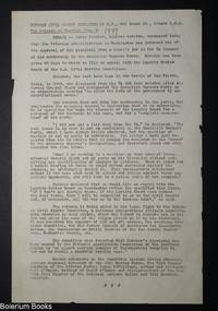
1949Best.-Nr. 326760Newark NJ: Kutcher Civil Rights Committee of New Jersey 1949. Ephemera. 8.5x14 inch mimeographed sheet. Edges with minor tears. Very Good. On the case of James Kutcher a World War 2 veteran who lost both his legs and was dismissed from his clerk’s job at the Veterans Administration because of his membership in the Socialist Workers Party. Describes Kutcher’s attempts to appeal through the Loyalty Review Board. Kutcher Civil Rights Committee of New Jersey unknown books
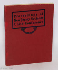
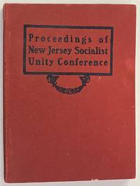
1906Best.-Nr. 323013New York: New York Labor News 1906. Paperback. 80p. wraps with minute chipping at the corner else very good condition. From the stock of the New York Labor News hence the publisher attribution. Some discussion of whether to endorse the IWW ultimately supported with a few delegates opposing. [New York Labor News] paperback books
1977Best.-Nr. 274856Washington DC: Forest Service U.S. Dept. of Agriculture Northeastern Forest Experiment Station 1977. Paperback. x 261p. illus. yellow pictorial wraps slightly shelfworn bottom edge else in very good condition. Forest Service, U.S. Dept. of Agriculture, Northeastern Forest Experiment Station paperback books
1949Best.-Nr. 265942Newark NJ: Kutcher Civil Rights Committee of New Jersey 1949. Two page mimeographed press release 8.5x11 inches stapled in the upper left hand corner date in pencil on first page else very good condition. On the case of James Kutcher fired from the Veterans Administration for being a member of the Socialist Workers Party. Kutcher Civil Rights Committee of New Jersey unknown books
1906Best.-Nr. 266820Jersey City: the Conference 1906. Paperback. 80p. slender paperback minor shelfwear otherwise very good. IWW union bug on title page. Some discussion of whether to endorse the IWW ultimately supported with a few delegates opposing. the Conference paperback books
1940Best.-Nr. 179918Long Branch: Sponsored by the City of Long Branch 1940. Hardcover. xiv 211p. preface foreword chronology bibliography index illustrated with photos artworks folding map at rear illustrated endpapers first edition in somewhat dulled and soiled green cloth boards. Browning/some soiling to pages. Slight lean to spine. Dust jacket is edgeworn and soiled with a relatively nice bright front but long tears with loss up from bottom of both front and rear flap folds. American Guide Series. Dykes 195 Powell 986. The Summer White House resort to US Presidents since the 1800s. Sponsored by the City of Long Branch hardcover books
1939Best.-Nr. 69266Newark: WPA 1939. Pamphlet. 6p. 8.5x11 inches wraps a few small rust stains on front wrap else very good condition. Stories of New Jersey bulletin #9 1939-40 series. WPA unknown books
1872Best.-Nr. 46897Jersey City: John H. Lyon 1872. Hardcover. Very good. Hardcover. 5245pp. Small ink name on verso of front free endpaper minor spot of loss at the head of the spine else very good in publisher's brown cloth. John H. Lyon hardcover books
Best.-Nr. 0092311892. First Edition. Hardcover. Very Good. 8vo publsihers blue/green pebbled cloth bevelled edges. Covers a tad soiled leaves toned as expected with this quality paper firmly bound apparently unused. A solid copy. hardcover books
Best.-Nr. B272415-2Paramus New Jersey 1990. 24pp. Prof. illus. in color. 4to. Wraps. The exhibition subsequently travelled to three other venues. Paramus, New Jersey, 1990. paperback books
Best.-Nr. B15609-5Trenton 1973. 61 1pp. 78 illus. Sq. 4to. Wraps. Trenton, 1973. paperback books
Best.-Nr. B254330-2Montclair 1981. 16pp. Prof. illus. 4to. Wraps. Montclair, 1981. paperback books
Best.-Nr. B92410-5Lambertville 2006. 287pp. Prof. illus. 4to. Wraps. 550 lots. Lambertville, 2006. paperback books
Best.-Nr. B267895-1Jersey City 1985. 12pp. 7 color illus. 4to. Wraps. Jersey City, 1985. paperback books
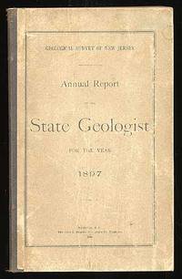
1898Best.-Nr. 45219Trenton: John L. Murphy 1898. Hardcover. Very Good. First edition. Very good in flexible boards. John L. Murphy hardcover books
Best.-Nr. 602461"5 3/4" x 2". Enclosed in the original dark blue leatherette folding snap case which is lined in white moiré silk stamped in gold on the front cover "City of Atlantic City William T. Somers Mayor." Case size when closed: 6 3/4" x 3 1/4". Provenance: from the estate of noted JFK collector Robert L. White. books