2910 resultados
1856ref. 2512030032Printed at the True American Office Trenton 1856. Hardcover. Acceptable. Bound in contemporary leather. Some leather loss at spine. Rebacked. Early stamp & signature of George Heisler Trenton NJ and James A. Fenwick. viii 248 numerous illustrations folded map; 23 cm. Second fold out map is mostly torn out. Toning scattered staining throughout. Burlington County library markings. Printed at the True American Office, Trenton hardcover
ref. 1397226803.Ghardcover. Good. Access codes and supplements are not guaranteed with used items. May be an ex-library book. hardcover
ref. 1397226706.Gpaperback. Good. Access codes and supplements are not guaranteed with used items. May be an ex-library book. paperback
ref. 0331320622.Ghardcover. Good. Access codes and supplements are not guaranteed with used items. May be an ex-library book. hardcover
ref. 0260446912.Ghardcover. Good. Access codes and supplements are not guaranteed with used items. May be an ex-library book. hardcover
ref. 0266078761.Gpaperback. Good. Access codes and supplements are not guaranteed with used items. May be an ex-library book. paperback
ref. 0331034018.Gpaperback. Good. Access codes and supplements are not guaranteed with used items. May be an ex-library book. paperback
ref. MA12A-01685New Jersey State Planning Board. Collectible - Good. Trenton NJ: New Jersey State Planning Board 1937. 4to. vii124pp. Tables maps. Good book. regional planning land use transportation New Jersey Inquire if you need further information. New Jersey State Planning Board unknown
192968p. illus. Published for the Old Rialto Theatre Hoboken N.J. Hardcover Very good condition good
Second edition, 8vo, x, 428 + 4pp., of adverts, frontispiece, 6 plates, rear hinge shaken, orig. green cloth, worn, a couple of nicks to spine.
1922ref. 41249Washington D.C.: Published by the United States Coast and Geodetic Survey 1922. Large folding nautical chart printed on heavy paper stock. Colored. A rare original coastal survey of New Jersey from Sea Girt to Little Egg Inlet including Manasquan Brielle Point Pleasant Beach Mantoloking Lafayette Seaside Park Island Beach State Park and Long Beach Island with an inset expanded map of Little Egg Inlet in the top left corner. Established by President Thomas Jefferson in 1807 as the Survey of the Coast the U.S. Coast and Geodetic Survey was the United States' first civilian scientific agency. This agency has followed its mission to survey the U.S. coastline create nautical charts of the coast and help increase maritime safety since its founding and has often played fascinating roles in significant chapters of U.S. history. It served in all theaters of the Civil War in the service of the Union Army and Navy pioneered acoustic exploration in the wake of the sinking of the Titanic and during WWI it worked to detect enemy submarines. In addition this agency worked to survey and produce detailed maps and renderings of the U.S. coast. These nautical survey maps commonly referred to as "T-sheets" provide fascinating insights into the history of the United States coastline which has and will continue to shift. These maps are the most important data source for understanding the physical and ecological characteristics of the U.S. shoreline. The present map is a highly detailed and accurate sea chart of Long Beach Island area and an important historical view of developing New Jersey. Published by the United States Coast and Geodetic Survey unknown books
1922ref. 41249Washington D.C.: Published by the United States Coast and Geodetic Survey 1922. Large folding nautical chart printed on heavy paper stock. Colored. A rare original coastal survey of New Jersey from Sea Girt to Little Egg Inlet including Manasquan Brielle Point Pleasant Beach Mantoloking Lafayette Seaside Park Island Beach State Park and Long Beach Island with an inset expanded map of Little Egg Inlet in the top left corner. Established by President Thomas Jefferson in 1807 as the Survey of the Coast the U.S. Coast and Geodetic Survey was the United States' first civilian scientific agency. This agency has followed its mission to survey the U.S. coastline create nautical charts of the coast and help increase maritime safety since its founding and has often played fascinating roles in significant chapters of U.S. history. It served in all theaters of the Civil War in the service of the Union Army and Navy pioneered acoustic exploration in the wake of the sinking of the Titanic and during WWI it worked to detect enemy submarines. In addition this agency worked to survey and produce detailed maps and renderings of the U.S. coast. These nautical survey maps commonly referred to as "T-sheets" provide fascinating insights into the history of the United States coastline which has and will continue to shift. These maps are the most important data source for understanding the physical and ecological characteristics of the U.S. shoreline. The present map is a highly detailed and accurate sea chart of Long Beach Island area and an important historical view of developing New Jersey. Published by the United States Coast and Geodetic Survey unknown
1969ref. 807483Trenton NJ: New Jersey State Museum 1969. 1st. Softcover. Very Good/None. Exhibition catalog. Brown stapled covers with monotone illustration of both sculptors 6 b&w plates complete catalog biographical notes on both Rickey and Seawright foreword by Zoltan Buki selected texts from multiple authors. Slight rubbing to covers pages crisp and unmarked; a very clean tight catalog. Record # 807483 New Jersey State Museum paperback
1969ref. 807482Trenton NJ: New Jersey State Museum 1969. 1st. Softcover. Very Good/None. Exhibition catalog. Brown stapled covers with monotone illustration of both sculptors 6 b&w plates complete catalog biographical notes on both Rickey and Seawright foreword by Zoltan Buki selected texts from multiple authors. Slight rubbing to covers name "Rickey" written in small pencil print to front covertiny ink stain to acknowledgments page crisp pages; a very clean tight catalog. Record # 807482 New Jersey State Museum paperback
ref. chcp01sdemPaperback. Very Good. A very nice clean copy. paperback
ref. 0910170746.Gpaperback. Good. Access codes and supplements are not guaranteed with used items. May be an ex-library book. paperback
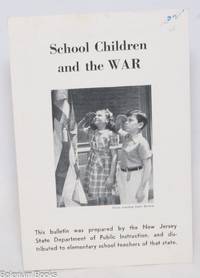
1942ref. 334951New York: Fellowship of Reconciliation 1942. 4p. brochure. Very Good. The text condemns the use of children as props in war propaganda e.g. in parades and the sale of war bonds or as cheap/free labor. Fellowship of Reconciliation unknown books
1876pp. vi, 116 + Frontis and eleven full page engravings from original drawings by D. B. Gulick, Charles W. Knapp, and others. First few signatures loose. Slight age stain. Original errata slip. All edges red. 8vo. Original full green cloth binding. Front cover title decorated in gold. Extremities worn. Hardbound. Full title: "Sketches of the Romantic Adventures of the Pioneer Colonists; The Wonderful Origin of American Society and Civilization. And the Necessity of Religious Freedom. To Which Is Appended a Geological Description of the Shore of New Jersey. Very good copy. PA 48
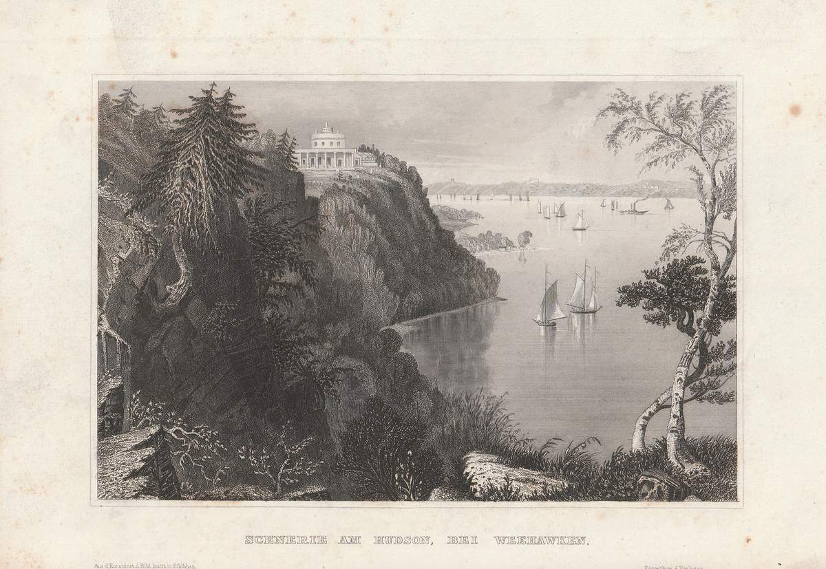
1850ref. 62914Hildburghausen, Bibliographisches Institut, um 1850. Bild ca. 11 x 16,5 cm, Blatt ca. 15 x 21,5 cm. 1 Blatt, verso weiß.
ref. 13207RCA American Communications 400 College Road East Princeton N.J. At the Royal Institution London England. November 6 1980. 3 13 2pp. 4to. Twenty-five figures in text and photograph of Inglis above a brief biography at the rear. Stapled. In good condition on lightly-aged paper. From the Pat Hawker archive with his ownership inscription on the front cover and the addition by him of '& CABLE' to the title also the note by him 'Shows Cable penetration etc.' 'RCA American Communications Inc. owns and operates the RCA domestic satellite communications system. This consists of two in-orbit satellites plus a growing network of earth stations in major U.S. cities. This system provides satellite communication services to businesses the media and agencies of the Federal Government. In June and October 1981 RCA American plans to launch a third and fourth communications satellite to meet the increasing demand for services in the United States. In addition the company has filed with the FCC for authority to launch a fifth communications satellite.' Scarce: no copy on COPAC or OCLC WorldCat. RCA American Communications, 400 College Road East, Princeton, N.J. [At the Royal Institution, London, England.] November 6, 198 unknown
1952ref. 65-1332Smith 1952 1952. 1st ed. About 150p. Photos. Operations in support of the war in Korea Crew roster. Oversize. White embossed cover. Front slightly rubbed. Near Fine Copy. 1st. Hardcover. Near Fine. Smith, 1952 Hardcover
ref. 1332348270.Gpaperback. Good. Access codes and supplements are not guaranteed with used items. May be an ex-library book. paperback
ref. 0267864965.Ghardcover. Good. Access codes and supplements are not guaranteed with used items. May be an ex-library book. hardcover