Antiquariat.de
2 007 résultats
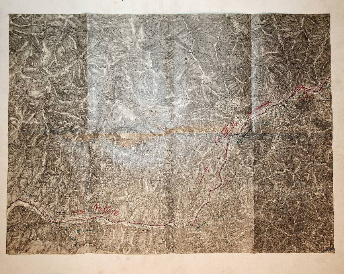
1900réf. K-1356Wien, Milit?rgeographisches Institut, ca. 1900. Formatangabe ca 50 x 37 cm, gefaltet zu 8 Segmenten, Ausgabe: einf?rbig ; Zustand: gut mit Farbstifteinzeichnungen Milit?r 1. Weltkrieg November 1916
19878vo., First Edition, with maps in the text; black cloth, gilt back, a near fine copy in price-clipped dustwrapper. EXTREMELY SCARCE, ESPECIALLY IN THIS CONDITION.
1980réf. N869bJerusalem: Yad Vashem 1980. 1st Edition . Original Cloth with d/j. Very Good/Good. 4to. Vol II of 2 only. Published 1980. 568pp Hebrew text. Illustrations. A very good and clean copy. Yad Vashem hardcover
réf. 57483Bucuresti, Academiei Republicii Populare Romine 1961-1966, 245x170mm, 959 + 793pages, reliure d'éditeur sous jaquette. Déchirures à la jaquette du tome 1, autrement bon état.
réf. 13792Théâtre de la guerre en Orient. Carte Empire de Turquie, Serbie, Roumanie, Monténégro et Royaume de Grèce 1876. Dressée d’après les documents les plus récents par L. BERTHE géographe Garnie Frères éditeur Paris. 880x680mm. (115 x 185mm pliée) Bon exemplaire. Année 1876 La Turquie déclare la guerre à la Serbie. 1er et 2 juillet La Serbie et le Monténégro déclarent la guerre à la Turquie Ottomane devant le refus d’accorder à la Serbie la Bosnie et au Monténégro l’Herzégovine. .
1891réf. X111583Vienna, Mkhit'arean Tparan [Mechitharisten-Buchdruckerei] 1891 [8] + 79pp., text fully in Armenian, 20cm., firmly bound in modern hardcover, frontcover preserved, in the series "Azgayin matenadaran" volume 4 [Nationalbibliothek 4], text is clean and bright, Very good condition, cfr. OCLC 28656138, X111583
1719réf. 228811719 Paris,Nouveau et Curieux Atlas Geographique et historique., c.1719.17 x 22,5cm,bon etat. Hungary. Copper engraving. Original colour with later additions. Fine condition, good margins. Size: 22 x 16 cm. (8? x 6? inches). Map of Hungary, including modern day Yugoslavia, Rumania and Bulgaria. List of Hungarian kings at lower centre, title cartouche at top right. In the early eighteenth century, French cartography overtook the Dutch in terms of accuracy and design. Chiquet's delightful Nouveau et Curieux Atlas was typical product of the time.Map shows total Hungary with Moldavia, Bulgaria, Rumania Serbia, Bosnia, Dalmatia and Slovenia.
19202 volumes: 89 + 16pp.with some illustrations in text & 3 plates out of text, together with the atlas: 20 maps in colour, original softcovers, 29 & 32cm., good condition, rare, publication by the "Institutul Meteorologic central al Romaniei" of which the author E.Otetelisanu was the director, W81357
2025réf. x-1032250100Taylor & Francis Ltd 2025. Paperback. New. 556 pages. 10.00x7.00x10.00 inches. Taylor & Francis Ltd paperback
1876Very Good German Original color map on cloth. A little foxing on cloth. Very good. Folded. Oblong folio. (45 x 59 cm). In German. Shows Kujaljnickij Limani, Dnjesstrowskij Liman, Odessa shores and hinterland. Rare. A sheet of the collection of 'The general map of Central Europe'. appeared in the years between 1873-1876 with the work of Joseph Ritter von Scheda, (1815-1888) who was a general, geographer and cartographer.
réf. DISPLAYMM042Editura Academiei Republicii Socialiste Romania. Very Good. Prompt shipment with tracking. we ship in CLEAN SECURE NEW boxes Good paperback with clean pages wear and creasing to covers. Comite International des Sciences Historiques XV Congres International des Sciences Historiques. Bucarest 10-17 aout 1980. 714 pages. rm Editura Academiei Republicii Socialiste Romania paperback
1880réf. 286293Bucuresti : C. Gobl 1880. First Edition. Softcover. Poor copy with wear tear and dust-dulling as with age. Text remains clear and without blemish. Physical description; 600 p. : ill. some col. ; 32 cm. Notes; Romanian text with documents in French German Greek Hungarian Italian Latin Old Church Slavic Polish as well as Romanian. Known also as Colectia ""Hurmuzaki."". Subjects; Romania — History — Sources.Genres; Bibliography. Illustrated. Bucures?ti : C. Go?bl paperback
1872In 16 (cm 12 x 19), pp. IX + (1b) + 58 + (8). Fioriture sparse alle pagine. Omaggio autografo al piatto anteriore. Brossura editoriale con danni riparati al dorso. Bibliografia in lingua rumena dei volumi pubblicati relativi agli antichi abitanti della Dacia.
réf. 189653Paris, Charles-Lavauzelle, s.d. (1899) in-8, 119 pp., demi-chagrin rouge, dos lisse orné de filets dorés (reliure de l'époque). Cachet (annulé).
1653réf. UUI-9981Carte géographique de format 28,5/34,5 cm (pour la planche), 14,5/16,5 cm (pour la carte). Issue du rare atlas de Briet : "Théâtre géographique de l'Europe", Pierre Mariette, 1653. Papier légèrement jauni, petite mouillure sur le haut de la planche, mouillure plus discrète sur la droite de la planche, bon état général, bel exemplaire. Frais d'envoi 7 euros sur la France, 15,05 UE et Suisse, entre 19,60 et 26,70 euros pour le reste du monde, à spécifier selon zone. Possibilité de remise en mains propres sur Paris, n'hésitez pas à me contacter avant de passer commande. Twitter : @Pontneuf06.
1909réf. 172171909 2 volumes, reliure demi-chagrin vert olive (binding half shagreen) in-octavo (22,8 x 14,5 cm), reliure d'époque, dos 5 nerfs (spine with raised bands) insolé (le vert olive a viré au soleil en marron-clair)- entre-nerfs à fleuron au fer plein or (floweret with full blocking stamp) - titre frappé or (gilt title) et tomaison (volume numbering), papier marbré vert aux plats (cover with marbled paper), toutes tranches lisses (all edges smooth), orné d'un portrait en frontispice en héliogravure en noir,[4]-IV-417 et [4]-426 pages, 1909 Paris E. PLON, Nourrit et Cie Imprimeurs-Editeurs,
1995réf. 1102861995 Editions Museion - 1995 - In-4, broché, couverture illustrée - 104 p. - Reproductions photographiques et illustrations en N&B in et hors-texte - Ouvrage en roumain, allemand, anglais et français
1981réf. 606778Bucuresti Editura Stiintifica si Enciclopedica 1981 In-8, cartonnage d'édition, jaquette noire, 289 pp., nombreuses illustrations en noir et en couleurs. Texte en roumain.
1821Carta geografica, antica ed originale, con coloritura coeva ai confini. La mappa edita nella città tedesca di Weimar è stata disegnata nel 1820 e rappresenta il territorio Croazia, Slovenia e Ungheria. Autore: Geograph: Instituts edit.. Luogo: Ungheria - Romania. Anno: 1821. Tecnica: incisione in rame. Dimensioni: 305x415.
1896ix + 352pp., with some illustrations, text fully in Armenian, 20cm., firmly bound in modern hardcover, frontcover preserved, in the series "Azgayin matenadaran" volume 19 [Nationalbibliothek 19], text is clean and bright, very good condition, cfr. OCLC 774057731, [Study on the Armenians in Gherla, Transylvania (Romania)], X111613
1896réf. X111613Vienna, Mkhit'arean Tparan [Mechitharisten-Buchdruckerei] 1896 ix + 352pp., with some illustrations, text fully in Armenian, 20cm., firmly bound in modern hardcover, frontcover preserved, in the series "Azgayin matenadaran" volume 19 [Nationalbibliothek 19], text is clean and bright, very good condition, cfr. OCLC 774057731, [Study on the Armenians in Gherla, Transylvania (Romania)], X111613
réf. GF252441 page 1/2 in8 - bon état -
réf. GF252431 page in8 - bon état -
2007réf. 55106ABCluj. Köln., Verlag der Buchhandlung Walther König., 2007. 23 x 16 cm + 1 DVD. [100] unpaginierte Blatt. OKarton., 55106AB 1. Auflage. Sehr gutes Exemplar. Colectia public.
2007réf. 817FBCluj. Köln., Verlag der Buchhandlung Walther König., 2007. 23 x 16 cm + 1 DVD. [100] unpaginierte Blatt. OKarton., 55106AB 1. Auflage. Sehr gutes Exemplar. Colectia public.