Salmon, ThomasMareMagnum

49.104 Ergebnisse
1757in 8°, (19x13) cm, rilegatura coeva in piena pergamena, titolo in oro incorniciato al dorso; p. (16), 672. Complessivamente 70 tavole di cui: antiporta, 3 grandi carte geografiche più volte ripiegate e 66 belle incisioni di vedute di città ripiegate più volte fuori testo. Bell'esemplare raro da trovarsi completo di tutte le tavole
1928Very Good Russian Original dark green cloth bdg. Oblong folio. (28 x 36 cm). Eight languages of the title on the colophon, the text is completely Russian. [6], [ii], 108 p., [36] maps in various sizes, some of folded: (62x47 cm, 52,5x45,5 cm, 49,5x27 cm [x3], 61x47 cm; other maps are 36x28 cm). Four unnumbered leaves with half-title and contents for each section. Two small millimetric cuttings on two text pages. Ex-owner's name is on the title page. Markings on the index. Otherwise a very good and clean copy. Rare complete and the first atlas including a fine collection of 36 attractive chromo-lithograph maps mostly with tissue papers of the Soviet Union, edited by the Central Executive Committee and Enukidze (1877-1937), who was a prominent Georgian "Old Bolshevik". One of 11000 copies. Being published only 10 years after the USSR was established, this is the earliest atlas of the country. It seems to have been published with a wider audience in mind, with a title page in various European languages. The borders of many areas -including not just administrative regions throughout the USSR, but also entire autonomous republics (especially in Central Asia)- were in a state of flux; as such, the borders in this Atlas (including the wax-paper overlays meant to update various maps with changes made between when they were drawn and when the Atlas was published) often don't look anything like the borders they were set at the end of the Soviet Union and have continued on to modern times. Since the boundaries were often ideologically- (sometimes ethnically-, less so economically-) motivated, this offers an interesting insight into the mindset of the administration that was making these changes. Map list: World map, General USSR, USSR in Europe, Asia and USSR, Karelian Autonomous Soviet Socialist Republic, Komi-Zyryan Autonomous Oblast, Avt, Votskaya Oblast, Maryinskaya, Cherepovetsky District, Vologda Oblast, Avt. Chuvashskaya SSR (Chuvashia), Avt. Tatarskaya SSR (Tatarstan), Avt. Bashkirskaya SSR (Bashkiria), ASSR Nemchev Povoljiya, Kalmykia (Kalmykia), Krimskaya SSR (Crimea), Adigeiskaya (Tscherkeskaya) Obl. (Cherkesia), Kabardino-Balkarskaya Avt. Obl. (Kabardino-Balkarian Rep.), Karachayskaya Avt. Obl. & Tscherkesskiy Nation. Okrug (Karachay-Cherkessia), Chechenskaya Avt. Obl. (Chechnya), Ingushetiya, Severo-Osetiya, Avt. Daghestanskaya SSR, Avt. Kazakskaya SSR, Kyrgyzkaya ASSR, Avt. Oiuratskaya Oblast, Burito - Mongolskaya SSR (Kazakhstan), Avt. Yakustkaya SSR (Yakutia), Beloruskaya SSR (Belarus), Ukrainskaya, SSR (Ukraine), Moldavskaya SSR (Moldovia), Zakavkazkaya SSR (Abkhazia), Azerbaijanskaya SSR (Azerbaijan), Arminskaya SSR (Armenia), SSR Gruzii (Georgia), Central Asian SSR (Karakalpakstan, Kyrgyzstan, Turkmenistan, Uzbekistan), Uzbekistan, Turkmenistan. OCLC shows copies in twenty-three libraries worldwide: 7852120, 968755133, and 822577467.
1775Best.-Nr. 43743Paris, Vente et Vignon, 1775. In-4, basane brune, dos orné à nerfs (reliure ancienne).
1761in 8°, (18x11,5 cm), antica rilegatura in pergamena, titolo manoscritto al dorso; 1 c.b, pp. xii, 419 (1); incisione allegorica all'antiporta, vignetta incisa al frontespizio, 26 tavole ripiegate fuori testo (aperte 17,5x22 cm). Le carte rappresentano nell'ordine: Roma, carta geografica del'Italia, Trento, Venezia, Padova, Vicenza, Verona, Brescia, Milano, Parma, Bologna, Firenze, Lucca, Livorno, Siena, Civitavecchia, Genova, Mantova, Ferrara, Urbino, Ancona, Loreto, Napoli, Pozzuoli, Bacoli, Cuma
1740In 8° (mm 160x110); 8 cc. nn (manca l'antiporta), 343 pp., 4 cc. nn. Bella veduta a volo d'uccello di Venezia su doppia pagina fuori elenco e 70 vedute della città su 42 tavole f.t., di cui 25 a doppia pagina, finemente incise in rame da Francesco Zucchi. Piacevole legatura di inizio Ottocento in mezza pelle con filetti, titolo e piccoli fregi al dorso, piatti in carta marmorizzata, dorso a quattro scomparti, tagli a spruzzo. Edizione originale rara e ricercata di questa nota guida storico-artistica, in seguito ristampata piu' volte. Le vedute raffigurano tutti i più importanti monumenti e scorci della città con fascino e ricchezza di particolari: palazzi, chiese, piazze animate da figure, il ponte di Rialto, la laguna con velieri e gondole. Il testo descrive minuziosamente la città. Mancano rispetto all'elenco originale due tavole a foglio singolo con la stampa 12 "Veduta dell'orologio" e 13 "Chiesa di S. Ziminiano", 29 "Ospitale dei mendicanti" e 31 "Ospitale dei SS. Gio. e Paolo", sostituite da altre 2 tavole, doppie, fuori elenco, ognuna con due vedute, su carta leggermente più spessa: "Veduta dell'orologio nella piazza di S.Marco", "Chiesa di S. Geminiano", "Chiesa di S. Nicolò di Castello e Seminario Ducale", "Monastero dell cappuccine e chiesa di S. Antonio…". Ottimo esemplare con la veduta di Venezia come al solito con margini brevi e pieghe editoriali. Schlosser, p. 563: "Specialmente notevole...". Morazzoni, pag. 230 e 64-65: "La guida che tutte le altre supera per praticita" di notizie e soprattutto per la ricchezza delle tavole...". Fossati-Bellani 2277. Cicogna, 4479.
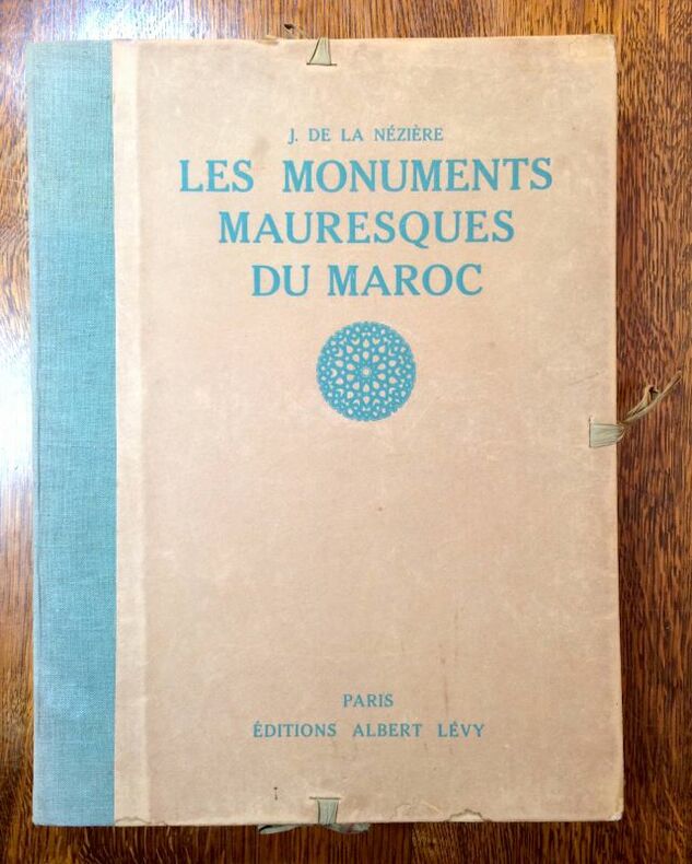
Best.-Nr. 12431 En feuillets, porte-folio d'édition à lacets, 1er plat titré en vert, vignette, dos toilé (passé). Quelques rousseurs éparses en marge de certaines pl. In-folio, 41 x 31 cm, XVI-27 p. + C [100] planches. Paris, Editions Albert Lévy, Librairie centrale des Beaux-Arts, s.d. [1921]. Edition originale
Best.-Nr. 12431 En feuillets, porte-folio d'édition à lacets, 1er plat titré en vert, vignette, dos toilé (passé). Quelques rousseurs éparses en marge de certaines pl. In-folio, 41 x 31 cm, XVI-27 p. + C [100] planches. Paris, Editions Albert Lévy, Librairie centrale des Beaux-Arts, s.d. [1921]. Edition originale
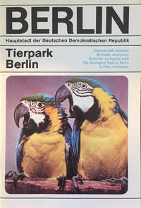
Best.-Nr. 16299A group of 35 zoo guides showcasing the animals and environments of various zoos around the world over the past century. It is quite amazing to see the evolution of the zoo especially the balance between protection and care of its animals on the one hand and the interests of the paying public over the years. A wonderful collection. NEW YORK HORNADAY William. Popular official guide to the New York Zoological Park. New York Zoological Society 1923. HORNADAY William. Official guide book to the New York Zoological Park. New York Zoological Society 1927. BERLIN Berlin Zoo Guides 1914-1941. HED L. Führer durch den Berliner zoologischen Garten. Verlag des zoologischen Gartens zu Berlin 1914. bound with Wegweiser durch den zoologischen Garten Berlin. Actien-Verein des zoologischen Gartens zu Berlin 1925; 1936; 1937; 1939; 1941. Six works bound together. Ansichten aus dem Zoologischen Garten zu Berlin. Berlin: Julius Sittinfeld n.d. Colored illustrations of the Berlin Zoological Gardens between 1873-1900. Der Zoologische Garten in Berlin. ca. 1915. Album of 20 tipped-in photographs. DATHE Heinrich. Tierpark Berlin 1975. Der Tierpark Berlin. Leipzig: Andersen Nexö 1985. Wegweiser durch den Zoologischen Garten Berlin und sein Aquarium. Lange 2004. LANGE Jürgen. Der Begleiter durch den Zoo Berlin und sein Aquarium 2007. LONDON MITCHELL P. Chalmers. Guide to the zoological gardens Regent’s Park. London: Zoological Society of London 1906. MITCHELL P. Chalmers. Official guide to the gardens of the zoological society of London. London: Offices of the Zoological Society of London 1921. bound with Illustrated official guide to the London Zoological Society’s gardens in Regent’s Park 1926. LEIPZIG SCHNEIDER Karl Max. Vom Leipziger Zoo aus der Entwicklung einer Volksbildungsstatte. Leipzig: Geest & Portig 1953. AUSTRALIA HEDLEY Charles. Wild animals of the World being a popular guide to Taronga zoological park. Sydney: William Brooks n.d. CINCINNATI Studies in zoology. Cincinnati Zoological Gardens 1900. STEPHAN Sol A. Cincinnati zoo guide. All information on animals and birds. Cincinnati Zoological Park Association 1928. Album of the zoological garden of Cincinnati. Cincinnati: Krebs lithography company. VIENNA ANTONIUS Otto. Führer durch dem Schönbrunner Tiergarten Wien. Hilfswerk f.d. Schonbrunner Tiergarten. SAN DIEGO SQUIER; BRANSBY. Whose zoo in San Diego 1933 . Official Guide Book of the San Diego Zoo. Third ed. San Diego: Zoological Society 1947. Official Guide Book of the San Diego Zoo. Fifth ed. San Diego: Zoological Society 1947. Official Guide Book of the San Diego Zoo. Sixth ed. San Diego: Zoological Society 1947. Visitor’s map San Diego Zoo & Balboa Park 1962. MÜNICH HECK H. Führer durch den Tierpark Hellabrunn Geo-Zoo München. München SOUTH AFRICA BIGALKE Rudolph. The National Zoological Gardens of South Africa. South Africa: central news agency 1954. FRANKFURT PRIEMEL Kurt. Ein Rundgang durcch den Frankfurter Zoo. Frankfurt am Main: Zoo Verlag: 1934. HAMBURG Führer durch Carl Hagenbecks Tierpark. Hamburg: Carl Hagenbecks Eigentum und Verlag 1929. AMSTERDAM Koninklijk Zoölogisch Genootschap Natura Artis Magistra. Amsterdam 1910. Koninklijk Zoölogisch Genootschap Natura Artis Magistra. 1910. KRONBERG Unsere Tiere. Ein Führer durch das Georg von Opel-Freigehege für Tierforschung in Kronberg. unknown
1587In-8°; pp. (16), 215, cc. (8), 64. Con due frontespizi con marca tipografica. Legatura in piena pergamena molle coeva, tracce di usura. E’ la prima edizione con le due opere insieme, e la prima della Dichiaratione. La prima opera è una guida artistica e storica della città di Venezia, concepita sotto forma di dialogo tra un Veneziano e un Forestiero; Schlosser, p. 321: “In questo periodo Venezia è già da lungo tempi la città dei forestieri per eccellenza...Il libretot veramente tascabile deve fornire tutte le cognizioni necessarie al forestiero; è redatto nella forma dialogata che ritornerà anche in seguito nella letteratrua delle guide... Un particolare valore di fonte ha la descrizione delle pitture del palazzo Ducale distrutte dal fuoco nel 1577, tanto più che Sansovino stesso ne aveva fatto una parte del programma letterario... Spiegazioni che riguardano solamente il puro contenuto ci dà un altro scrittore, pure di origine fiorentina, Girolamo Bardi, delle storie dipinte (1587) nella Sala del Gran Consiglio al Palazzo Ducale dopo l’incendio del 1577” (p. 321). La seconda opera qui unita in edizione originale descrive le pitture della Sala dello Scrutinio e del Gran Consiglio nel Palazzo Ducale, compresa un’opera del Tintoretto. Francesco Sansovino (1521-1586), nato a Roma, fu uomo di lettere, erudito e storico, la cui fama è legata anche alle descrizioni di Venezia, e alla divulgazione storica che attuò anche attraverso queste opere. Cicognara 4338; Lozzi 5895; Schlosser, 1935, pp. 330, 486. Alcune carte leggermente brunite.
Volume in 8vo, comprendente due parti in unico tomo (opera completa). Parte Prima (contiene i primi cinque libri). In Venetia, presso Gio. Batt. Pulciani Sanese, 1625. Front. con marca tipografica (stemma mediceo a sei palle sormontato da corona e con quattro figure allegoriche), dedicataria al Serenissimo Don Ferdinando Secondo de Medici Gran Duca di Toscana, scritta dalla seconda consorte del Fu Tommasi, signora Livia Cinuzzi, datata 10 agosto 1625, e in cui si spiega la volontà di offrire il lavoro del marito, prematuramente scomparso, prima di aver compiuta l'opera (al verso un sonetto scritto all'Autore, in Persona della Signora Livia Cinuzzi sua Consorte, "Sonetto del Signor Giulio Piccolomini Accademico Filomato"), antip. con bel ritratto finemente inciso a piena pagina del Tommasi (con monogramma VS), pp. 12 n. n. con la "Tavola delle Cose più Notabili", pp. 338 (segnatura A - X5); Parte seconda (contiene il libri dal sesto al decimo). In Venetia, presso Gio. Batt. Pulciani Sanese, 1626. Front. con marca tipografica (stemma mediceo a sei palle sormontato da corona e con quattro figure allegoriche), dedicataria al Serenissimo Don Ferdinando Secondo de Medici Gran Duca di Toscana, scritta dalla consorte del Fu Tommasi, signora Livia Cinuzzi, datata 20 dicembre 1626 e in cui si offre questa seconda parte delle Historie sperando che, animata dal favore, prenderà animo di presentare ancora la terza (al verso un sonetto scritto dall'Autore Alla Signora Livia Cinuzzi, in persona dell'Autore suo Marito, "Sonetto del Signor Giulio Piccolomini Accademico Filomato") antip. con bel ritratto finemente inciso a piena pagina del Tommasi (con monogramma VS), pp. 12 n. n. con la "Tavola delle Cose più Notabili, Errori e Correzioni", pp. 340 + (3) ("Lo Stampatore a' benigni Lettori - Errori e correzioni) (segnatura A – X5). Legatura originale in piena pergamena floscia con titolo manoscritto al dorso e riportato al taglio inferiore. L'opera contiene, cosa assai rara, entrambi i ritratti in calcografia (Cfr. Lozzi, II, 5128; Moreni, II, 399; Piantanida, 3734 per il secondo volume). La stesura delle "Historie" occupò gli ultimi anni della sua vita e la ricostruzione dell’attività di ricerca documentale ci mostra la sua presenza in archivio per il decennio che va dal febbraio del 1592 a tutto il dicembre del 1602 (Lisini, 1896). La morte lo colse prima della rifinitura dell’opera, e in particolare della sua seconda deca, e cadde in una fase di perdita di vitalità dell’editoria senese. La prima deca, che tratta la storia della città dalle origini al 1355, fu pubblicata a Venezia dal tipografo senese Giovanni Battista Pulciani in due volumi nel 1625 e nel 1626. Entrambi sono dedicati dalla vedova, la seconda moglie Livia Cinuzzi, al granduca Ferdinando II, con le date 10 agosto 1625 e 20 dicembre 1626. Nella seconda dedica la vedova prometteva al granduca: «animata dal suo favore, prenderò l’animo di presentarle ancora la terza, quando dalle mie deboli forze ciò mi sia conceduto». E, in effetti, fu la morte, il 28 maggio 1628, a impedire il completamento del progetto. La seconda deca delle "Historie", che tratta del periodo 1355 - 53, ha visto la luce a stampa, a cura di Mario De Gregorio, suddivisa in quattro volumi (2002 - 2007). Prima ancora della pubblicazione, postuma, e fino ai contributi storiografici più recenti (Ascheri, 2000), la Storia di Tommasi è stata messa in parallelo, e a confronto, con quella di Orlando Malavolti, in considerazione della opposta affiliazione delle due famiglie al Monte dei nove e al Monte dei grandi, e della comprensibile, opposta partigianeria dei due storici. A dare avvio a questo filone interpretativo, proseguito fino al presente, è stata la ricostruzione della stessa genesi dell’opera di Tommasi da parte di Ugurgieri Azzolini (1649): «Havendo egli letto l’Istoria di Siena stampata dal Malvolti, e parendogli, che egli attribuisse troppo d’honore alle famiglie Grandi, e che havesse abbassato l’altre, ed in particolare quelle del Monde de’ Nove, delle quali è la consorteria de’ Tommasi...» (p. 636). Per quanto Tommasi non citi mai l’opera di Malavolti, non nasconde certo le proprie simpatie "novesche" che emergono fin dalle prime righe della seconda deca, riferite al violento cambio politico del 1355: "Così variò il governo, e lo stato di Siena né passò dalla servitù alla libertà, come il minuto populo s’era persuaso, e s’andava vantando, ma dal governo di pochi (tal’era divenuto il reggimento de’ Nove) alla licenza della plebe condotta la prima volta dall’ambizione de’ Grandi al governo della Repubblica" (Dell’historie di Siena..., a cura di M. De Gregorio, 2002 -2007, I, p. 1). La struttura annalistica, l’inaffidabilità di alcune fonti per le epoche più antiche già rilevata da Giovanni Niccolò Bandiera, il ricorso a una documentazione archivistica meno ampia di quella di Malavolti e senza riferimenti puntuali (Cammarosano, 1988) se non rendono le "Historie di Siena " di Tommasi un’opera metodologicamente innovativa non cancellano però il suo interesse e la sua utilità per la riflessione moderna sulla storia della città (Bibliogr. "Treccani" on line). Un piccolo lavoro di tarlo, a circa sette cm dal basso, interessa i primi tre fogli (front. e dedicataria) facendo mancare solo poche sillabe, alcune antiche annotazioni e cancellature al front., ritratti ottimamente impressi, ben impresso anche tutto il testo che presenta solo alcune pagine leggermente più schiarite, leg. in parte allentata ma distesa e ben conservata. Nell'insieme un bell'esemplare.
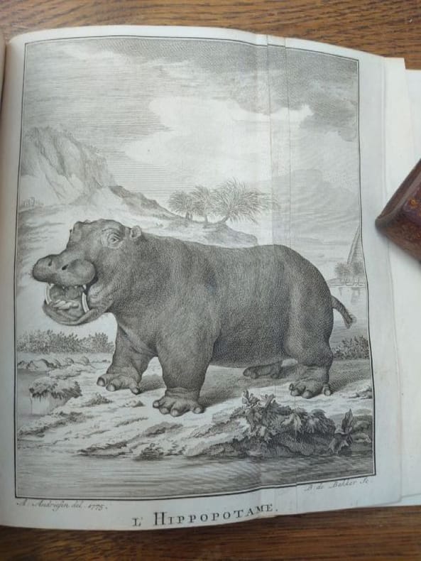
Best.-Nr. 7735A Amsterdam, chez J.H. Schneider, M. DCC. LXXVIII. (1778). 21 x 13 cm, 2 ff.-130 pp. et 1 f.-100 pp. Deux parties en un volume relié demi-veau glacé, dos à nerfs, tranches marbrées. Quelques traces de frottements sinon très bel exemplaire. Bien complet des 16 planches dépliantes (15 d'animaux et une de plante). Planches en bel état. Première et unique édition de la traduction française d'une intéressante histoire du Cap de Bonne-Espérance, accompagnée d'un journal historique d'une expédition dans l'intérieur de l'Afrique, faite par ordre de feu le Gouverneur Ryk Tulbach, avec une force de 85 hommes sous le commandement du Capitaine Henry Hope. La première partie de l'ouvrage contient une intéressante description du Cap. Le journal qui constitue la seconde partie de cet ouvrage contient des informations non moins intéressantes sur la faune et la flore, les tribus et les minéraux rencontrés et trouvés lors de l'expédition au Namaqualand du 16 juillet 1761 au 27 août 1762 sous le commandement d'Henry Hop. « Ce document est non seulement très intéressant, mais aussi d'une grande valeur permanente » (Theal, History of South Africa).
Best.-Nr. 7735A Amsterdam, chez J.H. Schneider, M. DCC. LXXVIII. (1778). 21 x 13 cm, 2 ff.-130 pp. et 1 f.-100 pp. Deux parties en un volume relié demi-veau glacé, dos à nerfs, tranches marbrées. Quelques traces de frottements sinon très bel exemplaire. Bien complet des 16 planches dépliantes (15 d'animaux et une de plante). Planches en bel état. Première et unique édition de la traduction française d'une intéressante histoire du Cap de Bonne-Espérance, accompagnée d'un journal historique d'une expédition dans l'intérieur de l'Afrique, faite par ordre de feu le Gouverneur Ryk Tulbach, avec une force de 85 hommes sous le commandement du Capitaine Henry Hope. La première partie de l'ouvrage contient une intéressante description du Cap. Le journal qui constitue la seconde partie de cet ouvrage contient des informations non moins intéressantes sur la faune et la flore, les tribus et les minéraux rencontrés et trouvés lors de l'expédition au Namaqualand du 16 juillet 1761 au 27 août 1762 sous le commandement d'Henry Hop. « Ce document est non seulement très intéressant, mais aussi d'une grande valeur permanente » (Theal, History of South Africa).
Very Good Turkish, Ottoman (1500-1928) Original bdg. 4to. (28 x 24 cm). In Ottoman script (Old Turkish with Arabic letters). 24 p. First and only edition of this scarce atlas printed in Leipzig for the Ottoman market before the proclamation of the Republic, distributed by Jewish agent A. M. Karmi of this atlas located in Dersaadet (Constantinople), including beautiful and attractive 34 chromo-lithographed maps of Africa, Australia, Americas, Europe, Turkey, Asia, and a celestial map. Özege 8803.; Only two copies in OCLC: 632952950, 949536147 (the Bogaziçi University of Turkey and Universitätsbibliothek Bamberg of Germany).
17375 volumi in-8° (cm. 16,3), legatura coeva in m. pelle con titolo e decorazioni in oro ai dorsi, piatti marmorizzati, tagli spruzzati; carte in ottimo stato e fresche come da bibliografia; con 47 tavole f.t. incise da Johann Georg Seiller, anch'esse in stato ottimale, con la sola assenza del prospetto/indice delle tavole (presente la grande pianta della città); alcune silografie n.t.. Prima edizione di questa celebre storia di Milano corredata da un ricco apparato iconografico dovuto al Ferroni. «Libro il più pregevole del diciottesimo secolo per la copiosità delle notizie, l'esattezza, i buoni riferimenti estetici e lo stile familiare e chiaro» [Villa 36]. Cicognara 4242; Predari 13; Fossati-Bellani II, 1938. Ottimo esemplare.
1807Best.-Nr. ABC_48079Amsterdam The Hague Middelburg Rotterdam Utrecht Leiden 1807. 12mo. L.A.C. Hesse Brothers Van Cleef S. van Benthem etc. Contemporary gold-tooled half sprinkled calf with a red title label lettered in gold on the spine sprinkled paper sides. With a folding letterpress title page to the atlas and 19 folding engraved maps and plans. 2 parts in 1 volume. 2 8 16 120129-218 pp. Extremely rare travel guide to the Netherlands with a separate atlas containing 19 maps and plans from the library of Henry Tronchin at Bessinge. Published during the reign of Louis Napoleon 1806-1810 the guide provides practical information for travellers as well as an extensive description of the country. The first edition published in 1804 contained only one map; the present second edition is the first to include the atlas.The guide opens with tables of distances and practical information on different means of travel including their costs followed by general observations on the Kingdom of Holland. These cover the constitution climate food and drink local products and trades weights and measures religion language education sciences police and customs. The second part describes the departments of Groningen Friesland Overijssel Guelders Utrecht Holland Brabant and Zeeland. The atlas includes maps and plans of the principal cities and numerous routes through the country as well as a map showing the routes between Paris London and Amsterdam.With the armorial bookplate of Henry Tronchin 1794-1865 and the library label of Bessinge the home of the famous library of the Tronchin family mounted the front paste down the signature of Charles Richard Tronchin 1763-1835 on the title page. The spine is slightly rubbed. The first free flyleaf is torn with loss of material the title page is slightly foxed the inner margins of the large maps are frayed. Otherwise in good condition.l Alphabetische naamlijst 1790-1831 p. 709; Koeman II Hes3 1 copy; Saalmink p. 2089. CARTOGRAPHY GEOGRAPHY & TOPOGRAPHY TRAVEL & VOYAGES Atlases & Globes Travel Low Countries unknown
1843Very Good French Original handsome leather bindings. Demy 8vo. (22 x 14 cm). In French and Ottoman script. 4 volumes set: ([vi], [2], 784, 125 p., [vi], 1372 p.; [xxx], [2], 1097 p., [vi], 1320 p.). Slight foxing on pages, faded on boards, otherwise a very good set. Ex-libris of Izzet Gündag Kayaoglu. First edition of the complete set of this early dictionary from French to Turkish and from Turkish to French, published in Paris, in London Oriental Translations Committee Printer. Bianchi visited Istanbul at the beginning of the 19th century and prepared dictionary and phrasebooks in Turkish after he had returned to his country. One of his most significant works occurs to be this dictionary. What makes this dictionary noteworthy among other his works is the fact that Turkish words are written together in both Arabic and Latin characters. Turkish words with Arabic letters are written as to stereotyped pronunciation in the work. Therefore, they do not indicate the changes in the language. Bianchi reflects the pronunciation of writing in Turkish letters with Latin characters; and thus, the differences between spelling and pronunciation are highlighted. Thomas-Xavier de Bianchi (1783-1864), born in Paris on June 25, 1783, was the younger brother of the Austrian Field Marshal de Bianchi, Duke of Casalanza. He studied at the Central School of the department of Seine-et-Marne and followed, in Paris, oriental language courses at the College de France and at the Imperial Library under Sylvestre de Sacy. In 1807, he was appointed a pupil at the French school of young people of language in Constantinople, then directed by the scholar Ducaurroy and completed his improvement in Arabic, Persian and Turkish. Sent to Izmir in 1811, he was second there, and then the first dragoman of the Consulate General, and was noted for his dedication during the plague epidemic of 1812. In 1816, he was appointed assistant to the King's secretary-interpreters in Paris and was in charge to accompany the Persian envoy to Louis XVIII in 1819. In 1829, he was sent on a mission to the last day of Algiers, Hussein-pasha. The following year, France intervened in Algeria. He was appointed secretary-interpreter in the title and served as professor of Turkish at the School of Oriental Languages until 1842. After his retirement, he devoted himself to lexicographical and bibliographical work. He was an officer of the Legion of Honor, decorated with the Nichan-Iftikhar, as a member of the Imperial Academy of Constantinople. Tout exemplaire de ce Dictionnaire qui ne serait pas revetu de la signature de l'un des auteurs et editeurs sera repute contrefaçon, et poursuivi cmme tel, en vertu de la loi du 19 juillet 1793. [i.e. Any copy of this Dictionary which does not bear the signature of one of the authors and publishers will be deemed to be counterfeit, and prosecuted as such, under the law of July 19, 1793].
1815Best.-Nr. ABC_46389Amsterdam 1815. 12mo. Evert Maaskamp Original publisher's blue paper wrappers over boards. With an engraved title page including a vignette showing the Amsterdam publishing house of Evert Maaskamp 3 folding maps 1 folding plate showing coins 16 double-page maps and 2 full-page plates; all coloured by a contemporary hand. 2 380 XXII 10 pp. Very rare first edition of a rare early interesting and charming travel guide for The Netherlands containing three folding maps: a Carte generale itineraire. des routes du Pays Bas a Carte des routes entre Paris Londres et Amsterdam and a Carte generale de la Hollande 16 double-page maps and plans including a Carte itineraire des environs d'Amsterdam Carte itineraire d'Amsterdam à Haarlem et Leiden Les environs de Haarlem and a Plan itineraire d'Amsterdam Carte itinéraire dAnvers a Breda etc. all including the roads waterways and distances. The text starts with a Table des distances and the descriptions of 29 different routes mostly to and from places within the Netherlands but no. 29 is a description of a route from Amsterdam to Paris all including the number of postes indicated pp. 1-31. Manière de voyager follows on pp. 32-41 with interesting details on distances prices ways of travelling by diligence post coach horse-drawn canal barge etc. Pp. 42-380 contain accounts of the money industries agriculture products schools and universities dress customs societies cafés colleges and everything else you might wish to know. Further descriptions of the cities and villages followed by a Table de matières and Table des cartes etc. on pp. i-xxii. With the bookplate of John Murison on the front paste-down. Binding worn and shaved especially around the spine. Otherwise in good condition and untrimmed.l Cf. Koeman Atlantes Neerl. II p. 271 Maa 1-2. EXPLORATION & TRAVEL LOW COUNTRIES TRAVEL & VOYAGES Netherlands Travel Low Countries hardcover
Best.-Nr. 5453Paris, chez C.J. Trouvé, 1826.21,5 x 13 cm, lx + 444 pp. et 480 pp. Avec quatre grandes cartes dépliantes dont une colorées. Deux volumes reliés plein veau glacé d'époque, dos à nerfs, caissons ornés, titres dorés, encadrement estampé à froid sur les plats. Aux centres des plats chiffre de la duchesse de Berry. Reliures légèrement frottés, essentiellement aux mors fragilisé, coins émoussés, des rousseurs. Sinon bon exemplaire. Sans l'atlas qui manque souvent. Provenance : ex-libris de Diane Gratzmuller. Ex-libris de la Bibliothèque de Rosny et chiffres de Marie Caroline de Bourbon Siciles, duchesse de Berry. Cet exemplaire est répertorié tel quel sans l'atlas sous le n°1371 dans le Catalogue de la riche bibliothèque de Rosny, dans laquelle se trouvent les grands et beaux ouvrages à figures publié lors de la vente de la bibliothèque en 1837 ((Bossange & Techener).
Best.-Nr. 5453Paris, chez C.J. Trouvé, 1826.21,5 x 13 cm, lx + 444 pp. et 480 pp. Avec quatre grandes cartes dépliantes dont une colorées. Deux volumes reliés plein veau glacé d'époque, dos à nerfs, caissons ornés, titres dorés, encadrement estampé à froid sur les plats. Aux centres des plats chiffre de la duchesse de Berry. Reliures légèrement frottés, essentiellement aux mors fragilisé, coins émoussés, des rousseurs. Sinon bon exemplaire. Sans l'atlas qui manque souvent. Provenance : ex-libris de Diane Gratzmuller. Ex-libris de la Bibliothèque de Rosny et chiffres de Marie Caroline de Bourbon Siciles, duchesse de Berry. Cet exemplaire est répertorié tel quel sans l'atlas sous le n°1371 dans le Catalogue de la riche bibliothèque de Rosny, dans laquelle se trouvent les grands et beaux ouvrages à figures publié lors de la vente de la bibliothèque en 1837 ((Bossange & Techener).
1730Very Good Turkish, Ottoman (1500-1928) Original b/w map from Kitab-i Cihannuma which is one of the most important Turkish incunabula. Oblong large 4to. (31 x 37 cm). In Ottoman script. It shows Venice and Venetian Bay and Algerian shores at North Africa (Maghrib). Toponyms are in Turkish with Arabic letters. Written directions (Simal, Cenûb, Sark and Garb) on corners of the map, and decorative compass on Mediterranean Sea. Scale can be seen at left upper side (El-mikyas: Mil-i Islâmiyân Mil-i Frençe, and Mil-i Italiya]. It's one of the thirteen maps and plates from the book of Cihannuma. The story of Cihannuma can be considered as an effort to keep up with the speed that knowledge spread around the world at a time when literacy was highly limited. Kâtip Çelebi began to rewrite Cihannuma in 1654. During the next six years, he added to his books the knowledge he gained from the books he read. Kâtip Çelebi was vastly influenced by nonreligious positive knowledge, especially by the Atlas and later the Atlas Minor of Gerardus Mercator. He had the book translated from Latin to Turkish by a French recruit andenriched his own book with the new information. He brought together in Cihannuma the knowledge of geography and astronomy existing in Western sources (1654). Cihannüma has 13 charts and 27 maps. Mercator's maps are distinguished by their distinct properties. However, there are such maps which depict Istanbul, Anatolia, the Caucasus and the Orient that have to have been borrowed from other sources and there are those with relatively less detail that might have been prepared by Muslim geographers. Sources cite Ahmed El Kirimî (Ahmed the Crimean) and Galatali Migirdich as mapmakers for Cihannüma. Their names are placed on the maps. Another name that is mentioned is Tophaneli Ibrahim. Researchers agree on the fact that he is Ibrahim Müteferrika. Perhaps he wished to hasten the printing of the book. Perhaps he enjoyed making this contribution to a book he half owned. There is one map in Cihannüma which definitely does not belong to Mercator. Nor is there any information that it was originally charted by Müteferrika's team. Historians state that the 'invertedness' can be found in other maps made by Muslim cartographers. Since it is amap of Turkey, the difference can easily be perceived. The Mediterranean coasts of Turkey are at the top of the map while the Black Sea coasts are at the bottom. The compass on the map correctly indicates the North. The map seems to be inverted but it is not considered scientifically wrong to draw maps in this fashion...". (Source: Boyut; Kitab-i Cihannuma). Extremely rare.
1753In-8° antico (173x120mm), pp. (6), 191, (1), cartonatura coeva alla rustica con titolo manoscritto in antico al dorso. 7 tavole ripiegate f.t. disegnate e incise su rame da Beltramo Antonio Re raffiguranti, nell'ordine, una pianta generale di Torino, il Duomo, il Palazzo Reale, Palazzo Madama, Palazzo Carignano, l'antica Torre Civica, il Palazzo di Città e la piazza antistante (per una più dettagliata descrizione delle singole piante rimandiamo alla Peyrot). Errata finale. Qualche leggera fioritura. Bellissimo esemplare. Prima edizione e seconda tiratura della "prima guida stampata, che si conosca, della città di Torino" (Peyrot). La guida fu redatta in occasione delle celebrazioni del terzo centenario del Miracolo del SS. Sacramento, in previsione del grande concorso di forestieri che sarebbe affluito in città. Nel medesimo anno furono fatte due tirature, di cui la prima contiene 9 tavole, mentre la seconda, quella del nostro esemplare, ne reca 7 (non sono presenti il Collegio dei Nobili e il Palazzo del Seminario) e presenta alcune lievi difformità testuali. Nelle prime pagine della guida l'autore sottolinea la necessità di tale opera, in particolare in quegli anni in cui Torino era "Metropoli del Regno", residenza del Sovrano e, quindi, meta di molti "Nobili Forestieri". La guida è pensata come un viatico di viaggio che conduce il visitatore nei differenti luoghi che si incontrano in un ideale percorso a partire dalla Cattedrale. Inoltre, si descrive Torino nei suoi contorni, ripartendo lo scritto in quattro giornate, come le quattro Porte della Citta' che si aprono verso le "delizie" dei sovrani e le altre particolarita' che si possono scorgere nelle zone limitrofe alla citta'. Al termine dell'opera sono posti ampi indici tematici. Peyrot, Torino nei Secoli, I, 181. Collezione Simeom, G 1. Cicognara, 4345. Schlosser, 552. Manca al Lozzi e al Manno. Italiano
1737Antoine-Augustin Bruzen de La Martinière (Dieppe, 1683-L'Aia,1746) fu storico e poligrafo. Studiò a Parigi sotto la guida del prozio Richard Simon, che gli trasmise la passione per gli studi storici e geografici. Grazie alla munificenza di alcuni mecenati, tra i quali il duca Federico Guglielmo di Mecklemburg-Schwerin e del duca di Parma Francesco Farnese, La M. poté continuare le sue ricerche e p 10 voll. STATO: USATO, BUONO. TITOLO: Le Grand Dictionnaire Géographique, et Critique. Par M. Bruzen La Martinière géographe de sa Majesté Catholique Philippe V, Roi des Espagnes et des Indes. AUTORE: Bruzen de la Martinière,Antoine-Augustin. EDITORE: chez Jean Baptiste Pasquali DATA ED.: 1737-1741, COLLANA: Rileg. in mz.pergamena, tasselli in pelle con scritte in oro al dor
Compagnie des Libraires, Paris, 1707. Quattro volumetti in 8vo piccolo (cm 10 x 17), antiporte figurate a ciascun volume e completo delle tavole. Tome primo: pp. (14), 334 + (2); Tome secondo: pp. (2), 359; Tome terzo: pp. (2), 302; Tome quarto: pp. (2), 266 + (30). Legature in piena pelle con dorso a nervi, tagli in rosso. Vedute delle principali città italiane da nord a sud e dei più importanti monumenti. Evidenti usure delle legature, sciolti due front. (con alcune pieghe) e sciolte alcune tavole, nell'insieme tutti i volumi sono ben conservati con tavole ben impresse.
Best.-Nr. 21598Venise, Giovanni Varisco & i compagni, 1569. Petit in-8, [8]-201 ff. [sign : 8 A-Aa8 Bb10], chagrin noir moderne, triple filet à froid en encadrement sur les plats, dos long orné de filets à froid,tranches mouchetées (petites épidermures, restaurations du papier au titre, pâle mouillure en début de l'ouvrage, petit manque sans atteinte au deux premiers ff. de texte, 2 restaurations de papier à la carte, quelques taches).
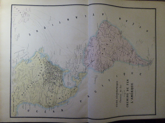
Best.-Nr. 60453Administration Des Chemins De Fer Paris 1877 In-plano ( 630 X 470 mm ), pleine percaline vieux-rouge, premier plat orné du titre et d'une locomotive dorés. 16 très belles cartes en couleurs dont 15 double-page de chemins de fer des principaux pays européens, une carte des chemins de fer des deux Amériques, carte des chemins de fer turcs et russes et une carte des chemins de fer de l'Algérie sur feuillet simple. Très Nombreuses belles publicités, en marge des légendes. Percaline maniée, les cartes et les feuillets sont en parfait état, d'une étonnante fraîcheur. Bel exemplaire de ce rare atlas entièrement monté sur onglets.