Murray's Travel Guide Book For FranceBiblio.com

69 697 résultats
1853réf. 203129London: John Murray 1853. Fourth Edition; revised. Hardcover. Good in boards. Spine crown/heel lightly bumped. John Murray hardcover
réf. SONG184215267XUsed: Good unknown
réf. SONG1592574920Used: Good unknown
réf. SONG1892559013Used: Good unknown
réf. SONG0763749346Used: Good unknown
1978réf. 201291978. Damron Bob contributor; Collins Andrew. Gay travel guides and newspapers 1978-2004. These publications document the circulation of location-based information used by gay and lesbian travelers to identify bars hotels and social spaces during a period when public visibility remained uneven and often restricted. Issued across the late twentieth century the guides and accompanying newspaper articles record the existence of queer establishments through printed directories organized by city state and country providing evidence of how individuals located community navigated unfamiliar environments and accessed networks of social life. The material supports research into LGBTQ mobility geography and print culture by preserving addresses descriptions and travel advice tied to spaces that were frequently undocumented elsewhere. Eight items including two newspapers and six travel guides published between 1978 and 2004 most in portable formats measuring approximately 4.25 x 5.5 inches to 5.5 x 8.5 inches. 1 Coast to Coast Times Issue 120 1978. Contains "Doing America with Bob Damron" documenting travel to Fire Island and identifying it as a site of gay social life establishing early print circulation of location-based queer knowledge. 2 Lambda News Vol. III Issue VI June 1978. Includes Damron's "Doing America" article on gay life in Houston Texas offering regional documentation of community spaces in the American South. 3 Collins Andrew. Fodor's Gay Guide to Los Angeles and Southern California. 1997. First edition. Provides approximately 170 pages detailing establishments neighborhoods and cultural sites within a major urban center of LGBTQ life. 4 Collins Andrew. Fodor's Gay Guide to San Francisco and the Bay Area. 1997. First edition. Includes 166 pages documenting one of the most established gay communities in the United States through listings and descriptive entries. 5 Damron Road Atlas. 1997. Presents city maps across the United States Canada and Europe with the majority of entries dedicated to U.S. locations and thousands of addresses identifying gay-friendly venues. 6 Collins Andrew. Fodor's Gay Guide to the USA. 1998. Second edition. Expands coverage nationwide with maps regional breakdowns and extensive listings of establishments. 7 Damron Amsterdam: Gay Tourists Guide. 1998. Contains detailed maps wallet reference cards and listings of bars hotels and venues in a major European destination. 8 Damron Accommodations. 8th edition 2004. Covers the United States Mexico Europe and additional regions with substantial emphasis on U.S. cities and travel infrastructure. These guides were produced within a broader context in which printed directories functioned as essential tools for locating queer space prior to digital communication preserving information that was often ephemeral due to business closures policing and shifting social conditions. The Damron guides in particular emerged from firsthand travel and reporting building cumulative geographic knowledge across successive editions. Scholars have noted the limited print runs and short functional lifespan of such guides contributing to their scarcity and historical importance; as Jack Swab observed "Given the topic and the community they catered to print runs even at the best-established gay publishers were relatively small. the information contained within them quickly went out of date reducing the number of surviving guides even further." Comparisons have been drawn to The Negro Motorist Green Book in their shared function as navigational tools for marginalized travelers. Together these materials provide primary evidence of how queer communities mapped social space traveled and sustained networks across regions before the advent of digital directories. Light wear to covers with minor edge rubbing; interiors clean with intact maps and advertisements. Overall very good condition. unknown
1978réf. 201291978. Damron Bob contributor; Collins Andrew. Gay travel guides and newspapers 1978-2004. These publications document the circulation of location-based information used by gay and lesbian travelers to identify bars hotels and social spaces during a period when public visibility remained uneven and often restricted. Issued across the late twentieth century the guides and accompanying newspaper articles record the existence of queer establishments through printed directories organized by city state and country providing evidence of how individuals located community navigated unfamiliar environments and accessed networks of social life. The material supports research into LGBTQ mobility geography and print culture by preserving addresses descriptions and travel advice tied to spaces that were frequently undocumented elsewhere. Eight items including two newspapers and six travel guides published between 1978 and 2004 most in portable formats measuring approximately 4.25 x 5.5 inches to 5.5 x 8.5 inches. 1 Coast to Coast Times Issue 120 1978. Contains "Doing America with Bob Damron" documenting travel to Fire Island and identifying it as a site of gay social life establishing early print circulation of location-based queer knowledge. 2 Lambda News Vol. III Issue VI June 1978. Includes Damron's "Doing America" article on gay life in Houston Texas offering regional documentation of community spaces in the American South. 3 Collins Andrew. Fodor's Gay Guide to Los Angeles and Southern California. 1997. First edition. Provides approximately 170 pages detailing establishments neighborhoods and cultural sites within a major urban center of LGBTQ life. 4 Collins Andrew. Fodor's Gay Guide to San Francisco and the Bay Area. 1997. First edition. Includes 166 pages documenting one of the most established gay communities in the United States through listings and descriptive entries. 5 Damron Road Atlas. 1997. Presents city maps across the United States Canada and Europe with the majority of entries dedicated to U.S. locations and thousands of addresses identifying gay-friendly venues. 6 Collins Andrew. Fodor's Gay Guide to the USA. 1998. Second edition. Expands coverage nationwide with maps regional breakdowns and extensive listings of establishments. 7 Damron Amsterdam: Gay Tourists Guide. 1998. Contains detailed maps wallet reference cards and listings of bars hotels and venues in a major European destination. 8 Damron Accommodations. 8th edition 2004. Covers the United States Mexico Europe and additional regions with substantial emphasis on U.S. cities and travel infrastructure. These guides were produced within a broader context in which printed directories functioned as essential tools for locating queer space prior to digital communication preserving information that was often ephemeral due to business closures policing and shifting social conditions. The Damron guides in particular emerged from firsthand travel and reporting building cumulative geographic knowledge across successive editions. Scholars have noted the limited print runs and short functional lifespan of such guides contributing to their scarcity and historical importance; as Jack Swab observed "Given the topic and the community they catered to print runs even at the best-established gay publishers were relatively small. the information contained within them quickly went out of date reducing the number of surviving guides even further." Comparisons have been drawn to The Negro Motorist Green Book in their shared function as navigational tools for marginalized travelers. Together these materials provide primary evidence of how queer communities mapped social space traveled and sustained networks across regions before the advent of digital directories. Light wear to covers with minor edge rubbing; interiors clean with intact maps and advertisements. Overall very good condition. unknown books
1935réf. 2111902160200897Suwa history discussion meeting 1935. Soft Cover. Fine. Volume: 1 Suwa history discussion meeting paperback
réf. DADAX0830825533New unknown
réf. 35600802, Paris, Didot, 1835. 6 tomes en 5 vol. in-8, demi-basane brune, dos lisses ornés, pièces de titres vertes et rouges (Rel. de l'ép.) Importante publication illustrée de 740 planches hors-texte finement gravées d'après les dessins de Rauch montrant les principaux monuments et sites des 89 départements français, ainsi que les portraits des personnalités marquantes. Exemplaire assez frais. Qq. petits accrocs aux reliures. La carte générale et les 89 cartes départementales manquent
réf. SONG1579470858Used: Good unknown
réf. DADAX1571290230New unknown
réf. SONG1576239977Used: Good unknown
réf. DADAX0805037241New unknown
réf. DADAX0792263715New unknown
réf. SONG041597318XUsed: Good unknown
réf. DADAX191271602XNew unknown
réf. DADAX190391941XNew unknown
réf. DADAX1931643016New unknown
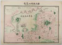
1920réf. 217674China.: No publication details. Circa1920. Colour folding pictorial map 39.5 x 54cm lower corners a little stained one panel browned and some folds strengthened with washi on reverse an attractive map. This is a pictorial guide map of Yíheyuan the Summer Palace in Beijing. Kunming Lake is feature in the centre where a fancy pleasure boat is floating. Numerous buildings and walking paths are drawn in detail. No publishing date is recorded on the map. . No publication details. unknown
réf. SONG1931514844Used: Good unknown
réf. DADAX0943396581New unknown
réf. DADAX0878915508New unknown
réf. DADAX3030522970New unknown
1805In-8 p. (mm. 203x117), 2 volumi, brossura muta coeva, pp. XXVIII,124; 132; con una deliziosa vignetta xilografata ai frontespizi e con 4 tavole f.t., più volte ripieg. ed inc. in rame, così composte: una pianta topografica di Milano colorata d’epoca, una carta dell'Alto Novarese, una della Val Tellina e una mappa del viaggio ai laghi Maggiore, di Lugano e di Como. La prima parte tratta di Milano, la seconda dei dintorni. Cfr. Villa “Bibliogr. Guide di Milano”, n. 100: “L'autore si rifà al Bianconi e segue il suo piano: la città descritta secondo le sei porte principali (Orientale. Romana, “porte Marengo ci-devant Ticinese”, Vercellina, Comasina, Nuova). Stampata per gli eventuali viaggiatori che dovessero venire a Milano in occasione dell'incoronazione di Napoleone Re d'Italia, la guida dà al viaggiatore un estratto per indicargli ciò che interessa a un artista, a un dilettante e a un curioso”. Esemplare con barbe, ben conservato. Euro 500 guide21 Euro 500 In-8; Première Partie pp. (28), 124. Seconde partie pp. 132. Vi è una pianta topografica di Milano (mm. 440x240) con i numeri che si riferiscono ai corrispondenti numeri del testo, una carta dell'Alto Novarese, una della Val Tellina e una Mappa del viaggio ai laghi Maggiore, di Lugano e di Como con acquarellatura coeva solo per i corsi d'acqua; tutte le carte sono più volte ripiegate. L'autore si rifà al Bianconi e segue il suo piano: la città descritta secondo le sei porte principali. Stampata per gli eventuali viaggiatori che dovessero venire a Milano in occasione dell'incoronazione di Napoleone Re d'Italia, dà al viaggiatore un estratto per indicargli ciò che interessa a un artista, a un dilettante e a un curioso. La guida consta di due parti rilegate in un volume: la prima tratta di Milano, la seconda dei dintorni. Cfr. L. Villa, Bibliografia delle Guide di Milano, scheda n. 100 In-8, cart. orig., pp. 132, 4 cc. di cui 3 geograf. inc. in rame. (1991) Mediolanum Lista D. Lit. 200.000 .