1935Best.-Nr. 78291935 plaquette in-octavo, dos muet blanc très légèrement défraîchi, couverture illustrée en couleurs sur le recto par Borline, petites illustrations photographiques, sans pagination, 84 pages, 1935 à Grenoble Dardelet et Compagnie Editeurs-Propriétaires,
Best.-Nr. 10534plaquette (booklet) in-octavo, dos muet (spine - no title) crème, couverture imprimée (front cover printed), abondamment illustré (plentifully illustrated), 112 pages, sans date (no date) (les années 1930 environ) à Nantes Edité par le Syndicat d'Initiative de Nantes et de la région nantaise,
1931Best.-Nr. 9151931 br. in-8, d. acc., couv. ill., nombr. petits clichés, carte du morvan repliée entre le contre-pl. et la p. de titre, établissements risacher et cie éd., 150 p., 1931,
1941Best.-Nr. 132671941 plaquette orange in-douze (orange booklet duodecimo), couverture imprimée et illustrée (cover printed and illustrated), toutes tranches lisses (all smooth edges), illustrations : bien documenté - manque le plan de Bordeaux (well-documented - missing the plan of Bordeaux), 112 pages, 1941 à Bordeaux Imprimerie Clèdes et Fils,
1905Best.-Nr. 141905 broché in-octavo, dos et couverture rouge, illustrations : plan de Nantes en couleurs sur une double page + gravures hors-texte, 32 pages de texte et 134 pages de publicité, 1905 Coulommiers Imprimerie Paul Brodard Editeur,
1962Best.-Nr. 12301962 br. éd. in-12, d. très lég. défr., 9 plans - 12 cartes géographiques kilométriques - 15 profils des pentes des routes - 4 tables d'orientation -, 1962,
1952Best.-Nr. 95791952 plaquette (booklet) in-octavo, dos avec une illustration photographique se prolongeant sur la couverture (spine with a photographic illustration goes on the cover), tranches lisses (smooth edges), illustrations : bien documenté (well-documented) - photographies de Yann, 128 pages, 1952 à Toulouse Réalisation Inter-Publicité,
1901Best.-Nr. 73601901 percale souple rouge in-octavo, dos et deuxième plat muets, premier plat orné d'un fer spécial (manque de dorure), toutes tranches dorées, illustrations : nombreuses figures, 192 pages, 1901 à Paris A. Richard Editeur - H. Bourgogne Successeur,
1919Best.-Nr. 46601919 broché in-octavo, dos blanc, première de couverture illustrée en vert et brun par Jacques Touchet, 2ème de couverture ornée d'une publicité centrale pour l'eau du Mont-Dore, nombreuses photos, plans, circuits en noir in et hors-texte, 24 pages, 1919 Paris Imprimerie Studium Editeur,
1909Best.-Nr. 7741909 br. in-8, couv. ill., plan replié de lyon et au verso carte de la région lyonnaise / onglet, nombr. clichés, 96 p., 1909,
1911Best.-Nr. 75831911 plaquette in-octavo, dos muet blanc - légèrement défraîchi, couverture illustrée, illustrations photographiques in et hors-texte, 112 pages, 1911 à Lyon Publié par le Syndicat d'Initiative,
1934Best.-Nr. 70991934 plaquette in-octavo, dos muet créme, couverture illustrée en couleurs sur le recto, illustrations photographiques + 1 plan et 1 carte sur une double page, 64 pages, 1934 Paris Editions Mayeux,
1921Best.-Nr. 13861921 plaq. in-8, pl. ill., bandeaux - lettrines - c. de lampe - gr. et clichés in-txt., plan de poitiers replié, 80 p., 1921 syndicat d'initiative des voyages en poitou,
1971STATO: USATO, MOLTO BUONO. TITOLO: Tournus. AUTORE: Oursel,Raymond. EDITORE: Zodiaque DATA ED.: 1971, COLLANA: Coll.Le Travaux des Mois,5.
Best.-Nr. 979Dessain et Tolra, Paris, 1984. In-4, cartonnage éditeur illustré en couleurs, 231 pp. Naissance et développement du musée - La peinture flamande - La peinture hollandaise - La peinture allemande, italienne et espagnole - La peinture française aux XVIIe et XVIIIe siècles - La peinture française du romantisme à l'impressionnisme - La peinture ...
1977Best.-Nr. 118829Zodiaque Travaux du Mois 1977 Zodiaque, les Travaux du Mois, 1977, 101 p., broché, environ 25x21cm, bon état.
Best.-Nr. 40640-33New. Our Christian hope: Leader guide unknown
1994Best.-Nr. 100136233Seuil 1994 439 pages 14x20x3cm. 1994. Broché. 439 pages.
1954Quinta edizione. Brossura in carta lucida, illustrata, lievemente brunita e con titoli al dorso trascritti a pennarello rosso. Pagine in buono stato, ingiallite dal tempo e riccamente illustrate in bianco e nero. Traccia di penna al frontespizio. Numero pagine 58. USATO
Best.-Nr. 100131777Moneta in12. Sans date. Broché.
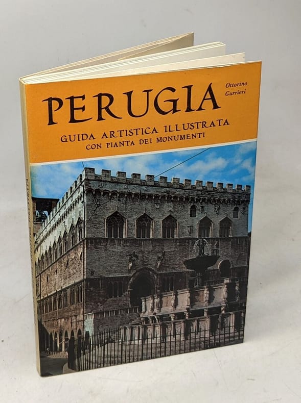
1967Ottorino Gurrieri Perugia. Guida illustrata. , Azienda autonoma di turismo 1967, Pagine testo: ingiallite, brunite ai margini. Copertina: in brossura, con margini lievemente stanchi, sporca lievemente, ingiallita lievemente. Interno in ottime condizioni. Buono (Good) .
1924Ottorino De Fiore Fenomeni eruttivi,sismici e pseudovulcanici avvenuti all'Etna nel 1916.(Estratto). , Società Tipografica Modenese 1924, I fenomeni eruttivi, sismici e pseudovulcanici avvenuuti all'Etna nel 1916. Estrattodal Bollettinodella Società Sismologica Italiana, Voll.XXI, XXIV, Anni 1917-18, 1922-23. Il dorso della copertina editoriale è artigianale, copertina stanca ai bordi, le pagine ingiallite ma in buono stato. Buono (Good) . 95
1898Volume rilegato in tutta tela, coperta maggiormente imbrunita al dorso e con legger irregolarità da fattore tempo ai margini, alle punte e alle cuffie, tagli imbruniti con il superiore spruzzato a colori, pagine con naturale imbrunitura, alcune con accenni di crescente fioritura, libro completamente fruibile, n. 11 della collana "Atlanti di Medicina", con prefazione dell'autore, traduzione italiana del Dottor Carlo Calza, presenti 24 tavole a colori fuori testo e 217 illustrazioni in nero nel testo, numero pagine 393 (XV, 378) USATO
1987In 8°, t.t. edit. con sovrac. ill. (lievi tracce d'uso e piccolo strappo), pp. 294,(2); coll. "il Cammeo. 156"; prima ed., nota di possesso al frontesp. per il resto copia molto buona. (L011)
1910Very Good Turkish, Ottoman (1500-1928) Original lithograph map with brown, white and blue tons. 81x57 cm. In Ottoman script (Old Turkish with Arabic letters). All toponyms are in Ottoman Turkish and Arabic. Scale: 1:500,000. Shows Mediterranean shores on the north, Bahr-i Lût [i.e. the Dead Sea], Aqaba Bay, areas of Arabic tribes in very detail, in addition, special huge lands like 'Al-Hism Land'. Also, it shows holy places, antiquities, fortresses, rivers; and Turkish Sanjaks, Qazas, Nahiyes, Qariyes based on the Ottoman administrative system. Cartographer is not indicated, but, it's composed for military purposes in the last period of the Imperial Ottoman, especially for showing Arabian tribes spreading over vast areas in its period, just before World War 1 (date of the printing of this map), such as 'Houtat Tribe'. A very detailed and attractive map of Palestine and Quds area and their topography. Following the Muslim conquest of Palestine in 636-640, several Muslim ruling dynasties succeeded each other as they wrestled control of Palestine: the Rashiduns; the Umayyads, who built the Dome of the Rock and the al-Aqsa Mosque in Jerusalem; the Abbasids; the semi-independent Tulunids and the Ikhshidids; the Fatimids; and the Seljuks. In 1099, the Crusaders established the Kingdom of Jerusalem in Palestine, which the Ayyubid Sultanate conquered in 1187. The Crusaders failed to retake Palestine despite further attempts. The Egyptian Mamluks took Palestine from the Mongols (who had conquered the Ayyubid Sultanate) in 1260. The Ottomans captured Palestine in 1516 and ruled it until Egypt took it in 1832. Eight years later, the United Kingdom intervened and returned the region to the Ottomans. Considerable demographic changes happened during the 19th century and with the regional migrations of Druze, Circassians, and Bedouin tribes. The emergence of Zionism also brought many Jewish immigrants from Europe and the revival of the Hebrew language. Arabs in Palestine, both Christian and Muslim, settled and Bedouin, were historically split between the Qays and Yaman factions. These divisions had their origins in pre-Islamic tribal feuds between Northern Arabians (Qaysis) and Southern Arabians (Yamanis). The strife between the two tribal confederacies spread throughout the Arab world with their conquests, subsuming even uninvolved families so that the population of Palestine identified with one or the other. Their conflicts continued after the 8th-century Civil war in Palestine until the early 20th century and gave rise to differences in customs, tradition, and dialect which remain to this day. Beit Sahour was first settled in the 14th century by a handful of Christian and Muslim clans (hamula) from Wadi Musa in Jordan, the Christian Jaraisa and the Muslim Shaybat and Jubran, who came to work as shepherds for Bethlehem's Christian landowners, and they were subsequently joined by other Greek Orthodox immigrants from Egypt in the 17th-18th centuries. Due to the legacy of the Ottoman period, the ethnic origins of some rural and urban Palestinians are either Albanian, Circassian, or from other non-Arab populations.