48 083 résultats
1909Very Good Turkish, Ottoman (1500-1928) Extremely rare huge chromo-lithograph map in 24 sheets mounted on canvas, showing a large zone including Midyat (Mardin), Mosul, Mt. Cilo (Resko-Buzul) on the southeast; Kahta (Adiyaman), Munzur Mt., Divrigi (Sivas) on the west; the Black Sea on north and Turkish borders to Armenia, Azerbaijan on the east, and to Russia on the northeast. In addition shows in separate little portions, roads, mountains and hills, lakes, and telegraph and post ways and borders in that zone. Not in any libraries and any collection. An attractive map with its huge size and decorative surface. Several toponyms are underlined in red ink. Otherwise a very good example. Original folded map mounted on canvas. 118x112 cm. In Ottoman script (Turkish with Arabic letters). Scale: 1/630.000.
Very Good Turkish, Ottoman (1500-1928) Original color map. Elephant folio. (67 x 45 cm). In Ottoman script. Scale: 1/400.000. [OTTOMAN MAP of CAUCASIA] Shores of Black Sea / Batum - Poti. Shows Black Sea shores of Batum and Poti of Georgia. Mostly shown Black Sea in the map, but from southeast to northwest, a coastline reaches from Batum city to Adler (?). Some toponyms are in Turkish, but mostly Russian and Georgian in Arabic (Ottoman) script. A handsome and calligraphic Ottoman map.
Very Good Turkish, Ottoman (1500-1928) Original color map. Atlas folio. (55 x 46 cm). In Ottoman script. Scale: 1/400.000. [OTTOMAN MAP of CAUCASIA] Yekaterinodar - Yeysk - Maykob - Anapa. Shows Krasnodar, Maikop, Yeysk, Anapa and shores of Black Sea. At northeast, map shows Kuban river (Kuban nehri) and its basin in Circassia (Republic of Adygea). Maykop is the capital city of the Republic of Adygea in Russia, located on the right bank of the Belaya River (a tributary of the Kuban River). Yekaterinodar (Krasnodar) at north of map, near to Maykop. From northwest to south east, map shows Black Sea shores of the extensive area with interesting details in Ottoman Turkish script. Also shown Belaya, Chokhrak and Dakh Rivers in addition all south land of Krasnodar Krai of the Northwestern Caucasus until southern Georgian borders and Georgia. Almost all toponyms are in Ottoman Turkish.
1916Very Good Turkish, Ottoman (1500-1928) Original color map. Folded. Oblong atlas folio. (50 x 60 cm). In Ottoman script. Shows Rhodes and Tilos Islands. Scale: 1/200.000. Hegira: 1332 = Gregorian: 1916. Not description on map-maker. This is one of the series of the Bonn projection maps which are the first map series in modern techniques in Turkey and the Ottoman Empire. This is one of the series of the Bonn projection maps which are the first map series in modern techniques in Turkey and the Ottoman Empire. In order to produce these maps covering Turkish territory, Reconnaissance Branch was incorporated into The Mapping Commission. The maps were produced in the datum based on the latitude and longitude of Ayasofya Mosque in an equal area Bonn Projection. The field works for the 123 sheets covering the country were conducted by 76 staff. The production was completed in 18 years starting from east-west. Fieldworks continued without stopping except in the years 1914 and 1920. This map series called also reconnaissance maps contributed a lot to producing 1:25.000 scale maps. A very detailed and attractive map of Rhodes Island showing its harbors and Ottoman place names.
1981Very Good English Paperback. 12mo. (17 x 12 cm). In English. 68 p. Spoken Arabic of the Arabian Gulf. "How to speak clearly and effectively on all occasions.; A faithful guide.; It makes your stay more enjoyable.; It helps you to make friends.".
1931Very Good Turkish Paperback with huge city plan. Foolscap 8vo. (18 x12 cm). Text in only Turkish with bilingual title on front cover in French and Turkish. 32 p. text in Turkish; 1 folded detailed Bursa city plan sized 51x70 (oblong). Scale: 1:8000. The earliest guide to and city plan of Bursa city in the Republican period. A very handsome, collectible and fine travel guide which describing old architectural monuments, special routes, hot springs of the city in its period and including a huge folded city plan and local history of the city. OCLC 1081128684. First Edition.
1995Very Good English Paperback. Demy 8vo. (21 x 14 cm). In English, German, and Russian. [3], 60, [4] p., b/w ills. Bakhchisarai historic reserve guide.= Historisch Kulturelle denkmaler in Bachtschissarai.= Bahchisaraiskiy istoriko-kulturniy zapovednik.
1958Very Good English Paperback. Large roy. 8bo. (23 x 18 cm). In English and Arabic. 114 p., color and b/w plates. Iraq. A pictorial record.
1959Very Good Turkish Paperback. Roy. 8vo. (24 x 17 cm). In Turkish. 10, [1] p., 1 folded statistics. Yemeklik zeytin istihsal ve ihraç durumumuz 1959.
1897réf. 18547stirling ENEAS MACKAY 1897 in-8 cartonnage illustré un volume, reliure pleine percale marron-clair éditeur in-octavo (hard-back percale editor)(15 x 22,3 cm), cartonnage éditeur (hard-back editor) à plaques spéciales monochromes pour les plats (with specials covers editor for the spine and the cover), dos long muet (spine without raised bands and without title), premier plat décoration or (stirling castle) avec titre et encadrement en noir (cover with black and gilt decoration), toutes tranches lisses, abondamment illustré (plentifully illustrated) de photographies hors-texte à la sépia, 96 pages, sans date (no date) (1897) stirling (Ecosse) Merchant's Committee ENEAS MACKAY, WM. SHIRRA, COOK & WYLIE Editeurs,
in 8° pp. 39. Legatura in cartone colore giallino chiaro, Piatto decorato, numerose illustrazioni e grande pianta (66x31) dell'esposizione. Buon esemplare
2003As New English Paperback. Pbo. Mint. Large demy 8vo. (22 x 15 cm). In Turkish. 253 p. Guide to researches on local history in Aydin City. Tarih ülkesi Aydin: Yerel tarih arastirmalari rehberi.
1990Fine English Paperback. Pbo. Cr. 8vo. (19 x 13 cm). In English. 176 p., b/w and color ills. Aegean region, Turkey. Plants and landscape. Izmir, Pergamon, Ephesus, Priene, Miletos, Didyma, Aphrodisias, Pamukkale, Kusadasi, Manisa, Aydin, Denizli.= Ege bölgesi bitki örtüsü.
1956STATO: USATO, MOLTO BUONO. TITOLO: Das deutsche Reisebuch. Reisen und Wanderungen durch Deutschlands schönste Landschaften. AUTORE: Müller-Alfeld, Theodor. CURATORE: Mit vielen farbigen Zeichnungen und Karten von Dietrich Evers. EDITORE: Deutsche Buch-Gemeinschaft DATA ED.: 1956,
2022ill., ril. Mai si era temuto tanto per la fine del cinema. È vero, nel primo decennio degli anni 2000 sono cambiate molte cose, nel modo di guardare i film come nel modo di vedere noi stessi. Internet e i social media hanno plasmato un nuovo modo di intendere l'essere umano e il mondo. Con il moltiplicarsi dei servizi di streaming - e l'ampliarsi delle possibilità di fruizione di materiale video che ne è conseguito - e l'offerta di affascinanti realtà alternative fornita dai videogiochi, il grande schermo si è visto minacciato da una concorrenza senza precedenti. Prima ancora che si accorciassero ulteriormente i tempi fra l'uscita nelle sale e la distribuzione successiva, i film sono stati declassati a semplici 'contenuti', disponibili semplicemente cliccando sui mattoncini colorati di uno schermo. Del cinema restano dunque soltanto il culto delle celebrità, i blockbuster e gli effetti speciali? Decisamente no: basta un rapido sguardo a questa antologia per scoprire una cinematografia sorprendentemente varia, dinamica e soprattutto viva e vegeta, che restituisce l'immagine di un decennio tutt'altro che noioso, monotono o destinato all'estinzione. E, in tutta onestà, vi riterreste appagati nel guardare tutti i film qui raccolti esclusivamente in streaming? La sala cinematografica si conferma essere un luogo del desiderio, e questo libro vi farà percepire il suo potente richiamo. Ognuno dei 100 film più interessanti del decennio è discusso nel dettaglio dal curatore Jürgen Müller e dal suo team di autori, oltre a essere accompagnato da un ricco materiale iconografico. Il volume accoglie anche le biografie di autori e registi, gli incassi al box-office, informazioni generali e una lista completa dei vincitori Oscar® dal 2012 al 2021. Come scrivono Jürgen Müller e Philipp Bühler nella loro ampia introduzione, il capolavoro di Quentin Tarantino Once Upon a Time... in Hollywood (2019) costituisce una metafora perfetta delle contraddizioni e ambivalenze del cinema contemporaneo.
Milano, Guigoni, 1900, in-16, br. edit. decorata a colori, pp. 152. Con antiporta illustrata. Sciolto e privo della pianta topografica.
1902155x110 mm. XII+384+58 pages. Gilt hardcover. Cover and spine rubbed. Spine edges bumped. Binding visible between inner cover and whitepages and several pages. Pages yellowing. Else in good condition.
1966Very Good English Paperback. Pbo. 12mo. (16 x 12 cm). In English. 96 p., 4 b/w plates, 1 folding map. Turkish cradle of mythology and history.
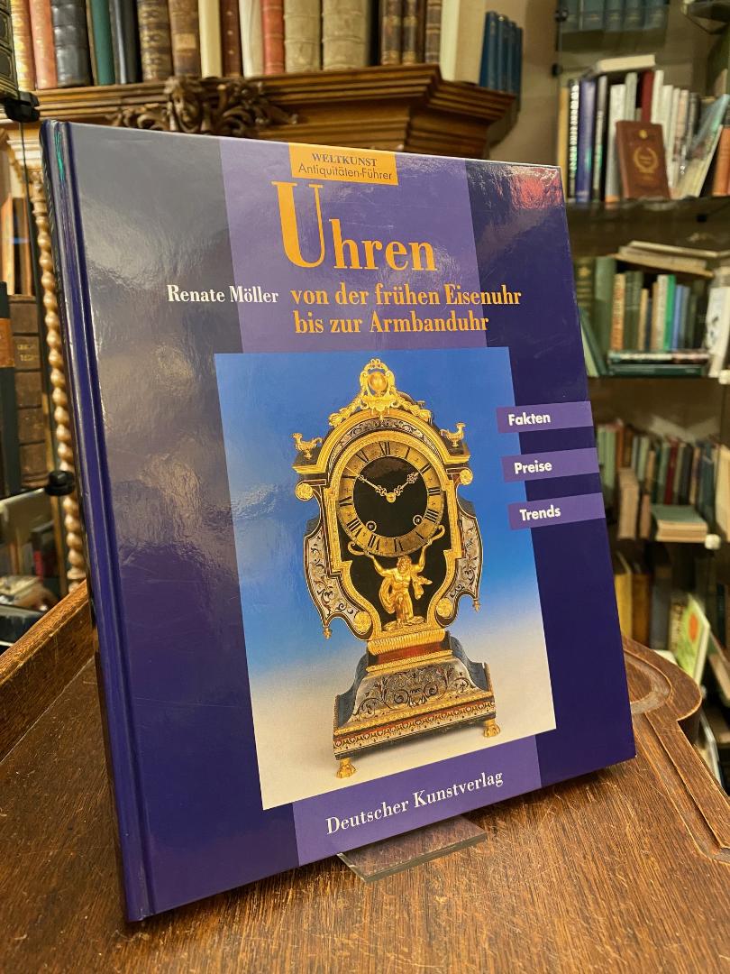
1996réf. 53325ABMünchen; Berlin, Deutscher Kunstverlag, 1996. 4° (26x21), 162 S., 9 Bl., vorgestellt werden 217 bebilderte, beschriebene und bewertete Uhren, sowie Einführung mit Tips und Wissenswertem, foto OPbd, rückseitig gering berieben, ohne Gebrauchsspuren, offensichtlich ungelesen, [= Weltkunst Antiquitäten-Führer],
1989réf. 7946Stock 1989 127 pages 19 2x1x27 6cm. 1989. broché. 127 pages.
2004réf. RO20230131Rando Editions. 2004. In-12. Broché. Bon état, Couv. convenable, Dos satisfaisant, Intérieur frais. 64 pages augmentées de nombreuses photos, illustrations et cartes en couleurs dans et hors texte. Texte sur deux colonnes.. . . . Classification Dewey : 53-Guide
1998réf. 500130041Hachette 1998 1x22x12cm. 1998. Broché.
1999réf. 500300126Hachette 1999 11 6x1 6x21 4cm. 1999. Broché.
1998réf. 500123404Hachette 1998 11 6x1 6x22cm. 1998. Broché.
réf. ORD-7216Guide du Promeneur dans les musées, les collections et les édifices. Paris. Delagrave. 1878. In-12 dos chagrin rouge, plat toile chagrinée frappée aux armes de la ville de Paris (Prix Municipal), 722pp. Mors un peu frottés sinon bon exemplaire.