WARD LOCK RED GUIDEMareMagnum

51 549 résultats
1940Sm. 8vo., Thirteenth Edition, with folding coloured map as frontispiece, plates, and 5 [of 6] folding coloured maps; original red cloth, covers and backstrip printed in black, radial corners, covers a little faded else a very good, bright, clean copy. WITH THE PUBLISHER'S NOTE CONFIRMING REDUCED MAP SET DUE TO WARTIME RESTRICTIONS MOUNTED FOLLOWING TITLE. With front and rear endpaper trade advertisements, 8p of advertisements at front and 40pp of advertisements at rear. EARLY ISSUES ARE SCARCE.
1938Sm. 8vo., Thirteenth Edition, with coloured map as frontispiece, plates, and maps and plans (a number folding); original series binding of red cloth, covers and backstrip printed in black, radial corners, upper cover very faintly marked else a near fine copy. With front and rear endpaper trade advertisements. SCARCE IN THIS CONDITION.
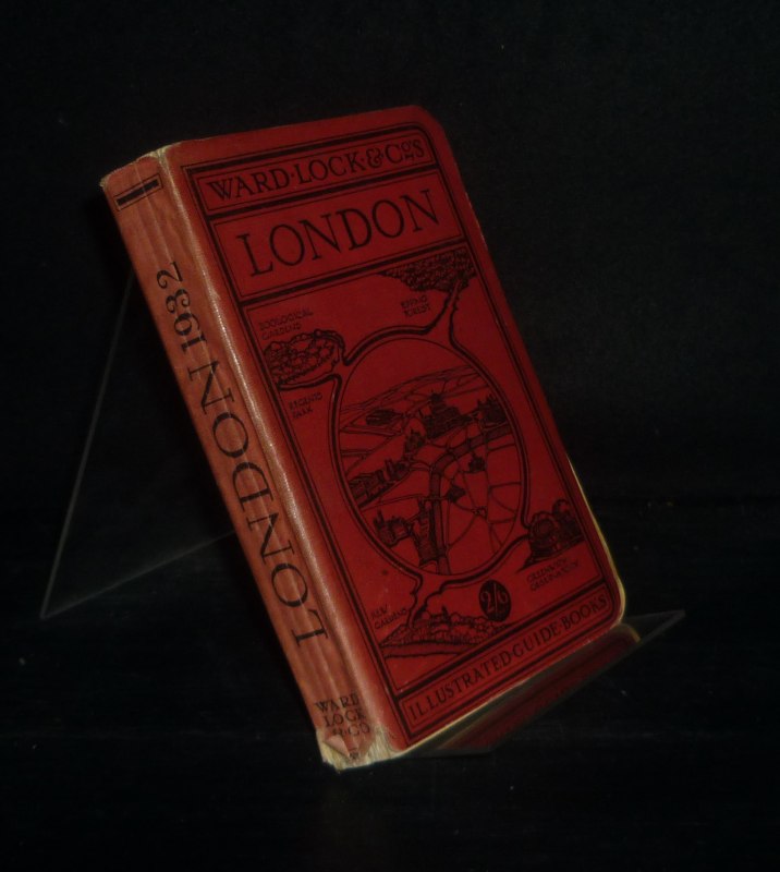
1932Sm. 8vo., Fifth Edition, with coloured map as frontispiece, plates, and maps and plans (a number folding); original series binding of red cloth, covers and backstrip printed in black, radial corners, some very light age-staining else a near fine copy. With front and rear endpaper trade advertisements. SCARCE IN THIS CONDITION.
1907Sm. 8vo., Ninth Edition, with folding coloured map as frontispiece, plates, and 3 folding coloured maps; original red cloth, covers and backstrip printed in black, radial corners, covers mildly age-marked else a very good, bright, clean copy. With front and rear endpaper trade advertisements, 4p of advertisements at front and 96pp of advertisements at rear. EARLY ISSUES ARE SCARCE.
1938Sm. 8vo., Seventh Edition, with coloured map as frontispiece, plates, and maps and plans (a number folding); original series binding of red cloth, covers and backstrip printed in black, radial corners, a near fine copy. With front and rear endpaper trade advertisements. SCARCE IN THIS CONDITION.
1935Sm. 8vo., Ninth Edition, with coloured map as frontispiece, plates, and maps and plans (a number folding); original series binding of red cloth, covers and backstrip printed in black, radial corners, a near fine copy. With front and rear endpaper trade advertisements. SCARCE IN THIS CONDITION.
1912Sm. 8vo., Fifth Edition, with coloured map as frontispiece, plates, and maps and plans (a number folding); original series binding of red cloth, covers and backstrip printed in black, radial corners, a very good, bright, clean copy.` With front and rear endpaper trade advertisements. SCARCE IN THIS CONDITION.
1920réf. 107691London: Ward, Lock & Co. (um 1920). Upwards of sixty illustrations [and various plans]. Kl. 8° (15-17,5 cm). Flexibler Orig.-Leinenband, [Hardcover / fest gebunden].
1929Sm. 8vo., Eighth Edition, with coloured map as frontispiece, plates, and maps and plans (a number folding); original series binding of red cloth, covers and backstrip printed in black, radial corners, upper hinge tender (but binding wholly sound) else a near fine copy. With front and rear endpaper trade advertisements. SCARCE IN THIS CONDITION.
1936Sm. 8vo., Twelfth Edition, with coloured map as frontispiece, plates, and maps and plans (a number folding); original series binding of red cloth, covers and backstrip printed in black, radial corners, a near fine copy. With front and rear endpaper trade advertisements. SCARCE IN THIS CONDITION.
1937Sm. 8vo., Ninth Edition, with coloured map as frontispiece, plates, and maps and plans (a number folding); original series binding of red cloth, covers and backstrip printed in black, radial corners, a near fine copy. With front and rear endpaper trade advertisements. SCARCE IN THIS CONDITION.
1928Vol. in -16 (11 x 17 cm.), legatura editoriale telata rossa con fregi e titoli in nero sul piatto e al dorso, angoli arrotondati, testo in inglese, pp. XVI, (2), XVI, (8), 272, 64, (2) con due planimetrie di grandi dim. del centro di Londra, mappa di Londra e Twelve Miles Round, mappe ferroviarie, strade principali fuori Londra, Hyde Park e Kensington Gardens e venti mappe e piantine oltre a 100 illustr. in nero f.testo. In buone condizioni. FORTY-SEVENTH EDITION-REVISED - WARD, LOCK e Co.'s GUIDE BOOKS England and Wales - Vol. In -16 (11 x 17 cm.), Editorial red cloth binding with friezes and titles in black on the plate and on the spine, rounded corners, English text, pp. XVI, (2), XVI, (8), 272, 64, (2) with Two Large Section Plans of Central London, Map of London and Twelve Miles Round, Railway Maps, Main Roads out of London, Hyde Park and Kensington Gardens, and Twenty other Maps and Plans
1920réf. 107693London: Ward, Lock & Co. (um 1920). Over one hundred illustrations [and various plans]. Kl. 8° (15-17,5 cm). Flexibler Orig.-Leinenband, [Hardcover / fest gebunden].
1935Sm. 8vo., Twelfth Edition, with coloured map as frontispiece, plates, and maps and plans (a number folding); original series binding of red cloth, covers and backstrip printed in black, radial corners, endpapers lightly marked else a very good, bright, clean copy. With front and rear endpaper trade advertisements. SCARCE IN THIS CONDITION.
1926Sm. 8vo., Fourth Edition, with coloured map as frontispiece, plates, and maps and plans (a number folding); original series binding of red cloth, covers and backstrip printed in black, radial corners, a near fine copy. With front and rear endpaper trade advertisements. SCARCE IN THIS CONDITION.
1933Broch?. 300 pages environ. Couverture tach?e.
1926Sm. 8vo., Ninth Edition, with coloured map as frontispiece, plates, and maps and plans (a number folding); original series binding of red cloth, covers and backstrip printed in black, radial corners, a near fine copy. With front and rear endpaper trade advertisements. SCARCE IN THIS CONDITION.
1941Sm. 8vo., Third Edition, with plates, and maps and plans (a number folding), small annotations on front free endpaper; original series binding of red cloth, covers and backstrip printed in black, radial corners, covers sunned else a bright, clean copy. With front and rear endpaper trade advertisements. Tipped-in is the publisher's printed disclaimer slip 'owing to the Control of Maps Order we have removed from this Guide all maps and plans likely to be useful to the enemy'. The COM Order 1940 banned commercial publication of maps and plans on a scale greater than one inch to one mile and therefore of likely use to the enemy. In this edition the omissions include the plan of Oxford City normally placed as frontispiece.
1938Sm. 8vo., Fourteenth Edition, with coloured map as frontispiece, plates, and maps and plans (a number folding); original series binding of red cloth, covers and backstrip printed in black, radial corners, backstrip faintly sunned else a near fine copy. With front and rear endpaper trade advertisements. SCARCE IN THIS CONDITION.
1935Sm. 8vo., Eleventh Edition, with coloured map as frontispiece, plates, and maps and plans (a number folding); original series binding of red cloth, covers and backstrip printed in black, radial corners, a near fine copy. With front and rear endpaper trade advertisements. SCARCE IN THIS CONDITION.
1927Sm. 8vo., Ninth Edition, with coloured map as frontispiece, plates, and maps and plans (a number folding); original series binding of red cloth, covers and backstrip printed in black, radial corners, edges very lightly browned else a near fine copy. With front and rear endpaper trade advertisements. SCARCE IN THIS CONDITION.
1928Sm. 8vo., Fourth Edition, with coloured map as frontispiece, plates, and maps and plans (a number folding); original series binding of red cloth, covers and backstrip printed in black, radial corners, backstrip lightly sunned else a near fine copy. With front and rear endpaper trade advertisements. SCARCE IN THIS CONDITION.
1941Sm. 8vo., Fourteenth Edition, with folding coloured map as frontspiece, plates and plans in the text; original series binding of red cloth, covers and backstrip printed in black, radial corners, backstrip mildly sunned else a very good, bright, clean copy. With front and rear endpaper trade advertisements. Tipped-in is the publisher's printed disclaimer slip 'owing to the Control of Maps Order and other exigencies of the situation, it is not at present possible to include the customary complete set of maps and plan in this Guide'. The COM Order 1940 banned commercial publication of maps and plans on a scale greater than one inch to one mile and therefore of likely use to the enemy. In this edition the omissions include the Touring Map of Cornwall, and plans of Penzance, the Lizard, and the Isles of Scilly.
1919Sm. 8vo., Seventh Edition, with folding coloured map as frontispiece, plates, plans in the text and 4 folding coloured maps; original red cloth, backstrip lightly faded else a bright, clean copy. With front and rear endpaper trade advertisements, 8pp of advertisements at front and 68pp of advertisements at rear.
1920réf. 107695London: Ward, Lock & Co. (um 1920). Upwards of seventy illustrations [and various maps/plans]. Kl. 8° (15-17,5 cm). Flexibler Orig.-Leinenband, [Hardcover / fest gebunden].