MEISSAS-MICHELOTLivre Rare Book

6 232 résultats
1848réf. ABE-1563782948060PLANCHE 7-31,5 CM X 25 CM-GRAVEE SUR ACIER PAR DUMORTIER-ECRITS PAR P.ROUSSET-REHAUSSEE EN COULEURS-1 TACHE 3 CM X 1,5 CM COIN INF DR
1884réf. 84480- 1 carte 30 x 23 cm, pliée en deux.
1910réf. 228611910 Antique Double Sided World Map by The Scarborough Company c1910 Grande carte toilée double face pliée sous étui avec itineraires et distances.This map has Europe, Asia, Africa & Australia on one side and North America & South America on the other and was published by the Scarborough Company, London, England, around 1910 (latest copyright date) but was printed in Boston, Mass, USA and was originally priced at 15 shillings (£0.75)- quite a sum at that time - equivalent to about £80 now. It includes principal ocean steamship lines, distances in nautical miles along steamship routes andthe routes shown in red on the map, principal places etc. It measures 39 inches wide by 41 inches high (100 x 104 cm) and is printedon cloth. It's in reasonable condition for its age - a bit of foxing, a couple of other marks and some slight frayingbut no splits or tears- see pictures - they form part of the description.
réf. 10989Carte en couleurs, dressée par SCHNITZLER J.H pour l’atlas historique et pittoresque, E. SIMON éditeur 1860. 330x480 mm et 380x580mm avec les marges
2011160 pages, illustrated. eng
réf. 1876944374.Gpaperback. Good. Access codes and supplements are not guaranteed with used items. May be an ex-library book. paperback
1912réf. 80313Adelaide: R.E.E. Rogers Government Printer 1912. First Edition. Hardcover. Very Good. Adelaide R.E.E. Rogers Government Printer 1912 and 1913. Foolscap folio 66 pages plus a folding chart 3 large folding plans or charts describing a typical plan of a lock and weir and charting the effects of certain reservoirs on navigation and a large folding map of the Murray 555 × 910 mm the 'section between Swan Reach and Wentworth . showing locations of lock-sites' with a very large inset map of the entire length of the river and 32 pages plus a folding map 'Proposed improvements in the vicinity of the mouth of the River Murray' 537 × 518 mm. Contemporary full morocco lettered in gilt on the front cover 'Captain Johnston's River Murray Reports'; the original spine is missing and has been replaced with a fairly pedestrian piece of cloth giving it a quarter cloth look; extremities rubbed bumped and a little worn; title pages a little marked with the second one a little foxed along the top margin; neat repairs to a few trifling tears to the folding plans with a tape-stain to an old repair along one fold of the last map; slight nicks to the bottom edge of some leaves in the first paper; overall in very good condition. The ownership signature of Arthur Searcy 1913 is written in pencil on each title page. Arthur Searcy 1852-1935 was Controller of Harbors from July 1911 and Chairman of the Harbors Board Committee until his retirement at the age of 65 information from the Searcy scrapbooks in the State Library of South Australia. He was the older brother of the more well-known Alfred 1854-1925. Loosely inserted are retained duplicate typescripts of two letters in all four pages foolscap from Searcy as Chairman of the Board to the Minister of Marine regarding proposed works at Victor Harbor one page and Goolwa three pages. The letters are signed and dated at the head by Searcy August and September 1922 respectively; the one on Goolwa raises numerous objections to Johnston's scheme. Three related contemporary newspaper cuttings one printing a lengthy letter from Simpson Newland are also present. The September 1928 ownership signature of E.H. Bakewell is written in pencil on the recto of the front free endpaper. Bakewell was managing director of the South Australian Reinforced Concrete Company which makes sense in this context. R.E.E. Rogers, Government Printer hardcover
103pp., facsimiles, orig. cloth.
103pp., facsimiles, orig. cloth.
1929Four Unique Reports on Captain James Cook. 30 pages. Includes black and white plates, plus a fold-out colour map. Original condition with blue wrappers, titles to front, and containing all the ads. This is a complete issue, seldom found in such good and original condition. This is a fantastic tribute to recount the merits and achievements of a once young apprentice to a shipping company at age 18, who later became one the world's most respected and accomplished explorers, and who commanded three voyages of discovery for Great Britain, and sailed around the world twice, the famous Captain James Cook. The first is a paper which was contributed to the Celebrations at Honolulu in August, 1928, a celebration with a threefold interest. The discovery of the Sandwich Islands was an event of unique importance in the story of the Hawaiians, and an incident of a typical and significant kind in the history of England; it is also the earliest recorded event in the history of what is now a State of the USA. On the topic of the Founding of British Power in the Pacific, Professor Holland answers in detail, the questions of what may have motivated the British Admiralty to unveil the age-old mystery of the southern tracts of the great Southern Ocean, and who sent Cook on those three long voyages. Cook, along with his patient crew of the Resolution hammered away at the Antarctic barrier, his iron strength breaking down under the prolonged strain of cold and privation, varied only by nauseating meals of highly salty meat and mouldy biscuits. Captain Cook has been hailed not only as the discoverer of several groups of islands in the Pacific, as the intrepid voyager who explored the coasts of New Zealand and Eastern Australia, but also as the chief explorer of the coast which is now Bristish Columbia, as the man who started the impulse which led to the North American-China trade, and thus laid the foundations of British power both in the southwestern and northwestern parts of the Pacific Ocean. Not only a renowned British Navigator and Explorer, this report includes fascinating detail of his career as a Hydrographical Surveyer, as well as an Astronomer. It was at age thirty that he was first heard of as a surveyer in connection with his well-known work of examining the St. Lawrence River and its channel, therefore making possible the attack on Quebec and the passage of the ships of the fleet in waters where the enemy had not dared to risk their vessels. Captain Cook's voyages lead to the establishment of colonies throughout the Pacific by several European countries. He travelled from his homeland of Great Britain to lands where few had gone before; bringing home much for his country. He was a discoverer, a mapmaker, and an innovator in the process of long distance sea travel.
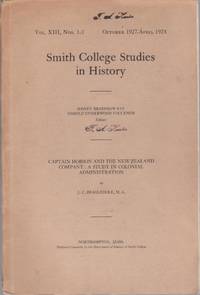
1928réf. 011459Northampton : Smith College 1928 gift copy with a signed presentation inscription to Professor F A Hunter from Beaglehole dated 1928 when issued "To Professor Hunter with gratitude and admiration J C Beaglehole August 1928" FA Hunter ownership stamp present on the wrapper cover which replicates the title page and once on the title page 112pp sewn sheets in paper wrapper which is detached easily reglued from the sheets EARLY PIECE by Beaglehole 4 years after graduating from Victoria University which was his M.A. thesis. This is part of the Smith College Studies in History; vol XIII No 1-3 October 1927-April 1928 Important piece in the history of New Zealand scholarship 500 grams . Signed by Author. First Edition. Original Wraps. Very Good/No Jacket. 8vo - over 7 - 9 tall. Smith College paperback
20048vo., First Edition, with illustrations and maps in the text; green cloth, a near fine copy in dustwrapper. Collects thirteen important essays.
2000Cm. 30x21, cartonato editoriale, sovracoperta, pp. 212, con numerose illustrazioni a colori nel testo. In ottimo stato (nice copy).
1901réf. 052410London: Sampson Low Marston & Co. Ltd. 1901. 31pp. Gray wraps with black tape spine. Black tape spine only silverfished several very short tears and small chips to edges of wraps prev owner name to front. Explores several logs of Cook's voyage to find the origins of the name of Botany Bay. Very scarce. First Edition. Soft Cover. Very Good. 8vo. Sampson Low, Marston & Co. Ltd. Paperback
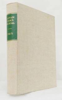
1968réf. BIB322018Adelaide: Libraries Board of South Australia. 1968. Small Quarto Size approx 17.5cm x 24cm. Near Fine condition - an excellent copy. Cream cloth boards green title patch to spine. Australiana Facsimile Editions No 188. Black & white plates and facsimile documents 2 & fold-out maps and charts. Robust professional packaging and tracking provided for all parcels. 400 pages. The first voyage of James Cook was a combined Royal Navy and Royal Society expedition to the south Pacific Ocean aboard HMS Endeavour from 1768 to 1771. It was the first of three Pacific voyages of which Cook was the commander. The aims of this first expedition were to observe the 1769 transit of Venus across the Sun 3 - 4 June of that year and to seek evidence of the postulated Terra Australis Incognita or "unknown southern land". Robust professional packaging and tracking provided for all parcels. . Near Fine. Facsimile Edition. Hardback. Libraries Board of South Australia hardcover
1969réf. 1709011Wellington: A.H. & A.W. Reed 1969. First Thus. Hard Cover. Very Good/Very Good. Very neat clean copies. First impression. Two companion volumes in publisher's green cloth with gilt titles to spine. 192 and 262 pages profusely illustrated with half-tone plates line drawings charts and a large foldout chart in each volume redrawn from Cook's original maps.Top edge on NZ volume spotty. The dustjackets have light rubbing and creasing to edges a few very small closed tears. These volumes bring together Cook's journals of his voyages to the east coast of New Holland Van Dieman's Land and New Zealand. These journals have been edited and annnoted to provide an interesting important reference. A.H. & A.W. Reed hardcover
1897réf. 037490London: Thomas Nelson & Sons 1897. ix 512pp index bw ills some folding. Near contemporary full maroon leather prize binding Eagle Hose School Sandhurst decorated in gilt with prize label on front pastedown covered by later owner's art deco bookplate. Marbled endpapers and edges. Approx 4cm crack at top of spine at both edges some minor rubbing otherwise a very nice example. First Edition. Hard Cover. Very Good. 8vo. Thomas Nelson & Sons Hardcover
1970In-8, cartonato editoriale, sovracoperta (piccoli strappi), pp. 177, con tavole in bianco e nero fuori testo. Prima edizione. Dedica autografa dell’autore. In buono stato (good copy).
1920réf. 009863London: Longmans Green & Co 1920. xix 290pp index folding map 16 bw plates. Or blue cloth. Spine sunned corners rubbed/bumped covers rubbed endpapers toned occasional moderate foxing. Folding map foxed. Frontis slightly loose. Scarce volume on Bligh's second South Sea voyage with the ships Providence and Assitant. First Edition. Hard Cover. Near Very Good. 8vo. Longmans, Green & Co Hardcover
1839réf. 80070London: The Author 1839. 3rd Edition. Hardcover. Very Good. London The Author 1839 third edition considerably enlarged/ 1837. Octavo iv 243 16 advertisements pages plus 3 folding maps 'District of Adelaide' with an inset 'Sketch of Encounter Bay' 310 × 312 mm; 'Maritime Portion of South Australia' 240 × 425 mm and 'The City of Adelaide' 162 × 198 mm a folding leaf of shipping statistics and a folding advertising slip with an engraved illustration. Original blind-stamped purple cloth slightly rubbed and bumped at the extremities with minimal expert restoration to the head of both joints; spine sunned to brown; first map lightly foxed; an excellent copy internally fine. With the armorial bookplate of the Marquess of Downshire most probably Arthur Wills Blundell Sandys Trumbull Windsor Hill 4th Marquess of Downshire 1812-1868. The preferred edition being more than twice as large as its predecessors of 1837 and 1838. Ferguson 2725. The Author hardcover
1996réf. 054495Brisbane: Rodney Liddell 1996. viii 276pp bibliography chronology maps bw ills.Or pictorial glossy boards. Minor foxing to page edges and prelims-otherwise excellent. Somewhat controversial look at Aboriginal history in particular on Cape York greatly enlarged from the 96 page edition of five years earlier. Looks at a supposed Aboriginal 'invasion' of Australia and extermination of the original Papuans less than 1000 years ago savagery among the native tribes of Cape York and the Torres Strait Islands last century and violent confrontations of native tribes and massacre of hundreds of Europeans including men women and children cast ashore from numerous shipwrecks. 'The history many authors were afraid to write for fear of being branded as racist by biased and prejudicial views'. First Edition Thus. Hard Cover. Very Good/None as Issued. 8vo. Rodney Liddell Hardcover
1900réf. 000012Christchurch New Zealand: Whitcombe & Tombs 1900 A Souvenir of the Jubilee of Canterbury New Zealand. Original olive cloth with black titling. Just the slightest edge and corner wear. Free endpaper age toned and bearing presentation inscription from the jubilee committee president and editor Miss E Stevenson with compliments of the NZNA Wm Reece President Dec 16 1900 Age toning to page edges and free endpapers otherwise a VG copy showing little ageing. 215pp with photographs and illustrations in the text. Covers the Pilgrim Fathers of the Canterbury Settlement the Canterbury Maori and the Natural History of Canterbury. Contents include The Story of the 'Pilgrim Fathers' of New Zealand; 'Peninsula and Plain'; The Sumner Road; Canterbury Settlement; Reminiscences of Early Days; 'Escapades of Mackenzie' & 'Meeting of Bishops Selwyn and Harper'; 'Sheep-Driving in the Early Days'; South Canterbury; The Maori - Origin Life and Legends; Historic Outline of the Canterbury Maoris; Notes on Maori Art; Plants and Animals of Canterbury; A Glimpse into the Alps of Canterbury 500 gram rate . Signed by Author. First Edition. Original Cloth. Very Good/No Jacket. 12mo - over 6 - 7 tall. Whitcombe & Tombs hardcover
1996réf. 290505PN. New. 1996. Soft Cover. Date is original print. This is a reprint edition . PN paperback
2002Large format, colour illustrations. eng
1937VI [ads], 55-124 pages. Profusely illustrated with black and white photos. Features: Ski-ing in Canada; With the Pearlers (Pearl Divers] of Northern Australia; Trans-Canada Airway - article includes informative map showing Canada's public airports, airports with lights, intermediate aerodromes and intermediate landing fields, and photos of land clearing for airports at Salmo, B.C., Kitchener, B.C., Coleman, Alberta, Amesdale, Ontario, and Yahk, B.C.; New Books; and more. Unmarked with average wear. Binding intact. A sound copy of this nice issue. Book