[SANUKI, KAGAWA PREFECTURE].Biblio.com
206 résultats
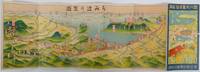
1920réf. 222913Japan.: 讃岐遊覧電鉄連合会. Sanuki Yūran Dentetsu Rengōkai. Circa1920s. Colour folding bird's-eye view map map 15.2 x 45.5cm fold into 15.3 x 7.8cm reverse a little time toned very good condition. A Japanese guide to the Sanuki region of Kagawa Prefecture in Shikoku featuring an attractively coloured bird's eye map probably published in the 1920s. The map shows the part of the Seto Inland Sea nearest to Sanuki's main city - Takamatsu - as well as the road and rail links to the region and the nearby Kotohira Temple - a major site of pilgrimage. The Japanese text on the back of the map includes a small sketch map of the local sightseeing railway showing distances between stops and the prices of fares and information about the best routes around the area including details of the Sanuki's cable cars. The cover features a charming illustration of a seaside temple in spring surrounded by cherry blossoms. . 讃岐遊覧電鉄連合会. [Sanuki Yūran Dentetsu Rengōkai]. unknown
1892réf. 170411No details of publisher. Circa1892. 2 volumes. Volume I: Two leaves with black and white line illustrations showing a uniform 583pp prior owner's seal on first leaf. Volume 2: Folding table at rear variously paginated over 600 pages prior owner's seal on cover. Some light occasional soiling and corners trifle creased. Wrappers with string ties. These two thick volumes were published in the 1890s probably by Mie prefectural government for managing their prison system. The volumes give details of all the rules and legislation relating to prisoners and prison guards. They offer rare historical information on the Japanese prison system in the late 19th century at the time when Japan was in the process of westernisation. The prison system and related legislation was set up in Meiji Japan and followed two European systems French and German. Until 1900 prisons were run by both local and central governments when their management was transferred to the central government. These 2 volumes were published by Mie Prefectural government prior to the transfer to central government and reflect the local system as it was before transition. The Japanese prison system to this day is well known for its strict and detailed rules and regulations. The first of these volumes covers the treatment daily schedules and inspections of prisoners as well as the handling prisoners with infectious diseases. The volume also lists numerous regulations relating to prison guards' work. The second volume is a collection of relevant rules and legislation on prison and prisoner handling. An important detailed resource for anyone interested in the prison system in the late 19th century. We have been unable to find this handbook in any institutional holdings. . No details of publisher. unknown
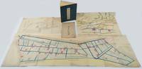
1880réf. 220946Japan. Circa1880. Coloured bird's eye view map 38.3 x 52cm with original envelope somewhat worn folded colour map with neat washi repairs to the verso 39.2 x 127.7cm black and white diagram 28.2 x 52.8cm colour illustrated book 27.7 x 20cm 28 double-folded leaves four hole string binding title label on front cover with minor chips. Covers discoloured and worn but holding firmly internally bright and clean. This collection of three historical maps one diagram and an original envelope offers a detailed view of land use and planning in the Tsu’u region of Okayama Prefecture during the early Meiji period. The area had a long history of human habitation with fertile soil and abundant water sources. From the beginning of the Edo period in the 17th century land in the area was progressively reclaimed leading to an expansion of agricultural land. The collection comprises the following five items: Detailed Map of Hayashima Shinden Village in Tsu’u County Bitchū 備中國都宇郡早嶋新田村明細地圖 Land Division Map untitled in Japanese Diagram of Natsukawa Village Primary School in Tsu’u County Okayama 備中國都宇郡撫川村小學校見取繪圖 Pictorial Map of Additionally Registered Lands 地積追番雛形繪圖 Original envelope with title Item 1 shows the divisions of rice-growing land in Hayashima Shinden Village with area measurements and registration numbers. Water channels are coloured in blue. Item 2 is a large map showing land divisions in an adjacent area of Hayashima although it does not have a title. Item 3 is a diagram of a primary school established in Natsukawa at the beginning of the Meiji period probably in the 1870s. An existing Buddhist temple and its compound were used for the school. The diagram identifies a fenced school yard pupils’ entrances to the classrooms at the rear and a flagpole standing beside the school gate. Item 4 is a beautifully drawn bird’s-eye view map showing a settlement with a temple and shrine along a river surrounded by mountains forests and rice paddies. Item 5 is the original envelope titled Hayataka Village Map and most likely belongs with Item 4. . unknown
réf. 244631 affiche 99,5 x 65 cm. Très bon état d'ensemble.
réf. 9583Agen, Raymond Noubel, An IX. Placard 42 x 52 cm sur vergé (un peu froissé).
1820réf. 24855Nantes 1820 Une gravure Originale sur cuivre en noir, format de la gravure seule : 13,2 cm de haut par 19 cm de large, gravure sur papier épais blanc, imprimé en bas au centre sous la gravure mais dans la cuvette : Musseau Délinéavit et Sculpsit 1820 + en dessous et sur toute la largeur de la gravure : "VUE DU COURS, DE LA CATHÉDRALE ET DE LA PRÉFECTURE, DE NANTES",
1975réf. 3457929 décembre 1975, in-4 agrafé de 18 pages, couverture rose, titrage noir. Au sommaire : notice historique (armes, toponyme, histoire locale), inventaire des sites, édifices et objets protégés. | Etat : Bon état général (Ref.: KH5851)
1976réf. 3458420 janvier 1976, Préfecture du Var, in-4 agrafé de 10 pages, couverture jaune, titrage noir. Au sommaire : notice historique (armes, toponyme, histoire locale), inventaire des sites, édifices et objets protégés. | Etat : Bon état général (Ref.: KH5852)
1976réf. 345857 février 1976, Préfecture du Var, in-4 agrafé de 34 pages, couverture rose, titrage noir. Au sommaire : notice historique (armes, toponyme, histoire locale), inventaire des sites, édifices et objets protégés. | Etat : Assez bon état général (Ref.: KH5853)
1976réf. 3458617 janvier 1976, Préfecture du Var, in-4 agrafé de 14 pages, couverture jaune, titrage noir. Au sommaire: I Notice Historique: Armes, Toponyme: 1-première forme écrite, 2-tradition orale, 3-synthèse explicative, histoire locale, II Inventaire des sites, édifices et objets protégés | Etat : Assez bon état général, fascicule un peu froissé (Ref.: KH5854)
réf. 35982N° 119 - 25e année - janvier-février 1972 - revue illustrée bimestrielle - illustrée - Broché
1938réf. 1038411938 Editions du Cuvier / Jean Guillermet, Villefranche-en-Beaujolais - 1938 - In-8, broché - 87 pages - Figures en noir & blanc hors texte
réf. 69-6171Boulogne France: Prefecture des Hauts-de-Seine 1977. 70 x 44 cm. Offset Color Lithograph. Good small tears along side edges small mark from water exposure. Boulogne, France: Prefecture des Hauts-de-Seine, 1977 unknown
1995réf. 31453Paris Perrin 1995 In-8 Dédicace de l'auteur pour ses parents et à la mémoire de Jean-Pierre Heckenauer - 295 pp + 1 ff Table
réf. 9264, Paris, l' Archipel, 2001., Broche, couverture d' editeur illustre n/b, 14x22,5cm, 356pp, bon etat.
1775réf. 24871Paris 1775 Une Eau-Forte Originale, sur papier vélin blanc en noir (seul les armes du MARECHAL DE DURAS ont été aquarellées en couleur à l'époque), Format de la cuvette : (35 cm x 23,8 cm), la gravure a été coupée au ras de la cuvette, imprimé sous la gravure dans toute sa largeur mais encore dans la cuvette : Titre : VUE PERSPECTIVE DE LA CHAMBRE DES COMPTES DE BRETAGNE DÉDIÉE ET PRESENTÉE A NANTES EN MIL SEPT CENT SOIXANTE NEUF A MONSEIGNEUR LE MARÉCHAL DE DURAS PAR SON TRÉS HUMBLE ET TRÉS OBÉISSANT SERVITEUR ANTOINE HENON, ARCHITECTE ET DESSINATEUR DE LA VILLE ET COMMUNAUTÉ DE NANTES, Gravée et Présentée par N. Ransonnette, Graveur ordinaire de MONSIEUR, le 15 de Décembre 1775 + imprimé en dessous : L'Estampe se vend à Nantes chez M. Tanqueret à l'entrée de la Grande Rue et à Paris chez Ransonnette, Rue des Rats, Place Maubert, au coin de la rue des trois porte, Armoiries du maréchal de DURAS au centre sous la gravure, aquarellées en couleurs, présence de quelques rousseurs,
réf. 12979Lyon, Emmanuel Vitte, 1911 - Extrait de " L'Université Catholique " - Monographie de 43 pages in octavo, feuillets agrafés sur plats vert d'eau titrés en noir, l'ensemble est bruni et fragile en ses plats.
réf. 50219331 pp. volume representing the first part of a two-part govermental report on the 1907 Tokyo Industrial Exposition covering the overall operations and organization of the exposition including maps and plans for the arrangement of the pavilions within Ueno Park and interior plans describing the use of the pavilions and displays within. Profusely illustrated throughout with black and white reproductions from photographs of the exposition architectural and engineering plans site plans floor plans and pavilion elevations some in color including approximately 30 folding plates. Some light toning and foxing scattered throughout. 4to. Original embossed wrpps. with title printed to cover some sunning and foxing minor scuffing. Tokyo Tōkyōfu/Meiji 42 n.d. 1909. This volume includes many photographs and architectural plans of the pavilions which made up the Industrial Exposition as well as the configuration of the exhibition. Through the exhibition the organizers had a goal to visually communicate a narrative about modern industrial Japan in a period of colonial expansion just after the Russo-Japanese War. The exhibition was also hoped to help Japan to increase consumption in a time of post-war economic depression. This was the 6th industrial exhibition to take place at Ueno Park and was the grandest. Many of the main exhibition buildings were western in style which differed greatly from Japanese pavilions in previous international expositions where a greater focus was placed on traditional Japanese artistic styles and crafts. The features of the exposition itself included Japan's second Ferris Wheel foreign products and processes and a Crystal Pavilion which became the target of Korean protests and was eventually removed. An estimated 35000 light bulbs or 4% of all of the light bulbs availble in Japan at the time were used at the fair. "The main buildings Gothic in the park proper were built around a huge foundain on six levels surmounted by Bacchus and bathed in lights of red blue and purple. A water chute led down to the lower level on Shinobazu Pond where special exhibitions told of foreign lands and a growing empire." Seidensticker 2011 Scarce; as of September 2019 WorldCat does not locate a single holding of this volume in North America. unknown books
réf. 31386Tours Cahiers Du Patrimoine in-4° 240 pp
1980réf. KOS06300214Oita Prefectural Museum of history 1980. Soft Cover. Fine. KOS06300214 Oita Prefectural Museum of history paperback
réf. 73-4939Toulon: Prefecture du Var 1994. 60x40 cm. Very Good. Color poster. Text in French. Toulon: Prefecture du Var, 1994 unknown
1980réf. KOS04500067TBD 1980. Soft Cover. Fine. KOS04500067 TBD paperback
réf. 244581 affiche tricolore 85 x 63 cm. Légèrement abîmée en bordure sinon très bon état. Rare.
réf. ria9780444513496_inpHardcover. New. New Book; Fast Shipping from UK; Not signed; Not First Edition; Contains proceedings from the Fourth Tokyo Conference on Advanced Catalytic Science and Technology Tokyo July 14-19 2002. This work contains a selection of works which present the research in catalysis. It provides reports on the ad hardcover
1972réf. 3000012421972 1972.