Michel GARNIER et Christian GENSKEITELLivre Rare Book
Le Nabour EricLivre Rare Book
A l'ombre de nos larmes
2014réf. 500101254Calmann-Lévy 2014 336 pages 14 4x2 4x22cm. 2014. Broché. 336 pages.

Démons et Merveilles · Joinville, France20,00 €
5 813 résultats
réf. 64775Editions patrimoines médias 2000 livre étude 24*17 47 pages
réf. 8450Selection du Reader's Digest, 2001. Grand in-8 avec reliure illustree de 352 pages.Excellent etat.
réf. 75076S.l., éd. chez l'auteur, 1983, EDITION ORIGINALE, pt. in-8, cartonnage souple couv. ill. en brun par Fraançois Lebert, 152 pp., nb. dessins en brun de François Lebert, Très beau roman qui nous conte une aventure dans le Berry. Pas courant Très bon état
1996réf. 117994Le Pigache 1996 In-8 broché 21,5 cm sur 15. 240 pages. Couverture légèrement salie, sans gravité. Intérieur très frais. Bon état d’occasion.
2014réf. 500101254Calmann-Lévy 2014 336 pages 14 4x2 4x22cm. 2014. Broché. 336 pages.
1953Very Good English Paperback. Pbo. Roy. 8vo. (24 x 17 cm). In English and Turkish. 141-148 pp., 1 b/w plate. Signed and inscribed by author as 'Kiymetli dostum Doç. Dr. K[iliç] Kökten'e'. A horn-core of Gazella capricornis Rodler and Weithofer found at Küçükyozgat.= Küçükyozgat'ta bulunan Gazella capricornis Rodler ve Weithofer'e ait bir boynuz. [Separatum Bulletin of the Geological Society of Turkey].
1996Very minor shelfwear. ; Studies in Mediterranean Archaeology Vol. CVI: I: 4; 4to - over 9¾" - 12" tall; 44 pages
1994Very minor shelfwear. ; Pp113-167; Studies in Mediterranean Archaeology Vol. CVI: I: 3; 4to - over 9¾" - 12" tall; 44 pages
1993Very minor shelfwear. ; Pp 31-111; Studies in Mediterranean Archaeology Vol. CVI: I: 2; 4to - over 9¾" - 12" tall; 80 pages
1993Very minor shelfwear. ; Studies in Mediterranean Archaeology Vol. CVI: I: 1; 4to - over 9¾" - 12" tall; 44 pages
1994220 pages. Index. Addresses these topics: Slope movement processes and characteristics; An office/field technique for recognizing landslide-prone terrain; Measure to manage unstable terrain during forestry activities; Road deactivation and revegegation of unstable terrain. Clean, bright and unmarked with very light wear. A nice copy. Book
198389 pages. Index, bibliography, glossary. "Divides the sedges of the region into five groups by environment, provides detailed descriptsions of each, provides life-like illustrations." - from Introduction. Usual library markings. Average wear. Sound working copy. Book
2000réf. 1063272000 Edité à compte d'auteur - 2000 - In-8, broché - 179 p. - Riche iconographie en couleurs et en N&B
1787réf. 27487Paris 1787 Une Estampe Originale, eau-forte au burin gravée en noir par Berthault d'après LE SAGE, format de la gravure seule : 30 cm de haut par 44 cm de large, gravure sur papier épais blanc, légères rousseurs, [Paris] [1787],
réf. 009764[Région de Roanne], Mémoire remis de la part du titulaire de la prébende du Lac. Texte XVIIIe envoyé par ce titulaire à « Messieurs de la Chambre Ecclésiastique » au nom de plusieurs personnes titulaires de prébendes demande une modération des prélèvements. Une note au crayon indique « région R.[illisible] Roanne ». Cette note est de Jean-Louis Debauve (on retrouve son discret cachet au dos) qui, connaissant le personnage, ne l'a pas mise sans raison, mais nous ne savons pas où il a trouvé l'information. [317]
1926Very Good Turkish, Ottoman (1500-1928) Original map of Kars Fortress. Oblong: 45x57 cm. In Ottoman script. Scale: 1/21000. [PLAN OF KARS FORTRESS] Kars Kal'asi plâni (Based on 1898 discoveries and 1908 practice). A very detailed plan in Ottoman script of Kars Fortress and is environment. Some red markings. Extremely rare.
1916Very Good Turkish, Ottoman (1500-1928) Original color map. Oblong atlas folio. (51 x 61 cm). In Ottoman script. Folded. Topography and toponyms of East Anatolia: Shows Erzurum region, Hasankale (Pasinler), Oltu, Hinis, Karakilise and surroundings. Scale: 1: 200.000. This is one the serie of the Bonn projection maps which are the first map series in modern techniques in Turkey and the Ottoman Empire. In order to produce these maps covering Turkish territory, Reconnaissance Branch was incorporated into The Mapping Commission. The maps were produced in the datum based on the latitude and longitude of Ayasofya Mosque in equal area Bonn Projection. The field works for the 123 sheets covering the country were conducted by 76 staff. The production was completed in 18 years starting from east west. Field works continued without stopping except in years 1914 and 1920. This map series called also reconnaissance maps contributed a lot to producing 1:25.000 scale maps. Rare.
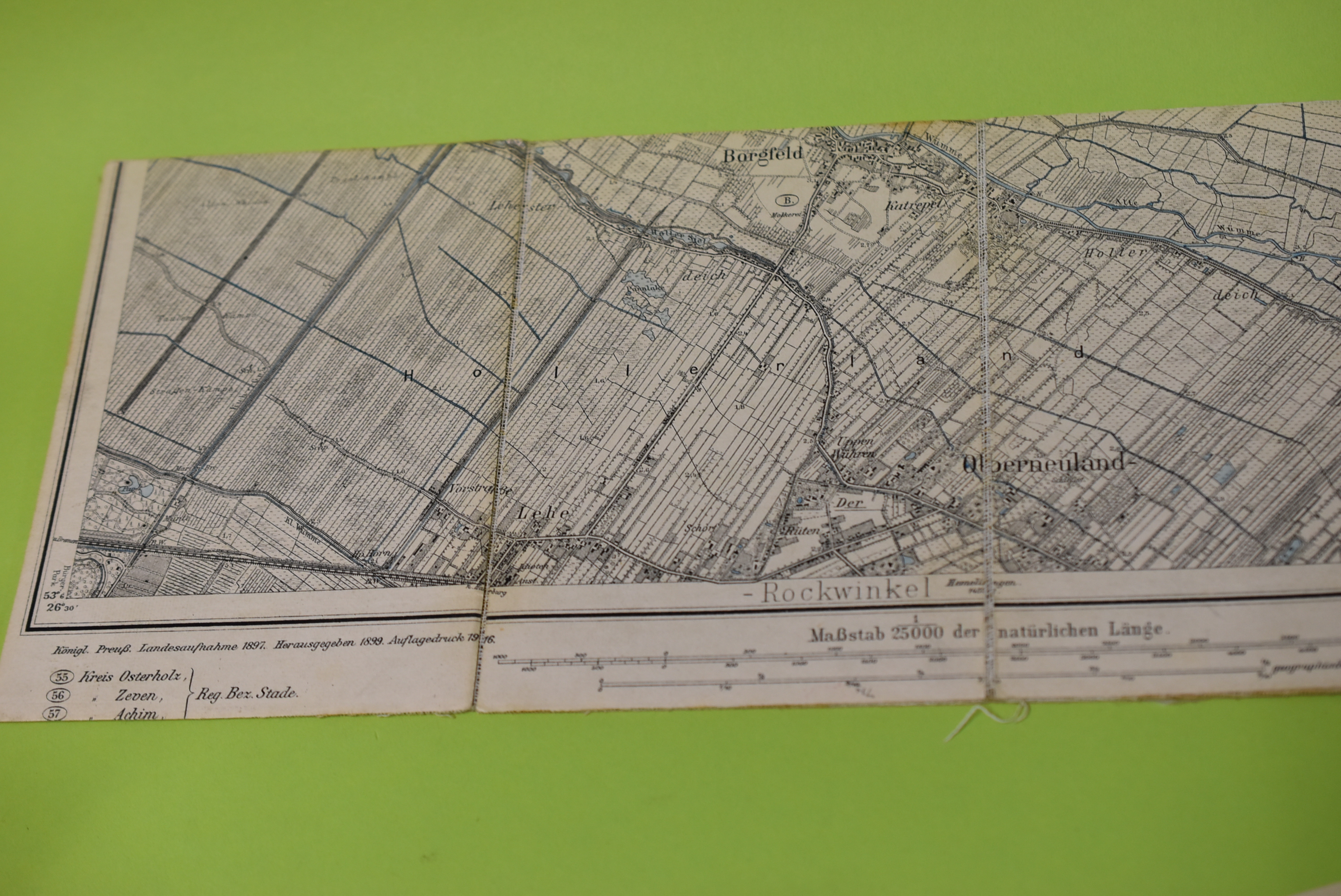
1916réf. 67110[Berlin] : [Kgl. Preuss. Landesaufnahme] 1916. Aufnahme 1897, hrsg. 1899, b[er. 19]13, Aufl.dr. 1916 1 Kt. : Flachdruck, farbig (schwarz/blau); 50,5x48cm auf Leinen aufgezogen [2 Warenabbildungen] 0
1920Very Good Turkish, Ottoman (1500-1928) Original color map of Erzurum city center and it environment. Folded. 69x42,5 cm. In Ottoman script. One sheet. Shows center of Erzurum city and topography environment. No scale info. Hegira: 1336 = Gregorian: 1920. Not description on map-maker. This is one the serie of the Bonn projection maps which are the first map series in modern techniques in Turkey and the Ottoman Empire. In order to produce these maps covering Turkish territory, Reconnaissance Branch was incorporated into The Mapping Commission. The maps were produced in the datum based on the latitude and longitude of Ayasofya Mosque in equal area Bonn Projection. The field works for the 123 sheets covering the country were conducted by 76 staff. The production was completed in 18 years starting from east west. Field works continued without stopping except in years 1914 and 1920. This map series called also reconnaissance maps contributed a lot to producing 1:25.000 scale maps. Extremely rare.
1969Very Good English Paperback. Map in original wrappers. Roy. 8vo. (24 17 cm). Folded huge color map. (Size: 70x75 cm). In English and Turkish. [MAP] Geographical distribution of vegetation in Trakya (Thrace).= [Trakya bitki örtüsü haritasi]. Shows the forestries of Quercus, Fagus, Carpinus, Pinus, Castanea, Fraxinus, Longos; Salix Alba and Populus Alba along the Meriç Valley.; Maquis.; Rush and swamp.; Littoral plants.; The boundary of Maquis.; Agricultural areas. OCLC 976817060.
1912Very Good Turkish, Ottoman (1500-1928) Original color map on cloth. Folded. Oblong atlas folio. (50 x 60 cm). In Ottoman script. [MAP of MAGNESIA - AEGEAN REGION] Manisa - Soma, Izmir, Aydin cities (Magnesia, Smyrna and Tralleis) in Aegean region. It shows villages and settlements in Tayakadin of Iskenderiye. Scale: 1/25.000. Hegira: 1328 = Gregorian: 1912. This is one the serie of the Bonn projection maps which are the first map series in modern techniques in Turkey and the Ottoman Empire. In order to produce these maps covering Turkish territory, Reconnaissance Branch was incorporated into The Mapping Commission. The maps were produced in the datum based on the latitude and longitude of Ayasofya Mosque in equal area Bonn Projection. The field works for the 123 sheets covering the country were conducted by 76 staff. The production was completed in 18 years starting from east west. Field works continued without stopping except in years 1914 and 1920. This map series called also reconnaissance maps contributed a lot to producing 1:25.000 scale maps. Not description on map-maker. A very detailed map showing lakes, rivers and mountains. Extremely rare.
1920Very Good Turkish, Ottoman (1500-1928) Original color map. Folded. Oblong atlas folio. (50 x 60 cm). In Ottoman script. [MAP of EAST BLACK SEA] Trabzon, Giresun, Erzincan, Ispir. Shows Trebizond, Cerasonte, Erzingan (Eriza), Suspiritis (Sper) of Erzurum (Erzeron city); mostly Black Sea shores of Trabzon and Giresun. . Scale: 1/200.000. This is one the serie of the Bonn projection maps which are the first map series in modern techniques in Turkey and the Ottoman Empire. In order to produce these maps covering Turkish territory, Reconnaissance Branch was incorporated into The Mapping Commission. The maps were produced in the datum based on the latitude and longitude of Ayasofya Mosque in equal area Bonn Projection. The field works for the 123 sheets covering the country were conducted by 76 staff. The production was completed in 18 years starting from east west. Field works continued without stopping except in years 1914 and 1920. This map series called also reconnaissance maps contributed a lot to producing 1:25.000 scale maps. Hegira: 1336 = Gregorian: 1920. Not description on map-maker. Extremely rare.
1914Good Turkish, Ottoman (1500-1928) Original color map. Folded. Tears in margins. Slightly stained. Otherwise a good copy. Oblong atlas folio. (50 x 60 cm). In Ottoman script. [MAP of EAST BLACK SEA] Artvin, Rize, Oltu. Shows Artvin and Georgian borders, Rize (Rizeon - Rizunda - Rizini) and Oltu cities and regions. Scale: 1/200.000. Hegira: 1330 = Gregorian: 1914. This is one the serie of the Bonn projection maps which are the first map series in modern techniques in Turkey and the Ottoman Empire. In order to produce these maps covering Turkish territory, Reconnaissance Branch was incorporated into The Mapping Commission. The maps were produced in the datum based on the latitude and longitude of Ayasofya Mosque in equal area Bonn Projection. The field works for the 123 sheets covering the country were conducted by 76 staff. The production was completed in 18 years starting from east west. Field works continued without stopping except in years 1914 and 1920. This map series called also reconnaissance maps contributed a lot to producing 1:25.000 scale maps. Not description on map-maker. Extremely rare.
1916Very Good Turkish, Ottoman (1500-1928) Original color map. Folded. Oblong atlas folio. (50 x 60 cm). In Ottoman script. [MAP of EAST ANATOLIA] Malatya - Divrigi, Mancinik, Adiyaman, Harput. Shows Malatya, Adiyaman and Kharpout region; Firat River (Euphrates), Yazi Düzü, Erguvan etc. Scale: 1/200.000. This is one the serie of the Bonn projection maps which are the first map series in modern techniques in Turkey and the Ottoman Empire. In order to produce these maps covering Turkish territory, Reconnaissance Branch was incorporated into The Mapping Commission. The maps were produced in the datum based on the latitude and longitude of Ayasofya Mosque in equal area Bonn Projection. The field works for the 123 sheets covering the country were conducted by 76 staff. The production was completed in 18 years starting from east west. Field works continued without stopping except in years 1914 and 1920. This map series called also reconnaissance maps contributed a lot to producing 1:25.000 scale maps. Hegira: 1332 = Gregorian: 1916. Not description on map-maker. According to Türkezer & Çobanoglu: History of Mapping in Turkey-1:200.000 Scale Maps, cartographer of this map is Kambay, Cemal.
1916Very Good Turkish, Ottoman (1500-1928) Original color map. Folded. Oblong atlas folio. (50 x 60 cm). In Ottoman script. [MAP of EAST ANATOLIA and ARTVIN] Oltu, Artvin, Ispir, Hasankale. Shows Artvin, Ispir, Hasankale and Kars city. Scale: 1/200.000. This is one the serie of the Bonn projection maps which are the first map series in modern techniques in Turkey and the Ottoman Empire. In order to produce these maps covering Turkish territory, Reconnaissance Branch was incorporated into The Mapping Commission. The maps were produced in the datum based on the latitude and longitude of Ayasofya Mosque in equal area Bonn Projection. The field works for the 123 sheets covering the country were conducted by 76 staff. The production was completed in 18 years starting from east west. Field works continued without stopping except in years 1914 and 1920. This map series called also reconnaissance maps contributed a lot to producing 1:25.000 scale maps. Hegira: 1332 = Gregorian: 1916. Not description on map-maker.