Sharon BerryBiblio.com

10 872 résultats
2024réf. Manohar-9781108994880Cambridge University Press 2024. Paperback. New. Cambridge University Press paperback
2022réf. x-1108834310Cambridge University Press 2022. Hardcover. New. 288 pages. 9.61x6.69x0.63 inches. Cambridge University Press hardcover
réf. ria9781108834315_inpHardcover. New. New Book; Fast Shipping from UK; Not signed; Not First Edition; Berry discusses motivations for and alternatives to the Potentialist approach to set theory providing a new and more intuitive justification for the standard axioms of set theory. This book will interest students and scholars of the hardcover
2024réf. SKU0563926Cambridge University Press 2024-04-04. paperback. Good. 6x0x9. Textbook May Have Highlights Notes and/or Underlining BOOK ONLY-NO ACCESS CODE NO CD Ships with Tracking Cambridge University Press paperback
2024réf. SKU0611433Cambridge University Press 2024-04-04. paperback. New. 6x0x9. New Textbook Ships with Tracking Cambridge University Press paperback
réf. 1108994881.Gpaperback. Good. Access codes and supplements are not guaranteed with used items. May be an ex-library book. paperback
réf. 68385025-6Used - Good. Pages intact with minimal writing/highlighting. The binding may be loose and creased. Dust jackets/supplements are not included. Stock photo provided. Product includes identifying sticker. Better World Books: Buy Books. Do Good. unknown
1963réf. 1769172136ADAGeorge Allen & Unwin Ltd 1963. Hardcover. Good/Good. 1963. First Edition. 118 pages. Red pictorial dust jacket over red cloth. Pages are lightly tanned at the edges with light foxing. Occasional thumb marks to pages edges. Binding has remained firm. Inscription to front endpaper. Boards have slight shelf wear with bumping to corners. Spine ends are a little crushed. Light wear to clipped dust jacket with tears nicks and creases to spine edge and corners. Light tanning to spine and edges. George Allen & Unwin Ltd hardcover
réf. 1998583112.Gpaperback. Good. Access codes and supplements are not guaranteed with used items. May be an ex-library book. paperback
réf. 50213569like new. unknown
réf. ria9781998583119_inpPaperback. New. New Book; Fast Shipping from UK; Not signed; Not First Edition; In the vibrant heart of Tokyo two worlds collide as cultures blend and hearts entwine in a romantic tale that transcends boundaries.Seventeen-year-old Kai Amara a passionate boy of Caribbean and Japanese descent navigates the complex paperback
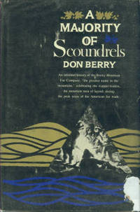
1961réf. 166532New York: Harper 1961. hardcover. very good/good. Illustrated. 432pp. 8vo cloth d.w.; ex-lib dust wrapper torn. New York: Harper & Brothers 1961. A very good copy in a good dust wrapper. Harper unknown
1961réf. 13724INDNew York: Harper & Brothers 1961. 432 pp. Original blue cloth covers w/ gilt title on spine. Includes two 2 folding maps in rear pocket. Light wear to spine ends. Light wear and tear to edges and spine ends of DJ. Small piece missing from top of front panel. Lightly rubbed and soiled. Illst. w/ b/w plates. First Edition. Hard Cover. Very Good/Very Good-. Harper & Brothers Hardcover
1961réf. 000221New York: Harper & Brothers. Hardcover. 1961. 1st Edition. 8vo 432pp . Very Good in Good DJ. B&W Illustrations DJ chipped at lower right front corner 2 maps in rear pocket as issued . Harper & Brothers hardcover
réf. 000485New York Harper & Brothers 1961. A fine copy bound in turquoise cloth chipped dust wrapper. A spirited account of men and events that reflected the power greed and ruin of the RMF "the greatest name in the mountains". Folding maps in rear pocket. First edition. New York Harper & Brothers (1961). hardcover
1961réf. 480Tight square spine. Former owner inscription to the front flyleaf but interior is else clean and unmarked. Gilt to spine remains bright. Only very minor shelf-wear to the book. Price-clipped jacket has some moderate edge-wear and areas of light rubbing. Jacket design by Anita Walker. 432 pp. History. Harper & Brothers hardcover
1961réf. 122469New York: Harper & Brothers 1961. First Edition; First Printing. Hardcover. Very Good in a Very Good dust jacket. All 4 corners clipped but not price clipped. Shelf wear on front/rear panels and spine. Bumping at spine crown/heel. 1/4 inch open tear at top of rear gutter. Stated First Edition. Harper & Brothers hardcover
réf. 000485New York Harper & Brothers 1961. A fine copy bound in turquoise cloth chipped dust wrapper. A spirited account of men and events that reflected the power greed and ruin of the RMF "the greatest name in the mountains". Folding maps in rear pocket. First edition. New York Harper & Brothers (1961). hardcover books
1961réf. 166532New York: Harper 1961. hardcover. very good/good. Illustrated. 432pp. 8vo cloth d.w.; ex-lib dust wrapper torn. New York: Harper & Brothers 1961. A very good copy in a good dust wrapper. Harper unknown books
réf. 1334529876.Gpaperback. Good. Access codes and supplements are not guaranteed with used items. May be an ex-library book. paperback
réf. 0484786296.Ghardcover. Good. Access codes and supplements are not guaranteed with used items. May be an ex-library book. hardcover
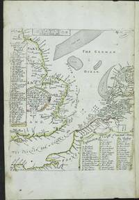
réf. 8772London: R. Morden and W. Berry at the Atlas in Cornhill and at the Globe between Charing-Cross and White-Hall. c.1675-88. No binding. Good. 200 x 175 mm. early outline colour with extended margin to the right side two minor centrefold splits either side otherwise in good condition. An extremely rare sea chart of the English Channel and North Sea engraved by Francis Lamb. A first state with typographic side panels including keys to the letters on the map survives bound into an undated example of Robert Morden's 'Geography Rectified' in the British Library Maps C.39.a.11 dated to c.1687. The left side is keyed to the English coast the right side keyed to the Dutch coast. However the address of William Berry in the title is for the premises occupied between 1672 and 1676. ""Two of the most active publishers and mapsellers in London during the end of the seventeenth century were Robert Morden fl. 1669-d.1703 and William Berry 1639-1718. At the beginning of their careers it appears they worked in partnership. The 'Term Catalogues' detail publications together between 1673 and 1677. Most early records including those of the diarist Samuel Pepys refer to their activity in the production of globes. The last known evidence of a partnership was their petition to the crown in September 1678 for a licence to produce a folio atlas of the world in an 'alphabeticall manner'. This would become the sole production of Berry. Morden and Berry would both sell Richard Daniel's map of c.1679. Morden began with a shop shortly after the Great Fire of 1666. His reputation is underrated indeed Worms describes him as 'a prolific and inventive map maker whose critical reputation despite a string of innovations remains undeservedly low' Burden. The atlas contains maps first printed in the 1680 edition of Morden's 'Geography Rectified'. In 1688 a new edition was published with a new series of copper plate maps. A further clue to the date of issue of this second state might be another very similar map engraved by Herman Moll entitled 'A New Map of the Sea Coast of England Holland & France' by John Taylor and Thomas Newbery which is dated 22 October 1688 BL Maps 1068.7. The date is significant for this is the year of the Glorious Revolution in England when William Prince of Orange was invited to England to take the throne as William III. In October William had made his first attempt to sail to England only to be turned back by inclement weather. He finally arrived at Torbay on 5 November 1688. This Morden and Berry map undated in the first state is here dated 1688 for similar reasons. This second state has had the two side keys engraved on the map itself in doing so the previous title has had to be re-engraved and slightly re-worded. The key to the Dutch coast replaces the scale which is re-engraved at the top of the map. Likewise the rhumb lines appear to have been either erased or worn with use. This second state is found in an example of 'Twenty four New and Accurate Maps of the several Parts of Europe' 1707 bound with Robert Morden's 'Fifty Six New and Accurate Maps' of the English Counties' in the British Library Maps C.24.b.25. The addition of 'Pag. 77' upper right has not been linked to any known work. Provenance: private English collection. Baynton-Williams 'MapForum' no. 13 'Collation Hermann Moll's 'Maps of the Several Parts of Europe''; Burden 2007 431; Shirley BL T.Moll 2a no. 24 & T.Mord 2b no. 3; Worms & Baynton-Williams 2011. R. Morden and W. Berry at the Atlas in Cornhill and at the Globe between Charing-Cross and White-Hall. c.1675-[88] unknown
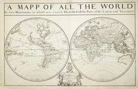
réf. 7758London: William Berry at ye Sign of the Globe between Charing Cross and Whitehall. 1680. No binding. Good. 575 x 885 mm. two sheets joined in early outline colour some professional repair to edge tears and reinforcement to lower corners not affecting the image with the accompanying page of geographical tables otherwise in good condition. A fine rare English double-hemispheric seventeenth century world map. In September 1678 Robert Morden fl. 1669 d. 1703 and William Berry 1639-1718 petitioned the crown for 'a licence to do all general and particular maps of the several parts of the world according to an alphabeticall manner'. Morden's connection with what appears to be the birth of the folio atlas is not heard of again. Berry began publishing a series of large two sheet maps with a group of the world and continents advertised in the 'London Gazette' from 1-5 July 1680. The world is also announced in the 'Term Catalogues' for the summer of that year. This only mentions the world map which would undoubtedly have been finished first and the continents would have followed. Berry did not advertise his next two sheet map that of England until February 1682. 'Through the 1680s Berry published nearly forty large maps of parts of the world sufficient to cover it all. From the late 1680s he clearly offered them bound together as a collection of maps as a handful of examples are known but this was clearly not the intention for the maps as none have borne any title page. Examples are known in the British Library the Library of Congress and the National Maritime Museum Greenwich all bearing either thirty-seven or thirty-eight maps. An example has been noted for sale by Maggs Brothers which bore sixty-nine maps the balance being made up of contemporary English maps by other cartographers dating the atlas to c.1704 and two further offered at Christies auctions in London in the 1980s' Burden. Cartographically the world map is drawn directly from that of Alexis-Hubert Jaillot 1674. Jaillot's map was in turn derived from Nicolas Sanson's geography who is here recognised in the running title above 'Described by Sanson Corrected and amended By William Berry'. Sanson had far more of a reputation in cartographic circles than Jaillot so it is natural that Berry would use his name. These 'amendments' include the patriotically named islands off Tierra del Fuego and 'New Albion' placed in California. New Guinea is distinctly an island and there is no southern continent. An ornate cartouche lower centre includes an effusive dedication to Charles II. Armitage 2012 pp. 41 & 99-100; Burden 1996-2007 532; Phillips 1909- 3442; Shirley 1984 501; Shirley 2004 T.Berr 1a; Tyacke 1973 p. 76; Tyacke 1978 no. 100 & pp. 109-10. William Berry at ye Sign of the Globe between Charing Cross and Whitehall. 1680 unknown
1961réf. 712838PN. New. 1961. Soft Cover. Date is original print. This is a reprint edition. . PN paperback
1932réf. 058941London: Constable & Company 1932. First Edition 1st Printing. Hardcover. Fine/Very Good. Ix 104 Pp. Red Cloth Spine Gilt Red Topstain. First Printing 1932 Date On Title Page Clean No Marks Gilt Brilliant.Dust Jacket Priced 3/6 Sligjht Usage A Little Dust 1/8" Chipping Across Top Edge Of Spine. Constable & Company hardcover