1 871 résultats
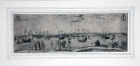
réf. 85055301Amoy n.d. early ca 1900-1910 n.p. A large panoramic photo view 13 x 91 cm. printed on "Agfa Troopex" paper rolled with some fold/cracks otherwise a very good clear image in glossy black & white an actual photograph. R A R E ! . . . AN EARLY PANORAMIC VIEW OF AMOY XIAMEN . . A lovely and early black and white panoramic photograph of Amoy Xiamen island at the mouth of the Jiulong River. It has an excellent natural harbor. Fishing shipbuilding food processing and tanning were the major industries of the period. . Because of its key position across the Taiwan Straits from Taiwan this has always been a strategic island and area. Opposite Xiamen proper across the inner harbor is the island of Gulangxu the former foreign settlement and a fine residential section. Amoy was one of the earliest seats of European commerce in China with Portuguese arriving in the 16th century and the Dutch in the 17th century. Amoy was captured in 1841 by the British in the Opium War Opium Wars 1839-1842 and again in 1856-1860 two wars between China and Western countries. The first was between Great Britain and China. Early in the 19th century and became a treaty port opened to foreign trade by treaty. . "TREATY PORT" is a term usually confined to ports in those countries that formerly strongly objected to foreign trade or attempted altogether to exclude it. Thus it is used especially in reference to China and later in Japan. Amoy was long a Chinese port of emigration mainly to Southeast Asia. . Panoramic views are rare and required the use of a special camera apparatus. This early view shows Amoy when it only had a very few tall buildings and with many small homes and other structures including what appears to be a large chimney probably the early beginnings of the first electrical power plant in that area. A few small sampans are seen anchored otherwise it was an usually quiet day in one of China's most bustling coastal cities ! . CONDITION: Early panoramic photographs of Amoy are RARE and seldom found. Most panoramic views were rolled resulting in the typical folding bends and cracks. This copy is in remarkable good condition based on its age and rarity. . The work is in original rolled condition with the usual bends folds cracks please see photos posted to our website. . The back could be restored thus giving it a more stiff flat body by removing some of the old bends and folds bringing it back to is old solid glory. . Suitable for framing and museum or library display. . . unknown
réf. Z1-C-085-00428Cengage Learning EMEA. Used - Good. Used - Good. Ships from UK in 48 hours or less usually same day.Your purchase helps support Sri Lankan Children's Charity 'The Rainbow Centre.' Ex-library but has been well cared for. 100% money back guarantee. We are a world class secondhand bookstore based in Hertfordshire United Kingdom and specialize in high quality textbooks across an enormous variety of subjects. We aim to provide a vast range of textbooks rare and collectible books at a great price. Our donations to The Rainbow Centre have helped provide an education and a safe haven to hundreds of children who live in appalling conditions. We provide a 100% money back guarantee and are dedicated to providing our customers with the highest standards of service in the bookselling industry. Cengage Learning EMEA unknown
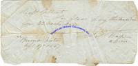
réf. 6331BATTLE OF BUENA VISTA. The Battle of Buena Vista fought over February 22 and 23 1847 saw the outmanned American Army under Zachary Taylor defeat the Mexicans under General Antonio Lpez de Santa Anna. The American forces were largely made up of volunteers rather than regular armyArchive. 15 pieces. 1847 mostly April. Buena Vista Mexico. An archive of fourteen receipts and manuscripts written in the wake of the Battle of Buena Vista; most are from April 1847 and a few state that the location of the receipts is Buena Vista. Some of these receipts are addressed to Charles C. Gilbert of Ohio and it is for volunteers from Indiana and Ohio. Some are in pencil and some are in pen. These documents show the American soldiers stuck in rural Mexico trying to find food for themselves and their beasts of burden. Mexican War dated manuscripts written from Mexico are scarce. A few sample documents include:aADS. 1pg. April 17th 1847. No place. An autograph document signed Lt. C.A. Shank AAQM 3 Reg Ina Vol addressing to pay for corn for mule feed.bADS. 1pg. April 17th 1847. Buena Vista. An autograph document signed Jos Napier AQM ordering pleas sic pay this Mexican for 33 Sacks.cADS. 1pg. April 17 1847. No place. An autograph document signed John Caldwell Act. A. Qr. M. 2d R. O.V. stating Return for 3 Horses and 40 Mules in the service of the 2r Regt. O.V. Ohio Volunteers for 2 days.dADS. 1pg. April 18 1847. No place. An autograph document signed Wm Erwin A A Q M ordering: Requisition for forage for fifty mules and seven horses in the service of the United States for two days commencing on the 17th and ending on the 18th April 1847.eADS. 1pg. April 17 1847. No place. An autograph document signed Thomas L. brent 1st Lieut & A.A. Qr Master noting Company B 4th Artillery Forage for two days 50 Bushels and 16 Quarts Corn116 Horses28 Mules. unknown
réf. SONG0878050922Used: Good unknown
réf. DADAX0792453573New unknown
réf. DADAX0932376002New unknown
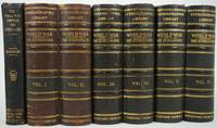
1923réf. 29466Meadville PA: Keystone View Company 1923. One of the first 4 editions. A complete set of 300 stereo views in their boxed slipcases the accompanying book by Major Joseph Hanson and the stereo viewer. The stereo views are a combination of images originally commissioned or photographed in-house by Keystone and cards numbered with a "V" prefix which denotes negatives originally produced by Underwood & Underwood. The set illustrates the war in all its facets including battlefields soldiers and activities on the home front. This was the most comprehensive set on the war issued by Keystone the largest and most prominent publisher of stereoscopic photographs in the United States and by the 1920s the only major publisher in the world with offices in London Paris Sydney Cape Town Rio de Janeiro and Tokyo. In 1918 they were one of the few publishers permitted to photograph World War I battlefields and military operations. The geographic locations included Germany Italy Turkey Gallipoli the Balkans Serbia and the United States; however military activities in Belgium and on the French front are most strongly represented comprising over one-third of the collection. Within these locations images detail troops city & battlefield ruins trenches medical operations troop provisioning victory parades and peace talks. Most interesting is the portrayal of the aircraft used during the war the first war that aircraft were used on a large scale. A series of views depict the aircraft including biplanes zeppelins and observation balloons. A card entitled "Scouts Old and New French cavalry and Army Airplane" shows a group of men on horseback looking into the sky at a biplane. Another interesting card is an aerial photograph "The Eyes of the Army- View of German Town from American Airplane". Other images of war machinery include warships U-boats and machine guns. Other interesting images include African-American soldiers returning home; women at work on the front and the use of dogs at the front. Generally there is an emphasis on the war from the American point of view but the horror of the French front is overwhelming along with the fat ineffectual generals. Starting in 1923 Keystone issued these sets in groups of 75 100 200 & 300 cards. The set was in print for 10 years. Originally they came in three double book-form volumes stereo views with series and position number on reverse side the title being "World War Through the Stereoscope 1st through 4th edition. They were also originally issued with a descriptive pamphlet & stereo viewer. This set is one of the first four editions. This set has the three original slipcases containing the stereo views the stereoscope and the accompanying book by Hanson "The World War Through the Stereoscope - A Visualized Vitalized History of the Greatest Conflict of All the Ages" 2nd edition 1923 small 8vo 442pp 3 maps 2 folding and 8pp ads. The book includes a chronology topical index statistics how to use the stereoscope etc. The boxes & book spines are bound in brown or black leather with gilt titles somewhat rubbed. The silver gelatin print images are extremely bright and compelling. The cards are slightly bowed as issued. Each card is numbered in the center lower margin below the images with descriptive text on the back the image number and the series. "Through sickly shrapnel-sown meadows reaped by death alone" ~ a very immediate depiction of the war conveying both the patriotic technical advances and the immensely sad desolation that is war. Keystone View Company unknown
1836réf. 3781Thomas Hookham 1836. 1836 4to. vi 155 p. Eighteen litho plates by Hullmandel on India paper mounted. First edition. Publisher's green cloth with spine ends and corners expertly restored. Original paper label present but chipped. Author's presentation inscription on front endpaper. Occasional faint spotting to the tissue guards. A very good copy of a scarce title. Thomas Hookham, hardcover
réf. SONG0838407005Used: Good unknown
réf. SONG1934757381Used: Good unknown
1909réf. 2111902160200943Oyagi toku kichi 1909. Soft Cover. Fine. Volume: 1 Oyagi toku kichi paperback
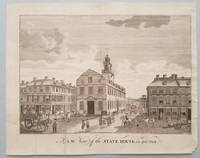
1793réf. 3843"One of the more important images of postcolonial Boston" The building now known as "the Old State House" at the head of State Street in downtown Boston stands on the site of the first Town House that was built in the 1650s and burned in 1711. Its successor building the State House housed both town and provincial officers and activities until 1742 at which time town personnel moved to a location in the newly constructed Faneuil Hall. Of this view Deák notes: "The view from Washington Street shows the rear of the structure flanked by eminent merchant houses. Fashionable residents tradesmen mounted pedestrians and a variety of horse-drawn vehicles animate the streets. We can look past the State House down State Street far off into the distance of the harbor. There numerous masts of ships can be detected towering above the town's buildings which are constructed close together and are of substantial proportions.What we have in this engraving is one of the more important images of postcolonial Boston showing it as a thriving independent seaport" p. 128. References: Lewis Guide to Engravings in American Magazines 1741-1810: pp. 11 49. Stokes & Haskell American Historical Prints: Early Views of American Cities etc.: B-109. Deák Picturing America: 194. Condition: Old fold lines some of which have been strengthened on the reverse; minor edge tears. Scattered spots of very light foxing. Overall a well-preserved and visually pleasing example. ICN 7755. From the July, 1793 issue of Massachusetts Magazine
1789réf. 3750Contemporary Image of the First Capitol of the United States In September 1788 Congress selected New York City as the temporary site of the new government. "The citizens of New York desirous of testifying their attachment to the new national government and of making their city the place of permanent residence of the Federal Legislature have enlarged and repaired their city Hall and made it a convenient and elegant structure worthy of the respectable body for whose use it is designed." Columbian Magazine p. 473. The conversion of City Hall to the "Federal Edifice" or Federal Hall was directed by L'Enfant at a cost of $65000. The Executive offices the Senate and House chambers and the Supreme Court were all housed in this building. It was the nation's first Capitol under the Constitution. Although New York City's tenure as the new nation's capital was brief lasting only until 1790 Federal Hall was the site of several highly significant historic events. Washington's inauguration was held on the balcony of Federal Hall and he gave his inaugural address in the Senate chambers. Also the Hall was the meeting place of the first Congress; it was here that Congress adopted the Bill of Rights. There is no engraver noted on the image but several other engravings in TheColumbian Magazine from this time period have been ascribed to James Trenchard the Magazine's publisher. The image appeared a year before Amos Doolittle's famous and virtually unobtainable engraving which portrays Washington's inauguration on the balcony of Federal Hall. References: Cresswell The American Revolution in Drawings and Prints: 554 illustrated p. 203. Lewis Guide to Engravings in American Magazines 1741-1810: p. 6. For the Doolittle engraving see Deak Picturing America 1497-1899: 181. Condition: A strong clean image with original fold lines present. Lower half of left margin replaced with a portion of the inner and outer neat lines and a tiny portion of the image manually recreated. Otherwise very good. ICN 3112. From the August, 1789 issue of The Columbian Magazine.
1788réf. 3741Harvard College -- "the earliest engraving of the College which one may reasonably hope to obtain" This engraving entitled "View of the ancient Buildings belonging to Harvard College Cambridge New-England" appeared in the December 1788 issue of The Columbian Magazine. Bail notes that the view is based on the Burgis-Price print of 1743 which in turn was a slight modification of the Burgis view of 1726. The view taken from a point in front of the present Johnston Gate shows three College buildings in 1726 from left to right: the second Harvard College the first Stoughton Hall and the still-standing Massachusetts Hall. Although unsigned the engraving is undoubtedly the work of James Trenchard a co-owner of The Columbian Magazine and the engraver of nearly all the plates which appeared in it. Of the Columbian Magazine view Bail states: "In spite of the fact that the print is solely an adaptation it is important because of its early appearance and relative scarcity. This is the earliest engraving of the College which one may reasonably hope to obtain." The engraving is accompanied by a disbound example of the December 1788 Columbian Magazine in which it appeared. It includes a 5-page "An Account of the ancient Colleges of Cambridge in New-England." Most of this is a republication of material from "a very scarce and valuable pamphlet" printed in London in 1642. In addition to a description of the College "The edifice is very fair and comely within and without." the rules and curriculum of the College are provided. A very desirable engraving of Harvard with an example of the magazine in which it originally appeared. References: For the engraving: Bail Views of Harvard: 13; Plate XVII illustrated. Fielding American Engravers upon Copper and Steel: 1819. Condition: Image is age-toned with some generally light foxing. Darkening to margins outside of platemark where previously matted; remnant of strip of masking tape at upper margin on verso. The Magazine is complete and quite bright and clean although several pages are detached from the balance of the text. ICN 3431. Printed for the Proprietors by W. Spotswood.
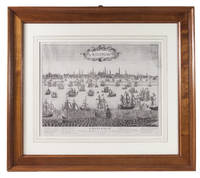
1660réf. ABC_49405Amsterdam 1660. In a passe partout framed in a modern wooden frame. Engraving: ca. 38.5 x 50 cm; frame: 66.5 x 76 cm. Rare large engraved view of Amsterdam as seen from the inlet known as the IJ. The work is captioned in French and includes a numbered legend for the buildings in the background. According to d'Ailly it must have been engraved between 1660 and 1668 as it shows the Oost-Indisch Zeemagazijn a large warehouse built by the Dutch East India Company between 1660-1663 but not the Lutheran Church which was built in 1668. The present engraving is not signed but is very similar to a slightly later view of Amsterdam by French engraver Pierre-Alexandre Aveline 1656-1722. It bears the same caption and legend and has a nearly identical background but differs in the typography cartouche and the amount of ships in the foreground. The present state is exceptionally rare as we have not been able to trace any other copies of it in sales records and only three in literature.The engraving is slightly creased the upper right corner has been professionally repaired. Otherwise in very good condition.l D'Ailly E. A. Repertorium van de profielen der stad Amsterdam en van de plattegronden der schutterswijken 98 3 copies; cf. d'Ailly 101 and 102 Aveline view. unknown
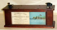
1878réf. 47603Providence RI 1878. During the 1870s excursion tours around Narragansett Bay were such a popular attraction that the Excursion View Company commissi . Providence RI 1878. During the 1870s excursion tours around Narragansett Bay were such a popular attraction that the Excursion View Company commissioned an artist to sketch the complete trip just as a passenger would see it. The drawings were transferred to lithographic stones and printed in color on a continuous roll which could be viewed in a wooden box by turning the knobs and moving the roll. This charming device uses two of these panoramic strips to take the viewer on a trip from Providence to Block Island and back again. The first scroll starts at Fox Point in Providence and travels south passing Squantum Point Silver Spring Pomham Rocks Light Riverside Sabin Point Light Annawanscut Nayatt Point Light Warren Hog Island and Bristol. It then proceeds around Bristol Point and heads northward into Mount Hope Bay passing Churchs Cove to Fall River Mass. and then southward again passing Globe Village and Bristol Ferry to Newport. The end of the first scroll shows Benton Reef at the southern tip of Newport Island and the Atlantic. The second scroll starts at Southeast Light on Block Island and travels northward along the coast to New Shorham Old Harbor. The viewer then passes Clay Head and Black Rock Fort Dumpling and Jamestown on the eastern shore on Conanicut Island Rose and Goulds Islands then around to the western shore of Conanicut Island into the West Passage heading south. Next past Dutch Island and Beaver Tail lighthouses Point Judith Lighthouse and north again to Narragansett Pier Bonnet Point South Ferry Wickford Quonsett Point East Greenwich Buttonwood Warwick Lighthouse Rocky Point Conimicut Point Lighthouse and Pawtuxet. This second scroll ends at the old Sassafras Point Lighthouse in Providence. Both strips show and identify many of the leading shoreline hotels of the day private homes rivers industries rocks forts and sailing vessels of all kinds. Many important paddle steamers are shown including the Bay State Florence City of Newport Rhode Island Canonicus Bristol Bay Queen Empire State and Providence. The lithographed illustration strips are in excellent original condition as is the box and its wooden scroll turners. Back in 1970 a company named Industrial National Bank unearthed a working specimen of this rarity. They were so impressed with it that they incorporated the views into a calendar for that year. Each month displays different illustrations along the way. With these vision views as they were called a passenger could relive his trip around Narragansett Bay long after he had returned home. At the time the Panorama was an exciting and elaborate souvenir but now the few existing rolls give us a fascinating look at the coastline as it appeared nearly a century ago. The calendar measures 16 x 12 ¾ inches. It is included with the Excursion View Box. Both items . Two chromolithographed strips each 30 feet in length and 3 3/4 inches wide. Contained in a double sided glazed walnut box measuring 5 x 6 x 13 1/2 inches. . unknown
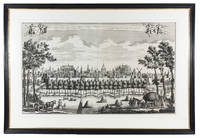
1728réf. 91I90T01U79OAmsterdam 1728. Leonardus Schenk Framed 82.5 x 121 cm. Large engraved wall print on 2 sheets together 57.5 x 97 cm showing the Leiden city wall between the Koepoort and Zijlpoort with various windmills and prominent buildings in the background identified by name. The title appears in a banderole at the head with putti on either side holding the arms of Leiden and Holland. Leonardus Schenk's name appears as engraver and publisher at the right end of the banderole. Large view of the city of Leiden by the Amsterdam engraver and publisher Leonardus Schenk. The viewer observes the city from the south from between the city's Koe and Zijl gates. In the background several windmills and a few characteristic buildings are identified by name in the engraving including the university the library the Pieterskerk the Town Hall the Mare kerk the "Burcht" the fort and the Hooglandse kerk. On the quay outside the wall groups of people walk sporadically passed by small boats on the nearby city moat. In the foreground we see a typical Dutch landscape with grazing cattle farm workers a loaded hay cart and haystacks in the field. We know of several other wall prints by Schenk depicting local situations with almost photographic detail. Thanks to this detail important socio-historical aspects have been passed on to later generations giving these prints an important cultural meaning today. A few spots formerly folded otherwise in very good condition.l Overvoorde Catalogus van de prentverzameling der Gemeente Leiden 1906 no. 640; Waller Biogr. woordenb. Noord Ned. graveurs p. 287. unknown
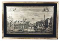
1728réf. A2RGD4WT38YEAmsterdam: Leonardus Schenk 1728. In black passepartout and gilt frame 82 x 121 cm. Large engraved wall print on 2 sheets together 58 x 97 cm the sheets overlapping each other slightly showing the traditional business centre of the city of Leiden. The title both in Dutch and French is printed in a banderole at the head with putti on each side supporting the arms of Leiden and Holland. Leonardus Schenk's name appears as engraver and publisher at the right tip of the banderole. A large engraved wall print in two sheets showing the trading and commercial centre of the city of Leiden at the convergence of the Oude Rijn and Nieuwe Rijn canals. Unlike most other Dutch towns Leiden had no central market square so that the waterways formed the major access routes for merchandise. On the banks of the canals there is a lively market that converges on the bridge central in the print. Market traders and customers come and go. Women from the coastal fishing villages of Katwijk and Noortwijk display fresh fish for sale. Right in the print we see the monumental "Waag" the weigh-house built in 1658 following a plan by the Dutch architect and engraver Pieter Post. The splendid relief designed by Rombout Verhulst that crowns the entrance is reproduced with a sharp eye for detail. In front of the building commercial goods are hoisted up from carts and a number of ships for transport to the weigh-house. Several other ships had moored and now continue to their destination. A boat flying the Dutch flag brings in a prominent party while a herald standing precariously at the bow trumpets for right of way. We know of several other wall prints by Schenk depicting local situations with almost photographic detail. Thanks to this detail important socio-historical aspects have been passed on to later generations giving these prints an important cultural meaning today. With some faint foxing otherwise in very good condition.l Overvoorde Catalogus van de prentverzameling der Gemeente Leiden 1906 no. 964; Waller Biogr. woordenb. Noord Ned. graveurs p. 287. Leonardus Schenk, unknown
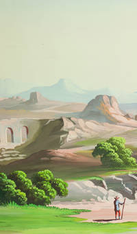
1910réf. J68AIMO7W1D1Palestine 1910. Rolled up and kept in a cardboard tube. An enormous panoramic view drawn in coloured gouaches on a single continuous roll of unwatermarked wove paper 70 x 583 cm the drawing running to the edges of the paper. A panoramic view of what appears to be a fantasy Middle Eastern landscape with spectacular mountains in the background a body of water near each end and a wide variety of buildings and ruins some clearly classical Roman and others Middle Eastern. The combination of classical Roman architecture with dromedaries and other Middle Eastern features places it very likely in Palestine but we have not been able to identify specific buildings. The most distinctive ruin a round Roman temple with five columns on the viewer's side an entablature above them and a vertical base below them looks more like the Temple of the Vesta at Tivoli than like any known in the Middle East the columns are not rendered in sufficient detail to determine their order but they are almost certainly not Ionic and are probably Corinthian. There are also classical Roman aqueducts. The six shepherds with their flocks all wear broad-brimmed hats and have staffs and two are blowing long slightly curved horns. Several more figures with broad-brimmed hats and staffs might be pilgrims one together with what is presumably his wife. With a 33 cm tear into the left end a few insignificant and much smaller tears and with pin holes about 1 cm from the edges from mounting on a wall but otherwise in very good condition and with the colours fresh and bright. A spectacular panoramic view of the Middle East including many classical Roman ruins. unknown
1730réf. E1Q9EQ01U79OAmsterdam: Reinier and Josua Ottens 1730. Mounted and framed. With title in banner at top centre arms of the city at top right city seal at top left and the primary locations with captions. Large engraved panorama on 4 sheets ca. 42 x 218 cm as assembled. Rare large engraved view of Amsterdam as seen from the inlet known as the IJ published by Reinier and Josua Ottens ca. 1730 with numerous ships on the IJ. It's the last state of the view by Jacob Savry published in 1647 and partly updated including the changes made by Visscher in his issue from 1653. Most obvious are the changes on the east part of the city with several new buildings including ''s Lands Zeemagazijn' now known as the Netherlands Maritime Museum.Washed and with one minor professional restoration near the title. Very good copy of a beautifully executed an detailed view of Amsterdam.l D'Ailly Profielen 186; De Vries Atlas van Amsterdam 14; cf. D'Ailly Profielen 55 & 74. Reinier and Josua Ottens, unknown
1599réf. DB9FTP3RHVIKAntwerp 1599. Pieter Bast Framed. Large engraved panorama on 2 sheets ca. 27 x 76 cm as assembled. Rare first state of a 16th-century view of Amsterdam as seen from the inlet known as the IJ made by Pieter Bast a Dutch engraver from Antwerp best known for his city map of Amsterdam and this view. "In its amplitude and the sheer audacity of the presentation this engraving is indisputably one of Bast's most significant creations. It is as much a portrait of the harbour of Amsterdam as of the city itself and underscores the unique importance of maritime trade as the principle source of the city's wealth and power". With its distinctive orientation he not only initiated the series of representations of Amsterdam as seen from the IJ but also "established the standard for an entire genre of Dutch maritime painting" Keyes. In 1611 a second state edition was published by Claesz Jansz. Visscher who drastically altered the composition. In very good condition.l Hollstein Dutch & Flemish I p. 168 8; Keyes Pieter Bast 8 and p. 19. unknown