COLLECTIFLivre Rare Book
Allen, James A. VanAntiquariat.de
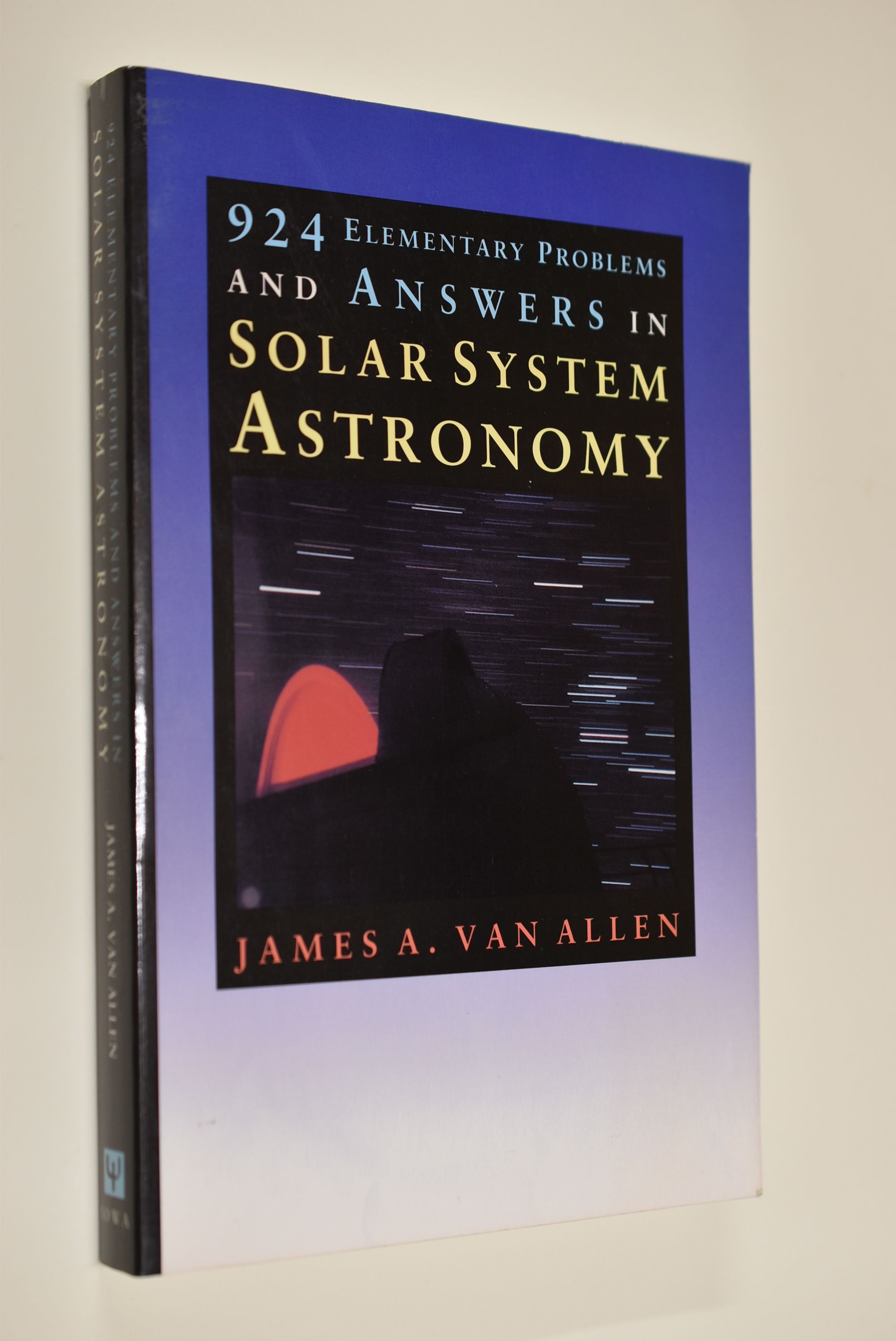
924 Elementary Problems and Answers in Solar System Astronomy.
1993réf. 67835USA, Iowa State Press 1993. 140 S., 23cm Karton 0
Antiquariat Biebusch · Allemagne10,00 €
10 841 résultats
réf. RO80196026NON COMMUNIQUE. NON DATE. In-32. Broché. Bon état, Coins frottés, Dos satisfaisant, Intérieur frais. 32 pages augmentées de nombreuse photographies en couleurs hors texte -. . . . Classification Dewey : 550-Sciences de la Terre et des autres mondes
1993réf. 67835USA, Iowa State Press 1993. 140 S., 23cm Karton 0
1997cm. 14,5 x 20, 180 pp. Saggi di ?Lettere italiane? Il volume non propone un'interpretazione globale della lode francescana, bens? l'approfondimento, in prospettiva diacronica e sincronica, di una singola occorrenza testuale. Ridisegnate, nel segno dell'umilt? e del servizio, le fila della visione creaturale di Francesco, e illustrata la posizione esemplare della terra in essa, la ricerca conclude verificando come la 'follia' del governo terrestre si iscriva nella follia sublime del paradosso cristiano: 'humilitas sublimis', il Figlio di Dio, nato da donna, ha umiliato la sua natura divina nella materia della nostra umanit?, fatta di terra, per mostrarci nella remissione e nel servizio la via verso il Padre, l'Altissimo. Rather than a comprehensive interpretation of Franciscan praise this volume, in a diacronic and synchronic perspective, proposes a deeper knowledge of a single precise circumstance. The succession of Francesco's visions re-designed as a token of humility and service illustrates the exemplary position of the earth, the research is concluded verifying how the ?foolishness? of terrestrial government enters into the sublime foolishness of Christian paradox: ?humilitas sublimis?, the Son of God, born of woman, humiliates His divine nature in the form of our humanity, made of earth, to show us, by means of remission and service, the way to His Father. 248 gr. 180 p.
1880Very Good Latin Extremely rare second edition of Quaresmus' work including four parts in two volumes, which is a a contribution to history, geography, archaeology, biblical and moral science of the East and Holy Land. First Edition is 1639, printed in Antwerp. This edition was edited by Father Cypriano da Treviso. First volume has one two-page map titled 'Chorographia Terræ Sanctæ Sev Terræ Promissionis Nova Descriptio' depicting a very attractive view of the Holy Lands, which is decorated ships heading to the Holy Land. Second volume has two maps, one plate, and two plans (All is folded and huge sizes). First map is one of the most attractive views of Extremely rare second edition of Quaresmus' work including four parts in two volumes, which is a contribution to history, geography, archaeology, biblical and moral science of the East and Holy Land. First Edition is 1639, printed in Antwerp. This edition was edited by Father Cypriano da Treviso. The first volume has one two-page map titled 'Chorographia Terræ Sanctæ Sev Terræ Promissionis Nova Descriptio' depicting a very attractive view of the Holy Lands, which is decorated ships heading to the Holy Land. The second volume has two maps, one plate, and two plans (All are folded and huge sizes). The first map is one of the most attractive views of Jerusalem titled 'Novæ Ierosolymæ et Locorvm Circvmiacentivm Accvrata Imago'. Other is depicting attractively 'Montis Calvariæ' [i.e. Calvary, or Golgotha] which was, according to the canonical Gospels, a site immediately outside Jerusalem's walls where Jesus was crucified, as well as Bethlehem and Resurrection Temple's plans. Quaresmio was a writer and Orientalist of the seventeenth century. His father was the noble Alberto Quaresmi and his mother Laura Papa. At an early age, he was enrolled among the Franciscan Observantines at Mantua. For many years he held the chairs of philosophy, theology, and canon law, and became successively guardian, custos, and minister of his province. His long apostolate in the East and the magnificent works he has left us have secured Quaresmius worldwide fame, especially among earlier historians, Biblical scholars, and Orientalists. On 3 March 1616, he went to Jerusalem, where he became Guardian and Vice-Commissary Apostolic of Aleppo in Syria (1616-8), and Superior and Commissary Apostolic of the East (1618-9). During this period he was twice imprisoned by the Turks. In 1620 he returned to Europe, but in 1625 was back in Jerusalem, whence the following year he addressed from the Holy Sepulchre an appeal to Philip IV of Spain, inviting him to reconquer the Holy Land, and at the same time dedicating to him his work, "Hierosolymæ afflictæ". Between 1616 and 1626 he wrote his classical work, "Elucidatio terræ Sanctæ", adjudged by the learned a monumental contribution to history, geography, archæology, Biblical and moral science. During 1627-9 he was at Aleppo as papal commissary and as vicar-patriarch for the Chaldeans and Maronites of Syria and Mesopotamia. In 1629 he went to Italy to render an account to the Holy See of the state of the Eastern Churches; he then returned to the East, but how long he remained is not known. Meanwhile, he journeyed through Egypt and Sinai, the Holy Land, Syria, Mesopotamia, Cyprus, Rodi, Constantinople, and a large part of Asia Minor; he also visited Germany, France, Belgium, and Holland. In 1637 he was a guardian of S. Angelo (Milan), wherein 1643 he completed his other great work on the Passion of Christ. Original 1/3 black leather bdg. Six raised bands to spine. Marbled endpapers. Gilt title on spine and volume numbers. Folio. (38 x 28 cm). In Latin. 2 volumes set: (xxviii, [8], 761 p.; 893 p., 6 engraved maps and plans (5 folded)).
1916Very Good Turkish, Ottoman (1500-1928) Contemporary red cloth. Roy. 8vo. (24 x 16 cm). In Ottoman script (Old Turkish with Arabic letters). [1], 229, [1] p., many b/w and color ills., 30 chromo-lithographed maps. Wear and fading on spine, some ex-library stamps on the colophon and several blank pages, ownership ink inscription and signature on the first page-overall a good copy. First edition of this rare Ottoman atlas for the primary schools in the late Ottoman Empire, including beautiful 30 chromo-lithographed maps of the Ottoman land according to administrative regions (provinces) and richly illustrated with b/w plates of the cities and provinces in the Middle East. Map list: 1. World map 2. Complete Imperial Ottoman 3. Arabian Peninsula 4. Anatolia 5. Asia Minor 6. Marmara and Black Sea 7. Aegean (The Archipelago) 8. Demography of Anatolia and Syria, Libya, etc 9. Administrative map of Anatolia 10. Map of mines of Anatolia 11. Agricultural map of the Imperial Ottoman 12. Arabian Peninsula 13. Map of the Edirne Vilayat [Adrianople Province of the Ottoman Empire] 14. Map of the Bosphorus 15. Map of the Hüdavendigâr Vilayat [Brusa Province] 16. Maps of Izmit and Biga Sanjaks 17. Map of Aydin Vilayat and Mentese Sanjak 18. Map of the Konya Vilayat 19. Maps of the Adana Vilayat and the Mediterranean Sea 20. Maps of the Erzurum and Ankara Vilayats 21. MAps of Kastamonu Vilayat and Bolu Sanjak 22. Map of the Trebizond Vilayat 23. Maps of the Van and Bitlis Vilayats 24. Maps of the Sivas and Harput Vilayats 25. Maps of the Bagdad and Basrah Vilayats 26. Map of the Mosul Vilayat and Day al-Zor Sanjak 27. Map of the Aleppo Vilayat and Urfa Sanjak 28. Map of the Syria and Beirut Vilayats 29. Map of the Arabia 30. Maps of the Yemen vilayat and Asir Sanjak. This atlas was printed four times for the different classes of the early Turkish / Ottoman schools, during World War 1 (two times in 1916) and the National Struggle (two times in 1921). Geylangil was born in Istanbul in 1887 and studied in Aleppo and Baghdad. Geylangil, who also studied economic geography, taught geography at many schools, including Galatasaray High School. Until his death, he wrote 14 books on geography, most of which were geographical atlases. In 1941, he was among the founding members of the Turkish Geographical Society. Özege 23216.; TBTK 11481.; We couldn't find any copy of this edition worldwide.
1868Very Good Turkish, Ottoman (1500-1928) Contemporary quarter leather bdg. Rebacked boards. Foolscap 8vo. (18 x 12 cm). In Ottoman script (Old Turkish with Arabic letters). 220 p. Very rare early book of the concise biographies of 137 people who served as admirals in the Ottoman Empire between 1352 and 1853, written by Mehmed Izzet Pasha (d. 1853), son of Turkish admiral Abdullah Râmiz Pasha (d. 1813). Ceridehâne Printing House was founded for publishing Ceride-i Havâdîs [i.e. The Journal of News], which was the first semi-official newspaper in the Ottoman Empire. This journal was published from 1840 to 1877 and was founded by William Nosworthy Churchill (1796-1846), a British-born journalist who moved to Turkey aged 19. He was the cause of a diplomatic incident that resulted in the temporary severance of diplomatic relations between Britain and the Ottoman Empire. Babinger p. 323/2.; Özege 6951.; Library of Congress. Karl Süssheim Collection, no. 1336., OCLC: 11810438, 880485954.
1860réf. 35665[Vers 1860] 24,5 x 18 cm environ tirage sur papier albuminé d'après négatif verre, contrecollé sur papier fort, marie-louise moderne
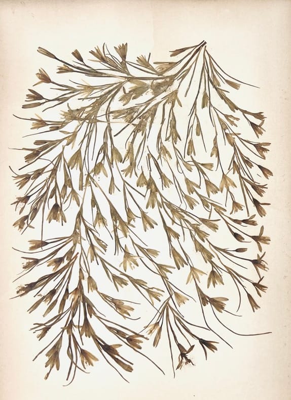
1897réf. 44475Jérusalem, Boulos Meo, (c. 1897). Album in-8 oblong (23 x 32 cm), titre, 18 chromophotographies et 18 planches de fleurs séchées en regard montées sur carton fort, titres imprimés sur les montages, demi-basane, dos titré à nerfs, premier plat orné d'une plaque noire décorative illustrée au centre du Saint Sépulcre en relief accompagné d'une plaque datée 1897, second plat couvert d'une plaque noire similaire sans illustration, tranches dorées (reliure de l'époque).
réf. LBW024ddcirca 1690 115 x 259 mm.
réf. 435852Moscow, 1970. In-8, rel. pleine toile grise éditeur, 178 pp., 56 planches.
réf. 13977083Paris: Musée de l'Homme, Museum National d'Histoire Naturelle, 1972 in-4, pp. 75-254, nombreuses illustrations. Broché, cachet, très bon état.
1680Incisione in rame (mm. 525x630), abilmente dipinta da mano coeva, verso velato da finissimo foglio di carta Giappone. Bella e rara carta nautica, tratta dal celebre atlante di De Witt ''Orbis Maritimus ofte Zee Atlas", raffigurante l'America meridionale, dal Rio della Plata (Paraguay) allo stretto di Magellano e all'Arcipelago della Terra del Fuoco. La mappa include sorprendenti dettagli decorativi. Il grande cartiglio rappresenta un incontro tra i popoli indigeni e gli europei. Nell'Atlantico meridionale c'è una nave solitaria e una battaglia mortale tra due flotte. Il grafico sottolinea i viaggi olandesi nella regione intorno alla fine del diciassettesimo secolo. Il primo di questi faceva parte del tentativo di commerciare con la Cina e le Isole delle Spezie e la creazione della Compagnia Olandese delle Indie Orientali (VOC). Delle quattordici flotte che partirono dai porti olandesi per le Indie Orientali tra il 1598 e il 1601, solo due lo fecero attraverso lo Stretto di Magellano. La carta è una delle carte nautiche più eleganti e dettagliate del Sud America pubblicate nel XVII secolo. L'abile rinforzo con carta Giappone evita il deperimento da acidità ai verdi e marroni; quindi l'esemplare si presenta in ottimo stato, anche grazie alla splendida coloritura del cartiglio. "Frederick de Wit deve essere considerato uno dei più importanti editori di mappe della seconda metà del XVII secolo. La maggior parte delle sue mappe sono di ottima qualità, sono caratterizzate da un'incisione chiara e bella, dall'attualità e ricchezza dell'immagine cartografica nonché dall'equilibrio delle decorazioni cartografiche". (Lexikon der Kartographie II, p. 899), Koeman M. Wit 1, 27. Koeman, Atlantes Neerlandici, IV, pp.191 e 518-519. Shirley 444. Putnam, Early sea charts, 75.. .
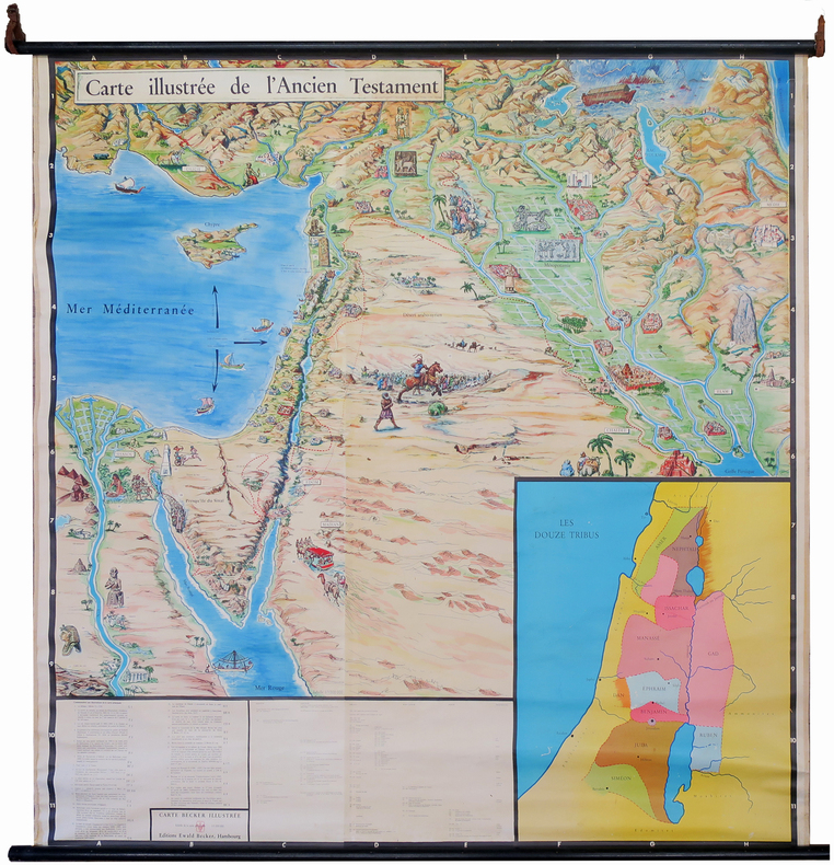
1950réf. LBW-7220Hambourg, Éditions Ewald Becker, [circa 1950]. En 4 feuilles jointes formant une carte de 1,70 x 1,66 m ; montée sur toile, entre deux baguettes de bois avec liens de cuir.
1666réf. LBW-7582Lutetiæ Parisiorum, Apud authorem, 1666. En deux feuilles pouvant être jointes pour former une carte de 746 x 523 mm.
Lotto di 5 carte goegrafiche inc. in rame, piegate all'origine, tratte da "Commentarius litteralis in omnes libros veteris et novi testamenti auctore Augustino Calmet", Venezia, 1797. 1) 'Tabula itineris & Stationum Israelitarum in deferto ab eorum egressu ex Aegypto ad transitum Jordanis', mm. 450x340 alla battuta. 2) 'Tabula Itineris Israelitarum per desertum ab exitu de Aegypto ad usque vadu Jordanis', mm. 240x330 alla battuta, con 10 piccoli riquadri contenenti figure (candelabri, altari, tabernacoli...). 3) 'Geographia sacra seu descriptio regionum quas trium filiorum Noe posteri incoluerunt', mm. 425x575. 4) 'Tabula Paradisi terrestris', mm. 240x230 alla battuta. 5) 'Charateres Phoenicii seu Samaritani quules in nummis extant' mm.200x230. Ottima conservaz.
réf. 0502QC2MW5VPaperback. Very Good. Scarce in Portuguese. I105 pages with reader remainder or x library marks ann ahli paperback
réf. SLIVCN-9791097088224DIVERGENCES EDITIONS
1900Milano, Treves, 1900, 23 dicembre, articolo e tre illustrazioni, stralcio de "L'Illustrazione popolare". - !! ATTENZIONE !!: Con il termine estratto (o stralcio) intendiamo riferirci ad un fascicolo contenente un articolo di rivista, sia che esso sia stato stampato a parte utilizzando la stessa composizione sia che provenga direttamente da una rivista. Le pagine sono indicate come "da/a", ad esempio: 229/231 significa che il testo è composto da tre pagine. Quando la rivista di provenienza non viene indicata é perchè ci è sconosciuta. - !! ATTENTION !!: : NOT A BOOK : “estratto” or “stralcio” means simply a few pages, original nonetheless, printed in a magazine. Pages are indicated as in "from” “to", for example: 229/231 means the text comprises three pages (229, 230 and 231). If the magazine that contained the pages is not mentioned, it is because it is unknown to us.
1980réf. 2082702114605926Ie no hikari kyokai 1980. Soft Cover. Fine. Number of books: 1 Ie no hikari kyokai paperback
réf. 6317THE FIRST EARTH DAY. Brochure. 14pg. 8 x 11. March 16 1970. Philadelphia. A photocopied brochure for the first Earth Day held in 1970 and entitled Earth Week Activities. This was meant for the Philadelphia region. The cover is hand-colored as is one of the interior maps showing where the activities would be held in Fairmount Park. The final page has The unanimous declaration of Interdependence based on the Declaration of Independence. There is also an Earth Week pin. OCLC shows no institutional holdings. unknown
réf. 6317THE FIRST EARTH DAY. Brochure. 14pg. 8 x 11. March 16 1970. Philadelphia. A photocopied brochure for the first Earth Day held in 1970 and entitled Earth Week Activities. This was meant for the Philadelphia region. The cover is hand-colored as is one of the interior maps showing where the activities would be held in Fairmount Park. The final page has The unanimous declaration of Interdependence based on the Declaration of Independence. There is also an Earth Week pin. OCLC shows no institutional holdings. unknown books
1925réf. 13793Trustees of the British Museum 1925. 1st edition. V.g./No Jacket. Publisher's cloth Complete with 12 plates. xxviii 250 pp. Trustees of the British Museum hardcover
1865réf. 9131883Eyre and Spottiswoode 1865. This is an ex-library book and may have the usual library/used-book markings inside.This book has hardback covers. In good all round condition. No dust jacket. Re-bound by library. 8vo green cloth binding gilt lettering on backstrip title page has tears red speckled page edges shelfwear pages clean text clear Please note the Image in this listing is a stock photo and may not match the covers of the actual item700grams ISBN: Eyre and Spottiswoode hardcover
1911Hardcover in good condition. No jacket. Ex-library. Library binding. Published for the British Association for the Advancement of Science Portsmouth meeting, 1911. Boards are lightly marked, warped and edge-worn. Shelf label on spine foot. Page block and pages are tanned and marked. Creases throughout pages. Stamps and pen on front pastedown and nicked title page. Text is clear throughout. HCW Used
2003réf. 5568008Oxford University Press 2003. This is an ex-library book and may have the usual library/used-book markings inside.This book has hardback covers. In good all round condition. No dust jacket. Please note the Image in this listing is a stock photo and may not match the covers of the actual item1600grams ISBN:0197262864 Oxford University Press hardcover