2 176 résultats
1898réf. 096271UK: W. Griggs & Sons 1898. Hardcover. Very Good. 40cm x 29cm. Tight and clean copy . Ex library Scottish National Museum with withdrawn stamp and discreet stamps. Clean and tight copy. Beige cloth boards with gilt titles. W. Griggs & Sons hardcover
2025réf. x-1638040834Clemson Univ Pr 2025. Hardcover. New. 256 pages. 9.43x6.43x9.00 inches. Clemson Univ Pr hardcover
réf. 19441799-nnew. unknown
réf. 650402937Taylor & Francis Group . Hardback. New. pp. 168 Taylor & Francis Group hardcover
réf. CBS 9781447175988US Edition. New. Brand New! Fast Delivery US Edition and ship within 24-48 hours. Deliver by FedEx and Dhl & Aramex UPS & USPS and we do accept APO and PO BOX Addresses. Order can be delivered worldwide within 6-10 days and we do have flat rate for up to 2LB. Extra shipping charges will be requested if the Book weight is more than 5 LB. This Item May be shipped from India United states & United Kingdom. Depending on your location and availability. unknown
2004réf. Q-0471976474Wiley 2004-10-15. Hardcover. New. In shrink wrap. Looks like an interesting title! Wiley hardcover
réf. 32710583-nnew. unknown
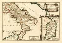
1705réf. 15703Paris: N. de Fer 1705. Other. In excellent condition. 223 by 335mm 8 by 13 inches. 223 by 335mm 8 by 13 inches. Original antique hand-colored copper engraving published 1705. Depicting Kingdom of Naples this map is a fine example of 0s European cartography. Image: 223 by 335mm 8 by 13 inches. An attractive and historically significant 18th-century map for the discerning collector. Nicolas de Fer 16461720 was a prominent French cartographer engraver and publisher based in Paris. After inheriting his father's mapmaking business de Fer built it into one of the most productive cartographic firms in France eventually becoming Geographer to King Louis XIV of France and King Philip V of Spain. His output was prolificmore than 600 sheet maps town plans and atlasescovering Europe the Americas and beyond. De Fer's maps are known for their decorative cartouches attractive hand coloring and commercial appeal though they were sometimes criticized for prioritizing artistry over accuracy. His maps are particularly associated with the campaigns of the War of the Spanish Succession and are sought by collectors for their decorative quality.This decorative map show the Southern part of Italy with Sicily. Inside the map are many place names rivers mountains etc. engraved. In the upper right corner we see the title cartouche. In the lower right corner we see an inset map which shows the island Sardinia. At the bottom are two mileage scales.A fine example from Introduction à la Géographie Paris sought after by collectors of antique maps of Italy antique maps of Kingdom of Naples and antique hand-colored copper engravings for sale. In very good condition. Light age-toning to the sheet as expected for a 18th-century map. N. de Fer unknown
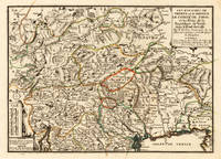
1705réf. 15715Paris: N. de Fer 1705. Other. Full margins as published. 252 by 352mm 10 by 13 inches. 252 by 352mm 10 by 13 inches. Original antique hand-colored copper engraving published 1705. Depicting Tyrol & Trentino this map is a fine example of 0s European cartography. Image: 252 by 352mm 10 by 13 inches. An attractive and historically significant 18th-century map for the discerning collector. Nicolas de Fer 16461720 was a prominent French cartographer engraver and publisher based in Paris. After inheriting his father's mapmaking business de Fer built it into one of the most productive cartographic firms in France eventually becoming Geographer to King Louis XIV of France and King Philip V of Spain. His output was prolificmore than 600 sheet maps town plans and atlasescovering Europe the Americas and beyond. De Fer's maps are known for their decorative cartouches attractive hand coloring and commercial appeal though they were sometimes criticized for prioritizing artistry over accuracy. His maps are particularly associated with the campaigns of the War of the Spanish Succession and are sought by collectors for their decorative quality.Ornated in the lower left corner with a small milage scale.A fine example from Introduction à la Géographie Paris sought after by collectors of antique maps of Italy antique maps of Tyrol and antique hand-colored copper engravings for sale. In very good condition. Light age-toning to the sheet as expected for a 18th-century map. N. de Fer unknown
réf. ria9781799840961_inpHardcover. New. New Book; Fast Shipping from UK; Not signed; Not First Edition; There has been an evolution of the explanations on the results of research on human learning and how digital technologies have supported the design of more efficient learning environments. Previous theories such as Richard Mayer's cogni hardcover
réf. Lars Larsson, Thomas B. LIn Pristine Condition. unknown
réf. 0984702013. 352 pages with 115 colour and 160 black and white illustrations. Hardback 34 x 24cms. ISBN: 9788897684183 8897684181. The most exhaustive publication to date on the artist born in Valsesia in 1703 who trained in Milan and combined French rococo traits with influences from eighteenth-century Genoa and Venice and contemporary Milanese painting discussing his religious scenes alongside his still lifes and landscapes. Text in Italian. 2013. hardcover
réf. 108318New Haven and London: 2015. 528 pages with 450 colour and 20 black and white illustrations. Hardback in a slipcase 29.2 x 25.1cms. ISBN: 9780300214895. Catalogue raisonné. New Haven and London: 2015. hardcover
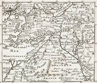
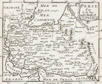
1700réf. 399AG1700. Paris c. 1700. Original copper engraved maps. 16 cm wide x 13.2 cm high. Mounted on paper. Very good condition. From a wonderful collection of Maps from an old english library South Shields - with a tiny library stamp to the mounting paper The stamp is NOT on the Map. Nicolas de Fer 164625 October 1720 was a French cartographer and geographer. De Fer was the youngest of three sons of Antoine de Fer who was also a cartographer. When he was 12 he became the apprentice of Parisian engraver Louis Spirinx and made his first map of the Canal du Midi at the age of 23. After the death of his father in June 1673 his mother Geneviève initially took over the map making company which had begun to decline. She passed it and the atelier called Quai de L'Horloge on to Nicolas in 1687 because of her old age. De Fer was so successful at improving the firm that in 1690 he became the official geographer to Louis Dauphin of France. With support from the Spanish and French Royal Families de Fer also became official geographer for Philip V and Louis XIV the kings of Spain and France respectively. Because of this his maps became Bourbon propaganda endorsing French King Louis XIV. His business flourished producing town plans atlases wall maps and more than 600 sheet maps. He made maps of places in Europe and North America including New Spain places fortified by Vauban the Low Countries and the War of the Spanish Succession. In 1698 de Fer published a map of North America which included a depiction of beavers building dams near Niagara Falls. Seventeen years later Herman Moll published a map which plagiarized elements of de Fer's work particularly the beaver scene. It became known as the "Beaver map". De Fer became the official geographer for His Catholic Majesty in 1720. Two of his sons-in-law Guillaume Danet and Jaques-François Bénard continued the company after de Fer's death on 25 October of that year until around 1760. Wikipedia unknown
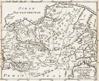
1700réf. 402AG1700. Paris c. 1700. Original copper engraved maps. 15.5 cm wide x 13 cm high. Mounted on paper. Very good condition. From a wonderful collection of Maps from an old english library South Shields - with a tiny library stamp to the mounting paper The stamp is NOT on the Map. Nicolas de Fer 164625 October 1720 was a French cartographer and geographer. De Fer was the youngest of three sons of Antoine de Fer who was also a cartographer. When he was 12 he became the apprentice of Parisian engraver Louis Spirinx and made his first map of the Canal du Midi at the age of 23. After the death of his father in June 1673 his mother Geneviève initially took over the map making company which had begun to decline. She passed it and the atelier called Quai de L'Horloge on to Nicolas in 1687 because of her old age. De Fer was so successful at improving the firm that in 1690 he became the official geographer to Louis Dauphin of France. With support from the Spanish and French Royal Families de Fer also became official geographer for Philip V and Louis XIV the kings of Spain and France respectively. Because of this his maps became Bourbon propaganda endorsing French King Louis XIV. His business flourished producing town plans atlases wall maps and more than 600 sheet maps. He made maps of places in Europe and North America including New Spain places fortified by Vauban the Low Countries and the War of the Spanish Succession. In 1698 de Fer published a map of North America which included a depiction of beavers building dams near Niagara Falls. Seventeen years later Herman Moll published a map which plagiarized elements of de Fer's work particularly the beaver scene. It became known as the "Beaver map". De Fer became the official geographer for His Catholic Majesty in 1720. Two of his sons-in-law Guillaume Danet and Jaques-François Bénard continued the company after de Fer's death on 25 October of that year until around 1760. Wikipedia unknown
1700réf. 403AG1700. Paris c. 1700. Original copper engraved maps. 15.5 cm wide x 13 cm high. Mounted on paper. Very good condition. From a wonderful collection of Maps from an old english library South Shields - with a tiny library stamp to the mounting paper The stamp is NOT on the Map. Nicolas de Fer 164625 October 1720 was a French cartographer and geographer. De Fer was the youngest of three sons of Antoine de Fer who was also a cartographer. When he was 12 he became the apprentice of Parisian engraver Louis Spirinx and made his first map of the Canal du Midi at the age of 23. After the death of his father in June 1673 his mother Geneviève initially took over the map making company which had begun to decline. She passed it and the atelier called Quai de L'Horloge on to Nicolas in 1687 because of her old age. De Fer was so successful at improving the firm that in 1690 he became the official geographer to Louis Dauphin of France. With support from the Spanish and French Royal Families de Fer also became official geographer for Philip V and Louis XIV the kings of Spain and France respectively. Because of this his maps became Bourbon propaganda endorsing French King Louis XIV. His business flourished producing town plans atlases wall maps and more than 600 sheet maps. He made maps of places in Europe and North America including New Spain places fortified by Vauban the Low Countries and the War of the Spanish Succession. In 1698 de Fer published a map of North America which included a depiction of beavers building dams near Niagara Falls. Seventeen years later Herman Moll published a map which plagiarized elements of de Fer's work particularly the beaver scene. It became known as the "Beaver map". De Fer became the official geographer for His Catholic Majesty in 1720. Two of his sons-in-law Guillaume Danet and Jaques-François Bénard continued the company after de Fer's death on 25 October of that year until around 1760. Wikipedia unknown
1896réf. 120209AB1896. London Hutchinson & Co 1896. 13.5 cm x 19.5 cm. Frontispiece XV 346 pages. Hardcover publisher's original cloth with gilt lettering and decoration on spine. Small embossment to front board. Deckled top edge. Very good condition with only minor signs of external wear. Minor bumps to board corners. Small cutout of old name on halftitle. Interior lightly tanned throughout but bright and clean. Binding is strong firm and square. Includes for example the following: Shadows from Child Life / Plans and Bushman-Paintings / Sunday Services / Bonaparte Blenkins Makes his Nest / Waldo's Stranger / Gregory Rose Finds his Affinity / A Boer-Wedding / Dreams etc. Olive Schreiner 24 March 1855 11 December 1920 was a South African author anti-war campaigner and intellectual. She is best remembered today for her novel The Story of an African Farm 1883 which has been highly acclaimed as one of the first feminist novels. It tells the story of a girl on an isolated farm on the veld who struggles for her independence in the face of rigid Boer social conventions. in doing so it deals boldly with such contemporary issues as agnosticism existential independence individualism the professional aspirations of women and the elemental nature of life on the colonial frontier. Since the late 20th century scholars have also credited Schreiner as an advocate for the Afrikaners and other South African groups who were excluded from political power for decades such as indigenous Blacks Jews and Indians. Although she showed interest in socialism pacifism vegetarianism and feminism amongst other topics her views escaped restrictive categorisations. Her published works and other surviving writings promote implicit values such as moderation friendship and understanding amongst all peoples and avoid the pitfalls of political radicalism which she consciously eschewed. Called a lifelong freethinker she also continued to adhere to the spirit of the Christian Bible and developed a secular version of the worldview of her missionary parents with mystical elements. Wikipedia hardcover
1700réf. 398AG1700. Paris c. 1700. Original copper engraved map. 16 cm wide x 13.2 cm high. Mounted on paper. Very good condition. From a wonderful collection of Maps from an old english library South Shields - with a tiny library stamp to the mounting paper The stamp is NOT on the Map. Nicolas de Fer 164625 October 1720 was a French cartographer and geographer. De Fer was the youngest of three sons of Antoine de Fer who was also a cartographer. When he was 12 he became the apprentice of Parisian engraver Louis Spirinx and made his first map of the Canal du Midi at the age of 23. After the death of his father in June 1673 his mother Geneviève initially took over the map making company which had begun to decline. She passed it and the atelier called Quai de L'Horloge on to Nicolas in 1687 because of her old age. De Fer was so successful at improving the firm that in 1690 he became the official geographer to Louis Dauphin of France. With support from the Spanish and French Royal Families de Fer also became official geographer for Philip V and Louis XIV the kings of Spain and France respectively. Because of this his maps became Bourbon propaganda endorsing French King Louis XIV. His business flourished producing town plans atlases wall maps and more than 600 sheet maps. He made maps of places in Europe and North America including New Spain places fortified by Vauban the Low Countries and the War of the Spanish Succession. In 1698 de Fer published a map of North America which included a depiction of beavers building dams near Niagara Falls. Seventeen years later Herman Moll published a map which plagiarized elements of de Fer's work particularly the beaver scene. It became known as the "Beaver map". De Fer became the official geographer for His Catholic Majesty in 1720. Two of his sons-in-law Guillaume Danet and Jaques-François Bénard continued the company after de Fer's death on 25 October of that year until around 1760. Wikipedia unknown
réf. 7853Stamped 'ROBERT STEPHENSON & CO. LTD. LOCOMOTIVE WORKS 29 APR. 1907 DARLINGTON'. Detailed coloured hand-drawn plan of a broad gauge locomotive with dimensions on large piece of cloth headed 'F.C.G.O.A.' and text in Spanish and English designed by the Stephenson Locomotive Works for the Argentine Great Western Railway Company. An attractive item on one side of a piece of cloth roughly 57 x 94 cm. Good: lightly aged and creased. Side section of the engine roughly 21 x 61 cm with dimensions in grey outlines and other lines in purple one block in pink and red and a few small parts in blue. Also a cross-section from the front of the left side of the train only roughly 22 x 9.5 cm. Beneath the heading 'F.C.G.O.A. are six lines of neatly-written text the first reading 'Trocha de. 1676<> Gauge. 5'-6''.' and the last 'Capacidad del deposito de carbon 3-1715 Cubic Metres Fuel Space 112 Cub: feet.' The Argentine Great Western Railway was a British-owned company which operated a broad gauge 5ft 6in railway network in Argentina where it was known as the Ferrocarril Gran Oeste Argentino FCGOA. Image on request. Stamped 'ROBERT STEPHENSON & CO. LTD. | LOCOMOTIVE WORKS | 29 APR. 1907| DARLINGTON'. hardcover
2023réf. x-303130246XSpringer Nature 2023. Hardcover. New. 239 pages. 9.25x6.10x9.21 inches. Springer Nature hardcover
réf. 32710583like new. unknown
réf. 4104710-nnew. unknown
réf. 12269803-nnew. unknown
réf. 35379127-nnew. unknown
réf. 4929AMERICAN IRON TRADE THE STATE OF THE TRADE AND MANUFACTORY OF IRON IN GREAT-BRITAIN CONSIDERED. London: 1750. 8vo. Disbound. 15 pages. First edition. Sabin 90633; Kress S-1991; Goldsmiths' Library 8504. An interesting anonymous tract largely about the trade in iron from the American colonies. Rare. Kress only records a photo copy. 4929. unknown