Ferro, AntoninoBiblio.com

2176 risultati
2019rif. x-0367150190Routledge 2019. Hardcover. New. 144 pages. 9.50x6.25x0.75 inches. Routledge hardcover
2019rif. x-0367103044Taylor & Francis 2019. Hardcover. New. 224 pages. 9.01x5.98x0.59 inches. Taylor & Francis hardcover
2026rif. x-1041360924Taylor & Francis Ltd 2026. Hardcover. New. 188 pages. 6.69x0.50x9.61 inches. Taylor & Francis Ltd hardcover
2022rif. x-1032245042Routledge 2022. Hardcover. New. 192 pages. 9.18x6.12x0.80 inches. Routledge hardcover
2017rif. x-113882058XTaylor & Francis 2017. Hardcover. New. 272 pages. 9.25x6.25x0.75 inches. Taylor & Francis hardcover
2006rif. 1-097069704XPrivateer Pr 2006. Hardcover. New. 4 pages. 11.50x8.50x1.25 inches. Privateer Pr hardcover
1997rif. x-0415140072Routledge 1997. Hardcover. New. 1st edition. 416 pages. 9.53x6.26x1.02 inches. Routledge hardcover
2002rif. __0471486698John Wiley & Sons Inc 2002. Hardcover. New. 1st edition. 272 pages. 10.25x7.00x0.75 inches. John Wiley & Sons Inc hardcover
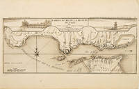
1710rif. 53828Atlas Curieux ou le Monde. c. 1710. The lower half of this attractive engraving shows the mouth of the Tagus from the sea to Lisbon showing the coastline settlement and fortification in detail. Title at top centre flanked by two views- To the left the 'Palais Royal de Lisbonne' and to the right 'Le Chateau de Belem'. Copper engraving. Fine condition. Uncoloured. Size: 405 x 175 mm. 16 x 7 inches. unknown
2015rif. SBBIH-FHV2QC3THAQLTate Publishing 2015. hardcover. Very Good. Most of our very good books have only minor imperfections such as shelf wear consistent with a new book that's sat on a bookshop shelf for a year or two. Occasionally we may miss other minor imperfections as we have to grade books at speed. Our books are dispatched from a Yorkshire former cotton mill. We list via barcode/ISBN so please note that the images are stock images and may not be the exact copy you receive furthermore the details about edition and year might not be accurate as many publishers reuse the same ISBN for multiple editions and as we simply scan a barcode or enter an ISBN we do not check the validity of the edition data when listing. If you're looking for an exact edition please don't order at least not without checking with us first although we don't always have time to check. We aim to dispatch prompty the service used will depend on order value and book size. We can ship to most countries see our shipping policies. Payment is via Abe only. Tate Publishing hardcover
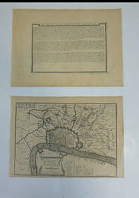
rif. 51-6462Paris: chez l'auteur dans l'Isle du Palais sur le quay de l'orloge a la Sphére Royale avec privilége du Roy 1705-1717. Engraved broadside and engraved map. Each 27.3 x 38cm. Contemporary laid paper uniformly time aged.OCLC Number / Unique Identifier:159878703.Published in "L'atlas curieux ou le monde reÌpreseÌnteÌ dans des cartes geÌneÌrales et particulieres du ciel et de la terre : diviseÌ tant en ses quatre principales parties que par eÌtats et provinces et orneÌ par des plans et descriptions des villes capitales et principales et des plus superbes edifices qui les embelissent comme sont les eglises les palais les maisons de plaisance les iardins les fontaines &c. ". OCLC Number / Unique Identifier:79022119.LThe Atlas Curieux is geographic encyclopedia of images and maps of France with detailed views of the grand waterworks at Marly views of the great palaces and chateaux views and plans of the Paris Observatory and samples of military architecture. Issued in six annual parts from 1700-1705 the maps are based on the new observations of the Académie des Sciences and drawn up with the assistance of Philipe de La Hire.ibrary of Congress:The French cartographer and engraver Nicolas de Fer was a master at creating maps that were works of art. The maps that he published were printed during the Baroque period when the decorative arts were characterized by ornate detail. De Fer’s detailed maps and atlases were valued more for their decorative content than their geographical accuracy.Nicolas de Fer was born in 1646. His father Antoine de Fer owned a mapmaking firm. At the age of twelve Nicolas was apprenticed to a Parisian engraver named Louis Spirinx. The family business was starting to decline when his father died in 1673. Nicolas de Fer’s mother Genevieve took over the business after the death of her husband. In 1687 the business was passed on to Nicolas and the profits increased after he took over the firm. Nicolas de Fer was a prolific cartographer who produced atlases and hundreds of single maps. He eventually became the official geographer to King Louis XIV of France and King Philip V of Spain.One of de Fer’s major works is an atlas titled L’atlas curieux The curious atlas. Paris: chez l'auteur dans l'Isle du Palais sur le quay de l'orloge a la Sphére Royale avec privilége du Roy, 1705-1717 unknown
1837rif. 53481N.p. n.d. 1837. 8vo pp. 36; large folding lithograph frontispiece of the Iron Mountains of Missouri one other full-page map; removed from binding; very good. American Imprints notes 3 editions in 1837: Hartford Philadelphia and Boston. The present edition is not located in American Imprints. Missouri Imprints 197. unknown
1906rif. 52925Philadelphia PA: Penn Metal Ceiling & Roofing Co. 1906. Oblong folio. 14 x 10.25 in. 62 pp. With over 300 woodcut-engraved text illustrations diagrams and photo illustrations. Quarter-gray cloth over limp gray embossed printed softcovers Arts & Crafts style decoration & ornamental letters in embossed raised silver & white lettering slight shelfwear still a NF copy. First edition of this scarce and lavishly illustrated catalogue of Edwardian architectural and ornamental ironwork filled with designs and illustrations for metal ceiling and side wall paneling and tiles; ornamental rock-faced stone & pressed steel brick; decorative iron awnings; galvanized steel and iron crestings cornices mouldings metallic cresting blocks ornamental finials corrugated roofing and siding weathervanes ventilators and skylights. In addition this catalogue includes an illustrated section of the necessary tools paint brushes and edging tongs required to install maintain and paint the attached metal pieces. Sagendorph 1842-1909 a Rhode Island Civil War veteran founded the Penn Metal Ceiling & Roofing Co. in 1889 and quickly became one of the largest manufacturers of corrugated iron & steel roofing galvanized pipe pressed metal ceilings and more. Sagendorph who had founded his first manufacturing company in 1869 was also a noted inventor and manufacturers securing over 100 patents for sheet metal manufacturing machinery with emphasis on his methods of corrugating metal sheets by means of rolls. Worldcat locates 3 copies Cleveland Public Hagley Univ. of Chicago; See: Penn Metal Company Seventy-fifth Penn Metal Year 1869-1944. Penn Metal Ceiling & Roofing Co., paperback
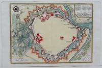
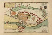
1705rif. M4699Paris 1705. Excellent. Size : 245x340 mm 9.625x13.375 Inches Coloring: Hand Colored Category: Maps City Maps; Maps Europe Austria unknown
2013rif. 199941Zurich Switzerland: Hauser & Wirth and Xavier Hufkens in association with JRP/Ringier 2013. First edition and first printing. Hardcover. Text in English by Briony Fer and Tacita Dean. Includes color illustration of 153 drawings by Roni Horn. A clean near fine copy in orange cloth boards with some light bumping to the top edge of the rear board and to the top right corners and in a near fine dust jacket with some minor wear. Please note that this is a heavy and oversized book and will require extra shipping. Hauser & Wirth and Xavier Hufkens in association with JRP/Ringier unknown
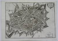
1705rif. M5140Paris 1705. Excellent. Size : 230x345 mm 9x13.625 Inches Coloring: Black & White Category: ; Maps Europe France unknown
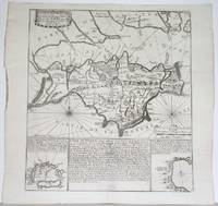
1715rif. M4751Paris 1715. Very Good slight wear at the center of the fold. Size : 350x320 mm 13.75x12.625 Inches Coloring: Black & White Category: ; Maps Europe United Kingdom unknown
1700rif. M5178Paris 1700. Very Good. Size : 225x340 mm 8.875x13.375 Inches Coloring: Original Outline Coloring Category: Maps South America Countries; unknown
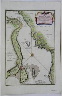
1705rif. M5485Paris 1705. Very Good. Notes: Map of strait between Sweden and Denmark. Size : 335x225 mm 13.125x8.875 Inches Coloring: Hand Colored Category: Maps Europe Scandinavia Countries; unknown
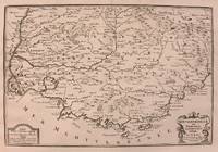
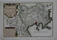
1708rif. M5770Paris 1708. Very Good. Size : 240x345 mm 9.5x13.625 Inches Coloring: Hand Colored Category: ; Maps Europe France unknown
1705rif. M5142Paris 1705. Excellent. Size : 237x346 mm 9.375x13.625 Inches Coloring: Black & White Category: Maps City Maps; Maps Europe France unknown
1700rif. M10974Paris 1700. Very Good. Notes: Map of Copenhagen Capital of Denmark. Size : 227x337 mm 8.94x13.27 Inches Coloring: Hand Colored Category: Maps Europe Scandinavia Countries; Maps City Maps; unknown
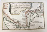
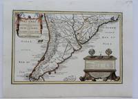
1704rif. M5174Paris 1704. Excellent. Notes: French Map of Chile by renowned French cartographer. Size : 235x340 mm 9.25x13.375 Inches Coloring: Original Outline Coloring Category: Maps South America Countries; unknown
2023rif. x-0323992374Academic Pr 2023. Hardcover. New. 422 pages. 9.00x6.00x0.75 inches. Academic Pr hardcover
1923rif. 88H. Antunes 1923. Brochure in good condition. Rare. Full title: The art of dying well: art conference held in Rio de Janeiro at Trianon on June 21 1922 and repeated in other parts of Brazil. Introduction by Paulo Menotti del Picchia. H. Antunes